London, 2016: The Palimpsest Routes Its Grief — Five Moments and a Three-Thousand-Year Spatial Grammar
The river, the wall, the liberated south bank, the old slaughterfield, the ghost map of a summer — in 2016, London absorbed five of its hardest shocks by doing what it has always done: routing each one to a site that had been waiting centuries for exactly this.

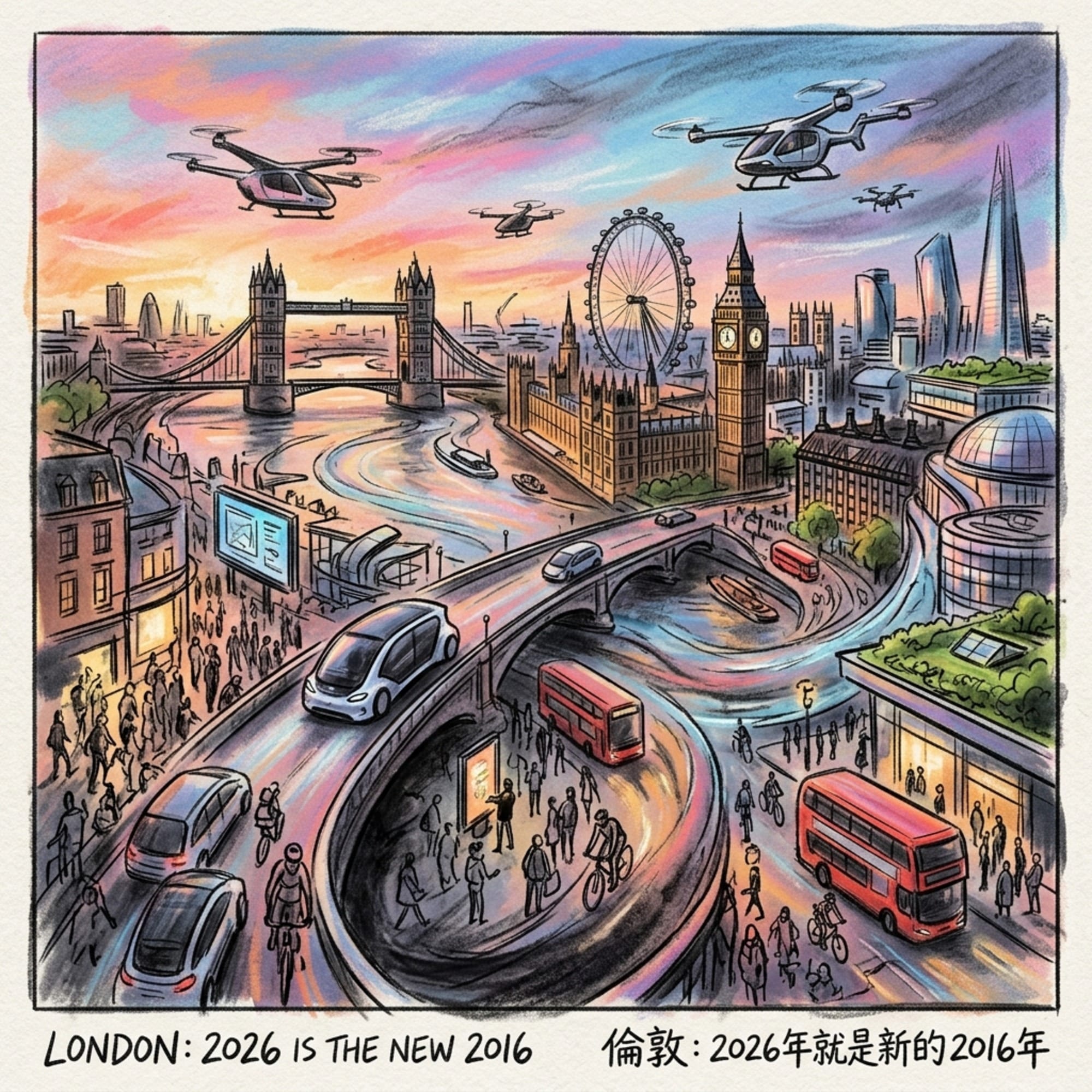
2026 Is the New 2016 series
 Lawrence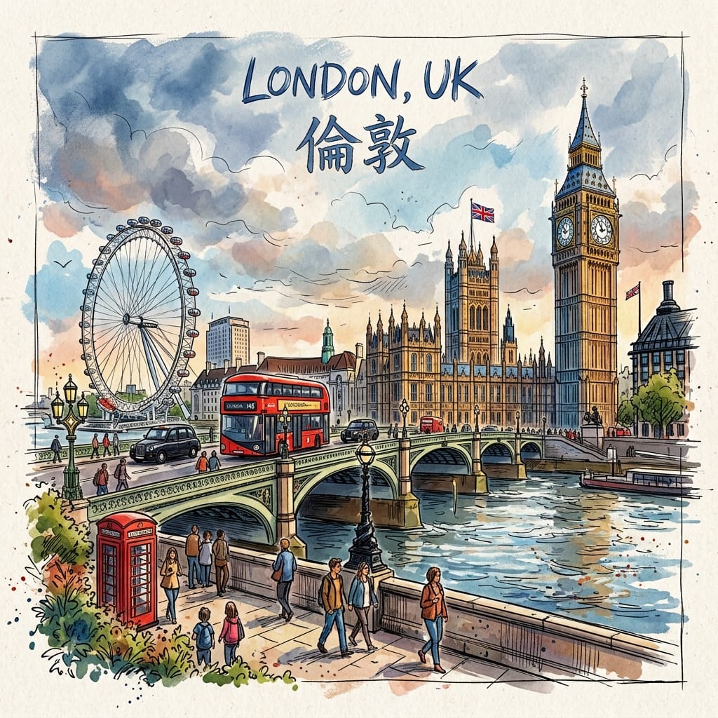
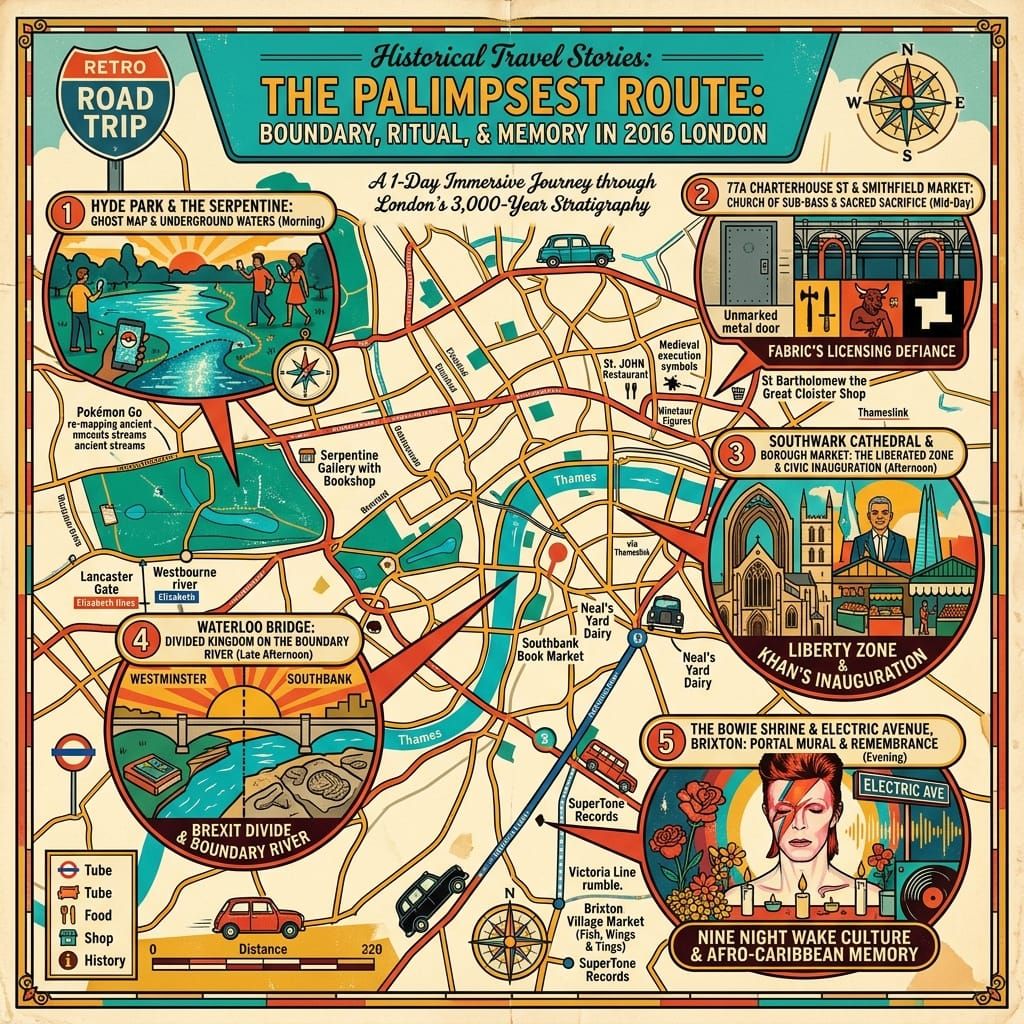
This is the fourth instalment of Historical Travel Stories' 2026 Is the New 2016 series — following Tokyo, Hong Kong, and Taipei — and it traces five events that fractured and reformed London in a single year. The Brexit referendum night, David Bowie's Brixton memorial, Sadiq Khan's inauguration at Southwark Cathedral, the summer of Pokémon Go, and Fabric nightclub's death and legal resurrection: five moments that appear, in retrospect, not to have been random but to have been routed — by the city's own three-thousand-year spatial memory — to precisely the kind of sites that had been built, over centuries, to absorb exactly these categories of loss.
On the Movement: Why 2016?
Somewhere in late 2025, something shifted in the way people were using the internet. Social media feeds began filling with posts celebrating the aesthetics, music, and cultural textures of 2016 — not in the spirit of uncomplicated nostalgia (no one was claiming 2016 was straightforwardly good) but as a form of resistance. Against algorithmic saturation. Against the flattening of experience into content. Against a mode of digital life that had come to feel less like a tool and more like a weather system that you simply lived inside.
2026 is the new 2016 described a mood as much as a movement: the recognition that something specific to that year — something embodied, analogue, still capable of genuine surprise — had been quietly lost in the decade since. Historical Travel Stories takes this seriously as a structural proposition, not merely a social media trend. Not what the fashion of 2016 looked like, but what a city felt like from the inside in that year: the texture of collective grief, political rupture, cultural resistance, and accidental communal joy.
London. 2016. The fourth city, and the oldest.
Listen to the historical stories told in detail (For subscribers only)
Opening: In London, the Past Is Infrastructure
In London, the past doesn't stay past. It rises through the pavement, exhales from Underground ventilation shafts on cold January mornings, persists in the grain of Victorian brickwork and the course of buried rivers that still inflect the surface streets above them. The city has been continuously inhabited, demolished, and reinvented for three thousand years without once erasing the spatial memory of what happened at any given coordinate.
This is not mysticism. It is the argument Peter Ackroyd has been making, across a dozen books about London since at least London: The Biography in 2000: that certain sites in the city function as permanent attractors for certain categories of human experience, regardless of what century is being enacted above them. It is the argument Iain Sinclair has been walking into being since Lights Out for the Territory in 1997: that London's street-level geography encodes an affective history invisible to anyone moving through it at speed but legible to anyone willing to go slowly enough. And it is, in a sense, the argument William Blake was making about Lambeth two centuries before either of them — that London's physical form is also a spiritual and political text, and that learning to read it changes what you think the city is for.
In 2016, London's spatial grammar — that accumulated, largely unconscious body of three-thousand-year spatial intelligence — was activated five times. Each time, the city routed its collective shock to a site that had been designated, over centuries, to absorb exactly that kind of force.
I. The Night the River Divided the Kingdom
Brexit Referendum Night — Thames Embankment, 23–24 June 2016
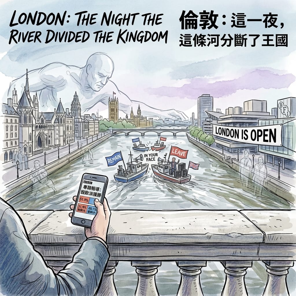
At 4:40 in the morning on Friday, 24 June 2016, the BBC projected that the United Kingdom had voted to leave the European Union. The final result — 51.9% Leave against 48.1% Remain, on a national turnout of 72.2% — produced, in the hours that followed, a stunned civic silence that Londoners who were awake for it have described with a consistency suggesting they all inhabited the same psychological space.
London had voted 59.9% to Remain. Lambeth: 78.6%. Hackney: 78.5%. Scotland: 62%. Gibraltar: 96%. Sunderland, on the North Sea coast, had returned 61.3% for Leave; Boston in Lincolnshire, 75.6%. The country had voted to leave. London, with the fervour of a city that had built its entire modern identity on being the place where the world wanted to come, had voted to stay.
David Cameron resigned outside Number 10 at 8:15 in the morning, his voice doing something that politicians' voices are trained not to do. The pound fell from $1.49 to $1.32 in the first hours of trading — its lowest level since 1985. FTSE 100 companies shed £122 billion in value before noon. Boris Johnson appeared at a press conference looking, by multiple contemporary accounts, precisely like a man who had expected his team to lose and now had to manage the consequences of winning. Nigel Farage declared victory in a speech that opened with the phrase without a single bullet being fired — a remark delivered eight days after the murder of MP Jo Cox by a far-right extremist, a fact several journalists noted in real time and which Farage did not acknowledge.
The Morning London Became An Island
Sadiq Khan — just seven weeks into his tenure as London's first Muslim mayor — issued a statement. Three words in the printed version: London is open.
On Waterloo Bridge in the hour before dawn, the geometry of the event became physically legible. To the north: the Strand, the Royal Courts of Justice, Whitehall, Westminster — the accumulated stone weight of institutional authority. To the south: the Royal Festival Hall, the National Theatre, the BFI — the institutions of a particular postwar cultural democratisation. The ancient tripartite structure of London — royal authority in the west, commercial-ecclesiastical power in the north, creative transgression in the south — laid out in a single visual arc. The bridge itself, largely built by women workers during the Second World War and whose Portland limestone has not forgotten any of the previous dawns it has absorbed, held the weight of what was happening in the same way it always had: without comment, without buckle.
Holographic Sensory Cue:
Waterloo Bridge, central London, 5:30 am, 24 June 2016. The Portland limestone balustrade under the hands, cold with a mineral precision that has nothing soft about it. The Thames running fast and dark — the specific dark-brown-green of a river that has been receiving rain for three days — the current moving with an almost aggressive purposefulness that reads, at this particular hour, as the river's refusal to acknowledge what has just occurred above it. Diesel-scented river air, with an undertone of wet stone. Absolute absence of traffic sound: the London silence that exists only between 4 and 6 in the morning, which is not quiet but is the sound of eight million people still dreaming. A phone screen, showing a BBC graphic, its colour-coded map of the nation a study in the geography of mutual incomprehension. The number 51.9 has, in this hour, the quality of a physical object.
II. The Wall That Became a Threshold
The Bowie Memorial, Brixton SW9, 10 January–February 2016
David Robert Jones was born on 8 January 1947 at 40 Stansfield Road, Brixton, to a waitress and an events promoter. He left Brixton at nine. He never came back as a Brixton man — not in any way that he acknowledged, or that Brixton, while he was alive, particularly claimed. His invented selves — Ziggy Stardust, Aladdin Sane, the Thin White Duke, Major Tom — were each a further degree of escape from a working-class south London postcode, constructed at maximum possible distance from their origin. This was not incidental to the mythology. It was the mythology: that you can come from anywhere and become anything, and the place you came from will have made that transformation possible precisely because you had to escape it.
On 10 January 2016 — two days after his 69th birthday, on which Blackstar (★) had been released — David Bowie died of liver cancer in New York. He had kept the diagnosis private for eighteen months. His son Duncan Jones announced it on Twitter. The news circulated globally within the hour.
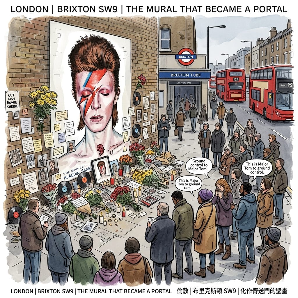
Within hours, people began arriving at the mural of Bowie painted in 2013 by street artist Jimmy C (James Cochran) near Brixton tube station — the Aladdin Sane-era lightning-bolt face, life-size on London stock brick. They brought flowers, handwritten notes, photographs, vinyl records, tea lights. By nightfall, the surrounding streets were dense with mourners, many weeping openly. Others stood in small groups and sang, quietly, to strangers: Ground control to Major Tom. The singing was not performative. It was addressed to the wall.
David Bowies Secret Final Masterpiece
What makes this event historically strange — and spatially resonant in ways that have not been adequately analysed — is the ambiguity of what Brixton was mourning. Bowie had not been a presence in Brixton's life after childhood. His artistic identity was a sustained act of self-reinvention from which Brixton was conspicuously absent. And yet when the news came, it was to Brixton that grief went — not to New York, where he died; not to Beckenham, where he formed his first bands; but to the coordinate of origin.
The historical context that the mainstream coverage largely missed: Brixton is not simply a London neighbourhood. It is a postcolonial sacred-communal space built by the Windrush generation from the late 1940s onwards, shaped by the 1981 riots — four days in April when Brixton's streets burned in response to Operation Swamp 81's saturation policing of the Black community — and the decades of creative and commercial culture that followed. The Caribbean tradition of the nine night — a wake in which a communal space is held open, between the living and the dead, for nine nights of music, gathering, and collective presence — had given this community a specific spatial vocabulary for grief: the street as threshold, the wall as membrane between worlds. The January 2016 memorial did not consciously invoke this tradition. It did not need to. The spatial grammar was already there.
Tony Visconti, Bowie's producer, confirmed after the death that Blackstar was deliberately constructed as a farewell: its imagery, its title track's lyric (Something happened on the day he died / Spirit rose a metre then stepped aside), the video for Lazarus released the day before he died — all composed with full knowledge of what was coming. Bowie had, in effect, pre-programmed a site-specific grief event at a specific coordinate in south London, timed to activate at the moment of his death. The wall received what the artist had, across decades, addressed to it.
Resonance Node: The Jimmy C Bowie Mural, Tunstall Road / Coldharbour Lane, Brixton SW9
This wall has been, since January 2016, the most consistently tended unofficial memorial in London — no institution maintains it, no programme renews it, yet it is never quite empty of offerings. What is specific about standing here is not the mural itself but the total sensory environment in which it exists: the particular exhaled air from Brixton tube station's ventilation shaft, the bass frequencies of the 109 bus on Coldharbour Lane, the Market vendors thirty metres away on Electric Avenue, the residue of every January since 2016 in the brick. To stand here is not to visit a monument. It is to enter a spatial conversation that has been running continuously for a decade, between a community, a wall, and the myth of departure.
Holographic Sensory Cue:
Brixton SW9, 10 January 2016, approximately 7 pm. Temperature: 5°C — the specific damp cold that London produces in January, which is not the cold of frost but the cold of a city that is permanently slightly wet. The mural surface: London stock brick, rough, retaining a little warmth from the day that has already dispersed from the streets. The smell of cut chrysanthemums in cold air, bright and slightly funereal. Ambient sound: a bus, the Underground ventilation's low-frequency exhalation, the market winding down, and under all of it something that is either street noise or silence depending on which register you are tuned to. Someone nearby, voice barely above a murmur, singing the opening of Space Oddity — not performing it, saying it, as one says something private to an old photograph.
III. A Coronation in the Zone of Exception
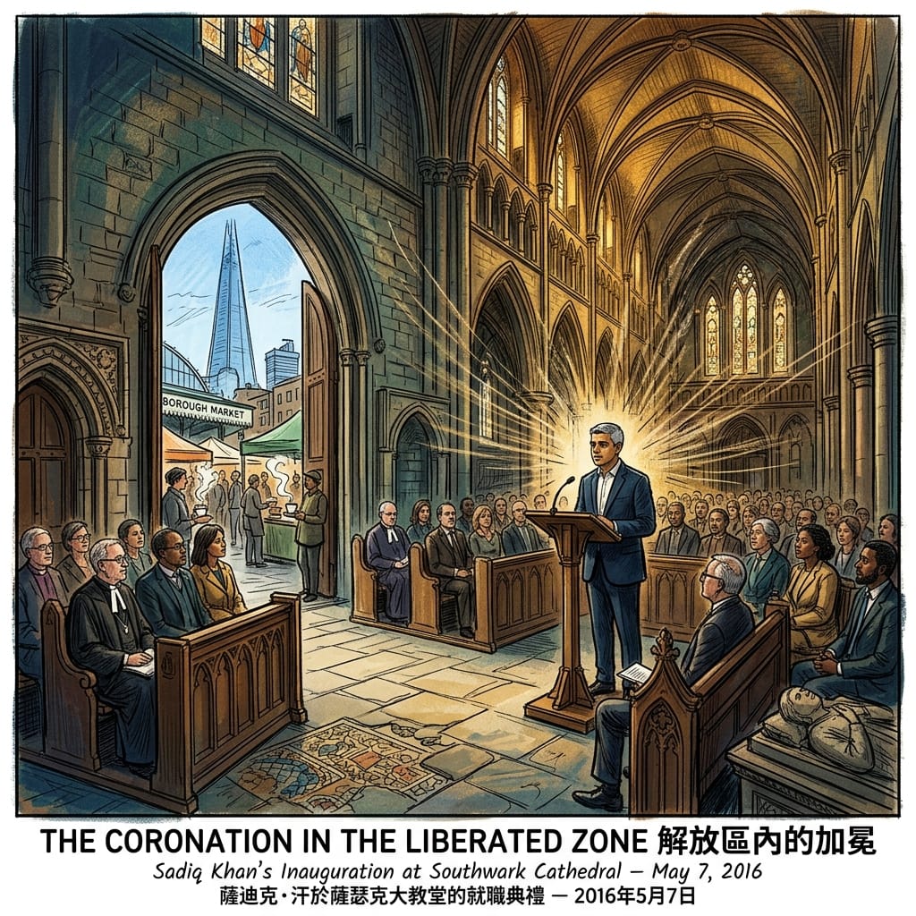
Sadiq Khan's Inauguration, Southwark Cathedral, 7 May 2016
The election of Sadiq Khan as Mayor of London on 5 May 2016 was understood, in the immediate commentary, primarily as a demographic milestone and a rebuke to a campaign of documented Islamophobia. Both readings are accurate. What has not been examined is the spatial reading: specifically, what it meant that his inauguration ceremony took place at Southwark Cathedral — on the south bank of the Thames, in the medieval Liberty of the Bankside — on 7 May 2016.
Khan was born on 8 October 1970 in Tooting, the son of Amanullah Khan, a bus driver who had emigrated from Pakistan. He attended a state comprehensive school, became a human rights solicitor, entered Parliament for Tooting in 2005, and on 5 May 2016 received 56.8% of the final preference vote to become the first Muslim elected mayor of a major Western capital. His opponent, Zac Goldsmith, had run a campaign that multiple senior Conservatives — including former Prime Minister John Major and former Deputy Prime Minister Michael Heseltine — publicly condemned as Islamophobic: a sustained, documented attempt to link Khan to extremism through guilt by association, conducted with what investigative journalists at the time confirmed was Downing Street support. The London electorate's response was unambiguous.
Two days after the vote, in Southwark Cathedral's Gothic nave, Khan delivered his inaugural address. I want to lead the most diverse, most progressive, most dynamic city in the world. The acoustics of dressed medieval stone give such a space a reverberation time of four to five seconds — which means a political address sounds like liturgy, each declarative sentence returning from the walls before the next begins, doubled, as if the building is issuing its own response.
The Mayor In The Lawless Zone
The choice of Southwark Cathedral is the spatial story here. This building sits within what medieval London designated as the Liberty of the Bankside — a zone legally and canonically outside the jurisdiction of both the City of London Corporation and the Diocese of London (Southwark fell under Winchester's authority until 1905). In the medieval spatial grammar of London, the Liberties were authorised spaces of exception: places where the rules of the city did not apply. Where theatres could operate when banned within the walls. Where the Bishop of Winchester could simultaneously govern a priory and a licensed district of prostitution. Where Shakespeare's Globe could perform King Lear and Measure for Measure and The Tempest — the most politically dangerous imaginative work of the Elizabethan period — because the Globe was built at the one coordinate in London where such work was, technically, permitted.
The south bank was not merely a rougher neighbourhood. It was the city's structurally necessary zone of exception — the place London authorised itself to do what it could not, officially, do within its own walls. And it is this function — not the architecture, not the prestige, not the convenience — that makes the choice of Southwark Cathedral for Khan's inauguration a piece of unconscious spatial intelligence of the first order. To inaugurate London's first Muslim mayor — in a political climate that had weaponised his faith against him — at the city's historic site of authorised exception, in an Anglican Gothic building on the wrong side of the Thames, was to enact exactly the spatial logic that the south bank had been designated to enable for nine centuries: this act cannot happen in the space of normal civic authority; therefore, it happens here.
Holographic Sensory Cue:
Southwark Cathedral nave, 7 May 2016, afternoon. Light through medieval stained glass at this latitude and this time of year falls in amber and deep red across dressed stone that has been absorbing light at this angle since the 13th century. The reverberation tail of a spoken sentence in this space is four to five seconds, which means a political address sounds like liturgy — each declarative sentence folding back into itself before the next begins. Outside: Borough Market's bread, coffee, and cheese; the Thames forty metres north; the specific quality of London light in May that is almost warm; the Shard's glass tower rising 310 metres over Bankside like a question about the relationship between money and memory. Inside: dressed Kentish ragstone, the tomb of John Gower (c. 1408), Roman tile in the floor, and a Muslim mayor receiving the authority of a city in the building that city had designated, for nine hundred years, for exactly these kinds of necessary impossibilities.
IV. The Ghost Map Goes Live
Pokémon Go, London, July–September 2016
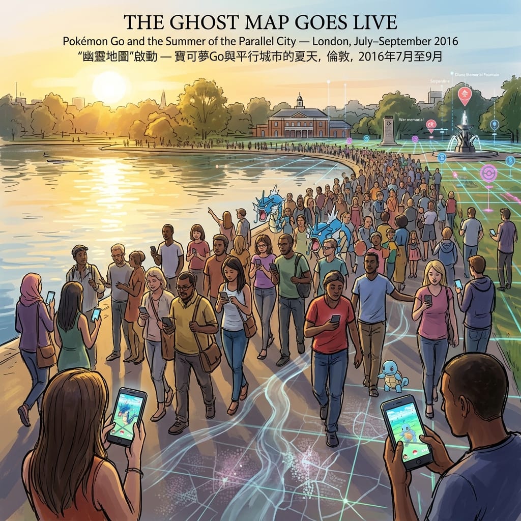
On 14 July 2016, Niantic released Pokémon Go in the United Kingdom. The game used GPS and augmented reality to overlay digital Pokémon on the real-world landscape — visible through the phone's camera as if physically present in the street or park before you. It reached 45 million daily active users globally in its first week, becoming the fastest-growing mobile application in history to that point.
In London, the game restructured the city's topography into a specific play-map: parks, waterways, and major public spaces generated rare Pokémon and functioned as Pokéstops (supply nodes) and Gyms (contested sites). Hyde Park — specifically the Serpentine and Round Pond — attracted hundreds of players on summer evenings. Trafalgar Square, Greenwich Park, the South Bank between Westminster and Tower bridges, the Thames Path from Putney to Woolwich: these became, for approximately six weeks in the summer of 2016, routes of slow, embodied, collectively purposeful urban exploration. A city that had spent the previous six months fracturing along lines of age, geography, and political identity was, briefly and inexplicably, united by an activity that required every participant to put the phone down to the level of the street and look, very carefully, at specific coordinates.
The Accidental Ghost Map Of 2016
Guy Debord, in his 1956 Théorie de la dérive, described the practice of the dérive — the unplanned urban drift that follows the city's own affective geography rather than instrumental purpose — as a form of political resistance: the dériveur refuses the spectacle's prescribed routes and, by following spatial attraction instead, discovers the city's hidden affective structure. What Pokémon Go produced in London in the summer of 2016 was, in scale, the largest collective dérive in urban exploration history. Not politically critical — the game was designed to be played, not to resist anything. But the mechanism was identical to Debord's prescription: players went to places they had not intended to go, moved at speeds the city was not designed for, stopped at coordinates they would have walked past their entire lives, and looked at things they had looked past for years.
The spatial intelligence behind this is structural rather than intentional. The Niantic point-of-interest database — which determined Pokéstop locations — had been assembled from its predecessor game Ingress (2012), whose players had been invited to photograph and tag culturally significant locations. The result was that the Pokémon Go map of London corresponded, with remarkable density, to the city's existing heritage geography: war memorials, churches, blue heritage plaques, public sculptures, notable architecture. Players following a digital prompt to stand at a specific coordinate were being directed, without knowing it, to the places where London's historical memory was densest. They were performing, gamified and unknowing, what Ackroyd would recognise as a spatial-repetition event: arriving, century after century, at the sites where the accumulated emotional temperature of the past had not cooled.
This is what, within the psychogeographic framework, we might call an inadvertent ghost map: a digital representation of the city's surface built, without intent, on the accumulated trace-deposits of what had mattered there across centuries. The game sent players to exactly the right sites. It sent them in the correct posture — slowly, attentively, following a prompt they had not designed, toward a destination they could not predict. And it sent a fractured, post-referendum city back, briefly, into its own historical geography.
By September 2016, daily active users had fallen 75% from peak. The window — which had also been the window between Brexit and whatever came next — quietly closed.
Holographic Sensory Cue:
Hyde Park, Serpentine north shore, July 2016, 7 pm. The sun still well above the horizon — latitude 51° N in high summer means the light is late and golden and arrives at an angle that elongates every shadow to the east. The specific sound of the Pokémon Go notification chime — which in the summer of 2016 had the quality of a cultural event — mixing with birdsong and the distant low roar of Kensington traffic. A phone screen held slightly lower than usual, the camera pointed at a lake created in 1730 by damming the Westbourne river — a pre-Roman sacred tributary of the Thames now channelled entirely underground — the digital overlay barely transparent against the afternoon water. Someone nearby, a few metres away across the path, lets out a short sound of pure delight — a Pokémon found — and it carries across the water with the uncomplicated joy of a thing that does not yet know it is already ending.
V. The Resurrection of the Church of Bass
Fabric Nightclub's Closure and Reinstatement, Farringdon EC1A, September–November 2016
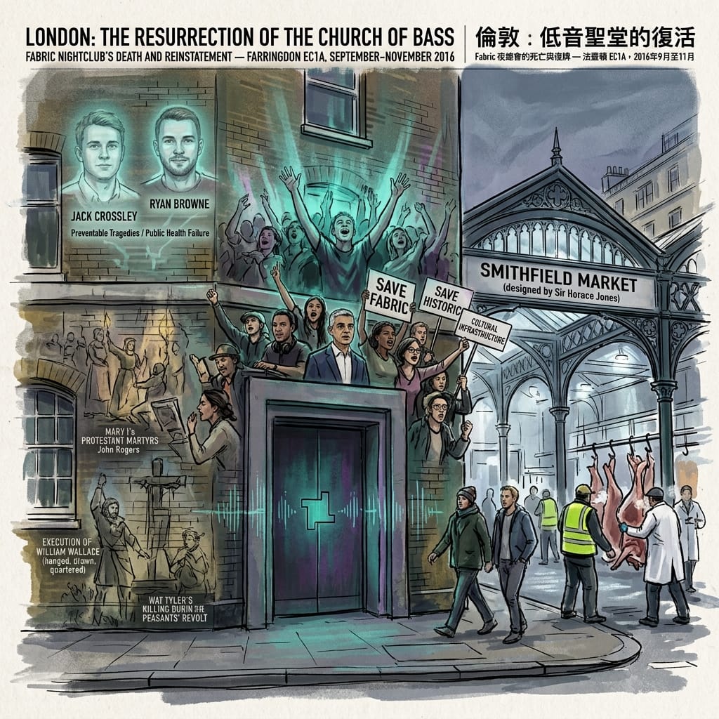
On 6 September 2016, Islington Council's licensing sub-committee voted to revoke Fabric's licence. The venue at 77a Charterhouse Street, Farringdon — operating since 1999 in a former cold-storage building adjacent to Smithfield Market — was ordered to close following the drug-related deaths of two 18-year-old men, Jack Crossley and Ryan Browne, both of whom had taken MDMA at the venue earlier that year.
What followed was without direct precedent in London's licensing history. A petition gathered 150,000 signatures within days. Sadiq Khan, DJs, musicians, public health academics, MPs, and architectural historians assembled a coalition that extended the argument far beyond a single venue's licence. Between 2005 and 2015, London had lost approximately half its nighttime music venues — a documented, measurable cultural haemorrhage driven by residential encroachment, rising property values, and a licensing regime that reflexively prioritised residential quiet over cultural infrastructure. Fabric's closure was the most visible instance of a process that had been proceeding silently for a decade. The campaign named that process, forced it into the light, and built a legal argument that a nightclub could constitute a form of cultural heritage — that the right of a community to its collective ritual space deserved the same institutional protection as its concert halls and galleries.
On 21 November 2016, the licence was reinstated with strict new conditions.
The location is not incidental to this story. Charterhouse Street runs alongside Smithfield — the Smoothfield, smooth open ground outside the City walls — which has been, in documented succession: the largest medieval livestock market in England (operating from at least the 10th century); the site of Bartholomew Fair (Royal Charter, 1133; suppressed 1855), London's great annual carnivalesque; the execution ground of William Wallace on 23 August 1305, hanged, drawn, and quartered here; the primary location of the Marian burnings of 1553–1558, in which approximately 43 Protestant martyrs died at Smithfield — the events that fill the most viscerally physical sections of John Foxe's Acts and Monuments; and the site of Wat Tyler's killing during the Peasants' Revolt on 15 June 1381.
This is the ground beneath Fabric's subfloor. This is what the building at 77a Charterhouse Street is standing on.
Ackroyd's spatial-repetition thesis achieves its most precise demonstration at Smithfield. The site has been, across a thousand years, a space where collective death, communal transgression, carnivalesque excess, and public ritual have concentrated. The form changes with every century — livestock market, execution ground, seasonal fair, Victorian meat hall, 21st-century electronic music venue — but the spatial function persists. Every dancer in Room One was dancing on a field of accumulated ritual intensity. The sub-bass frequencies that Fabric's sound system was engineered to produce — intense enough to be registered physically in the chest cavity — vibrated at coordinates that had been receiving collective intensity since before the Norman Conquest.
The Thousand Year Techno Temple
The campaign to save Fabric was, therefore, not simply a campaign for a nightclub. It was a community asserting its right to maintain a collective ritual at a site that has been a ritual site for a thousand years. The reinstatement of 21 November 2016 was, in the deepest available spatial grammar, a re-consecration.
Holographic Sensory Cue:
Charterhouse Street, 77a, approximately 5 am on a Saturday in autumn 2016. Temperature: 3–5°C. The thermal shock of the door: body heat and bass-frequency residue in the muscles and chest encountering cold air with the precision of a fact. Smithfield Market, directly opposite, is active — the Victorian cast-iron-and-glass building designed by Sir Horace Jones in 1866 is lit from within, and the figures in white coats moving through it are performing, with the unhurried efficiency of people doing something they do every night, the same work that has been done on this ground since the 10th century. Cold meat and cold street mixing with the bass residue in the body. St Bartholomew's Hospital, founded 1123, still operating, visible at the end of the street as the sky begins to differentiate itself from the buildings. The morning, arriving. Fabric's door, closing.
Psychogeographic Cartography: What the City Knew That the People Didn't
Five events in a single city in a single year. Are they separate?
In the conventional historical account, yes. Brexit is political history; Bowie's death is cultural biography; Khan's election is a story about British democracy and Islamophobia; Pokémon Go is a technology story; Fabric is nightlife-preservation advocacy. Five distinct categories, five separate news desks.
Psychogeography offers a different taxonomy.
The tradition — developed by Guy Debord in the 1950s, extended and applied to London most rigorously by Iain Sinclair and Peter Ackroyd from the 1990s onwards — proposes that cities are not neutral containers but active spatial grammars: accumulated, largely unconscious sets of rules about which categories of human experience occur at which categories of site. The rules are built, over centuries, from use. A site that has once concentrated a particular kind of intensity — grief, transgression, collective ritual, political crisis — becomes attuned to that intensity. Future events of the same category are drawn to it: not by any mystical mechanism, but by the accumulated spatial intelligence of the people who, generation after generation, understand without articulating it that this is the place for this.
Ackroyd calls this spatial repetition: the tendency of sites to repeat their function across epochs, changing costume without changing role. Sinclair calls the temporal aspect thick time: the co-presence of past event-traces in contemporary space, the way a London street corner is simultaneously the 21st century and the 10th, if you are attuned to both registers.
Read through this framework, the five events of 2016 reveal a single, coherent mechanism:
The Brexit vote went to the Thames — to the pre-Roman sacred river whose function as a cosmological and political boundary predates Londinium by fifteen centuries. The archaeological record of the Thames riverbed — over 600 Bronze Age weapons and shields deliberately deposited as votive offerings — establishes the river as a sacred threshold node from the earliest documented period of London's occupation. Three thousand years later, on the night of 23–24 June 2016, a nation's political fault line ran down the middle of the same water. In London, the language of division is always the Thames.
Bowie's memorial went to a wall in Brixton — to a community whose Caribbean heritage had encoded a specific spatial vocabulary for grief (the nine night, the street-as-threshold-between-worlds), and whose history since 1981 had reconstituted its streets as a permanent site of collective emotional memory. The grief of January 2016 needed a community that knew, somatically, how to hold a public space open between the living and a lost world. Brixton knew.
Sadiq Khan's inauguration went to the south bank Liberty — to the site that London's medieval spatial grammar had designated as the zone of authorised exception, where what cannot happen in the normal city is permitted to happen. The first Muslim mayor of a major Western capital required a site where the spatial grammar would work for the symbolic meaning of the act rather than against it. Southwark Cathedral, in the Liberty, across the river from Westminster, was the one coordinate in London's spatial vocabulary where the gesture could be fully itself.
The Pokémon Go summer went to the parks, the heritage plaques, the riverside paths, the memorial squares — to the surface layer of London's historical geography, its face turned toward the public. Niantic's point-of-interest database had, without intent, mapped the city's historical memory density. Players followed a digital prompt and arrived, week after week, at the sites where the past was closest to the surface. It was a dérive disguised as a game: the city routing a fractured population back to its own historical geography and, briefly, making them look at it.
Fabric's crisis went to Smithfield — to the field of accumulated ritual intensity that has been processing collective death, transgression, and communal excess on this ground since before the Conquest. The community's extraordinary mobilisation was, in the psychogeographic reading, a community asserting its right to maintain its ritual at the site London's spatial grammar had designated for exactly these intensities. The reinstatement was a re-consecration.
The Thesis: Palimpsestic Shock Routing
Together, these five events constitute a single demonstration of what we might call Palimpsestic Shock Routing: the tendency of a city with sufficient historical sedimentation to direct each category of collective trauma — or collective event — to the spatial node that its own accumulated history has designated for absorbing that category of intensity.
The city does not consciously route its shocks. The citizens do not consciously choose their destinations. They go where the grammar takes them — to the river, to the wall, to the liberated zone across the water, to the field of the old fair and the old executions, to the parks and the heritage plaques — because something in the city's accumulated spatial intelligence makes those sites feel, when the moment comes, like the right places to be. The grammar is three thousand years old. The events were from 2016. The routing happened in between, in the vast, unexamined space between historical memory and present movement.
Conclusion: The City Outlasts Us, and Remembers Everything
The movement that calls 2026 the new 2016 is, at its most precise, a response to a specific loss: the loss of the experience of being fully physically inside a place, rather than receiving content about it.
In 2016, even a digital game — Pokémon Go, with its low-resolution sprites and GPS stuttering — sent its users into the city's body rather than past it. The technology was a vehicle for returning to physical space, for standing at a specific coordinate, for looking at something that had been built by people who were not thinking about the 21st century and finding it strange and present. That game has been superseded many times over by technologies of incomparably greater sophistication. What those technologies tend to do, in the aggregate, is generate the experience of a place rather than require the body's presence in it. The city becomes content. The city becomes interface. The walk becomes the simulation of the walk.
London's spatial grammar cannot be accessed as content. It can only be felt through the body, at the specific coordinates, in the accumulated cold of the stone or the specific bass-register of a tunnel entrance or the particular quality of a river at dawn after rain. Three thousand years of spatial intelligence is not searchable. It requires, precisely, that you go there — that you be inconvenienced by it, surprised by it, confronted by the fact that a wall can hold a decade's worth of grief without being asked to, and without being thanked.
The history of London that matters most is not the history that can be summarised. It is the history that rises, unprompted, from the ground beneath your feet at the exact moment you are standing at the right coordinate. The people who gathered at the Thames that night were not thinking about Bronze Age votive offerings. The mourners who went to the Brixton wall were not thinking about Caribbean grief traditions. The people who walked into Southwark Cathedral were not thinking about the medieval Liberties of the Bankside. The Pokémon players in Hyde Park were not thinking about the buried course of the Westbourne river.
But the city was thinking about all of it. The city always is.
If this kind of spatial history interests you — the layers beneath the layers, the grammar that predates the events it governs — Historical Travel Stories' newsletter goes to the places that travel writing mostly doesn't reach. Subscribe to receive new instalments as they arrive.
Accessing the Physical Nodes: London 2016
Getting There
From Hong Kong: Cathay Pacific and British Airways both operate direct services between Hong Kong International Airport (HKG) and London Heathrow (LHR), with flight time of approximately 13–14 hours. From Heathrow, the Elizabeth line (formerly Crossrail) runs directly to Paddington in approximately 25 minutes — substantially cheaper than the Heathrow Express and marginally slower. A contactless Visa or Mastercard tapped directly on Transport for London's yellow card readers covers all Tube, Overground, and bus travel across the network; no Oyster card is necessary.
The Five Nodes and How to Find Them
The Bowie Mural, Brixton SW9 Victoria line to Brixton (zone 2); four minutes on foot. The mural is near Tunstall Road / Coldharbour Lane. Brixton Market runs along Atlantic Road and Electric Avenue — Electric Avenue itself, one of the first streets in London to be electrically lit (1888) and subject of Eddy Grant's 1982 song of the same name, compounds the site's resonance. Best visited in early morning or late afternoon for the market light and sound-environment. There are no visiting hours, no admission, and no institutional presence of any kind.
Southwark Cathedral, Bankside SE1 Northern or Jubilee lines to London Bridge; five minutes on foot. Borough Market immediately adjacent: documentable as a market site from at least 1014, making it one of the oldest continuously operating markets in London. The Cathedral's interior is free to enter; the nave where the inauguration ceremony was held is the Gothic section furthest from the entrance. Roman tile in the floor near the crossing.
Waterloo Bridge, WC2 Accessible on foot from Waterloo station (Northern, Bakerloo, Jubilee lines) or Temple (Circle, District lines) or Charing Cross. The midpoint of the bridge span is the specific coordinate: this is where the city's tripartite geometry is simultaneously visible in all three directions. Best at dawn — in London in midsummer, that means 5 am; in midwinter, a more accessible 7:30.
Hyde Park — The Serpentine, W2 Central line to Lancaster Gate. The Serpentine's north shore path is a ten-minute walk from the station. The ghost-map reading of this site requires knowing what lies beneath it: the buried course of the Westbourne river — a pre-Roman sacred tributary of the Thames, now entirely channelled underground — surfaces in the 1730 damming that created the Serpentine. The lake is, in a specific geological and archaeological sense, an 18th-century landscape's materialised memory of an older sacred watercourse.
Fabric Nightclub / Smithfield, Farringdon EC1A Farringdon station (Circle, Hammersmith & City, Metropolitan lines); two minutes on foot. Fabric at 77a Charterhouse Street is a functioning nightclub, not a heritage site. The more instructive option for this article's purposes is the 5–7 am window on weekday mornings, when Smithfield Market is still active. The market operates from approximately midnight to 7 am on weekdays; visiting in that window allows the spatial repetition to become physically available — the Victorian cast-iron-and-glass building (Sir Horace Jones, 1866–75), still functioning as London's primary wholesale meat market, operates ten metres from the door through which, on weekend nights, Fabric's last dancers emerge into the dawn.
Where to Stay
South Bank / Bankside (closest to the densest cluster — Southwark Cathedral, Borough Market, Tate Modern, and Waterloo Bridge walkable):
- citizenM London Bankside: Design-forward, good value, five minutes from the Cathedral
- The Hoxton, Southwark: Slightly more expensive, excellent public spaces, same neighbourhood
Brixton (for full immersion in the community context of the Bowie memorial):
- Self-catering accommodation is the most honest option here. Brixton has a dense offering in the streets around the mural and market; staying in the neighbourhood, rather than visiting it, changes the experience substantially.
Clerkenwell / Farringdon (closest to Smithfield and Fabric):
- The Rookery: An 18th-century Georgian terrace converted to a boutique hotel, period-appropriate to the neighbourhood's own history; five minutes from both the Fabric exterior and Smithfield Market
Suggested Routes
The South Bank Stratigraphic Walk (approximately 4km, 3–4 hours):
Southwark Cathedral → Borough Market → Thames south bank footpath heading west → Tate Modern (former Bankside Power Station, itself a study in industrial-to-cultural spatial transformation) → Millennium Bridge crossing → St Paul's Cathedral (the view from the north bank establishes Ludgate Hill's pre-Roman sacred-high-ground hypothesis visually) → return across Blackfriars Bridge → south bank back to Waterloo Bridge midpoint for the tripartite view
The Smithfield Deep Time Route (approximately 2km, 2 hours):
Farringdon station → Charterhouse Street (Fabric exterior) → Smithfield Market building (enter during market hours for the full experience) → St Bartholomew's Hospital outer wall (founded 1123, still operating) → St Bartholomew the Great Church (begun 1123, the oldest surviving church in the City of London, with a Norman nave in continuous use for 900 years and a Lady Chapel that served as a printing office and a blacksmith's forge before its restoration)
The Smithfield route is significantly enhanced by starting at 5:30 am on a weekday: the market is operating; if it is a weekend, Fabric's last session has just ended; and the spatial layering of the site — medieval sacrifice ground, Victorian iron market hall, and 21st-century bass music venue, all within 100 metres of each other — is at its most legible in the hour before the City's working day begins and covers everything over.
💡 Frequently Asked Questions: London 2016 Shockwaves & Place-Memory
Q1: What major events in London in 2016 reshaped the city's identity and culture?
In 2016, five key events redefined London's social and spatial identity: the impromptu public mourning for David Bowie at his Brixton mural; Sadiq Khan's historic swearing-in at Southwark Cathedral as London's first Muslim mayor; the political shockwave of the Brexit referendum night along the River Thames; the high-profile campaign to save nightclub Fabric in Farringdon from closure; and the craze of Pokémon GO transforming historic parks like Greenwich into collective virtual arenas. Each event intersected deeply with London's layered urban history and sacred geographies.
Q2: What does '2026 is the new 2016' mean for London's urban history and psychogeography?
'2026 is the new 2016' captures a cultural longing for a period before algorithm saturation, when grief, political shifts, and digital phenomena were physically grounded in public urban spaces. Through psychogeography, London absorbs contemporary shocks using its 3,000-year spatial framework—from Roman Mithraic temples beneath the City to medieval execution grounds at Smithfield and Caribbean migration routes in Brixton. Visiting these historic shockwave sites reveals how London continuously digests loss, identity crises, and modern anxiety through physical place-memory.
Q3: How can travellers visit the iconic London 2016 historical and cultural landmarks?
Travellers can trace London's 2016 shockwaves via a self-guided walking itinerary: start at the David Bowie mural on Tunstall Road in Brixton to explore post-war Windrush migration heritage; cross to Southwark Cathedral near Borough Market for civic and religious history; walk the Thames embankments near Westminster and Tower Bridge to reflect on Brexit's political landscape; head north to Farringdon to see Fabric and Smithfield Market's industrial architecture; and finish at Greenwich Park, where ancient royal grounds met 2016 augmented-reality gaming culture.
Reference and Further reading
First layer – Main sources of literature and institutions:
- Electoral Commission, EU Referendum Results, June 24, 2016. [Publicly accessible: electoralcommission.org.uk — full borough-by-borough breakdown]
- House of Commons Library, Brexit: The process of leaving the EU, Research Briefing CBP-7960, 2016 onwards.
- Greater London Authority, Sadiq Khan, statement on referendum result, June 24, 2016: "London is open to Europe and to the world."
- Duncan Jones (@ManMadeMoon, previously @zowie_bowie), Twitter, January 10, 2016 — primary public death announcement
- Tony Visconti, statement published via Facebook, January 11, 2016 — confirming the intentional farewell structure of Blackstar
- Lambeth Council, January 2016: public statements regarding management of the Tunstall Road/Coldharbour Lane shrine. [Further archival verification of formal documentation recommended: 建議進一步查證原始檔案]
- Islington Council Licensing Sub-Committee, Decision: Revocation of premises licence for 77a Charterhouse Street EC1A (September 6, 2016) — publicly archived
- Islington Council Licensing Sub-Committee, Decision: Reinstatement of premises licence with conditions (November 21, 2016) — publicly archived
- Night Time Industries Association (NTIA), London's Disappearing Music Venues, report, 2015–2016
- Greater London Authority / Electoral Commission: London Mayoral Election Results, May 5, 2016 (full first and second preference breakdown publicly archived)
- Sadiq Khan, inaugural address, Southwark Cathedral, May 7, 2016 (transcript archived by the Greater London Authority; publicly accessible at london.gov.uk)
- Southwark Cathedral Archive — ceremony documentation [Further archival verification of internal records recommended: 建議進一步查證原始檔案]
- Niantic Inc., press releases and download statistics, July–September 2016 [publicly archived via Niantic's press centre and SurveyMonkey Intelligence contemporary data reporting]
- SurveyMonkey Intelligence, "Pokémon Go surpasses Snapchat in daily users on Android," July 2016 — contemporary user statistics
- Historic England, National Heritage List for England — for cross-referencing Pokéstop location data against listed buildings and scheduled monuments [Further systematic cross-referencing recommended: 建議進一步查證原始檔案]
The second layer – secondary academic materials:
- Harold D. Clarke, Matthew Goodwin, Paul Whiteley, Brexit: Why Britain Voted to Leave the European Union (Cambridge University Press, 2017)
- Sara B. Hobolt, "The Brexit vote: a divided nation, a divided continent," Journal of European Public Policy, Vol. 23, No. 9 (2016), pp. 1259–1277. [Further verification of exact page range recommended: 建議進一步查證原始檔案]
- Matthew Goodwin and Oliver Heath, "The 2016 Referendum, Brexit and the Left Behind: An Aggregate-level Analysis of the Result," Political Quarterly, Vol. 87, No. 3 (2016), pp. 323–332.
- Simon Reynolds, Shock and Awe: Glam Rock and Its Legacy, from the Seventies to the Twenty-First Century (Faber & Faber, 2016) — contextualises Bowie's cultural function within British popular music's relationship to escape, self-invention, and class identity
- Lord Scarman, The Brixton Disorders 10–12 April 1981: Report of an Inquiry by the Rt. Hon. The Lord Scarman OBE (Cmnd. 8427, HMSO, 1981) — essential primary document for understanding Brixton's political-spatial memory and its role in structuring the 2016 grief event
- Graham St John (ed.), Rave Culture and Religion (Routledge, 2004) — primary theoretical text for the sacred-space framework applied in Section B
- Mike Presdee, Cultural Criminology and the Carnival of Crime (Routledge, 2000) — for the carnivalesque tradition and its relationship to licensing, urban space, and community transgression
- John Stow, A Survey of London (1598; revised edition 1603) — primary historical source for Smithfield's pre-modern functions [British Library, Harley MS; multiple scholarly editions in print]
- Maria Sobolewska and Robert Ford, Brexitland: Identity, Diversity and the Reshaping of British Politics (Cambridge University Press, 2020) — for the political context of the Goldsmith campaign and London's demographic-electoral transformation
- Richard Gem and colleagues, Southwark Cathedral: A History — [Further archival verification recommended; institutional historical records held by the Cathedral Library]
- Guy Debord, "Théorie de la dérive," Les Lèvres Nues, No. 9 (November 1956); reprinted as "Theory of the Dérive," Internationale Situationniste, No. 2 (December 1958) — primary theoretical text for the Section B application
- Adriana de Souza e Silva and Jordan Frith, Mobile Interfaces in Public Spaces: Locational Privacy, Control and Urban Sociability (Routledge, 2012) — for theoretical framework on GPS-mediated urban experience [Further bibliographic verification of precise publication details recommended: 建議進一步查證原始檔案]
- Peter Ackroyd, London: The Biography (Chatto & Windus, 2000) — for the heritage-geography framework of historical POI clustering applied in Section B
Third layer – Supplementary information:
- Iain Sinclair, The Last London: True Fictions from an Unreal City (Oneworld, 2017) — direct psychogeographic response to Brexit London; treated as cultural-interpretive primary source
- William Blake, Jerusalem: The Emanation of the Giant Albion (self-published, 1804–1820) — foundational cultural text for the Blakean cosmological framework
- Peter Ackroyd, Thames: Sacred River (Chatto & Windus, 2007) — foundational text for the Celtic/pre-Roman Thames interpretation
- Jimmy C (James Cochran), interview with The Guardian, January 2016, on the mural's sudden transformation into a shrine
- Merlin Coverley, Psychogeography (Pocket Essentials, Oldcastle Books, 2006) — theoretical framework for spatial memory as applied in Section B
- Resident Advisor, Mixmag, FACT Magazine, The Guardian: sustained coverage of the Save Fabric campaign, September–November 2016 [treated as contemporary cultural-primary documentation]
- John Foxe, Actes and Monuments (known as the "Book of Martyrs") (John Day, London, 1563; revised editions 1570, 1576, 1583) — for the Smithfield martyrdom record [digitised at johnfoxe.org]
- Matthew d'Ancona, commentary published in The Guardian and Evening Standard, May 2016 — on the Islamophobia dimension of the Goldsmith campaign [treated as contemporary political-cultural documentation]
- Peter Ackroyd, Shakespeare: The Biography (Chatto & Windus, 2005) — for the Southwark Liberty / Globe Theatre spatial history applied in Section B
- Iain Sinclair, The Last London: True Fictions from an Unreal City (Oneworld, 2017) — contains observations on London's shifting relationship to digital overlay of physical space, directly relevant to the Section B analysis
Historiographical Discontinuities and Contradictions:
- The spatial sociology of the Leave/Remain divide within Greater London — its correlation with distance from arts/cultural infrastructure, age stratification, and tenure type (private rental vs. ownership vs. social housing) — has received substantial quantitative analysis but almost no qualitative psychogeographic treatment. The street-level experience of June 24 in specifically divergent boroughs (Havering: 70.4% Leave; Lambeth: 78.6% Remain — boroughs separated by fewer than 15 kilometres) constitutes an entirely undocumented chapter in the oral history of the event.
- There is no systematic ethnographic study of the Brixton Bowie shrine as a grief-ritual event — specifically no investigation of the intersection of Afro-Caribbean community grief-spatial practice (the nine night tradition) with the secular, racially heterogeneous mourning of a white rock musician. What Brixton was mourning on January 10 — Bowie the artist, Bowie as a myth of departure-and-reinvention, a specific version of what Brixton-as-origin-story could mean — remains historiographically open and constitutes one of the more significant unanswered questions in contemporary London cultural history.
- No sustained academic analysis exists of the Fabric case as a study in the legal construction of communal ritual space in British urban law. The campaign's precedent-value for "nighttime economy" cultural heritage protection is under-examined. Additionally: the specific public health failure that permitted two 18-year-old men to die of MDMA toxicity at a licenced venue in 2016 — and the subsequent licensing response — has not been evaluated against evidence-based harm-reduction models (e.g., the drug-checking services implemented in Netherlands, Portugal, and subsequently in some UK festivals post-2016). The licensing debate consumed the political oxygen that a public health analysis required.
- The spatial and cosmological dimensions of Khan's choice of Southwark Cathedral — its position as a historical Liberty, its location in London's structural "transgression zone," its status as the Anglican church built over a medieval priory that once licensed both sacred and profane activities in the same jurisdiction — are entirely absent from existing political commentary. The event has been analysed exhaustively as a demographic milestone and a rebuke to Islamophobia; its spatial-symbolic logic has not been examined at all.
- No scholarly study exists of the London-specific spatial distribution of Pokémon Go Pokéstops in relation to the city's heritage geography — specifically the hypothesis that the game's POI data constituted an inadvertent sacred-geography map, directing players to historically significant sites while framing the encounter as play. The sociological literature on the 2016 Pokémon Go phenomenon is substantial but focused overwhelmingly on public health (physical activity) and social media (community formation) dimensions. The psychogeographic and heritage-geography dimensions — including the game's relationship to the Situationist dérive tradition and to Ackroyd's spatial-repetition thesis — are entirely unexamined. This constitutes a genuine gap in both game studies and urban cultural geography literatures.
 Lawrence
 Lawrence
 Lawrence
This is the fourth instalment of Historical Travel Stories: 2026 Is the New 2016 series. Previous instalments: Tokyo, Hong Kong, Taipei.