Tamsui: The Hill Every Empire Had to Bless
Everyone comes to Tamsui for the sunset over the river. Almost no one notices that the same handful of hills has been consecrated, fought over, and physically rebuilt by five different faiths in four hundred years — each one certain it had the final word.
 Lawrence
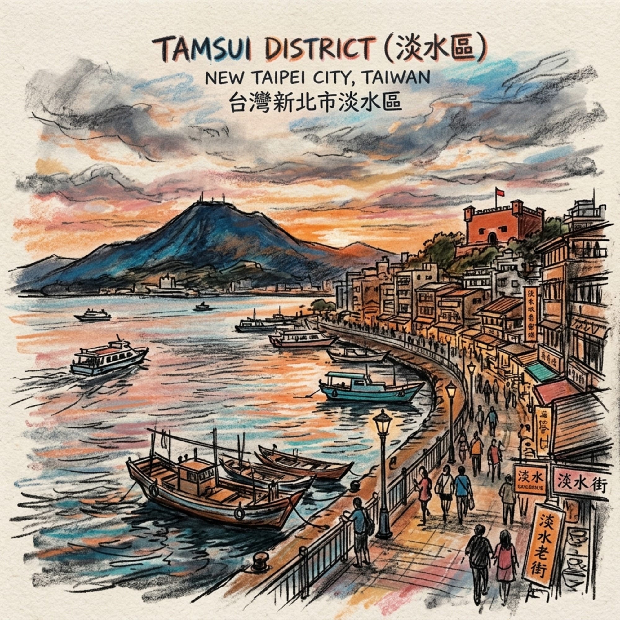
At the mouth of the Tamsui River, where Taiwan's northern coastline folds inward to meet the sea, there is a low ridge of hills that has never once been left alone. In four centuries, it has hosted a Spanish fort, a Chinese sea goddess's temple, a Canadian missionary's grave, a Japanese Shinto shrine, and a Chinese nationalist memorial hall — sometimes stacked directly on top of one another's foundations. This is not a story about pretty colonial architecture by a river. It's a story about what happens when five unrelated belief systems all conclude, independently, that the exact same hilltop is the one place they need to plant their flag in the language of the sacred. By the end of this piece, you won't be able to look at Tamsui's postcard sunset the same way again.
Listen to the historical stories told in detail (For subscribers only)
The Weight of a Place That Keeps Getting Renamed
Some places carry their history in archives. Tamsui carries it in its topography. Stand on the ramparts of Fort San Domingo and look across the river toward Mount Guanyin, and you are looking down the exact sightline a Spanish sentry used in 1628 to watch for Dutch sails — a view that has not meaningfully changed in almost four hundred years. Empires have come and gone here with startling speed; the terrain has not moved an inch. That, more than any single ruin, is what makes Tamsui worth taking seriously: it isn't a town with a lot of old buildings. It's a piece of geography that has repeatedly forced whoever controlled it to answer the same question — by what higher authority do you get to be here? — and to answer it, every time, in stone.
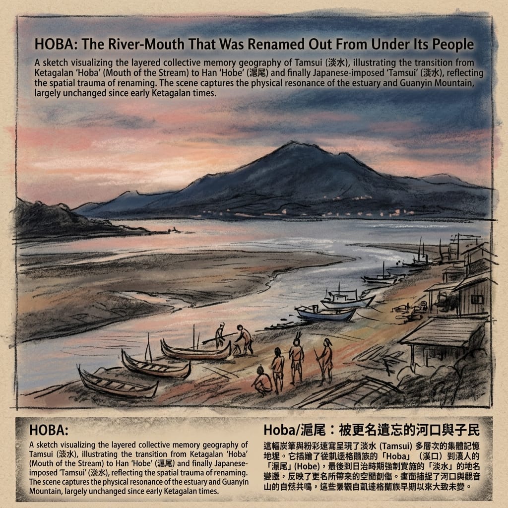
I. Hoba: The River Mouth That Outlived Its Own Name
The human history. Long before any European ship entered the estuary, this river mouth belonged to the Ketagalan people, who called it something recorded in later transliteration as Hoba — roughly, "the mouth of the stream." An oral account collected by the early-twentieth-century Japanese ethnographer Inō Kanori describes ancestors drifting ashore by canoe after a typhoon, their descendants later splitting off and moving north. Han Chinese settlers who arrived from Fujian sinicized the name into Hobe (滬尾), and the Qing administration used it for two centuries. Then, in 1912, a single Japanese colonial decree abolished it, mandating "Tamsui" as the name going forward. Three hundred years of naming continuity ended with the stroke of a bureaucrat's pen. The Ketagalan themselves were reclassified again and again by successive regimes — "matured savages" under the Qing, "Pingpu" under the Japanese — and were, for most of the twentieth century, considered culturally extinct, before descendant-led revitalization efforts began re-emerging in the 1990s.
The Town Renamed Out From Under Its People
Here, honesty matters more than atmosphere: no credibly documented Ketagalan sacred-geometric system survives for this specific site. What we have instead is something arguably more revealing — a river mouth renamed by four different sovereign powers in recorded history, each renaming coinciding exactly with a change of control. The place never moved. The authority to name it did. That is not folklore; it's a documented pattern of erasure, and it deserves to be read as one, rather than dressed up in borrowed mysticism it never claimed for itself.
The estuary today looks much as it must have looked to the Ketagalan: the brackish smell where river water meets incoming tide, the low tang of exposed mudflat at low water, and a wide, unusually open stretch of sky where the surrounding hills fall away — perhaps the one feature here that no regime has ever managed to rename.
II. Fort San Domingo: A Dominican Beachhead at the Edge of a Providential Map
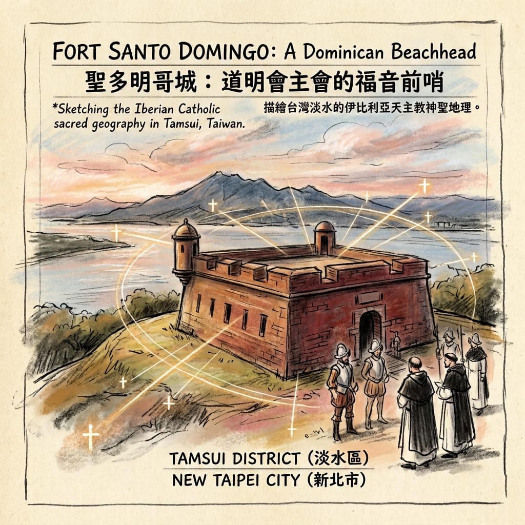
The human history. In 1628, a Spanish expedition sailing from Manila built a wooden stockade at the Tamsui estuary, garrisoned by Spanish soldiers alongside Filipino auxiliary troops from Pampanga and Cagayan, with Dominican and later Franciscan friars attached almost from the start. The fort was never just a military asset — it was simultaneously a trading post for sulfur, gold-bearing sand, and deer hides, and an explicit missionary project aimed at converting the local Ketagalan and Basay communities. In 1636, local residents furious over a new Spanish tax burned the fort to the ground; the Spanish rebuilt it in stone the following year, this time with higher walls. By 1642, a weakened Spanish garrison was finally pushed out by the Dutch, ending sixteen years of Spanish rule in northern Formosa.
The Holy Fortress Burned Over Taxes
The Counter-Reformation lens. It undersells what this fort actually was to call it a garrison with a chapel attached. Its dedication to Santo Domingo — Saint Dominic, founder of the Dominican order — was a formal territorial claim, staking this river mouth as Dominican missionary ground, echoing the way the earlier Spanish settlement at Keelung had been dedicated to the Holy Trinity. Within the Counter-Reformation worldview these friars carried with them, a fort-and-church complex on a foreign coast wasn't just a defensive position; it was a literal anchor point in an expanding map of Christendom, from which baptism was meant to radiate outward into the surrounding villages. What complicates the story — and what deserves to be stated plainly rather than smoothed over — is the 1636 burning. That fire is the clearest surviving evidence that the sacred geography being imposed here was contested from the very first decade, not just by later historians, but by the people who actually lived on the land.
The surviving brick core of the fort still radiates the day's stored heat well into evening; its window slits, deliberately narrow, keep the interior cool and shadowed even in Tamsui's thick summer humidity — a building engineered for defense, not devotion, and it shows.
III. The Five Tiger Ridges: A Sea Goddess Signs Off on a Battle Report
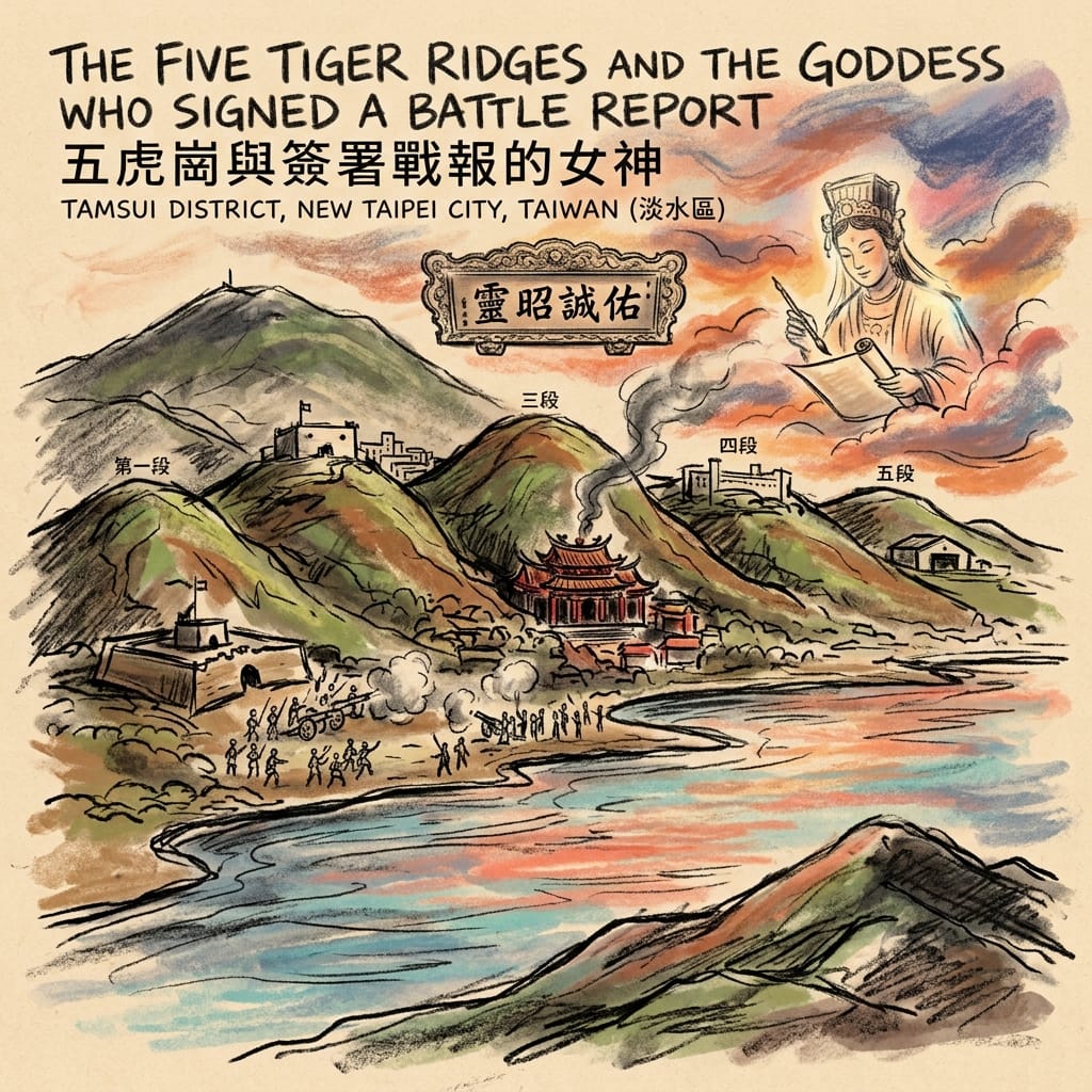
The human history. By the early 1700s, Hoklo settlers from Fujian had built a durable town on the slopes above the estuary, funding Fuyou Temple, completed in 1796 and dedicated to Mazu, goddess of seafarers, which quickly became the settlement's literal and symbolic center. On October 8, 1884, during the Sino-French War, a French naval squadron attacked Tamsui by sea; Qing defenders under General Sun Kaihua, backed by local militia who had built earthworks along the shore, repelled the landing in roughly four hours — a rare and strategically important Qing victory that helped justify the decision to elevate Taiwan to full provincial status the following year. Local tradition holds that Mazu intervened directly in the battle. Whatever one makes of that claim, its political consequence is verifiable: the Guangxu Emperor subsequently bestowed an imperial plaque on Fuyou Temple, reading (in translation) roughly "her miraculous manifestation grants sincere protection" — a plaque that still hangs in the temple's main hall today.
The Goddess Who Defeated The French Navy
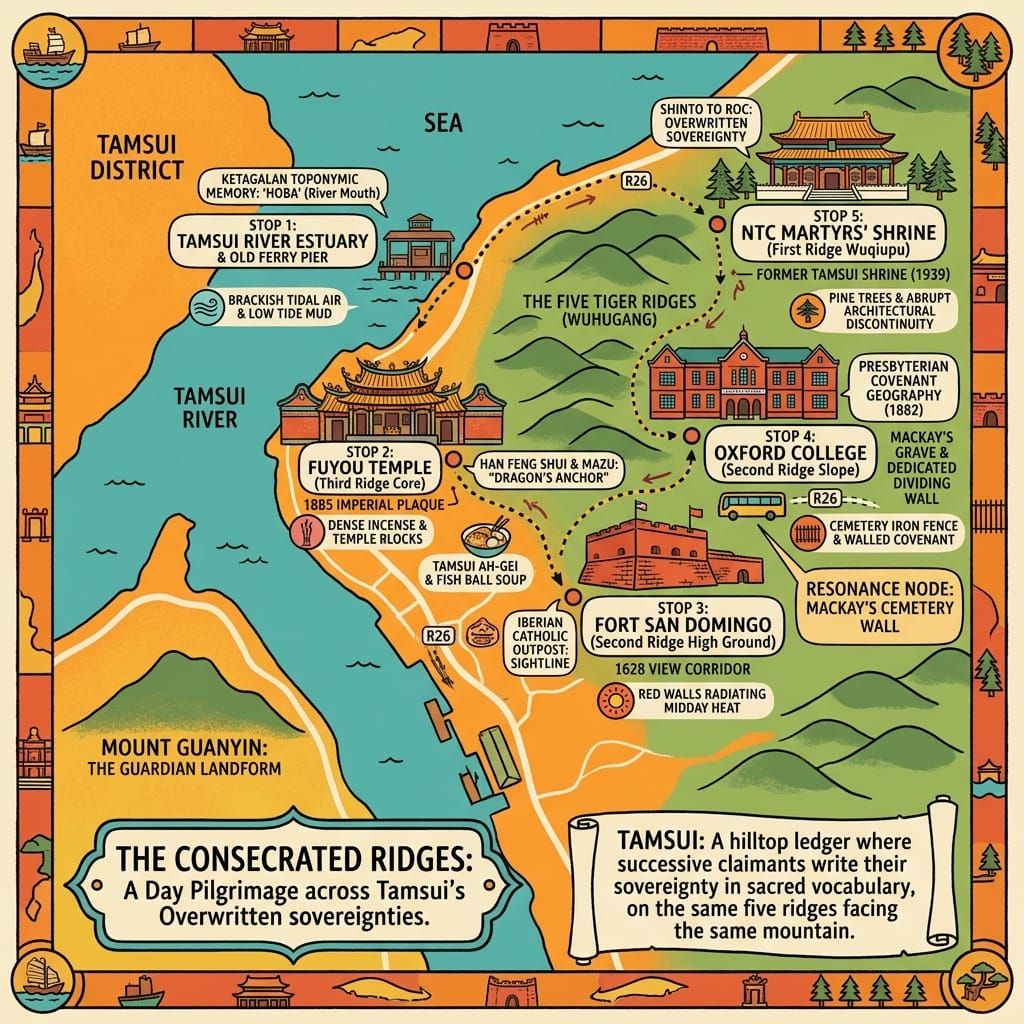
The Daoist / Mazu cosmology. The Hoklo settlers had already mapped this exact terrain in their own geomantic vocabulary, long before the French ever arrived. Volcanic lava flows from Datun Mountain had carved five distinct hills descending toward the river, classified in local usage as the Five Tiger Ridges — a genuine, still-used piece of settler geomancy, not an outsider's invention. Fuyou Temple sits on the third ridge, sited according to the classical feng shui principles of dragon, cave, sand, water, and direction, facing southwest across the river toward Mount Guanyin — a mountain whose Buddhist-associated name marks it, in local understanding, as a benevolent guardian landform directly opposite the temple's front door, with the river itself serving as the "water" element believed to gather and hold auspicious energy rather than let it dissipate. Read within this framework, that imperial plaque stops looking like flattering rhetoric and starts looking like something closer to a legal instrument: the Qing state, in the temple's own cosmological terms, formally certifying that the protective power anchoring this stretch of coastline had done its job at the exact moment the settlement needed it — political theology as much as devotional history.
Resonance Node: Fuyou Temple's side-hall threshold — a stone doorsill worn into a shallow groove by two centuries of footsteps — is easy to miss beside the noise and incense of the main altar, but it may be the truest record of time passing anywhere in Tamsui: not a plaque commemorating the past, but the past quite literally underfoot.
Inside the temple, incense smoke pools low beneath the beams; the wooden divination blocks known as poe clatter against the stone floor with a sound that carries out through the open doors and into the street — a sound that has, by all accounts, barely changed in two hundred years.
IV. The "Black-Bearded Barbarian" and the Wall in the Cemetery
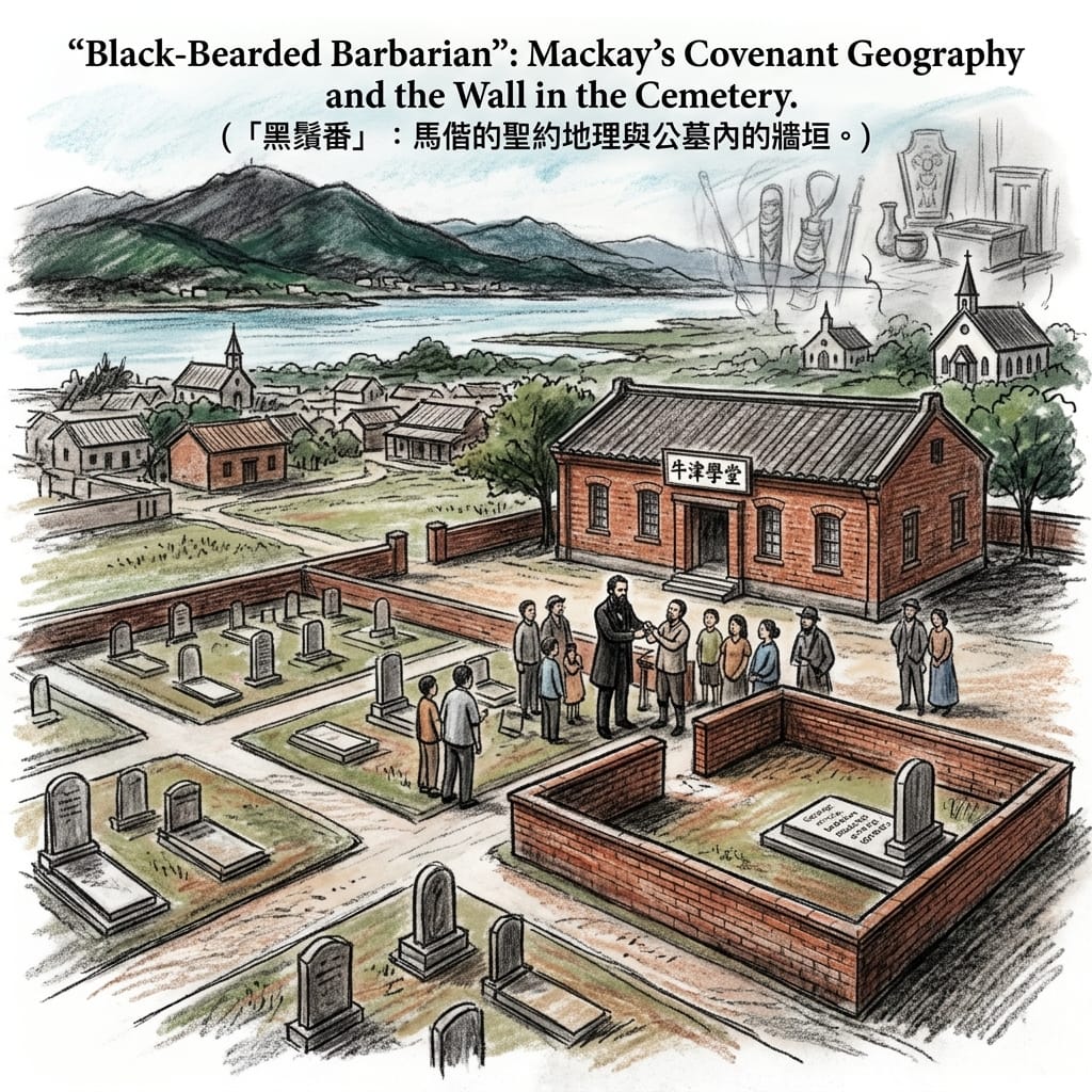
The human history. George Leslie Mackay, a Canadian Presbyterian missionary, arrived in Tamsui on March 9, 1872, and made it the base for the first Presbyterian mission in northern Taiwan. Over nearly three decades he combined preaching with dentistry — pulling teeth by the tens of thousands, often in public demonstrations that doubled as evangelism — and education, founding roughly sixty chapels, a girls' school, and, in 1882, Oxford College, the forerunner of today's Aletheia University, funded largely by a fundraising drive among his home congregations in Oxford County, Ontario. He married a local woman, trained Taiwanese clergy rather than relying solely on foreign missionaries, and picked up the local nickname "Black-Bearded Barbarian." He died of throat cancer in Tamsui in 1901.
The Missionary Who Walled Himself In
The Reformed covenantal lens. In his own writing, Mackay describes confiscating and destroying what he called local "idol worship" — a documented instance of one belief system attempting to physically dismantle the material infrastructure of another, on the very ground discussed in the previous section. It's worth stating without euphemism: the Presbyterian mission's spatial project here was explicitly covenantal in its own self-understanding. Building a chapel meant, in the Reformed missionary theology of the period, literally reclaiming a piece of land from spiritual darkness into covenant — the same underlying logic, differently denominated, that had animated the Spanish Dominican project at this same river mouth two and a half centuries earlier. The single most revealing detail in this entire dossier is Mackay's own burial instruction. He asked to be buried in the Tamsui Foreign Cemetery, but behind a wall physically separating his plot from the rest of the grounds — themselves already divided by a cross-shaped path into quadrants for Protestants, Catholics, merchants, and officials. Even the missionary most deeply woven into local Taiwanese life chose, in death, to maintain a literal boundary between his covenant community and everyone else around him, foreign or otherwise. That wall isn't a footnote. It's a theology of separateness rendered in brick.
Mackay's grave sits enclosed exactly as he asked, in a corner of what is now a school campus, the iron fencing and the gap in continuity with the neighboring foreign graves still legible to anyone willing to walk the perimeter rather than just read the plaque.
V. One Hilltop, Three Gods
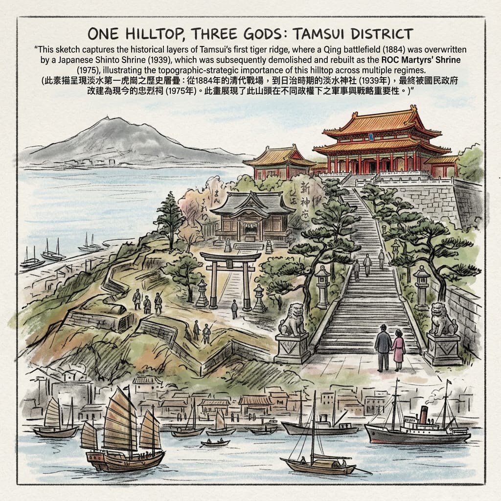
The human history. The first of the Five Tiger Ridges — the same high ground Qing defenders held against the French in 1884 — was chosen by the Japanese colonial government in 1939 as the site of Tamsui Shrine, dedicated to the Meiji Emperor, the harvest goddess Toyouke, and, as at other Taiwan shrines of this era, Prince Kitashirakawa Yoshihisa, who died during Japan's 1895 conquest of the island. The shrine had barely six years of active use before Japan's 1945 defeat. The postwar Republic of China government initially kept the physical Japanese structure under a new name — a county martyrs' shrine — before demolishing it entirely in 1975 and rebuilding it in Chinese palace style as today's New Taipei City Martyrs' Shrine, honoring an entirely different set of war dead.
The Most Contested Hill In Taiwan
Reading the layers. This single hilltop now carries three sequential and mutually incompatible sacred claims: a Daoist / Mazu framework remembering the ground as the site of a goddess-sanctioned military victory; a Shinto framework that formally reconsecrated the same ground as a dwelling for imperial and pioneer kami, deliberately overwriting the Qing-era meaning with a new narrative of Japanese sacrifice; and a Republic of China framework that judged the Shinto architecture inseparable from its cosmology and chose to bulldoze it rather than reinterpret it. Every regime needed this exact hill for the same reason: each needed to narrate the same strategic high ground as its own founding sacrifice. What survives from the Shinto period — stone retaining walls, a pine-lined approach path, guardian lion statues repositioned along the original layout — is the physical residue of a spiritual claim that even its own government's successor found it necessary to demolish rather than simply reinterpret. Compare that to Fuyou Temple, in continuous use on the same site since 1796, where meaning has been allowed to accumulate in layers rather than be scraped clean. One building let its history stack up. The other has been torn down and rebuilt by every government that has held it. That contrast is not incidental. It is, arguably, the single most concrete finding in this entire dossier about how state power in Taiwan has actually treated sacred architecture: not as heritage to be preserved, but as an instrument to be reissued.
Conclusion: Memory as the One Thing No Regime Could Fully Erase
It would be easy to flatten Tamsui into a pleasant collage of colonial leftovers strung along a scenic river — a fort here, a missionary's grave there, a sunset to close out the day. That framing misses the pattern underneath it. Over four hundred years, Ketagalan islanders, Spanish Catholic friars, Han Daoist settlers, Canadian Presbyterian missionaries, Japanese Shinto officials, and the postwar Republic of China government have all, independently, felt compelled to physically consecrate the same handful of ridgetops in their own sacred vocabulary, rather than simply administering the land. Political historians tend to read this as a sequence of separate conquests. Travel writers tend to read it as charming multicultural texture. Neither lens registers what actually emerges once you set the ridges side by side: Tamsui's real signature isn't any single culture's belief system. It's the terrain's unusual power to force every occupier, regardless of what they actually believed, into the identical reflex of consecrating the same high ground — a pattern about what geography can do to belief, rather than a pattern belonging to any one belief itself.
In an age that increasingly treats the past as something to be scraped, searched, and summarized in seconds, Tamsui is a reminder that historical memory — the slow, contested, physically layered kind, the kind you can only get by standing on the actual hill — remains one of the few things that can't be fully digitized out of existence. If that's the kind of history you want more of in your life, our newsletter sends out one deep dive like this every so often — no noise, just the places worth standing in.
Accessing the Physical Node
Getting there: From central Taipei, take the MRT Tamsui-Xinyi line to Tamsui Station; it's a ten-to-fifteen-minute walk from there to the Old Street and Fort San Domingo. With extra time, the riverside promenade from the station makes for a slower, more deliberate approach, with several unbroken sightlines across to Mount Guanyin along the way.
Where to base yourself: The Old Street area has a range of riverside guesthouses and hotels, and is worth treating as a base for a full afternoon rather than a quick sunset stop squeezed in before dinner.
Guided access: The Tamsui Fort San Domingo Museum runs periodic guided tours of the fort and Fuyou Temple. To take in all five sites covered here — Fuyou Temple, Fort San Domingo, Mackay's grave, Oxford College at Aletheia University, and the Martyrs' Shrine — set aside at least half a day, and consider a local historical guide if you want to actually walk this history rather than just pass through it.
🔍 Tamsui Ghost Lore & Geospatial History Q&A
Q1: Are the ghost stories and secret underwater tunnels at Tamsui Fort San Domingo real?
A1: Rumors of haunted dungeons and secret underwater tunnels at Fort San Domingo stem from four centuries of colonial transition. Originally established as Spanish Fort San Domingo (1628), rebuilt by the Dutch as Fort Anthonio (1644), and later leased as a British Consulate with dark prison cells, the structure features 2-meter-thick masonry walls, brick vaults, and subterranean cisterns that create oppressive acoustics. The legendary "secret tunnel beneath the river" is a myth arising from 19th-century colonial drainage channels and World War II air-raid shelters. Public anxiety surrounding colonial incarceration and wartime defense naturally evolved into modern urban legends of ghosts and hidden passageways.
Q2: Did Goddess Mazu manifest miracles and fog to defeat the French Navy at Tamsui Fuyou Temple?
A2: The legend of Goddess Mazu summoning supernatural fog to blind the French navy at Fuyou Temple originates from the 1884 Battle of Tamsui (Franco-Chinese War). Historical records show that Qing commander Sun Kaihua strategically exploited Tamsui's coastal geography—sandbars, low tide at Shalun, and dense bamboo groves—to ambush landing French marines. Meanwhile, naturally occurring estuarine humidity generated heavy sea fog that hindered French naval artillery precision. Following the victory, Emperor Guangxu bestowed an imperial "Shen Zhao Hai Biao" plaque upon Fuyou Temple, elevating a tactical victory rooted in estuarine geomorphology into a sacred narrative of divine protection.
Q3: What is the historical truth behind the haunted rumors at Tamsui Martyrs' Shrine and Five Tigers Hill?
A3: Eerie rumors regarding Tamsui Martyrs' Shrine stem from a sequence of sacred space replacements atop Five Tigers Hill. Situated on the fourth ridge of Tamsui's natural "Five Tigers Hill" terrain, the site was originally developed in 1939 as the Japanese Tamsui Shinto Shrine. Following World War II, the Nationalist government demolished the Shinto structures and erected a traditional Chinese palace-style Martyrs' Shrine to honor fallen soldiers. The dense canopy of ancient trees combined with the psychological weight of forced religious and political transitions generated local ghost lore. In reality, the site reflects 400 years of shifting geopolitical sovereignty over Tamsui's strategic heights.
Reference and Further reading
First layer – Main sources of literature and institutions:
- New Taipei City household/administrative gazetteers recording the 1912 name-change order from Hobe to Tamsui;
- Taiwan Governor-General's Office administrative records (Japanese colonial period).
- Spanish colonial administrative correspondence referenced in Formosa-period Dominican records (Manila archives);
- Tamsui Historical Museum site documentation on Fort San Domingo's construction phases.
- New Taipei City Cultural Affairs Bureau heritage designation records for Fuyou Temple (third-class historic site);
- Qing dynasty plaque inscription, extant in situ.
- Presbyterian Church in Canada Archives (Mackay family fonds, including original diaries housed at Oxford College/Aletheia University);
- Mackay's will, referenced in secondary biographical sources regarding his burial instructions.
- New Taipei City government heritage records for the Martyrs' Shrine site;
- Japanese colonial-era shrine registry documentation for Tamsui Shrine (淡水神社) construction and enshrined deities.
The second layer – secondary academic materials:
- Inō Kanori's early ethnographic surveys of Taiwan's plains indigenous peoples;
- Academia Sinica Institute of History and Philology linguistic-diversity research on the Tamsui River mouth as a point of dialect divergence.
- José Eugenio Borao's published research on the Dominican mission in Taiwan (1626–1642);
- Academic surveys of Spanish Formosa's colonial administration and demographics.
- Local gazetteer and urban-geography scholarship on the Wuhugang (Five Tiger Ridges) topographic-cultural classification;
- Sino-French War military histories (Keelung Campaign scholarship).
- George Leslie Mackay, From Far Formosa: The Island, Its People and Missions (1896), read as a primary missionary ethnography rather than neutral history;
- Marian Keith, The Black-Bearded Barbarian (1930), a hagiographic biography requiring critical distance.
- Scholarship on the conversion of Taiwan's Shinto shrines into ROC Martyrs' Shrines as a case study in postcolonial spatial politics (e.g., comparative work on the Taoyuan Martyrs' Shrine conversion, methodologically parallel to Tamsui's).
Third layer – Supplementary information:
- Ketagalan descendant oral-history and revitalization-movement accounts (Indigenous Sight/IPCF-TITV documentation), treated as cultural-interpretive testimony, not verified ethnographic fact.
- Bishop Diego Aduarte's own missionary reports (Historia de la Provincia del Santo Rosario), treated as a participant-observer religious account rather than neutral record.
- Temple-tradition accounts of Mazu's intervention in the 1884 battle, treated explicitly as devotional/cultural-interpretive data rather than verified military fact.
- Local Tamsui oral tradition regarding Mackay's public dentistry demonstrations and popular nickname, treated as cultural-memory data.
- Local heritage-walk and photographic-documentation accounts (independent researcher fieldwork) describing which specific Shinto-era physical elements (stonework, trees, lion statues) survive on site today.
Historical gap:
- No surviving, credibly documented Ketagalan sacred-geometric, astronomical, or ritual-calendar system specific to the Tamsui river mouth was located in this research. 建議進一步查證原始檔案 (further archival and community-sourced verification recommended, ideally in direct consultation with Ketagalan descendant knowledge-keepers rather than secondary ethnography alone).
- The indigenous side of the 1636 fort-burning — motivations beyond the taxation dispute recorded in Spanish sources, and any Ketagalan/Basay oral memory of the event — is not preserved in the available record. 進一步查證原始檔案建議 for Philippine and Vatican archival holdings on the Dominican Formosa mission.
- The exact founding date of Fuyou Temple is itself contested in the record — some accounts place initial establishment in the Yongzheng era, with 1796 marking a rebuilding rather than a founding. 建議進一步查證原始檔案 (temple stele inscriptions and Qing land records would help resolve this).
- Mackay's own account of confiscating indigenous/folk-religious ritual objects lacks a corresponding record of how the communities he took them from remembered or narrated the loss. 建議進一步查證原始檔案 in Taiwanese Presbyterian Church regional records and any surviving local-family oral history.
- Detailed contemporaneous ROC-era documentation of the 1975 demolition decision-making process — who ordered it, what internal debate (if any) preceded destroying rather than adapting the existing Japanese structure — was not located in this research. 建議進一步查證原始檔案 in New Taipei City/Taipei County municipal archives from 1973–1975.
 Lawrence
 Lawrence
 Lawrence
 Lawrence
© Historical Travel Stories | Unraveling Strange Tales Across Dimensions and Time