Devil's Peak & Yau Tong: A Gate That Cannot Be Kept
At the eastern end of Victoria Harbour, the water narrows to 420 metres. In that gap — between a granite mountain named for its fearsome pirate and a gun cliff built to contain the world's last Brennan torpedo

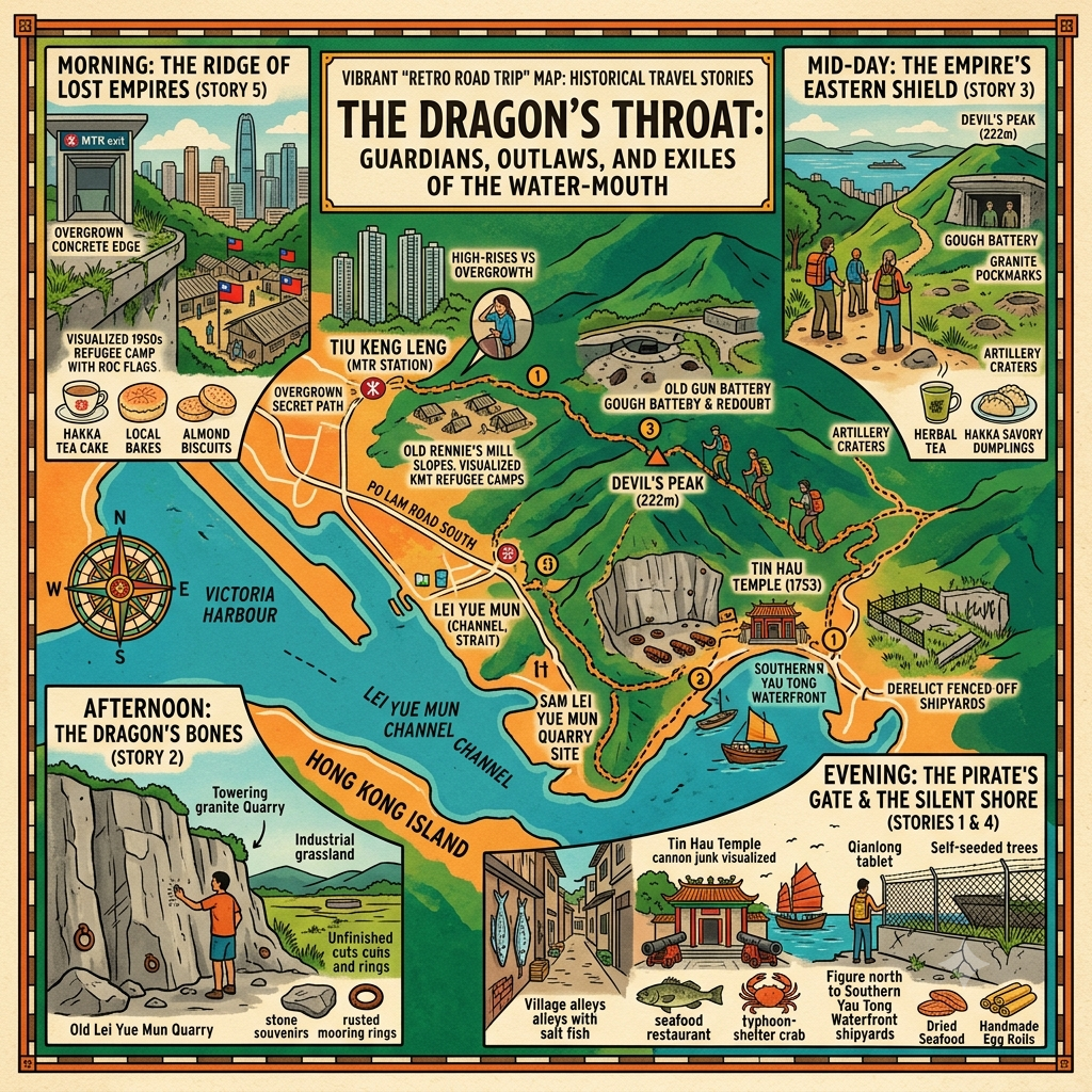
Devil's Peak, the Dragon's Descent, and Three Centuries of Failed Guardians at Victoria Harbour's Eastern Throat
 Lawrence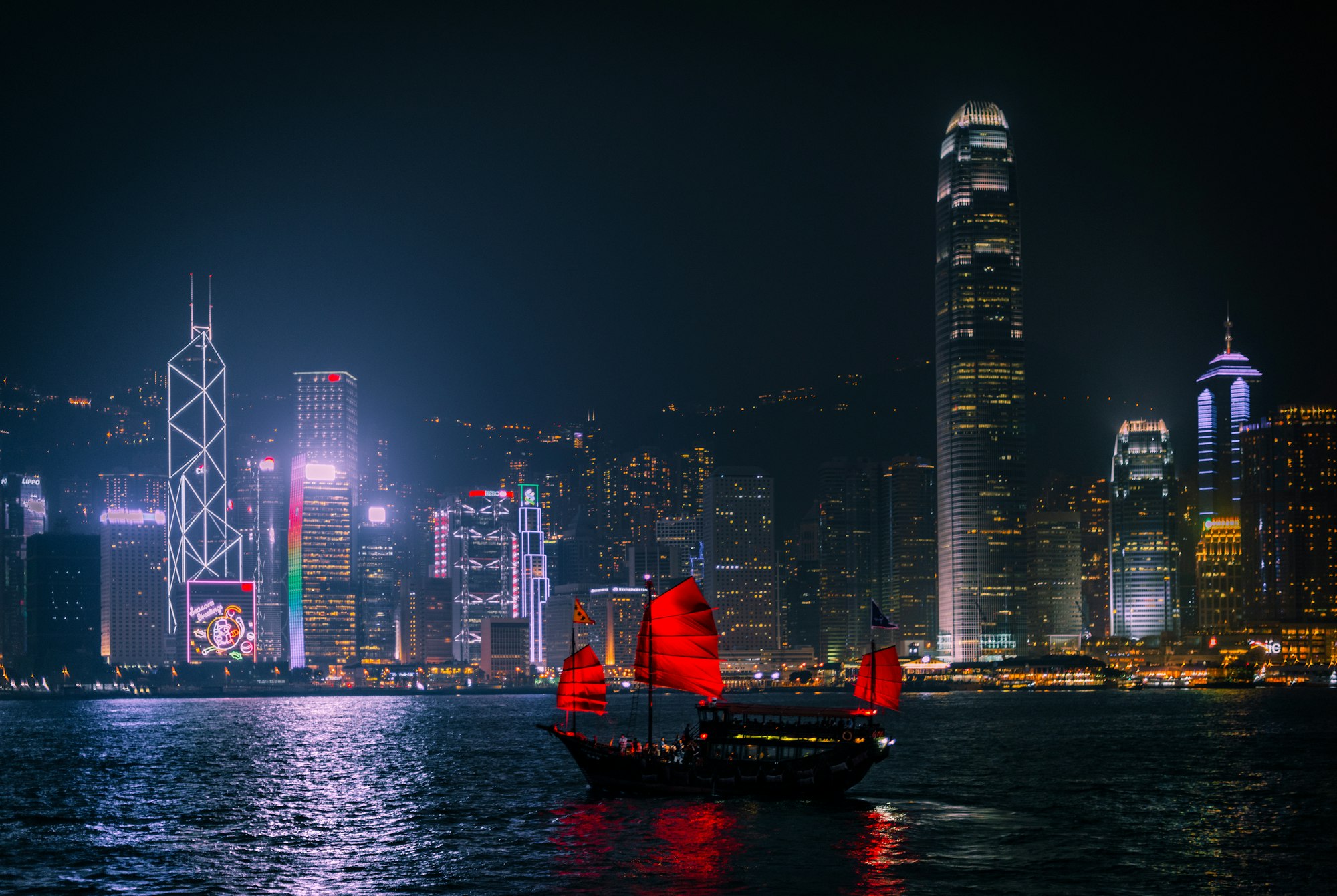
A deep-history travel essay about Devil's Peak (魔鬼山), Lei Yue Mun, and Yau Tong in east Kowloon — three sites that contain, within a single mountain and its shoreline, five of Hong Kong's most extraordinary and overlooked histories. Drawing on feng shui, folk cosmology, and archival research, the article decodes why this specific 420 metres of water has been the most contested point in four centuries of conflict. Includes a practical guide for visiting the physical sites today.
The Mountain Named for Its Pirate
Stand on the summit of Devil's Peak at first light, when the mist from the South China Sea is still filling the lower channels and the container ships are moving through it without sound, and you are looking down at a gap in the earth's surface that has determined the fate of this part of Asia more decisively than any decision made in London, Tokyo, or Beijing.
The gap is 420 metres wide — the eastern mouth of Victoria Harbour, the only maritime approach from the east. On one side: the cliff faces of Hong Kong Island, where the British would eventually carve a torpedo station from the living granite. On the other: the mountain you are standing on, which carries two Chinese names and keeps the older one. One name calls it the Cannon Fort Hill — the military geometry of the colonial century, still audible in the syllables. The other name — the name that survived — calls it Devil's Peak. That name is much older, and it belonged first to a pirate.
This is an article about five histories that happened within walking distance of each other, across four centuries, and that conventional historical categories have kept separated when the geography always held them together.
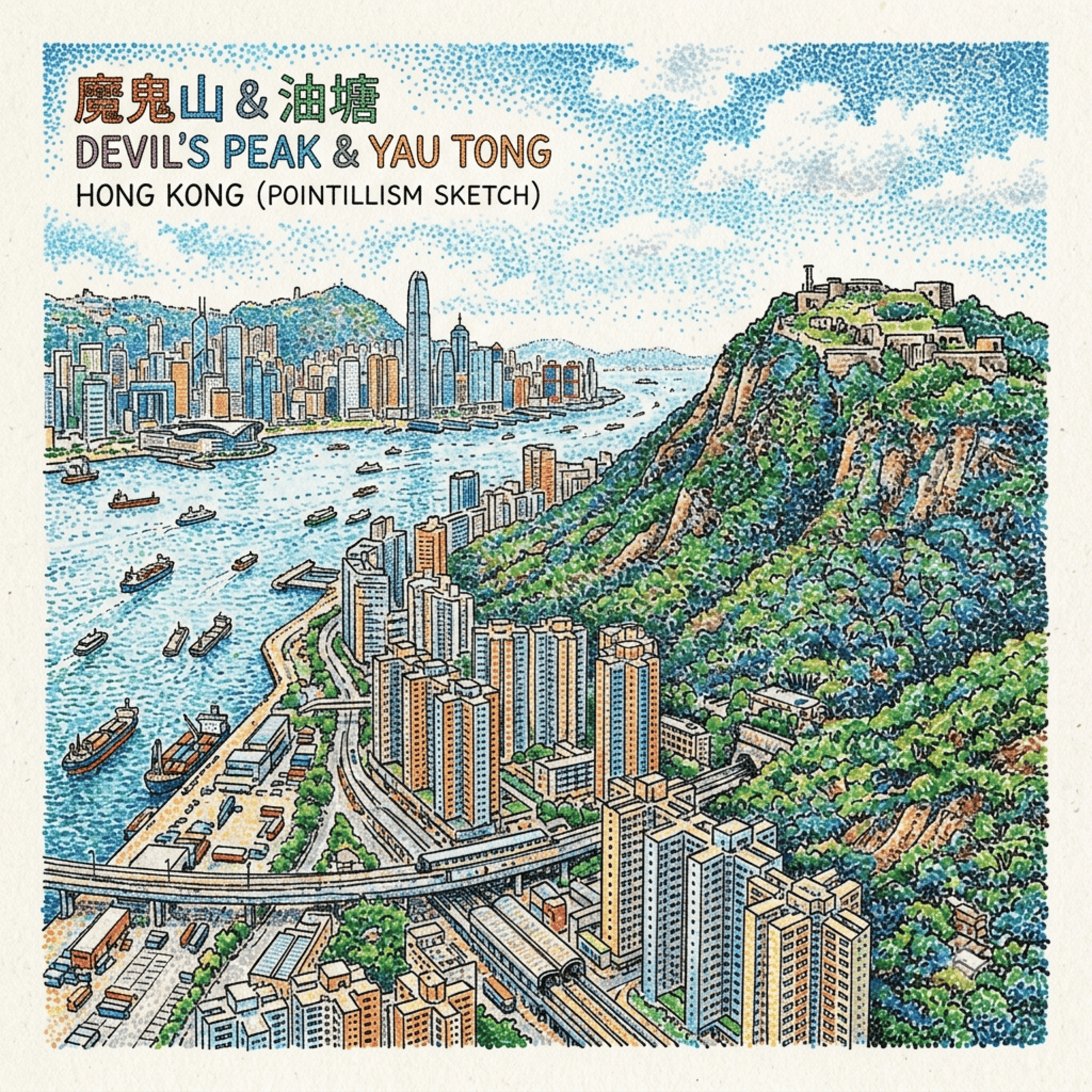
Listen to the historical stories told in detail (For subscribers only)
I. The Dynasty at the Water's Mouth (1735–1810)
Long before the British decided this gap needed a torpedo, a family had already understood what it was worth and built a temple at its edge.
The Cheng clan were not ordinary pirates. Their genealogy traced back to Zheng Chien, a naval officer under Koxinga — the legendary pirate-patriot who drove the Dutch from Taiwan in 1662 and held a Ming loyalist kingdom there for twenty years after the dynasty had collapsed on the mainland. When Koxinga sailed east, Zheng Chien's descendants did not follow. Instead, they settled at Lei Yue Mun — the Carp Gate — and in the generations that followed, built the business of controlling the harbour's eastern entrance into a hereditary institution.
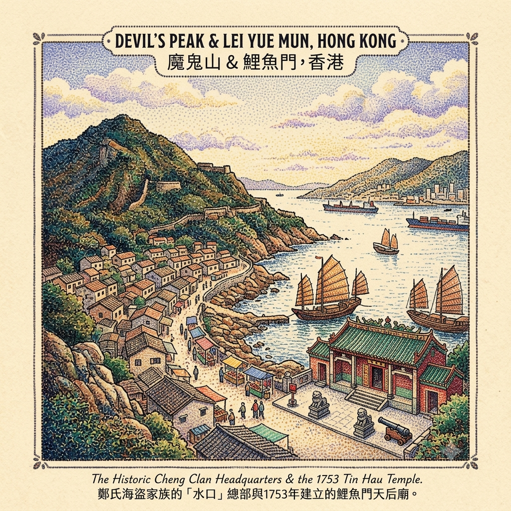
In 1753, the Cheng patriarch at Lei Yue Mun — recorded in later documents as Cheng Lin Cheong — built a Tin Hau temple at the water's edge. Tin Hau is the Empress of Heaven, the patron goddess of all who work the sea. Her temple at Lei Yue Mun is still there, a Grade III historic building at the end of the village path, its stone inscriptions confirming Cheng Lin Cheong's patronage — rediscovered, embedded in the original masonry, during a restoration in 1953. They have been in the stone for two hundred and seventy years.
Building a Tin Hau temple at a water-mouth is not only a devotional act. The temple's placement was a declaration of territorial authority in the vocabulary this culture knew best: the goddess's gaze fixed permanently on the maritime threshold that her patrons controlled. Every vessel entering the harbour from the east passed under her supervision and, by extension, under the Cheng family's.
The 420 Meter Pirate Empire
Cheng Lin Cheong's son or grandson — the genealogy requires further archival confirmation — was a man called Cheng I, and what he built from the Lei Yue Mun base was, by any global metric, the largest private military force in history. By 1807 he commanded 600 warjunks and more than 40,000 men, having unified six rival pirate fleets into a single confederation. For context: the Spanish Armada, at its most fearsome, launched 130 ships.
Then Cheng I died in a storm off Vietnam, in November 1807. And his wife took over.
Ching Shih — known in Chinese as Cheng I Sao, meaning simply Cheng I's widow — is the most successful pirate commander in recorded history, by any measure that matters. Under her direction, the confederation grew from 800 to 1,800 warjunks, with an estimated force of between 40,000 and 80,000 people under arms. Blackbeard, at his height, had four ships and 300 men. The Qing imperial navy, the British East India Company, and the Portuguese colonial fleet were all unable to defeat her in open battle.
She surrendered eventually, in 1810, on terms she negotiated — retaining the bulk of her wealth, retiring to Guangzhou, and living to approximately seventy years old. The pirate queen of the South China Sea died of natural causes and is, somewhere, still unlocated in the historical record.
The family enterprise that produced her, across three generations, had its operational headquarters at the foot of the mountain now known as Devil's Peak. The temple her ancestor commissioned is still receiving incense offerings from fishermen whose boats pass through the same 420 metres.
Holographic Sensory Cue: The approach to the Tin Hau temple at Lei Yue Mun requires passing through an alley of seafood restaurants so narrow that the shoulders almost brush the walls — charcoal smoke, brine, the mineral cold of shellfish on ice. The alley opens onto the temple frontage without warning. The building is smaller than expected, quieter than anything else in the village. Stone cannons stand at the entrance, their patina the colour of very old rust — 270 years of salt air and incense rather than any applied treatment. Inside, the temperature drops by several degrees: thick granite walls, and whatever else thick granite walls contain. The Tin Hau figure sits in gold brocade that has been replenished many times; the expression on her face is the calm of permanent authority. Through the open temple gate, framed precisely: the Lei Yue Mun channel, 420 metres of reflective water, and a container ship crossing it with the unhurried confidence of something that knows the goddess is watching.
II. The Bones of the Mountain (c. 1780s–1967)
Half a century after the Cheng family built their temple, another community settled on the lower slopes of Devil's Peak and began, quite literally, to take the mountain apart.
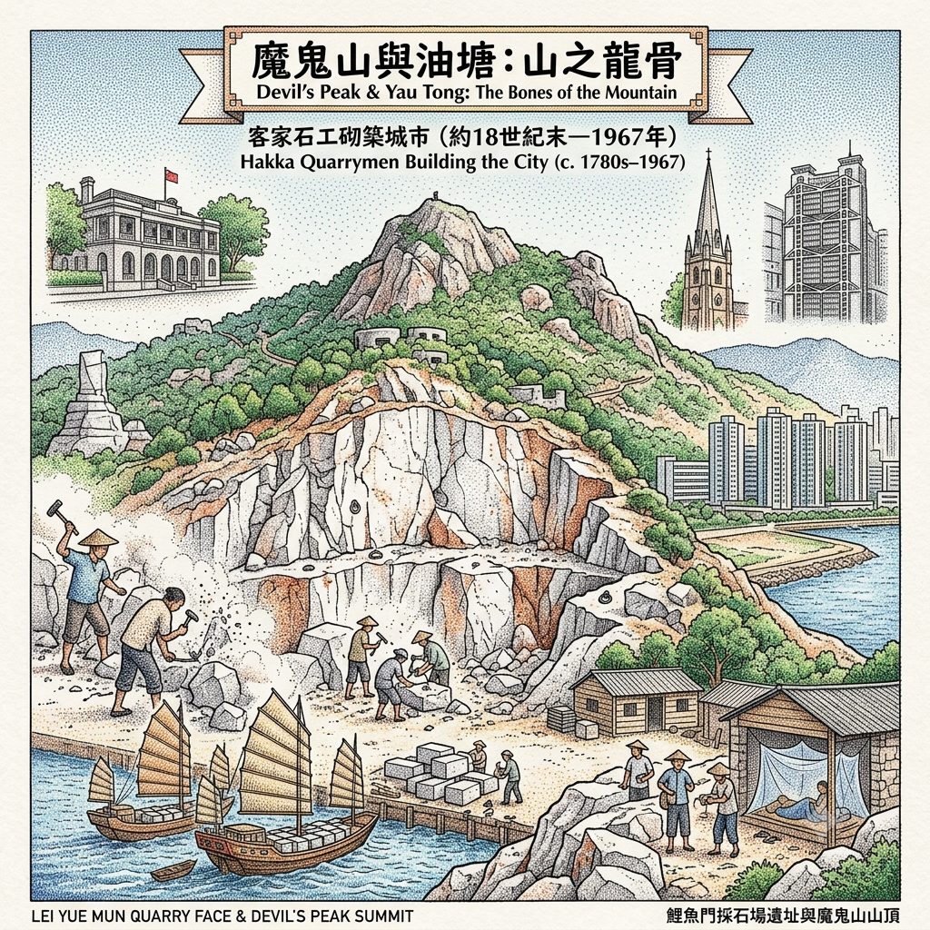
The Hakka people who established the quarrying villages of east Kowloon in the late 18th century had a particular skill for reading mountains — not for their strategic position or cosmological significance, but for the quality of the stone inside them. The granite of Devil's Peak and its surrounding hills was exceptionally dense and fine-grained, capable of a high polish, prized throughout the Pearl River Delta for prestige construction. Four Hakka quarrying villages worked this ridge: Cha Kwo Ling, Ngau Tau Kok, Sai Tso Wan, and Lei Yue Mun. Collectively known as the Four Hills of Kowloon (九龍四山), they operated under a governance structure unusual for migrant labour communities: an officially recognised headman system under the Qing dynasty, and a communal hall — the 四山公所 — for coordinating the stone trade across all four villages.
After 1841, the British colony's building programme created an insatiable market for everything the Four Hills could produce. The granite that built Flagstaff House, St John's Cathedral, the Supreme Court, and the early HSBC headquarters came from these quarries — quarried from the slopes now occupied by hiking trails and military ruins, hauled down to water, and shipped across the harbour. At its peak, the Lei Yue Mun quarry employed one-eighth of the local population. The stone also shipped further: to Guangzhou, to Shunde, to the Netherlands, eventually to Japan.
The Dragon Bones That Built Hong Kong
Workers lived in single-storey barracks of timber and stone at the quarry's foot, sleeping on elevated wooden platforms, with blankets and mosquito nets supplied by the operators. A formal afternoon rest period was observed in the hottest months — between Dragon Boat Festival and Mid-Autumn Festival — in what was otherwise a colonial economy with no labour law worth the name.
The industry ended not in exhaustion but in politics. The 1967 leftist riots prompted the colonial government to ban explosives citywide, fearing their misappropriation. Quarrying without explosives meant quarrying by hand alone — costs that no market price could sustain. The Lei Yue Mun quarry closed within a few years. The quarry face is still there, below the hiking trail to Devil's Peak summit: raw cuts left mid-sentence, iron hoisting rings still set in the granite, the whole face arrested at a moment in the late 1960s and preserved by abandonment.
The people who dismantled this mountain in order to build a city have no memorial in that city. The buildings their stone went into stand across Hong Kong. The quarrymen who cut and carried it are not named in any plaque attached to any of them.
Holographic Sensory Cue: The quarry face at Lei Yue Mun is reached by a path running behind the seafood village and above the harbour. The granite is grey-white with rust-orange seams where iron has leached through — the colour of very old ice. Press a palm against it: cooler than the air by several degrees, and granular at a scale just below visual resolution, the crystal structure registering as generalised roughness against the skin. The unfinished cuts run horizontally across the face, each beginning with decisiveness and ending in nothing. The iron rings set in the stone — two inches in diameter, oxidised dark — held hoisting machinery that has been gone for decades. Below the path, through a gap between village buildings, the Lei Yue Mun channel is visible: the direction in which the stone was carried. The quarry is silent in a way that the seafood village directly below it is not. The contrast, which happens in about twenty steps, is immediate and absolute.
III. The Last Guided Torpedo, and the Night the Fishing Boats Won (1892–1941)
What happened at Lei Yue Mun between 1892 and 1894 is not well known. It should be.
Louis Brennan — an Irish-Australian engineer — patented the world's first practical guided weapon in 1877. The Brennan torpedo was steered in real time by an operator on shore, using two steel wires connected to contra-rotating propellers that could be differentially controlled to alter the weapon's course underwater. It ran at twelve feet of depth, reached speeds of up to 27 knots, and could be guided with sufficient accuracy to hit a specific ship in a specific channel. In principle, it was the direct ancestor of every wire-guided anti-tank missile and precision munition developed in the following century. Every laser-guided bomb in the 20th century arsenal is the Brennan torpedo's technological grandchild.
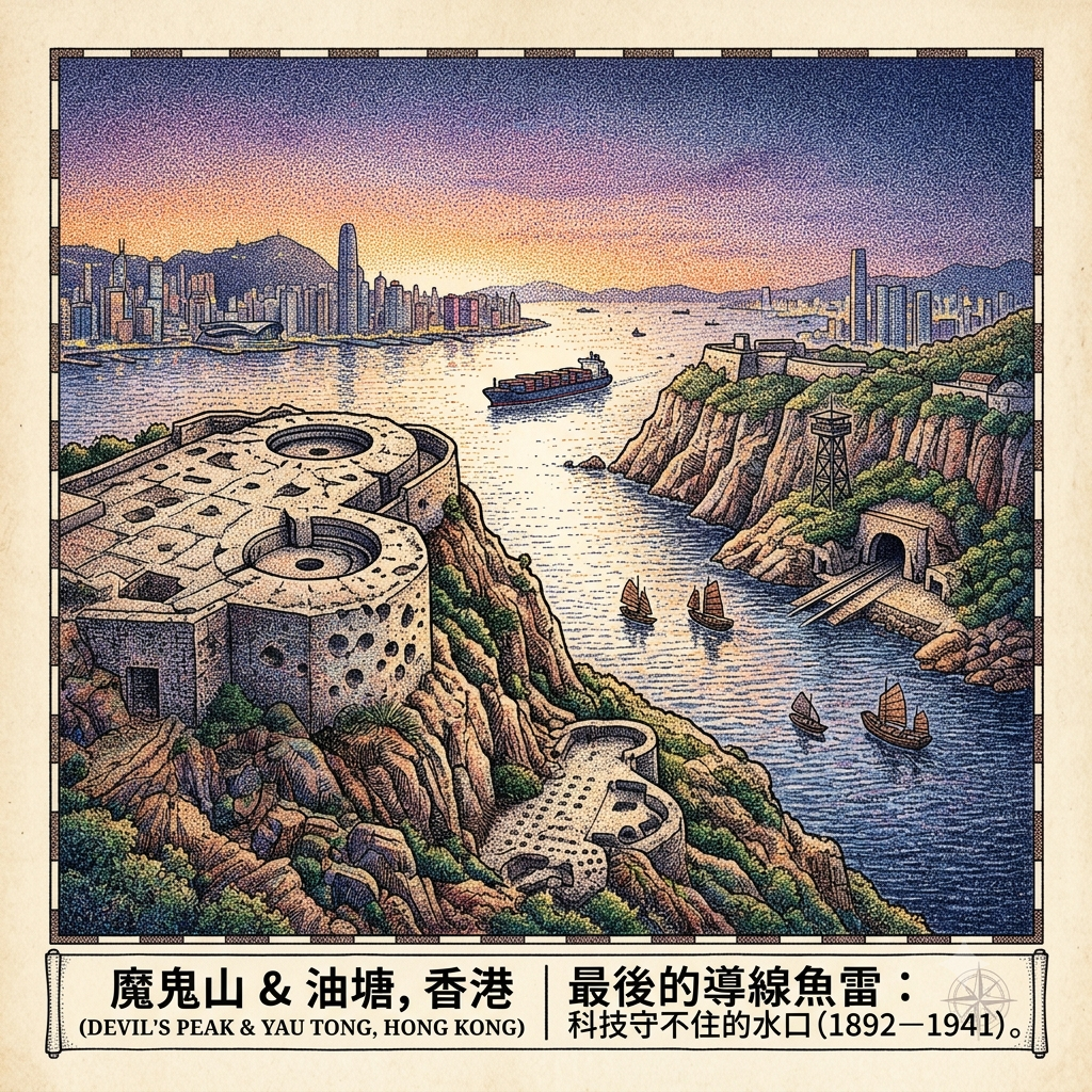
Between 1892 and 1894, the final Brennan torpedo installation ever built — the last example constructed either in Britain or anywhere in her empire — was installed at Lei Yue Mun Fort on the Hong Kong Island side of the channel, directly facing Devil's Peak. It was not inserted into an existing structure. A cave was hewn from the cliff face, a torpedo slipway cut down to the water, and a 40-foot steel observation tower erected from which the operator could see and steer the weapon across the channel. The stone removed in building it was almost certainly quarried from the same Hakka communities working the hill across the water.
On Devil's Peak itself, the British completed Gough Battery and Pottinger Battery after 1898, and added the summit Redoubt in 1914. Devil's Peak was designated headquarters of Eastern Fire Command. Between the torpedo station on one shore and the gun emplacements on the other, the 420-metre channel was, on paper, the most technically comprehensive naval defence in East Asia.
The Battle of Hong Kong lasted eighteen days. The Gin Drinkers' Line — a defensive network across the Kowloon hills, conceived on the Maginot principle — was expected to hold for weeks. It lasted two days. Devil's Peak, as the line's eastern anchor, became the final Kowloon position as the rest of the peninsula fell. The fighting on December 12th was the most intense of the mainland campaign. By the morning of December 13th, the position untenable and no reinforcement possible, the remaining defenders crossed to Hong Kong Island under fire. The Japanese found an empty summit and converted it, immediately and logically, into an artillery platform for shelling the island they had not yet reached.
The Guided Missile Defeated By Wooden Boats
On the night of December 18th, seven Japanese battalions — 7,500 soldiers — crossed the Lei Yue Mun channel in sampans and commandeered wooden junks. They moved in darkness, at low tide, in the smallest craft available. The Brennan torpedo station, designed to destroy naval warships crossing in daylight, had no tactical response to infantry in open boats at night. No gun on Devil's Peak could depress far enough to engage targets at waterline in the channel immediately below.
Ching Shih, 130 years before, had controlled this same water from the same shore in similar craft. The Japanese crossed it the same way, for the same reason: this channel rewards whoever has thought smallest.
Hong Kong surrendered on Christmas Day 1941. Governor Mark Young signed the document in the Peninsula Hotel ballroom, facing north, away from the strait he had failed to close.
Holographic Sensory Cue: Devil's Peak summit Redoubt, late afternoon. Two circular gun emplacements open to the sky — wide enough to lie down in, the concrete floors worn in specific patterns recording the movement of equipment and men who have been gone for more than eighty years. On the western face of the caponier, irregular depressions in the concrete: Japanese artillery rounds from December 1941, uninterpreted and unlabelled, existing as pure physical fact — the record of a specific event compressed into the surface of a specific wall. From the summit, the Lei Yue Mun channel is narrower than imagination suggests: a band of reflective water between two landmasses, with a container ship crossing it now, its hull larger than the entire fleet of sampans that made the same crossing in 1941, its passage making no sound at this distance. The wind off the South China Sea is consistent and cool. There are no other visitors. The silence, after the climb through the cemetery and along the exposed ridge, has the quality of something the landscape has been holding in reserve.
IV. Swimming Pond, Oil Pond, Waste Ground (1920s–present)
Yau Tong's history is contained in its name — or rather, in two versions of its name that are phonetically identical in Cantonese and mean opposite things.
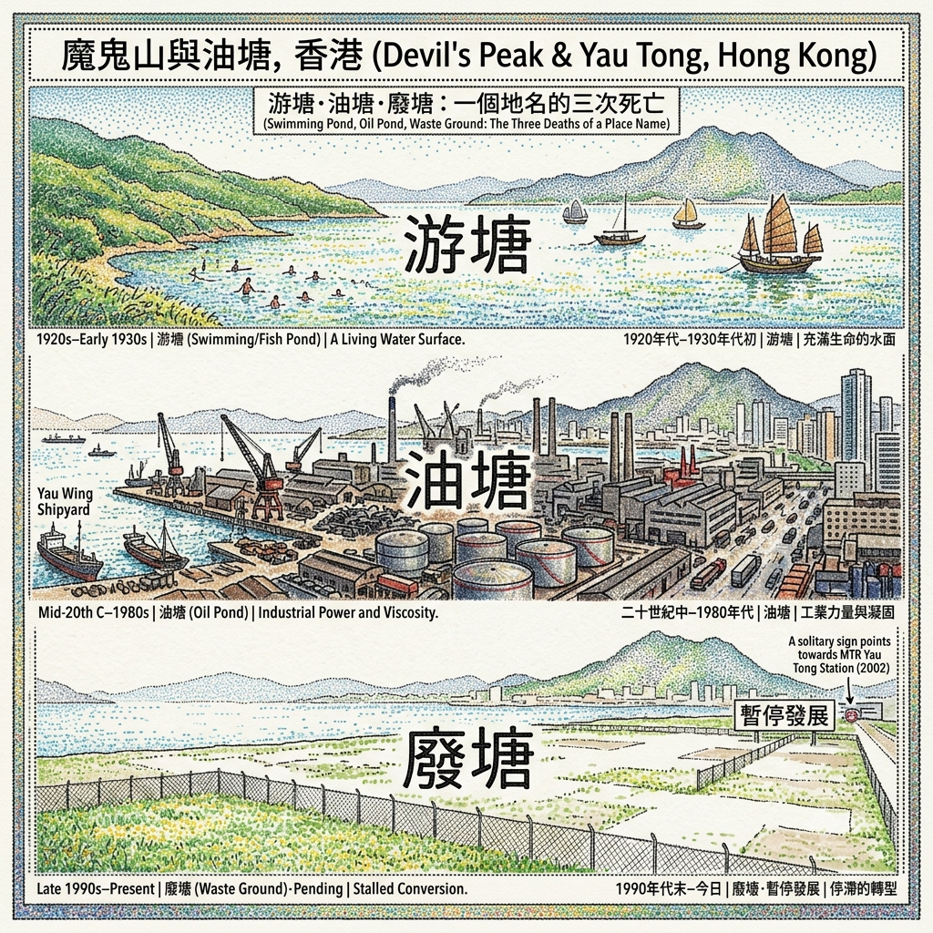
The earliest maps, including a British military survey of 1924, record the place as 游塘 — swimming pond, or fish pond: a living water surface at the base of Devil's Peak's western slope, facing the harbour. At some point in the early 20th century, the character 游 was replaced by 油. Same sound, different meaning: oil pond. The substitution tracked the arrival of petroleum storage tanks at the bay's southern end. In a strictly administrative sense, the new name was simply more accurate.
But naming is never only accuracy. A place called swimming pond carries different obligations from a place called oil pond. The character 游 implies movement, living things navigating water, the agency of creatures; 油 implies viscosity, weight, stasis — something that coats and does not drain. The renaming of Yau Tong from 游 to 油 is one of the most compressed accounts of industrial Hong Kong available, readable in a single syllable that split into two meanings.
The Curse Of Oil Pond
What followed was the full 20th-century industrial arc. The bay was reclaimed from the sea in the late 1950s to provide industrial land for a colony managing rapid population growth. By the early 1980s, the reclaimed ground held steel scrap yards, two operating shipyards, and multiple textile and weaving factories. Photographs from 1983 show what appears, from the air, to be a working industrial district. Devil's Peak is visible in the background, unchanged.
Then the logic shifted, as it reliably does. The 1967 riots had already begun a disruption; factories found cheaper locations; residential conversion was planned for the 1990s. The buildings were demolished. The conversion did not happen on the planned schedule, or on any revised schedule that has yet been met. The former industrial lots of southern Yau Tong remain enclosed behind chain-link, grass-covered, facing the harbour — not ruins, since ruins require a structure to have decayed in place, and these structures were deliberately removed; not development, since development requires something to have been built. A suspended administrative present tense. The swimming pond became an oil pond; the oil pond became waste ground; the waste ground remains, in a state that has been described as pending for twenty years.
The Chinese Permanent Cemetery occupies the hillside between Yau Tong and Devil's Peak, arranged in rows on the mountain's slope, each grave oriented toward the water. The dead pointing in the direction the living pointed when they chose this site.
V. The Republic on Suicide Ridge (1903–1996)
Above and east of Yau Tong, on the northern slope of the Devil's Peak ridge, there is a place that has carried three names, each one replacing the last without fully displacing it.
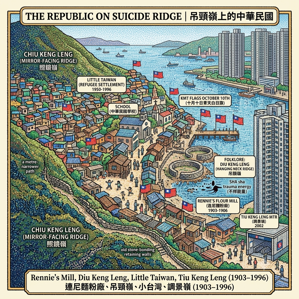
Its original topographic name was Chiu Keng Leng — Mirror-Facing Ridge, a neutral description of the hillside's orientation. In the early 1900s, a Canadian businessman named Alfred Herbert Rennie built a flour mill in the valley below, intending to supply Hong Kong's Chinese population with domestically milled grain. The enterprise failed within three years. Rennie died by suicide. The documented method, in the historical record, is drowning; what the neighbourhood remembered and repeated was hanging; and in the folk geography of this culture, what is remembered becomes what is named. The area was renamed 吊頸嶺 — Hanging Neck Ridge, or Hangman's Ridge. It rhymes with its predecessor. It means something entirely different. The English name Rennie's Mill preserved the failed enterprise in a more neutral register, as English names often do.
In the geomantic tradition native to this landscape, a place named for a violent death carries sha — accumulated inauspicious energy associated with sites of trauma. Sha is not a supernatural claim; it is a cultural technology for marking places that carry psychic weight, that resist easy habitation, that retain the imprint of what has happened on them. A place where someone died violently is a place that carries, for any community subsequently settled upon it, the implication of that ending. This is where, on June 26, 1950, the Hong Kong colonial government deposited seven thousand Kuomintang refugees in oil-paper shelters built in a matter of days.
The political arithmetic was brutal and clear. After the Communist victory in China's civil war, tens of thousands of Nationalist soldiers, civil servants, and their families had poured into Hong Kong. Their presence complicated British neutrality; their allegiance to the Republic of China created a standing problem for the colony's relationship with the People's Republic forming across the border. The solution was distance: move them to the most remote, least accessible location available. The abandoned mill site on Hanging Neck Ridge — no road, no mains water, no electricity — was precisely that.
The community did not behave as communities deposited in impossible places are expected to behave. They built schools, a hospital, churches, clan halls, a cinema, and a social infrastructure that eventually supported somewhere between fifteen and twenty thousand people across four and a half decades. The Republic of China flag was flown from the piers and rooftops on every October 10th, the ROC's National Day — openly visible from the harbour, in a British colony beside the People's Republic. They called the place Little Taiwan. Taiwan's future president, Ma Ying-jeou, spent part of his childhood here.
The Erased Republic Of Suicide Ridge
In 1961, the Hong Kong colonial government formally promised residents they could remain indefinitely. In 1996, one year before the sovereignty transfer, the government revoked the promise and cleared the site. The political logic was understood by everyone and stated by no one official. A Republic of China enclave — flying its flag, running its schools, maintaining its allegiances — could not be permitted on territory that would, on July 1, 1997, become part of the People's Republic of China.
The residents were dispersed. The buildings were demolished. The Tseung Kwan O New Town rose on and around the cleared ground. The MTR station that serves the area opened in 2002. Its name, Tiu Keng Leng (調景嶺), is an officially sanctioned homophone of Diu Keng Leng (吊頸嶺): the characters meaning "adjusting the scenery" have been substituted for the characters meaning "hanging neck," while the sound of the name remains, syllable for syllable, the same. It is among the more precise administrative euphemisms in recent Hong Kong history.
There are no plaques. There is no museum. The community of twenty thousand people and forty-six years has been expressed, in the built environment, as an MTR station name that sounds like what it replaced.
Holographic Sensory Cue: Exit Tiu Keng Leng MTR station and walk uphill, past the residential towers — standard late-1990s new-town construction, nothing to distinguish it from a dozen other estates. At a certain point, beyond the last estate block, the urban surfaces begin to change. A section of path is a metre or two narrower than current road specifications permit. The retaining walls use a stone-bonding pattern superseded in the 1980s. A path above the last building leads into a hillside where grass has grown over what was once a grid of streets, and the ground has an unexpected regularity — the compaction of surfaces that were once used, and used heavily, over a long period. There are no interpretive signs. No heritage markers. The evidence of the community's four-and-a-half-decade existence is encoded entirely in these quiet anomalies: a road width, a bonding technique, a grade that the current maps do not acknowledge. The city has been placed over the community like a sheet over furniture in a closed room. The furniture is still there.
The Water-Mouth: A Feng Shui Reading of Five Centuries
The five histories above have been kept separate by their conventional categories — piracy, quarrying, military defence, industrial development, refugee settlement. But they occupy the same geography, and that geography has its own explanatory framework, one articulated long before any of the five histories began.
Feng shui — traditional Chinese geomancy — is not mysticism. It is a systematic analysis of how landforms direct and concentrate vital energy (qi), and how human environments can be aligned with or against those flows. Applied to Hong Kong's terrain, it generates readings specific and precise enough to function as genuine geographical intelligence.
The concept most relevant to understanding Devil's Peak is the water-mouth (水口): the point at which the energy contained within an enclosed basin — a valley, a harbour, a bay — either accumulates or disperses. The narrower and better-flanked the water-mouth, the more effectively energy is retained within the enclosure. Victoria Harbour's eastern water-mouth, at Lei Yue Mun, is 420 metres wide — narrow in proportion to the several-kilometre-wide harbour it contains. Classical feng shui analysis would call this an ideal configuration.
More specifically: Hong Kong's main dragon vein (龍脈) — the primary energy channel of the Kowloon peninsula — is understood to descend from the heights of Kowloon Peak southward along the ridgeline, reach its maximum terrestrial concentration at Devil's Peak, and then descend beneath the Lei Yue Mun channel to re-emerge on Hong Kong Island before terminating at Victoria Peak. Devil's Peak is, in this reading, the point at which the dragon vein is most concentrated — the last gathering of terrestrial energy before it enters the sea.
This is simultaneously a metaphor and an accurate topographical observation. What the geomantic reading describes — directional force concentrated at a specific summit, focused through a specific narrow gap — is exactly what every military analysis of this terrain has independently concluded. The British engineers who designed the torpedo station and the gun batteries in 1887 and 1914 were not consulting feng shui masters. They were reading the same landform and reaching identical conclusions through entirely different epistemological traditions.
The folk reading that names Victoria Harbour as a carp's body — with Lei Yue Mun as its mouth and a rock near the Tin Hau temple at Shau Kei Wan as its tail — is not merely picturesque. The harbour is understood as a living organism, and the eastern gap is where it breathes. The Cheng family built their temple at the mouth. The British installed their ultimate weapon at the mouth. The Japanese crossed through the mouth at night in fishing boats. Ching Shih had understood the mouth's mechanics before any of them.
The Hakka quarrymen extracted the mountain's granite and distributed it through the buildings of the colonial city — a dispersal of concentrated terrestrial energy into the urban fabric, stone by stone, across nearly two centuries. In a strict feng shui reading, they were redistributing the dragon's substance through the city the dragon was supposed to protect.
The KMT community on Hanging Neck Ridge existed in the dead ground behind the water-mouth — not at the threshold itself, but deposited on the ridge above it, in a place named for a violent death. When the political gate of Hong Kong's sovereignty changed hands, they were cleared first.
Resonance Node: The Stone Platform at the Tin Hau Temple
Walk to the end of the seafood village at Sam Ka Tsuen, past the last restaurant, until the path ends at the Tin Hau temple's sea-facing stone platform: approximately thirty square metres of original flagging, open on three sides to the water. This is the oldest continuously maintained surface in the Lei Yue Mun zone. The stone was laid in 1753. Stand here long enough and what you notice is not the historical significance, which is substantial, but the spatial logic: behind you, three centuries of continuous religious occupation; before you, the 420-metre channel that Ching Shih's fleet commanded from these shores, that a Brennan torpedo was installed to close, that seven thousand Japanese soldiers crossed in darkness. The container ships that pass through it now are individually larger than the entire Red Flag Fleet. The goddess watches them. The incense burns. No interpretive board has been provided. None is needed.
A Gate That Cannot Be Kept
There is a structural pattern in the history of Devil's Peak that the conventional categories — military site, industrial heritage, refugee history — are not designed to detect, because they require keeping the five histories separate.
Every power that has tried to hold this gate has been transformed by it, and the transformation has ended the form of power they brought.
The Cheng dynasty held the water-mouth for three generations and departed on their own terms, their wealth intact and their power dissolved. The Hakka quarrymen took the substance of the mountain for two centuries, built the colonial city from its bones, and were erased from that city's memory the moment its economy found cheaper stone elsewhere. The British Empire installed the most advanced guided weapon in the world at the gate and were defeated by infantry in wooden boats applying a strategy as old as the boats. Yau Tong's swimming pond became an oil pond, then a derelict platform, and remains suspended between definitions, unable to resolve what it now is. A community of twenty thousand people who had flown a different nation's flag from this hillside for forty-six years were cleared by administrative order in the year before that flag's political meaning became intolerable.
The pattern is not supernatural. But it is consistent, across four centuries and five entirely different historical situations, in a way that demands a unifying explanation.
The feng shui framework for this landscape offers one: the water-mouth is not a lock. It is a dynamic threshold, one that regulates what passes through it rather than stopping anything permanently. Whatever attempts to remain becomes, in time, what passes through. The dragon vein does not stop flowing because an army occupies the summit. The energy of the terrain continues according to its own logic, indifferent to the superstructure of human intention built above it.
This is not mysticism. It is geography wearing a cosmological vocabulary, and the vocabulary is accurate: a gate that cannot be kept is not a weakness in the defence. It is the nature of the gate itself.
The world's last guided torpedo was installed at this strait because someone correctly understood that it was the most significant 420 metres in this part of Asia. The sampans that passed through it on the night of December 18, 1941 understood the same thing, and chose the right vehicle for the crossing. Ching Shih had understood it a century and a half before either of them, and built a dynasty on the understanding. The Hakka quarrymen turned the gate's guardian mountain into the material of an entire city. The KMT community lived on the ridge above the gate for four decades and flew their flag over it until the gate's political meaning changed beneath them.
The gate is still there. The mountain is still there. What passes through it now, as ever, is everything — container ships, fishing sampans, the Coral Sea Ferry with its nine-dollar fare, mist off the South China Sea in the early morning. The goddess in the temple at the water's edge watches all of it with the calm of permanent authority and the patience of something that has not been moved in three centuries.
Whatever is held, the gate will transform. Whatever is kept, the gate will eventually pass through itself and on.
If you want to receive these essays — histories of places that contain more than they appear to — the subscription link is below. One dispatch, once a week. The places are always specific. The histories are always longer than they seem.
Accessing the Physical Node
Getting There
The entire Devil's Peak / Lei Yue Mun / Yau Tong cluster is served by Yau Tong MTR Station (Kwun Tong Line and Tseung Kwan O Line interchange). Every site in this article is accessible from this station on foot, by ferry, or by a short bus or minibus journey.
Tin Hau Temple and the Quarry Face (Lei Yue Mun Village) From Exit A1, walk southeast along Cha Kwo Ling Road approximately 12–15 minutes to Sam Ka Tsuen — the Coral Sea Ferry pier. The Tin Hau temple is at the end of the main village path; the abandoned quarry face is accessible via the coastal path beyond the last buildings. Total walking time from MTR: 20–25 minutes with stops.
The Coral Sea Ferry A converted wooden fishing vessel runs between Sam Ka Tsuen pier (Kowloon) and Sai Wan Ho pier (Hong Kong Island) throughout the day. Fare: approximately HKD 9. Crossing time: five minutes. The view of the Lei Yue Mun channel from water level — the perspective shared by every person who has ever crossed it by boat, from the Red Flag Fleet to the December 1941 sampans — is not available from any position on land. The crossing is worth making for this alone.
Devil's Peak Summit, Gough Battery, and the Redoubt From Exit A2, follow Cha Kwo Ling Road to the junction and take the road toward Junk Bay Chinese Permanent Cemetery. Wilson Trail Section 3 begins here. Gough Battery is 30–40 minutes from the trailhead; the 1914 summit Redoubt is a further 15 minutes of open ridge. The trail ascends through the cemetery before reaching the exposed hillside. Total one-way time from the MTR: approximately 60–75 minutes. The site is unmanaged government land; carry water. The shell damage to the West Caponier wall — the physical record of December 1941 — is on the caponier's exterior, facing the channel.
The Brennan Torpedo Cave: Hong Kong Museum of Coastal Defence On the Hong Kong Island side of the channel, at the former Lei Yue Mun Fort, now a full museum of coastal defence history. MTR to Shau Kei Wan (Island Line), Exit B2, 15-minute walk uphill. The torpedo slipway — a concrete ramp descending from the cave to the water — is the most eloquent object in the museum: a guidance system aimed at a channel it never had occasion to defend, pointing at the same 420 metres it has been pointing at since 1894. Check current hours at hk.waranddefence.museum before visiting.
Tiu Keng Leng: The Vanished Community MTR to Tiu Keng Leng Station (Tseung Kwan O Line), then on foot uphill from the new-town development. There are no interpretive signs and no heritage markers. The evidence of the pre-1996 settlement exists in road widths, retaining wall construction techniques, and infrastructure anomalies above Po Lam Road South. Reading this landscape requires attention to what is inconsistent rather than what is labelled — the standard-gauge roads that are slightly too narrow, the stone courses laid in a pattern that post-1980s construction does not use. The experience is one of reading negative space.
A Suggested Route for a Full Day
Morning: Shau Kei Wan → Hong Kong Museum of Coastal Defence (Brennan Torpedo Cave: allow 90 minutes) → walk to Sam Ka Tsuen pier → Coral Sea Ferry to Lei Yue Mun
Late morning: Tin Hau Temple → quarry face → seafood lunch at Lei Yue Mun village
Afternoon: Walk or minibus to Yau Tong MTR → walk south to the former industrial waterfront → ascend Wilson Trail via cemetery to Gough Battery and Devil's Peak summit → descend to Yau Tong MTR
Optional extension: One stop on the Tseung Kwan O Line to Tiu Keng Leng station → uphill to the former settlement ground
Total walking: approximately 8–10 km, with significant elevation gain on the summit trail. Moderate fitness required for the final ascent. All other components are flat or gently inclined.
💡 Frequently Asked Questions & Historical Guide
Q1: Why is it called Devil's Peak in Hong Kong, and what is its history?
Devil's Peak (Pau Toi Shan) overlooks the narrow 420-meter Lei Yue Mun strait, the eastern entrance to Victoria Harbour. In the 18th century, it served as a stronghold for pirate networks led by Zheng Lianchang and later Cheng I Sao (Zheng Yi Sao), who built the Lei Yue Mun Tin Hau Temple nearby. During British colonial rule in the late 19th century, the British military fortified the strategic peak with artillery redoubts and batteries (Gough Battery and Pottinger Battery) to defend Victoria Harbour against naval threats, cementing its historical military importance.
Q2: How do you hike Devil's Peak and Gough Battery from Yau Tong MTR?
To hike Devil's Peak, take MTR Exit A2 at Yau Tong Station, walk up Ko Chiu Road, and join Wilson Trail Section 3. The paved trail winds past the Tseung Kwan O Chinese Permanent Cemetery before reaching Gough Battery and the Devil's Peak military ruins at the summit. The ascent takes about 45 minutes to 1 hour (around 2.5 km) and offers panoramic views of Victoria Harbour and Hong Kong Island. It is an easy-to-moderate trail suitable for beginner hikers.
Q3: What is the connection between Lei Yue Mun Quarry and Rennie's Mill (Tiu Keng Leng)?
Lei Yue Mun was home to Hakka granite quarrymen in the 19th century whose stone built early colonial Hong Kong. Just over the ridge lies Rennie's Mill (now Tiu Keng Leng), which became a settlement for displaced Kuomintang (KMT) soldiers and refugees after the Chinese Civil War in 1950. Known historically as "Little Taiwan", this enclave preserved Republic of China heritage for decades. Together, Lei Yue Mun Quarry and Tiu Keng Leng showcase Hong Kong's transformation from a maritime quarrying hub to a Cold War refugee refuge.
Reference and Further reading
First layer – Main sources of literature and institutions:
- Qianlong-era stone inscription discovered during the 1953 Tin Hau Temple reconstruction (in situ at the temple; also documented in the 2014 Sociostudies.org article on Lei Yue Mun's historical development)
- Guangdong Provincial Archives: anti-piracy naval campaign records, Jiaqing reign
- Hong Kong Public Records Office: coastal defence and community records related to Lei Yue Mun
- Antiquities and Monuments Office Historic Building Appraisal for the Old Quarry Site (AAB documentation)
- Qing Dynasty government records appointing 四山公所 headmen and governing the Four Hills community
- 1876 Government Survey maps showing quarry extent along the Lei Yue Mun coastline
- Springer Nature / Geoheritage: "The Exportation of Hong Kong's Quality Granite in the 19th and 20th Centuries: A Historical Re-Evaluation" (2024) — extensive archival research conducted across Hong Kong, mainland China, and UK repositories
- Hong Kong Museum of Coastal Defence institutional archives and Historical Trail documentation (hk.waranddefence.museum)
- UK National Archives, War Office Series WO 106 (Far East operations)
- Hong Kong Public Records Office: Battle of Hong Kong operational records
- Hong Kong Annual Report 1963 (maps showing dual names "Ma Yau Tong" / "Yau Tong")
- 1924 military survey map (first English record of the name "Yau Tong")
- 1958 Public Works Department reclamation plans
- Lands Department land use records
- Hong Kong Government PRO records on Rennie's Mill / Tiu Keng Leng
- 1961 government guarantee of indefinite residency (cited in multiple secondary sources; primary document location requires verification)
- 1996 eviction documentation and policy correspondence
- Industrial History of Hong Kong Group: Alfred Herbert Rennie biography (death circumstances documented)
The second layer – secondary academic materials:
- Dian H. Murray, Pirates of the South China Coast, 1790–1810 (Stanford University Press, 1987) — the definitive scholarly source on the Cheng confederation
- Historical-comparative analysis article: Sociostudies.org "Historical Comparative Analysis of the Development and Transformation of Lei Yue Mun" (2014)
- The Flower Boat Girl by Lawrence Wong Wai-man (Camphor Press, 2021) — extensively sourced research appendix tracking the Cheng genealogy to the Lei Yue Mun temple
- Industrial History of Hong Kong Group (industrialhistoryhk.org) — Hugh Farmer's extensive archive on Kowloon quarrying
- Zolima CityMag: "Hong Kong's Industrial History, Part IV: The Rock That Built Hong Kong" (August 2025 update)
- Hong Kong Heritage Resource Centre (cache.org.hk): Lei Yue Mun Quarry documentation
- Philip Snow, The Fall of Hong Kong: Britain, China and the Japanese Occupation (Yale University Press, 2003)
- Tim Carew, The Fall of Hong Kong (Anthony Blond, 1960)
- Pacific War Online Encyclopedia entry on the Battle of Hong Kong (budge.kgbudge.com)
- Warfare History Network: "Tragedy at Hong Kong: The Ordeal of C Force"
- History Learning Site: "The Fall of Hong Kong"
- Zolima CityMag: "December 1941: Hong Kong's Christmas Tragedy" (January 2026)
- Gwulo.com: "Yau Tong Bay [Kwun Tong Tsai Wan] Development" — primary industrial history documentation
- Industrial History of Hong Kong Group: Yau Tong articles and photographs (1983 aerial photo series)
- Zolima CityMag: "Born from the Waves of the Sea: Land Reclamation in Hong Kong" (February 2026)
- Wikipedia: Yau Tong article (etymology documentation)
- Dominic Meng-Hsuan Yang, "Humanitarian Assistance and Propaganda War: Repatriation and Relief of the Nationalist Refugees in Hong Kong's Rennie's Mill Camp, 1950–1955," Journal of Chinese Overseas, Vol. 10, Issue 2 (Brill, 2014)
- South China Morning Post: "Memories of a Haven for Nationalists" (November 2012) — oral accounts from former residents
- Zolima CityMag: "Hong Kong's Industrial History, Part VIII: The Ill Fate of Rennie's Mill, AKA Little Taiwan" (January 2026)
- Wikipedia: Tiu Keng Leng (1996 clearance context)
Third layer – Supplementary information:
- Village elders' oral accounts documented in the Walk in Hong Kong heritage programme
- The community acknowledgment of the pirate founding lineage as recorded in Cathay Pacific Inspirations travel feature ("Lei Yue Mun: Carp Gate" series)
- Oral accounts from quarry workers' descendants documented in Industrial History of Hong Kong Group interviews
- The daily life details (sleeping arrangements, seasonal work rhythms) appear in oral testimonies preserved in the Heritage Resource Centre
- Major John Monro's recorded memoir of the Devil's Peak withdrawal (cited in Hong Kong Hike documentation and secondary military histories)
- SCMP "Discover relics of war in Hong Kong" (January 2017)
- Anna Tam, "History Stories: Tiu Keng Leng" (Journey to Hong Kong blog, 2010) — documented oral accounts from early residents
- Former residents' testimonies cited in SCMP 2012 feature
Historical gap:
- The precise genealogical relationship between Cheng Lin Cheong (the temple builder) and Cheng I (the Red Flag Fleet founder) is described in multiple sources as a father-son relationship, but no single accessible primary source — genealogical record or archival document — confirms this directly. The chain is widely accepted in secondary literature and is internally consistent across sources, but requires Guangdong genealogical archive verification. 建議進一步查證原始檔案.
- Almost no scholarship documents the spiritual and devotional practices of the Hakka quarrying communities specifically — what earth-god propitiation ceremonies accompanied stone extraction, how the 四山公所 administered religious as well as commercial affairs, whether any community mythology addressed the relationship between quarrying and the mountain's spiritual substance. The Hakka community's internal religious life in these villages is essentially undocumented for this specific zone. Hakka clan associations may hold relevant genealogical and ritual records. 建議進一步查證原始檔案.
- Whether the Brennan Torpedo station at Lei Yue Mun was still operationally functional in December 1941 — and if so, whether it was considered for deployment against the Japanese landing — is not answered in any accessible secondary source. The operational status of the station at the time of the Japanese assault is a genuine archival gap. British War Office records at Kew (WO 106 series) likely contain relevant operational orders. 建議進一步查證原始檔案.
- The precise moment at which the character substitution from 游塘 to 油塘 became the official and community-standard usage is not documented in accessible sources. The 1924 military map records the name in English transliteration only (which cannot distinguish the characters). Whether the shift was driven by colonial administrative decision or organic community usage remains unclear. 建議進一步查證原始檔案 — Hong Kong Historical Maps archive and Lands Department records likely hold relevant documentation.
- The 1961 government promise of "indefinite" residency — its exact wording, the official who issued it, and the legal status of the guarantee — is cited across multiple sources but the primary document has not been verified in accessible archives. This is a significant gap given the centrality of the broken promise to the ethical narrative of the 1996 clearance. 建議進一步查證原始檔案 — Hong Kong PRO should hold the relevant correspondence.
 Lawrence
 Lawrence
 Lawrence
Research for this article drew on: Hong Kong Museum of Coastal Defence archives and Historical Trail documentation (hk.waranddefence.museum); the Industrial History of Hong Kong Group (industrialhistoryhk.org); the Antiquities and Monuments Office Historic Building Appraisal for the Old Quarry Site; Dian H. Murray, Pirates of the South China Coast, 1790–1810 (Stanford University Press, 1987); Dominic Meng-Hsuan Yang, "Humanitarian Assistance and Propaganda War," Journal of Chinese Overseas Vol. 10, Issue 2 (Brill, 2014); "The Exportation of Hong Kong's Quality Granite in the 19th and 20th Centuries," Geoheritage (Springer Nature, 2024); Philip Snow, The Fall of Hong Kong (Yale University Press, 2003); and Zolima CityMag's Hong Kong industrial history series.
This article is part of the lawrencetravelstories.com series 多維時空的精神錨點 — Spiritual Anchor in Multidimensional Spacetime.