Mong Kok (旺角): The Corner That Kept Losing Its Edges
The name Mong Kok points to a headland that no longer exists. Five histories, five lines drawn and then erased, all lie beneath the street names around Soy Street.

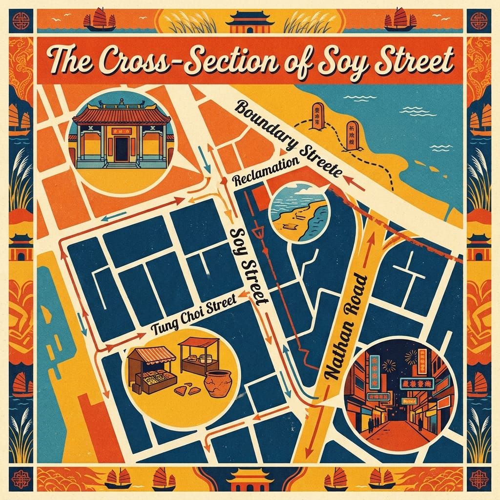
A Jin-dynasty jar, a missionary’s map, a vanished headland, a moved temple and one street: five little-known histories of Mong Kok, Hong Kong
 Lawrence
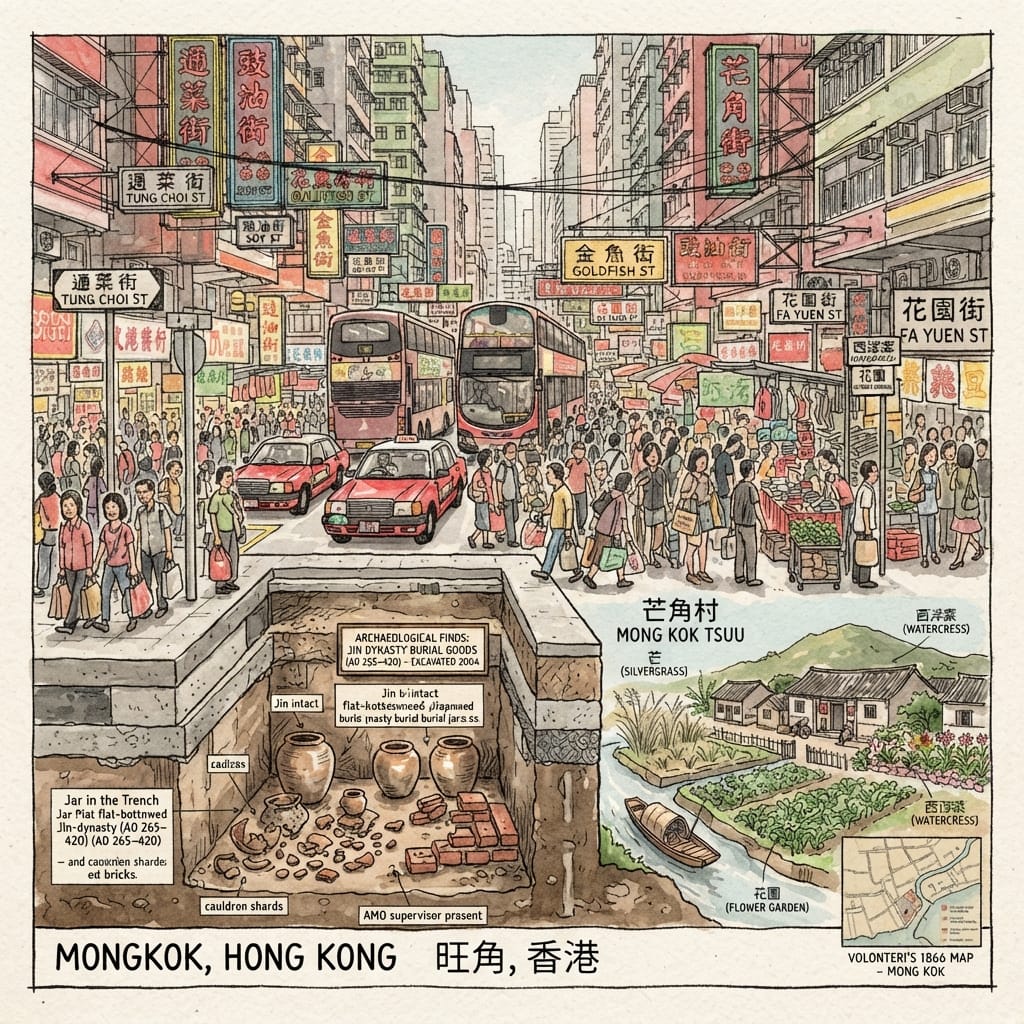
Mong Kok began as a Hakka village called Mong Kok (芒角), after the silvergrass and a horn-shaped point of land. This article follows five documented threads through one district: Han-to-Jin pottery found in a drainage trench in 2004; the 1866 map by the Italian priest Simeone Volonteri and the boundary at Boundary Street; the 1906 typhoon, the reclamation that removed the headland, the buried stream and the cloth-dyeing streets; a Guanyin temple moved by a road in 1926; and the crowd that gathered in Soy Street in April 1966, with its echo in 2016. The argument is that each layer of the district is a line drawn by an authority and later erased, while the names and the people stay at the same junctions. Points the research marks as unverified are left unverified in the text.
💡 Join a community of discerning travelers. Simply enter your email to instantly unlock audio guides and one-day itineraries, and carry our exclusive historical walking maps with you on your journey.
As a Hongkonger, Mong Kok is a place where I frequently spend my time. Being a local, I often navigate through streets like Sai Yeung Choi Street, Tung Choi Street, Soy Street, Sai Yee Street, Hak Po Street, and Pak Po Street without ever giving them a second thought. It was only through this research that I discovered these street names originated from the everyday objects and tools used by the grassroots population in their daily lives; furthermore, these streets have served as the vital arteries for several social movements.
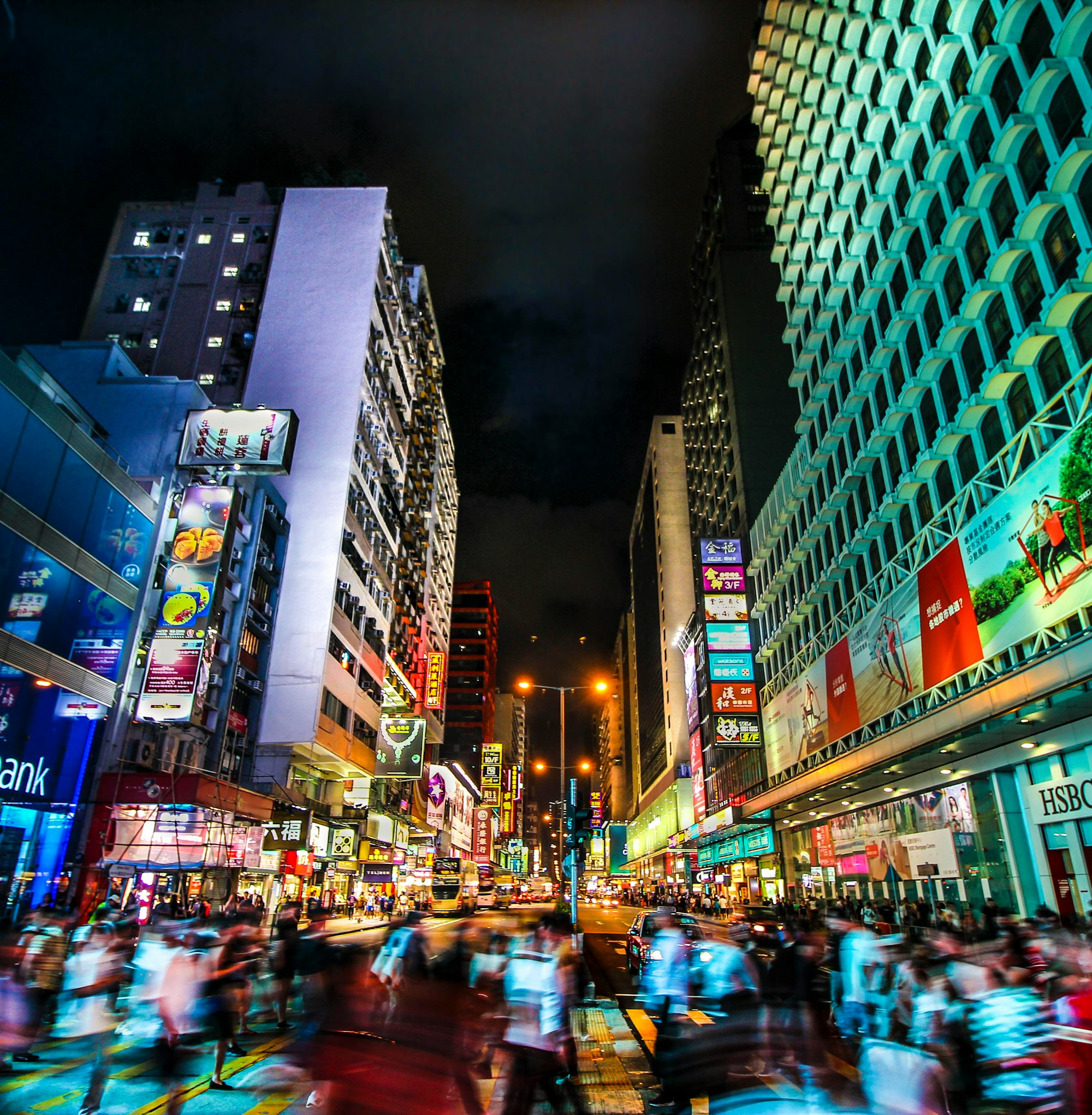
The sign at the corner of Tung Choi Street and Soy Street gives two names and no instructions. One street is named for a vegetable, the other for a sauce. Around them the evening crowd moves in the narrow, practised way of people who have shopped here all their lives, past phone cases, toys and crates of fruit. Nobody looks down. In May 2004 a trench, reportedly about two metres deep, stood open at this corner for a few days, and from its clay someone lifted a jar that a witness described as shaped like an incense burner. On the experts’ first reading it had lain there since the Jin dynasty. The street above it has been given several names since. None of them was ever meant for the jar.
1. The Jar in the Trench: Beneath the Silvergrass
On Friday 7 May 2004, at about nine in the morning, someone telephoned the Antiquities and Monuments Office to say that a drainage trench at the junction of Tung Choi Street and Soy Street had turned up something old. The records do not give the caller’s name. Officers found four intact flat-bottomed jars, which they read at first as Jin-dynasty (AD 265–420) grave goods. The office’s annual report dates the finds more loosely, from the Eastern Han to the Jin.
On 10 May, with officers watching, the contractor took out 174 more pieces: fragments of jars and cooking cauldrons, parts of a lime kiln, coarse shards, bricks. Han, Jin and Tang material lay in the same clay. On 11 May seven hours of searching found nothing further, and the site was handed back to the Drainage Services Department. The finds went on show at the Hong Kong Museum of History from 12 to 31 May.
A newspaper essay later remembered the episode more fully, or at least differently. Scholars wanted to dig on; the trench smelled in the early summer heat; shopkeepers complained; work resumed; the objects were quickly forgotten. It is a recollection, not an archive, but it does not contradict the official record, whose last act is the handing back.
The Buried Village Beneath Mong Kok
What the jars once held nobody knows. Whoever buried them left no name and no written word about belief, and I will not supply one. The oldest evidence of people here is pottery, and pottery is all it is.
Writing arrives late. The place first appears in the 1819 Xin’an gazetteer as Mong Kok Village (芒角村), under the Kwun Fu district. It is thought to have been founded in the late seventeenth century by settlers who, according to one account, came from Huizhou once the coastal evacuation was lifted. They grew watercress and water spinach in flooded fields and kept flowers, pigs and chickens. The fields became Sai Yeung Choi Street (watercress) and Tung Choi Street (water spinach); the flower beds, which villagers called gardens, became Fa Yuen Street. The mong of the name is silvergrass, the tall wild grass used for fencing. The kok is a horn, a point of land pushed into the sea: the headland called Mong Kok Tsui. In 1897 the village had 218 people. By 1918 the district had about 5,000. The village is said to have been cleared in the mid-1920s, a date still to be checked.
The contradiction sits in the spelling. Mong is wild grass; the character the district now uses, 旺, means prosperity and is read wong. In 1884 or 1885, the sources disagree, a Guanyin temple a few blocks away received a bronze fan inscribed 芒角村, “Mong Kok Village”, and an altar table donated by a shop called 旺角同昌, written with the later character. Two spellings of one place stood in one temple, decades before officials settled the matter. The English form, Mong Kok, never changed, and keeps the older sound. A popular explanation holds that boat people pronounced the first syllable as 望 and the British wrote it down so. But Cantonese already reads 芒 as mong, so the explanation may not be needed. It is unresolved.
Holographic Sensory Cue. What you can check today: the street signs, in Chinese and English, naming a vegetable and a sauce. The second is said, by tradition, to recall soy-sauce workshops. No workshop and no field remains to test it.
A jar like those is a burial gift, something the living give to one who no longer needs it. It was in the ground before the village, before the name, before the street.
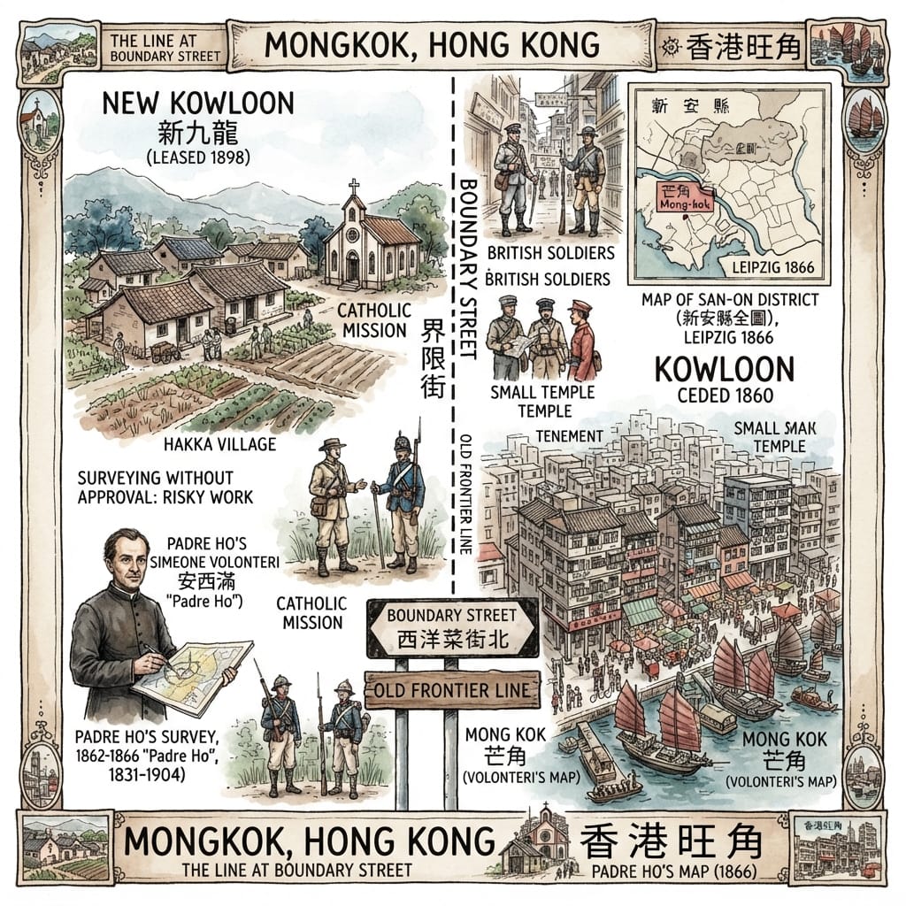
2. A Priest’s Map and the Line at Boundary Street
Boundary Street (界限街) is an ordinary road of old tenements, bus stops and shops. What sets it apart is that it began as a line. In 1860, under the Convention of Peking, the Qing ceded the southern part of the Kowloon Peninsula along with Stonecutters Island. Britain took what lay south of a line that later became this street. The land to the north waited until 1898, when the Convention for the Extension of Hong Kong Territory leased it for ninety-nine years less three days, from 1 July. Mong Kok lay just south of the line, at the northern tip of the ceded ground.
English parishes once walked their boundaries every year and bumped boys against the stones so the position would be remembered. That is an English habit, and I offer it only as a contrast. This boundary was agreed in a treaty, and the picture of the country on either side of it came, reportedly, from a map drawn by a priest.
The map of 1866 shows “Mong-kok” (芒角). Its maker was Simeone Volonteri (安西滿), born in Milan in 1831, who joined the Pontifical Institute for Foreign Missions in 1855 and reached Hong Kong on 7 February 1860. From 1862 he worked in the Hakka villages of San-On county, where farmers called him “Padre Ho”, reportedly from the first syllable of his surname as they heard it. Sources say he spent four years on foot drawing the Map of the San-On District, and that surveying without imperial leave was illegal and might have been read as spying; that claim should be checked against Ronald Ng’s 1969 study. In May 1866 he advertised in the Government Gazette for 120 subscribers at five dollars a copy. The map was engraved in Leipzig.
The Priest Who Drew Hong Kong
Its later use is something he may not have foreseen. After the lease of 1898, Governor Henry Blake’s telegram of February 1899 still referred to “the Missionary map of 1866”, and a study cited by one historian says it remained the main reference until the survey of 1901. These are secondary accounts; the archives are still to be consulted.
There are two contradictions. A map made quietly inside Qing territory became a working document for a second empire taking more of it. And the man who recorded Mong Kok as a Hakka village was, in Sai Kung in late 1869, according to mission histories relayed at second hand, helping tenant villagers resist payments to the Liu clan, including through self-defence bands; some villagers died. In February 1870 he was moved to Henan. He was consecrated bishop in 1874, became Vicar Apostolic of Southern Henan in 1882, and died on 21 December 1904 at Fengqiao (some sources say 1905).
The same sources record a smaller thing. At Tai Wo, after he had a window in his lodging enlarged, a baby died and a woman fell ill on the same day; the villagers blamed him and asked him to leave. That was their belief, set down in a mission history. It does not belong to Mong Kok, and it needs no explaining.
Stand on Boundary Street now and both sides are the same road with the same traffic lights. The north end of Sai Yee Street meets it here. A line on a map is only a line; once it is a street, people live along both sides of it.
3. A Headland Without a Sea: Typhoon, Culvert and Cloth Streets
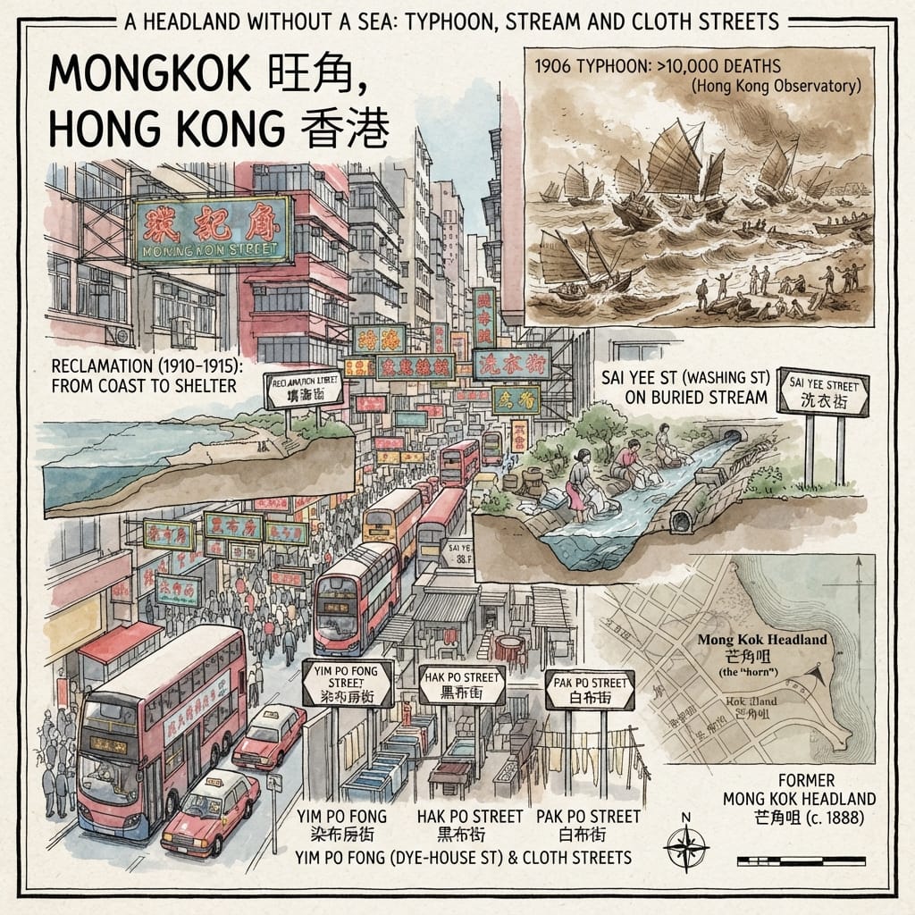
On 18 September 1906 a typhoon struck Hong Kong. The Hong Kong Observatory’s own exhibition puts the dead at more than ten thousand; other estimates differ. A 2022 re-analysis notes three small craft thrown ashore at Yau Ma Tei. Late that year and early the next, the Legislative Council argued about where a new typhoon shelter should go. In 1908 the Public Works Committee chose, unanimously, Mong Kok Tsui; the plans went to London on 7 March. By the end of January 1910 the dredging was done, and Reclamation Street (新填地街), which had stood at the water’s edge, had to be raised. The works ran until about 1915. Boat people lived in the shelter from around 1916 until about 1990.
So the horn went. The name describes a point of land pushed into the sea, and today’s Mong Kok has no coast. Its site is roughly where Soy Street meets Reclamation Street, though that wants checking against the maps of 1888 and 1903.
The Ghost Coast Of Mong Kok
The other water was a stream. Sai Yee Street (洗衣街), “Clothes-Washing Street”, follows one that fed the watercress fields. In the 1920s, when the fields were levelled for tenements, women along its bank took in washing for their neighbours, and the path took its name from them. In the 1930s the government cut the stream off at Boundary Street and buried it in a drain under a new road. The stream went; the name stayed. The street is said to have been gazetted in 1923 and 1924, which still needs confirming.
Further east, Yim Po Fong Street, Hak Po Street and Pak Po Street (dye-works, black cloth, white cloth) are named for the dyeing trade, and the largest works is said to have been called Ngai Hing (藝興). Cloth hung to dry beside the mills, white and black. In the 1950s and 1960s the factories began to move to Tsuen Wan, where land was cheaper.
Villagers once carried vegetables and flowers to Hong Kong Island in the boats of the boat-dwellers. That is on record. What the boat-dwellers themselves believed, the record does not say, and I will not write it for them.
Holographic Sensory Cue. The sign Reclamation Street can still be read. The words are plain: this is land that was made.
Water gave the district its names and then went away.
4. The Temple the Road Moved
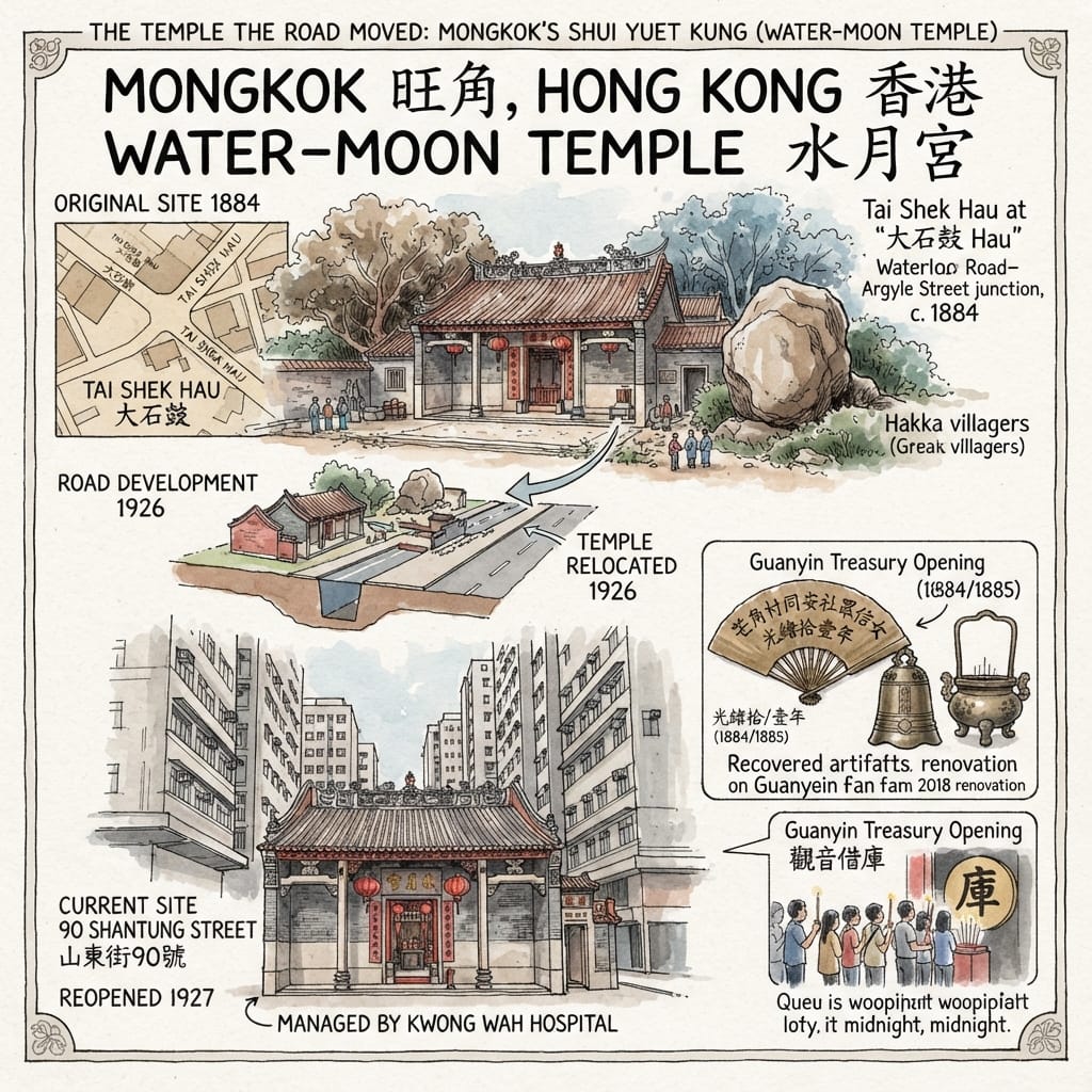
Around 1884, at a place called Tai Shek Hau (大石鼓, “Great Stone Drum”), Hakka villagers from Mong Kok and Ho Man Tin paid for a temple to Guanyin. A local commentator places it near today’s Waterloo Road and Argyle Street, where no village stood but where people passed between Mong Kok and Kowloon City. It was known as the Tai Shek Hau temple, and as Shui Yuet Kung (水月宮), the Water-Moon Palace.
In 1926, because of road building, it was moved to 90 Shantung Street. In 1928 it passed to Kwong Wah Hospital; today it is run by the Tung Wah Group of Hospitals for the Chinese Temples Committee. The Antiquities Advisory Board lists it as a Grade 3 historic building, dated 1927 and confirmed in January 2010. Chinese-language sources give more detail of the move, including a government payment, which I could not confirm in official records and so do not use.
The Erased Village And The Hidden Fan
In 2018 the renovation turned up an old bell, an altar table, an incense burner and a bronze fan of Guanyin, inscribed 芒角村同安社眾信女等仝敬送: a gift from the female devotees of the Tung On Society (同安社) of Mong Kok Village. Some accounts date the inscriptions to Guangxu 10 (1884), others to Guangxu 11 (1885). What the Tung On Society was, I could not find. “Female devotees” means what it says: a group of women raised money for a goddess and signed with the name of their village, not their own. The side halls were once a community office and a school, so deliberation, teaching and worship shared one roof.
The cultural frame. This is Hakka and Cantonese village religion. On the twenty-sixth day of the first lunar month, people “borrow” from Guanyin’s treasury at midnight and “return” the loan a year later. The popular origin story, in which five hundred arhats disguised as monks test Guanyin’s generosity, is legend, not history. “Water-Moon” names a form of Guanyin imagery. That a temple of that name should now stand on land whose water has been taken away (see Part 3) is a coincidence of words. I offer it as a figure, not a fact.
Holographic Sensory Cue. Records say the temple still holds a bell from the Guangxu years, and plaques recording its rebuilding in 1927. If you enter during opening hours you can check both (confirm on site).
5. Soy Street, April 1966
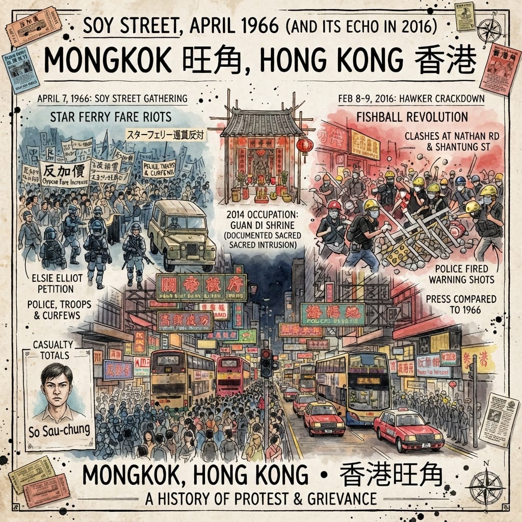
In October 1965 the Star Ferry company applied to raise its fares; in March 1966 the Transport Advisory Committee approved the rise. On 4 April So Sau-chung (蘇守忠) began a hunger strike at the Central ferry terminal, soon joined by Lo Kei (盧麒); Elsie Elliot (葉錫恩) circulated a petition. On 5 April a march went up Nathan Road from Tsim Sha Tsui to Mong Kok and back.
On 7 April, at seven in the evening, about 200 people gathered in Soy Street. Police arrested two, and the crowd dispersed. At about nine, some 150 gathered at Argyle Street and Nathan Road, and tear gas was used. Later the crowds moved about the district and some tried to enter the Mong Kok police stations. A curfew, troops and Gurkha soldiers followed.
In all, 1,465 people were arrested and 905 convicted; one civilian died, ten police officers were casualties and 16 people were injured. A commission of inquiry was set up. Critics called its focus narrow, and Elsie Elliot called its findings a farce. Officials leaned toward reading the events as apolitical disorder; later commentators saw civic action and grievances over housing and living costs. Both readings stand side by side here.
The Ghost Intersection Of Hong Kong
One observer told the commission that the crowds in the street were mainly hawkers, children of poor families, street boys and the unemployed. It is one person’s impression, not a statistic.
Fifty years later the same blocks heard an echo. On 8 and 9 February 2016 a crackdown on unlicensed Lunar New Year hawkers led to clashes around Nathan Road, Shantung Street, Argyle Street and Nelson Street. Police fired warning shots, and in later years some people were jailed for rioting, with sentences from 28 months to more than four years. Press coverage compared it with 1966. Whether one led to the other cannot be inferred.
During the 2014 occupation a temporary shrine to Guan Di is reported to have stood on Nathan Road in Mong Kok (from a Wikipedia list; to be verified): a place of worship on a road closed by protest.
The frame here is not cosmological. It is memory geography: the same junctions, in different years, becoming places where crowds gather.
The Resonance Node: Soy Street
Four of the five stories cross one street. Soy Street begins at the old shore near Ferry Street, crosses Reclamation Street, Nathan Road, Sai Yeung Choi Street South, Tung Choi Street, Fa Yuen Street, Sai Yee Street and Hak Po Street, and ends at Yim Po Fong Street, about 720 metres in all. The Han–Jin jars came out of it. The headland lay near its western end. The buried stream runs under its crossing with Sai Yee Street. The first crowd of April 1966 formed on it. The temple stands one street away. Its name is said, as a tradition, to come from soy-sauce workshops. This is not an energy line. It is five bodies of documents that happen to lie on one road.
Mong Kok Today
What survives: the street names, a working temple, the line of Boundary Street, the sign for Reclamation Street. What has gone: silvergrass, fields, stream, shoreline, cloth works. What has changed: a village of 218 people in 1897 is now reported to be among the world’s most densely populated districts (a Guinness claim not yet confirmed). A visitor can see the names and one working temple. The crowds hide the rest.
The Horn
In Chinese, 角 means a horn and also a corner, a place where a road turns.
The bronze fan found in 2018 in the temple on Shantung Street carries three old characters: Mong Kok Village. Nobody calls the place by them now.
Accessing the Physical Node
- Nearest stations: Mong Kok MTR station for the junction of Soy Street and Tung Choi Street and for the temple, both on foot. Prince Edward station is near Boundary Street.
- Soy Street: about 720 metres, an easy half-hour. Part is pedestrianised; check signs on site for hours.
- Boundary Street: meets the north end of Sai Yee Street, a natural end point for a walk.
- Shui Yuet Kung: 90 Shantung Street, run by the Tung Wah Group of Hospitals. Opening times are as published by the group. On the twenty-sixth day of the first lunar month it opens overnight for Guanyin’s treasury custom; arrangements change each year, so check the latest notice.
- A route: from the west end of Soy Street (near Reclamation Street), east through Nathan Road, Tung Choi Street and Sai Yee Street to Boundary Street, with the temple as a side trip.
💡 Q&A
Q1 | Is Mong Kok named after fishermen mispronouncing silvergrass, or is there a different etymology? What is the historical reality behind the name change from Mong Kok (芒角) to Mong Kok (旺角)? (Etymology and Hakka Village History [Mong Kok Tsui / 芒角村])
Answer: The name Mong Kok does not derive from a popular folk tale about boat people mispronouncing the word for silvergrass, but rather from its original geographical features and settlement history. The area was historically known as Mong Kok (芒角), referring to silvergrass and a horn-shaped headland that once projected into the sea. The 1819 Xin'an gazetteer documented Mong Kok Village, founded in the late 17th century by settlers who cultivated watercress and water spinach in flooded fields—giving rise to modern street names like Sai Yeung Choi Street and Tung Choi Street. The character for "Mong" later shifted to 旺 (prosperity), though temple artifacts from the 1880s show both spellings coexisted long before official administrative changes.
Q2 | What were the Jin-dynasty jars discovered beneath Tung Choi Street in 2004? What did this archaeological find reveal about Mong Kok's early human settlement history? (Tung Choi Street Drainage Trench Archaeological Discovery [Jin Dynasty / 晉代瓦罌])
Answer: In May 2004, drainage workers at the intersection of Tung Choi Street and Soy Street uncovered four intact flat-bottomed jars and subsequently 174 artifacts, which the Antiquities and Monuments Office and the Hong Kong Museum of History identified as Han-to-Jin-dynasty grave goods and pottery. Mixed within the same layer of clay were cooking cauldrons, lime kiln fragments, and Tang-brick shards, indicating prolonged human activity centuries before the documented Hakka village formation. Although public health complaints and commercial pressures quickly led to the site being handed back to the drainage department without extensive excavation, these artifacts conclusively established that Mong Kok's history extends far beyond its modern urban and colonial origins.
Q3 | How did Boundary Street establish the geopolitical division of the Kowloon Peninsula? What was Mong Kok's strategic position following the 1860 Convention of Peking? (Boundary Street Geopolitical History [Convention of Peking / 北京條約])
Answer: Boundary Street originated not as an urban thoroughfare, but as a demarcation line established by the 1860 Convention of Peking after the Qing Empire ceded the southern Kowloon Peninsula and Stonecutter Island to Great Britain. Mong Kok found itself positioned at the northernmost edge of this newly established British colonial territory, just south of the border that remained under Qing administration until the 1898 Second Convention of Peking leased the New Territories. This transitional borderland position shaped Mong Kok's early spatial expansion, transforming a quiet agricultural and fishing headland into a bustling frontier zone where imperial expansion intersected with local village life.
Want to follow the historical routes I’ve selected right from your phone as you walk? Click to join the exclusive Google map of historical tours titled "Historical Travel Stories"—import it to Google Maps on your phone with a single tap and let it guide you as you visit each historical site in person.

📖Reference and Further reading📖
First layer – Main sources of literature and institutions:
- LCSD Annual Report 2004 — Antiquities and Monuments Office
- news.gov.hk, 11 May 2004 — 旺角出土文物供市民參觀
- Tung Wah Group of Hospitals Records and Heritage Office — Shui Yuet Temple, Shan Tung Street
- Antiquities Advisory Board — List of 1,444 historic buildings (Shui Yuet Temple, Grade 3)
- Hong Kong Police Force — history, chapter 2 (1966 figures)
- Report of the Commission of Inquiry, Kowloon Disturbances 1966 — digitised excerpt (HK In Texts)
- SCMP archive, first published 8 April 1966
- HKBU Library Special Collections — Commission of Inquiry clippings
- Hong Kong Observatory — Natural Disasters before WWII
- CUHK Library — Map of the San-On District (新安縣全圖), record cited by Wikipedia; not opened
The second layer – secondary academic materials:
- Hong Kong Chronicles Institute — 蔡兆浚, 芒角還是望角?旺角的前世今生
- Industrial History of Hong Kong Group — Mellor, Mapping Hong Kong Part 4: 1866 Map of San On District
- PIME Hong Kong — Mission in Central China (PDF)
- Historical re-analysis of the 1906 typhoon (ScienceDirect)
- Edward Elgar — Making Hong Kong, ch. 1 (search snippet only; page blocked)
- SCMP — February 8, 2016: Night of mob violence in Mong Kok
Third layer – Supplementary information:
- Homemory 我家 — 借庫hotspot水月宮 見證旺角變遷
- Master Insight — 陳天權, 旺角鬧市中的水月宮 (2018)
- Liberty Times essay — 破卻陸沉:從芒角到旺角
- HKTVmall blog — 觀音借庫 (legend and ritual)
- Education Publishing House note on the 2011 Hak Po Street find
- City Unseen — Canton Road, in Four Parts
- Walter De Havilland — The Star Ferry 5 Cent Riot
- Chan Tak-hang blog — 染布房街和諸聖中學
Supplementary — lead-finding only; verify before citing
 Lawrence
 Lawrence
 Lawrence