Wong Tai Sin District: The Mountain That Three Governments Borrowed
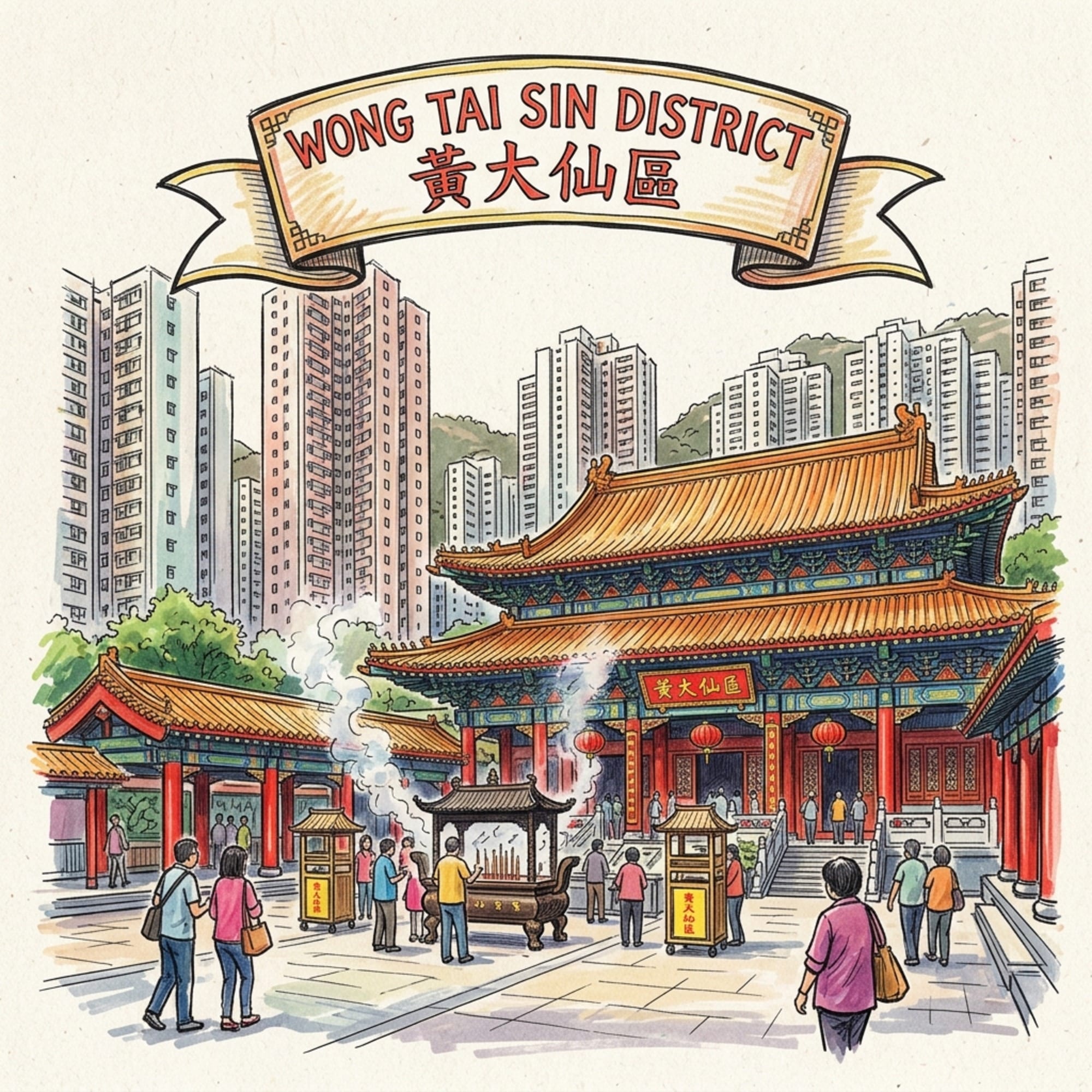
Lion Rock names the spirit of Hong Kong. It has also been borrowed — three times, by three different political projects — as a source of authority over the people in its shadow. This is a walk through the ground it watches over, and through five histories most visitors never find.

 Lawrence
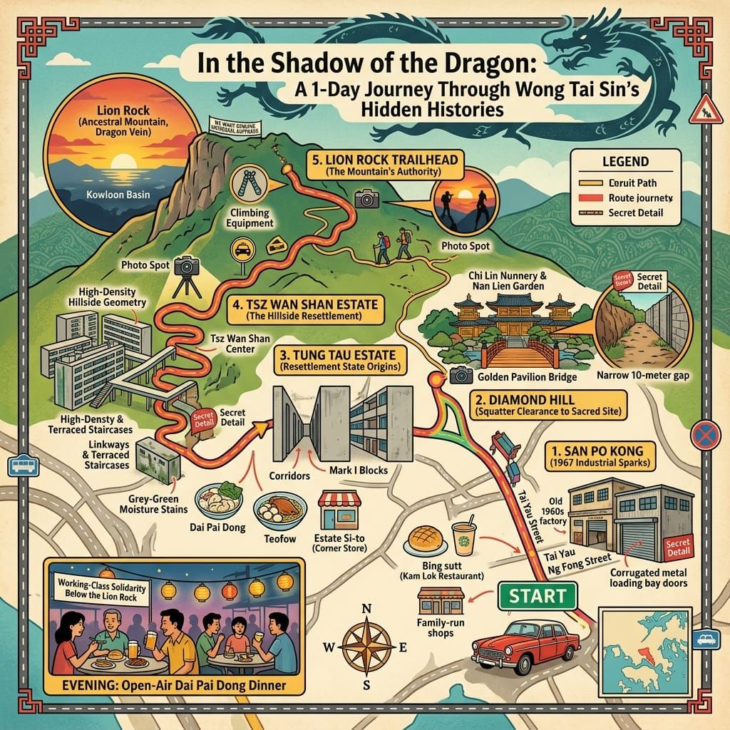
This is a long-form historical walk through Wong Tai Sin District in eastern Kowloon, built around five lesser-known histories: the resettlement programme that made the district, the factory strike that nearly broke the colony, the squatter village that was replaced by a Buddhist garden, the estate that failed the people it housed, and the mountain whose symbolic authority every government has borrowed. Readers will leave with a different understanding of what this district carries — and a route for walking into it themselves.
The Weight of the Place
There is a moment, approximately two-thirds of the way up the Lion Rock trail, where the mountain stops being a backdrop and becomes a fact. The city falls away below — the grey-white tower blocks of Wong Tai Sin District arranged in long, repeating rows with the insistence of an administrative decision, which is precisely what they are — and the granite summit rises above, warm in the morning sun, the rock bare and indifferent. You are caught between them: the mountain that geomancers have classified for centuries as the guardian of eastern Kowloon, and the city that a colonial government built beneath it in less than a decade. Both look permanent. Neither is. The summit holds the memory of a yellow banner that lasted only hours. The towers below have absorbed fifty years of lives the official record has not troubled to name.
Lion Rock does not choose sides. But it has been borrowed, repeatedly, by those who needed its authority more than they were willing to admit.
Listen to the historical stories told in detail (For subscribers only)
The Christmas Fire and the Shape of the District
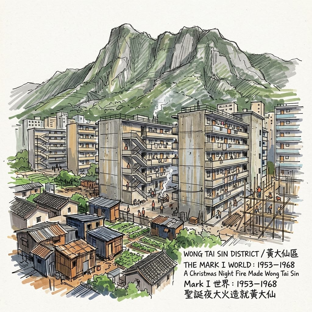
The district we call Wong Tai Sin today was made by a fire that began on Christmas night, 1953, in a place called Shek Kip Mei, roughly two kilometres to the west. A kerosene stove ignited a squatter shack. By morning, more than fifty thousand people were without shelter — mainland refugees who had arrived since 1949, Hakka and Teochew and Shanghainese families who had been sleeping on the hillsides of urban Kowloon in improvised structures for four years, invisible to the official city's mapping systems. The fire, in the calculus of colonial administration, made them visible in the worst possible way: simultaneously, all at once, in the newspapers, in the streets, in the governor's morning briefing.
Governor Sir Alexander Grantham faced a problem with no precedent in colonial Hong Kong. He could not send fifty thousand people back to a China that, four years earlier, they had fled. He could not disperse them to other hillsides, where they would rebuild and the fire risk would return. What he authorised instead — the Resettlement Programme, beginning in 1954 — was one of the largest and most rapid exercises in state-directed housing anywhere in the postwar world. The government would build permanent blocks on available land, allocate space by administrative fiat, and transform the squatter problem into a managed population. The territory of what would eventually become Wong Tai Sin District received some of the earliest and largest of these estates: Tung Tau, Wang Tau Hom, Lok Fu, and — climbing the slopes above Diamond Hill — the beginnings of Tsz Wan Shan.
The Christmas Fire That Built A City
The Mark I resettlement block is one of the most consequential architectural objects in Hong Kong's history, and one of the least remarked upon. H-shaped, six or seven stories, unreinforced concrete, it offered shared toilet facilities per floor, no private kitchen, and approximately one hundred and twenty square feet per family unit. Walking into the surviving older sections of Tung Tau Estate today — the stairwells dark even at noon, the corridors narrow enough to force a sideways shuffle when anyone is carrying groceries — you encounter not an architectural failure but a precise material record of the logic that produced it: maximum human density at minimum cost, the managed storage of a population that the administration needed somewhere to put.
And yet: these blocks filled almost immediately, and people stayed. For families who had been living in structures with no running water, no sanitation, and no physical security, the allocation of a concrete room — even one shared by six people, even one accessed through a communal corridor smelling of a dozen different regional cuisines — represented arrival. It was, for many, a first address. It was proof of presence in a city that had been trying to look away from them.
Holographic Sensory Cue: Upper floor of an older Tung Tau block, early morning. The corridor is dark and approximately forty centimetres narrower than a British standard hallway. The floor tiles are original — ochre and grey geometric mosaic, worn to a near-polish at the corridor's centre where seventy years of foot traffic has concentrated. The smell is compound and indistinct: cooking oil laid down over decades, damp concrete, something that suggests both industrial detergent and the specific vegetable stocks of a dozen different regional cuisines. From the north-facing window at the corridor's end, Lion Rock fills the entire sky — not as a scenic backdrop but as a wall, a geological fact that forecloses the horizon. On overcast mornings, cloud caps the summit and the rock appears severed from the earth, floating above the district it overlooks. The window frame is original iron, slightly oxidised, cold to the touch.
The form-school tradition of Chinese geomancy — known in Cantonese as fung shui, in Mandarin as fēng shuǐ, and in its classical texts as xíngshì pài (形勢派), the Form-School — would read Lion Rock as a shīxíng shān, a lion-form mountain: one of twelve classical archetypes, and among the most auspicious. In the theory that this tradition developed over many centuries, the ideal site for dense human settlement is one where a guardian mountain occupies the northerly position (the Black Tortoise, one of the four directional animals), where a descending vein of telluric energy — the lóngmài, the dragon vein — runs from the mountain's body south through the basin below, and where the settlement itself faces southward, opening toward light and water. The basin between Lion Rock and lower Kowloon is, in formal terms, a near-perfect expression of this configuration. The mountain shelters from behind; the dragon vein descends; the city turns its face toward the harbour.
The colonial Resettlement Department consulted no geomancers. Their criteria were available land, manageable gradient, and proximity to existing infrastructure. But the site they built upon — the basin where Hakka farmers had been cultivating market gardens for generations before the colonial city reached them — was the same site that those farmers had selected for precisely the reasons that the Form-School would have endorsed: topographically sheltered, southward-facing, the mountain holding the wind. Whether this constitutes evidence of an unconscious spatial wisdom transmitted through centuries of occupation, or simply reflects the fact that Form-School geomancy and sensible farming practice often agree on the same conclusions, the colonial resettlement planners placed their most politically precarious population in the most geomantically propitious basin in eastern Kowloon. The dragon vein sustained what the administration built, whatever the administration believed about dragon veins.
The Factory Floor Where the Colony Nearly Broke
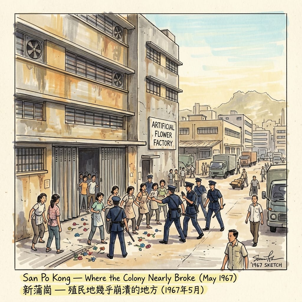
San Po Kong — the characters mean something like "New Market at the Po Kong Confluence" — occupies the northeastern quadrant of Wong Tai Sin District: a flat, grid-planned industrial zone developed primarily in the 1950s as light manufacturing migrated away from the congested urban core. By the mid-1960s, it was a dense array of two-to-four-storey factory buildings producing plastic flowers, garments, toys, and miscellaneous export goods. Its workers were largely the daughters and younger sons of the resettlement estate families — teenagers and young adults who had grown up in the district's numbered blocks and now spent ten to twelve hours a day on assembly lines, earning wages set entirely by management, with no legal right to collective bargaining, no minimum wage, no statutory sick leave, and no mechanism for contesting any of it.
In the spring of 1967, a labour dispute at a factory in San Po Kong — the exact company name and the precise date of the initial confrontation vary across secondary sources and have not been definitively settled in the accessible public record — became the ignition point for six months of colonial crisis known, depending on who is doing the naming, as the 1967 Hong Kong Leftist Riots, the 1967 Disturbances, or 六七暴動 (liùqī bàodòng), the '67 Uprising. Workers went on strike. Management called the police. The police attempted to disperse the picket line. The workers fought back.
What followed was an escalation that no one, perhaps not even its principal organisers, had entirely intended or could fully control. The Hong Kong Federation of Trade Unions, aligned with the Maoist energy of the Cultural Revolution then consuming mainland China, saw the San Po Kong confrontation as an opening. Within weeks, Hong Kong was experiencing coordinated strikes, street barricades, and — most terrifyingly — a sustained bombing campaign: more than eight thousand real and fake explosive devices reported across the territory over six months. Fifty-one people died. The colonial government imposed emergency regulations and came, in the assessment of several historians who have studied the period, closer to losing administrative control of the territory than at any point since the Japanese occupation of 1941.
The Plastic Flower Revolution
The aftermath was structural. Governor Sir Murray MacLehose, inheriting the political damage when he took office in 1971, presided over a decade of social reform that transformed the terms of Hong Kong's colonial relationship: labour legislation, nine years of compulsory free education, the establishment of the Independent Commission Against Corruption, an accelerated public housing programme. The reforms were real, and they changed lives. They were also, demonstrably, the administration's response to having discovered what the population would do when pushed far enough. San Po Kong's factory workers had, without quite knowing they were doing it, extracted a social contract from a colonial government that had no previous interest in providing one.
Walk through San Po Kong today and you will find no memorial to any of this. The streets where workers confronted police — Ng Fong Street, Tai Yau Street, Tung Tau Tsuen Road — have been through several cycles of redevelopment. The neighbourhood is now known, mildly ironically, for its restaurant clusters: roast goose, hand-pulled noodles, seafood. People queue patiently outside the better-regarded places on weekends. The factory floors where young women worked twelve-hour shifts assembling plastic flowers are occupied, to the extent that older structures survive at all, by logistics companies and small commercial offices.
There is a particular kind of historical silence that settles over a place when both sides of a political conflict have reasons to keep quiet, and San Po Kong is saturated with it. The colonial government, having nearly lost Hong Kong, had every reason to bury the memory of that vulnerability. The subsequent SAR government, aligned with the political descendants of the very forces that the colonial government was fighting against, found the memory of 1967's leftist violence equally inconvenient from the opposite direction. The result is a bipartisan amnesia so complete that the site of the colony's most serious political crisis in the twentieth century exists today as a mid-range dining destination, unmarked, unacknowledged, the street surfaces bearing no trace of what they once held.
Psychogeography — the tradition of reading cities through the emotional residue of their streets — has a term for this: displaced memory site, a location where events of foundational significance have been so comprehensively erased from the physical fabric that the event survives only in archival and oral form, while the landscape performs total ignorance. The peculiarity of San Po Kong is that the amnesia is not passive or accidental. It is an active, maintained agreement between successive administrations with nothing else in common.
What Replaced the Village
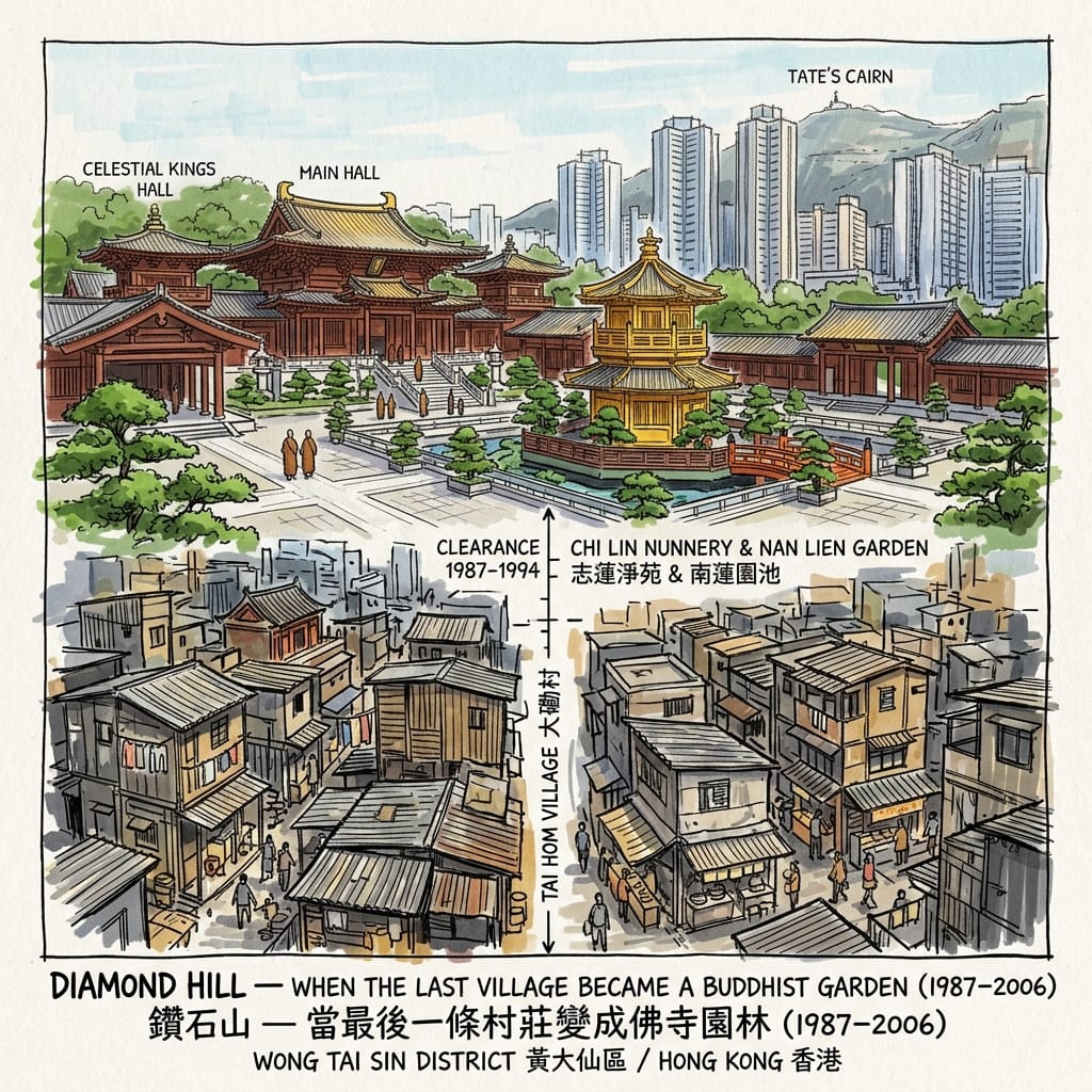
Diamond Hill (Zuànshí Shān) — the name, transplanted directly into English, carries a romance that the place has never quite warranted. The slope at the eastern edge of what is now Wong Tai Sin District, at the foot of the rising hills toward Tate's Cairn, was for four decades the site of one of Hong Kong's largest and longest-surviving informal settlements: Tai Hom Village (大磡村), the Diamond Hill squatter area, a community of tens of thousands built in stages from the late 1940s by the same wave of mainland refugees who populated the resettlement estates elsewhere in the district.
The difference between Tai Hom Village and the estates was the difference between organic accumulation and administrative planning. The village grew according to its own logic: kinship groups occupying adjacent lanes, workshops and provision stores and noodle shops and schools establishing themselves along the natural pedestrian flows, neighbourhood temples — a Tin Hau shrine, several earth-god altars — anchoring the community's informal sacred geography. It was, by most objective measures, poorer and less physically secure than the resettlement blocks. It also had something the blocks lacked: the texture of a place that had grown rather than been imposed.
The clearances proceeded in stages from the late 1980s through the early 1990s. Residents received compensation and were offered public housing elsewhere — dispersed, in the standard administrative pattern, without reference to the networks they were leaving behind. The structures were demolished. The land became available.
What was built on it is genuinely beautiful, and this is part of the problem with describing it. The Chi Lin Nunnery (志蓮淨苑), constructed in phases between 1998 and 2000 by the Sik Sik Yuen — the same charitable organisation that administers the Wong Tai Sin Temple — is one of the most architecturally accomplished Buddhist complexes built in the twentieth century: a complete reconstruction of Tang Dynasty sacred architecture using traditional joinery without nails, a series of courts and halls and covered walkways and lotus ponds arranged according to the cosmological principles of Tang-era Buddhist space. The adjacent Nan Lien Garden, opened in 2006, extends the Tang aesthetic into a public landscape of shaped paths and ornamental water. Walking through them is genuinely moving — the scale of the woodwork, the quality of the light in the inner courts, the sound of the bell reverberating across stone.
The Temple That Erased A City
The Tang Dynasty Buddhist spatial model encodes something called mandala geometry: the idea that a sacred precinct should be organised as a series of concentric zones of increasing holiness, moving from the outer secular world through successive thresholds to the innermost sanctum. Chi Lin's sequence of gates and courts and halls performs this precisely. The mountain behind the complex provides the northerly backing that Form-School geomancy would require, and the entire precinct faces southward. Whether the Sik Sik Yuen consulted a fung shui practitioner when selecting the site and orienting the buildings, or whether these alignments are the product of Tang architectural convention applied to a southward-facing hillside, the sacred geometry is intact.
What is also intact, though not marked, is the fact that this particular sacred geometry was built on ground cleared of forty years of working-class habitation. The phrase sacred site substitution — the replacement of informal vernacular sacredness with institutionally formalised sacredness — describes a pattern visible throughout Chinese urban history: the regularisation, after political disruption, of a landscape's spiritual economy. The earth-god shrines and neighbourhood temples of Tai Hom Village were not simply demolished; they were superseded by an institution of incomparably greater formal authority. The land's sacred function was not cancelled but upgraded, aestheticised, and made architecturally magnificent.
Holographic Sensory Cue: The narrow strip of ground between Chi Lin Nunnery's northern rear wall and the Diamond Hill hillside — a space of perhaps ten metres that most visitors never enter. The nunnery's rear wall is Tang Dynasty woodwork at its most precise: horizontal brackets, fitted members, the joinery so exact that it reads as draftsmanship rather than carpentry. Against this, the hillside: subtropical scrub, lower canopy at about chest height, the roots of the vegetation cracking the natural granite underfoot. The sound changes completely at the transition — inside the nunnery complex, there is a specific acoustic quality produced by stone courtyards and wooden structures, a slight amplification and resonance; outside, in this strip, sound is absorbed by vegetation rather than reflected. The temperature drops three or four degrees. Underfoot, the rock is not the carefully laid flagstone of the inner courts but natural hillside granite, unchanged. This strip of ground was, fifty years ago, the back lanes of Tai Hom Village. There is nothing on the nunnery wall to say so. The Tang Dynasty joinery looks back at the scrub with perfect indifference.
This unintended gap — between the wall's immaculate woodwork and the unchanged hillside stone — is the thinnest point in the veil between what was here and what replaced it. Walk the northern perimeter of the nunnery complex and stand in this strip. The bell sounds from somewhere inside. The sound arrives as if from a different spatial register, lower and slower than its physical source would suggest, as though it is travelling through something denser than air.
A Mountain Named for Mercy
The characters that give Tsz Wan Shan its name — 慈雲山 — mean, in a direct rendering, Compassionate Cloud Mountain. The first character, cí (慈), is the Buddhist virtue of loving-kindness: maitrī in Sanskrit, the unconditional goodwill directed toward all sentient beings without expectation of return. The second and third, cloud and mountain, suggest elevation and permanence. It is, as place names go, almost unbearably aspirational.
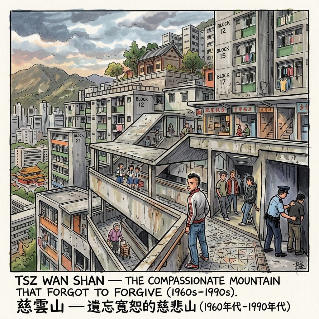
Tsz Wan Shan Estate was built on the slopes above Diamond Hill from the early 1960s, absorbing successive waves of squatter clearances in a steeply terraced series of resettlement blocks connected by covered staircases and elevated walkways — a vertical city on the hillside, the upper blocks looking down at the lower with a topographic authority that implied a social hierarchy that did not, in reality, exist. The estate grew until it housed hundreds of thousands of people on a gradient that required significant engineered infrastructure just to make the blocks habitable.
The logic of its construction was the same as every other resettlement estate: administrative efficiency, population management, the conversion of an informally housed and therefore ungovernable population into a formally registered and therefore legible one. What the colonial administration consistently failed to account for — at Tsz Wan Shan as at every comparable estate — was what happened after the forms were filled in. The resettlement system took families out of squatter communities that, for all their physical precarity, had organic structures of mutual aid, kinship solidarity, and neighbourhood accountability, and placed them in numbered blocks adjacent to families they had never met, from provinces they had never visited, speaking dialects they could not understand. The administrative logic was clean. The social outcome was the destruction of the only community infrastructure many of these families had.
Into that vacuum, the Sun Yee On triad society established itself with a thoroughness that the colonial administration did not anticipate because it had not thought to provide what Sun Yee On offered instead. Protection — transactional, coercive, but real. Dispute resolution — violent, unpredictable, but operative. A form of belonging — conditional, hierarchical, extractive, but recognisable as belonging, in a context where nothing else was. For teenagers who had grown up in the numbered blocks with few educational options, no recreational infrastructure, and a labour market that wanted their bodies for factory work and nothing else, the gang gave something to be: a name, a territory, a set of obligations that went both ways, however lopsidedly. The covered walkways and shadowed stairwells of Tsz Wan Shan's older blocks were not incidentally conducive to this kind of organisation; they were architecturally suited to it in ways that post-hoc social planning could not easily undo.
The Gangs Of Compassionate Mountain
The estate today is a normal Hong Kong residential district. The gang history has receded through a combination of improved social services, educational access, and economic change, into the memory of a generation that mostly doesn't discuss it publicly. The Buddhist centre near the lower blocks — quietly active, people arriving for morning prayers, children attending dharma classes on weekend afternoons — maintains, in its small corner of the estate, the aspiration encoded in the mountain's name. Compassion. Cloud. Mountain. Exactly what was promised, in exactly the corner where it was least delivered.
The bitter irony of a place called Compassionate Cloud Mountain becoming, for three decades, one of the most gang-controlled residential areas in Hong Kong, is not a coincidence of naming but a structural consequence of planning. The administration built an estate for maximum human density and minimum human investment, named it for a Buddhist virtue it had no intention of practising, and was then surprised when the population organised itself through whatever non-state structure was available. The name was the colonial government's aspiration; the outcome was its accountability.
The Three Borrowings of Lion Rock
Return, now, to the mountain. Or rather: return to what has been done to it.
In the Form-School tradition, Lion Rock is zǔshān — the ancestral mountain, the source point of the dragon vein that descends through Wong Tai Sin District to the harbour. Its shīxíng profile — the leonine silhouette unmistakable from any elevated point in Kowloon — marks it as the most auspicious of the twelve classical mountain archetypes: guardian, sustaining, southward-facing in its authority. The lóngmài, the dragon vein, is the Form-School's name for what the landscape actually does: the way topography channels and concentrates telluric energy, the way certain geological configurations create conditions for human habitation that persist across centuries regardless of the particular political arrangements that happen to occupy them. The mountain does not know about politics. But its authority is geological and therefore endures long after any government.
This authority has been borrowed three times in the past fifty years, by three different political projects, to legitimise three different and mutually incompatible agendas.
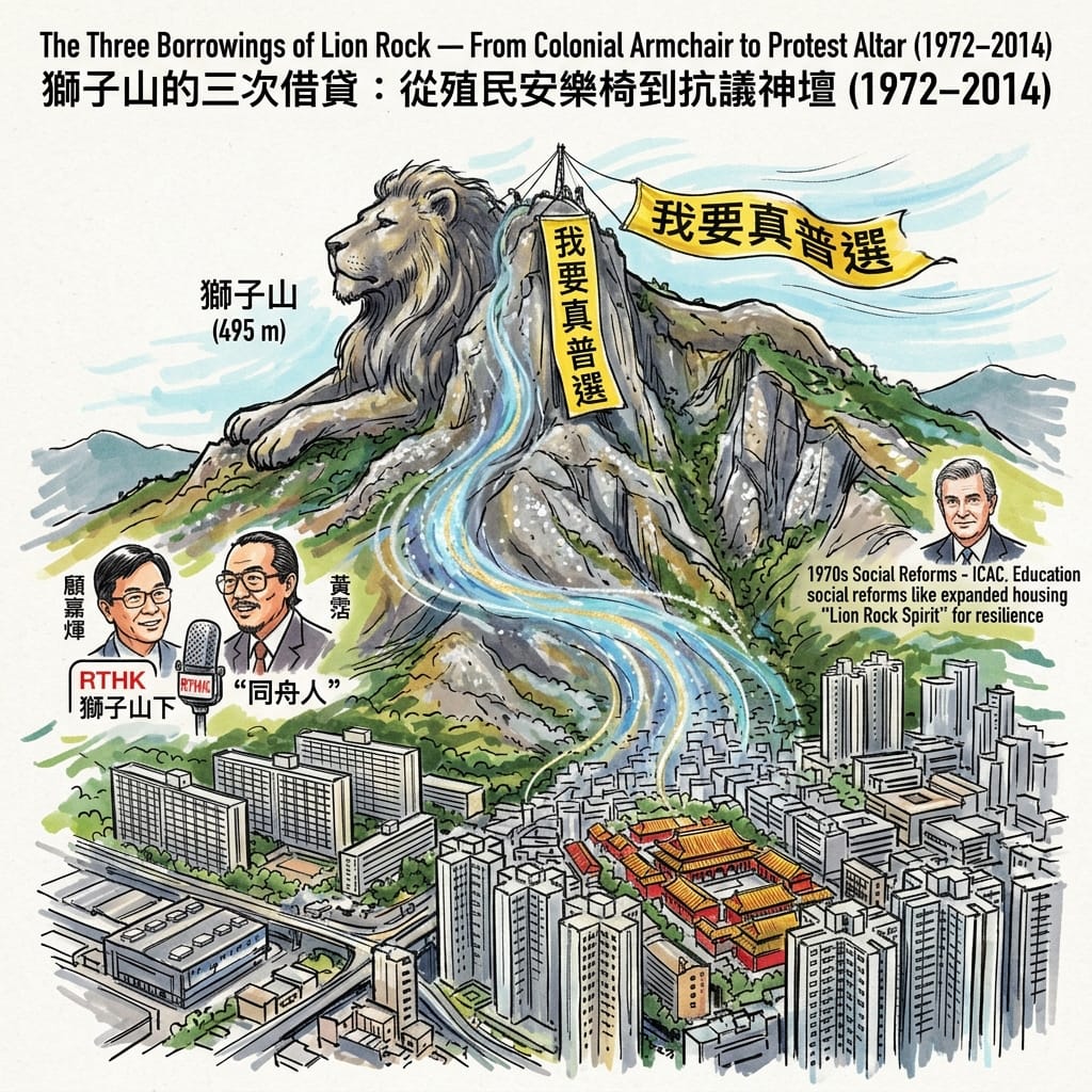
The First Borrowing, 1972. Radio Television Hong Kong broadcast the first series of Below the Lion Rock (獅子山下), a social drama anthology whose theme song — music by Joseph Koo, lyrics by James Wong — articulated what would become Hong Kong's closest approximation to a civic creed. The song is about solidarity: struggling together, giving from the heart, setting aside differences of origin and circumstance, enduring because endurance is what the people under the mountain do. It is not a cynical song. It expresses something true about the experience of the resettlement estates, about the communities that formed — despite administrative indifference, despite the stripped social infrastructure, despite the cramped rooms and shared facilities — among families from twenty different provinces who had no reason to trust each other and did anyway.
But the political use to which the Lion Rock Spirit was immediately put was something different from the truth the song expressed. The colonial government, presiding over a social system that had nearly broken three years before the song was written, found in the Lion Rock mythology a cultural instrument of considerable convenience: the reframing of working-class suffering as civic virtue, the conversion of legitimate grievance into collective pride, the suggestion that the population under the mountain did not need to demand better conditions because the act of enduring them was itself the proof of their character. The mountain, in this reading, endorsed the arrangement. The dragon vein sustained it.
Stealing The Dragon S Vein
The Second Borrowing, 1997–present. Sovereignty returned to China; the Lion Rock Spirit did not change its function. Successive SAR administrations inherited the mythology intact and deployed it with unchanged technique, calling on Hong Kongers to endure economic crises, political transitions, and social stress with the same apolitical resilience that the colonial narrative had proposed. The symbolic authority of the mountain crossed the handover without requiring renegotiation. Different rulers, same mountain, same use of its prestige.
The Third Borrowing, October 2014. At the height of the Umbrella Movement — the pro-democracy protests that occupied major thoroughfares across Hong Kong for seventy-nine days — a group of activists made a night ascent of Lion Rock and unfurled a large yellow banner across the mountain's southern face, the face visible to the entire Kowloon basin. The banner read: 我要真普選. We want genuine universal suffrage.
It hung for a matter of hours before authorities removed it. The photograph had already gone around the world.
The symbolic precision of this action is worth dwelling on. The same mountain that had been used for four decades to communicate do not ask, endure was being used to say we ask, and we demand. The apolitical resilience narrative was not just rejected but reversed: the activists had climbed to the source of the authority that the narrative claimed, attached their demand physically to the rock, and used the mountain's prestige — the same prestige that colonial and SAR governments had been quietly borrowing all along — to amplify a political claim that those governments were refusing to hear.
Whether the activists understood what they were doing in geomantic terms — whether anyone thought consciously about the lóngmài and the zǔshān and the tradition of declarations made to the ancestral mountain — is not the point. What matters is the structural logic: when you want to make an authoritative claim to the people of a place, you climb to the source of that place's authority and speak from there. The Form-School tradition had been mapping this logic for centuries. The activists enacted it without necessarily knowing the map.
This is the thesis the district reveals, if you walk it carefully enough: Dragon Vein Leverage. The resettlement government borrowed the mountain's sheltering authority to stabilise its most precarious population in the 1950s. The colonial cultural apparatus borrowed its symbolic height to depoliticise working-class suffering in the 1970s. The democratic movement borrowed its ancestral prestige to amplify a political demand in 2014. Three borrowings. One mountain. Three entirely different projects, each drawing on the same geological account as if the mountain were a bank of symbolic capital, always open, never depleted.
What the Form-School tells us is that whoever controls the ancestral mountain controls the dragon vein that flows from it through the land below. What the history of Wong Tai Sin District tells us is that no one has ever controlled the mountain — they have only borrowed it, each in turn, for purposes that eventually became inadequate or untenable. The mountain remains. The banner lasted hours. The estates have been through three cycles of redevelopment. Lion Rock will be there when Hong Kong's current political arrangement is the subject of a history article.
What the Ground Holds
There is a concept in the work of W.G. Sebald — never stated directly, embedded in the structure of his prose — that places carry a kind of distributed consciousness, that the material surface of a city holds, in its textures and temperatures and smells, the weight of what has happened in it. He is not mystical about this. He is precise. He describes the quality of light in a particular corridor, the temperature of a wall, the specific sound of wind through a ruined building, and leaves the reader to find, in those sensory particulars, the historical pressures that produced them.
Wong Tai Sin District rewards this kind of attention. The Mark I corridors of Tung Tau carry the weight of a resettlement regime. The streets of San Po Kong carry the weight of a deliberate forgetting. The rear perimeter of Chi Lin Nunnery carries the weight of everything that was there before the joinery. The covered walkways of Tsz Wan Shan carry the weight of a social experiment that did not account for what it meant to be human in a numbered block on a hillside with no infrastructure and no community.
And Lion Rock carries, in its geological patience, the record of three separate political projects that each needed its authority and none of which could finally own it. The mountain is the district's ancestor, in the precise geomantic sense: the source of the terrain's sustaining energy, the background presence that makes the foreground possible. What the district's history reveals — across all five of these stories, across all of the bureaucratic ambition and working-class suffering and structural violence and occasional human triumph that they contain — is that the background presence has been continuously exploited by the foreground, and has continued to sustain it regardless.
That continuity — the mountain's willingness to keep providing the authority that successive governments keep borrowing — may be the most unsettling thing about this place. History moves through Wong Tai Sin District in waves: the fire, the blocks, the factory, the clearance, the garden, the banner. The mountain watches from the same position it has always occupied, contributing its authority to each wave, irrespective of what the wave is carrying.
Historical memory, in the end, is the only corrective. Not because it reverses anything — the Tai Hom Village lanes will not reappear from beneath the Tang joinery, the San Po Kong factory workers will not receive the plaque they have not been given — but because it restores to the landscape the full weight of what it holds, against the continuous administrative pressure to make that weight manageable, narratable, useful for current purposes. Walking these streets with that weight in mind is a different kind of activity from tourism. It is, perhaps, the only form of respect available to those of us who arrive here long after the decisions were made.
If you want to receive the ongoing Spiritual Anchor in Multidimensional Spacetime series — histories of the overlooked, the suppressed, and the misremembered, written from the places themselves rather than about them — the email list is the best way to follow the work. You can subscribe below.
Reaching the District
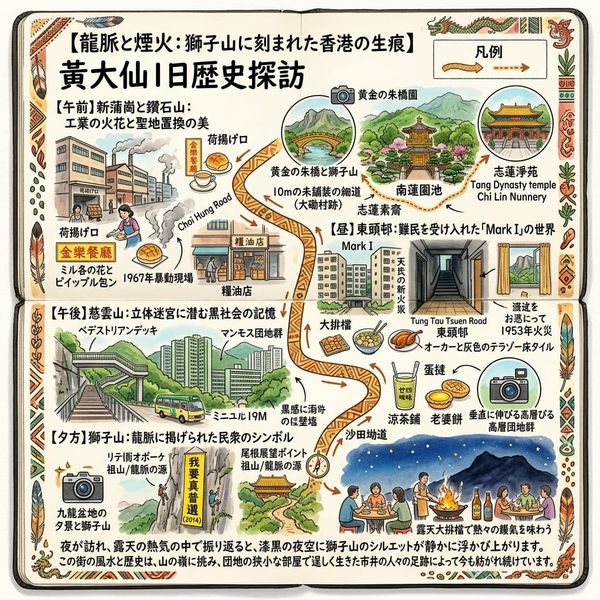
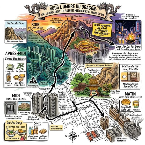
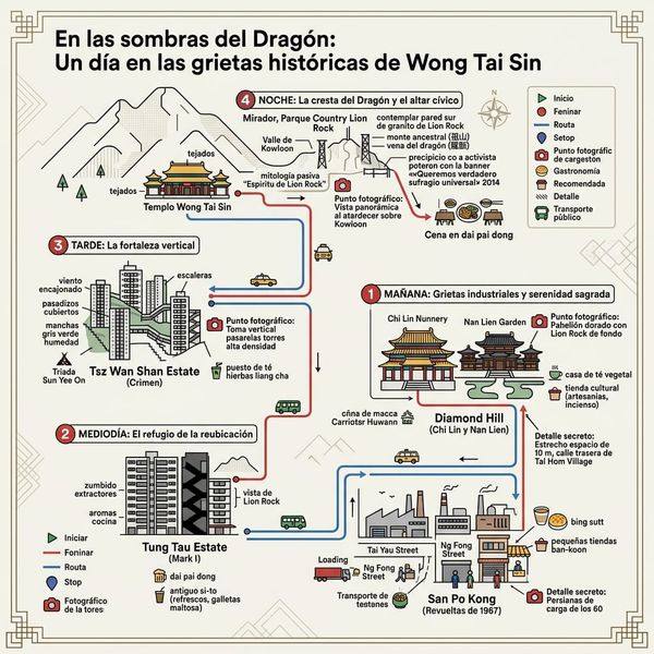
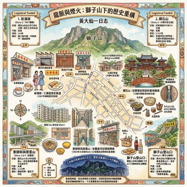
Getting there. Wong Tai Sin District is well-served by the MTR. Tung Tau Estate, the Wong Tai Sin Temple area, and the district's older residential core are most accessible from Wong Tai Sin Station on the Kwun Tong Line. Diamond Hill Station (same line) gives access to Chi Lin Nunnery, Nan Lien Garden, and the southern approach to the Lion Rock Country Park. San Po Kong is a short walk from either station. The district is compact and navigable on foot; walking is strongly recommended over any form of transport.
Ordering the visit. A useful sequence: begin at Tung Tau Estate (Wong Tai Sin Station, Exit B3), walk north through the estate to sense the architectural register of the original resettlement blocks, then south through San Po Kong to Ng Fong Street and Tai Yau Street (the industrial core); cross to Diamond Hill Station and spend an hour in Chi Lin Nunnery, including time at the northern perimeter wall; walk uphill toward the Tsz Wan Shan estate lower sections; finish, on a separate morning, with the Lion Rock trail ascent to the ridge — allow two to three hours return.
Where to stay. The district itself has few tourist accommodation options. The practical bases are Mongkok, Tsim Sha Tsui, or Kowloon City — all within easy MTR reach. For those who want to be close to the Lion Rock Country Park for an early-morning ascent, hotels in Sha Tin, accessible from the Shing Mun Redoubt side, are an alternative.
Going deeper. The HK Memory Project (hkmemory.org) holds oral history testimony from former Tung Tau, Wang Tau Hom, and Tai Hom Village residents — worth reading before arrival, not after. The M+ museum in West Kowloon periodically shows material on Hong Kong's urban transformation that illuminates the resettlement years; check their exhibition calendar. Chi Lin Nunnery offers guided architectural walks (check current availability on their website) that approach the Tang Dynasty spatial logic from the inside; the experience is considerably richer if you have spent time thinking about what was here before. For the Lion Rock ascent, Lion Rock Country Park maintains several marked approaches; the trail from the Diamond Hill side is the most historically resonant given the 2014 banner position on the southern face.
💡 Historical Dossier & Urban Myths: Frequently Asked Questions
Q1: Why is Tsz Wan Shan Estate frequently linked to haunted urban legends and ghost stories?
Answer: The ghost stories surrounding Tsz Wan Shan Estate stem from the harsh social reality of Hong Kong's 1960s resettlement era. Built on steep slopes to house fire victims and low-income refugees, the high-density public housing estate suffered from poor lighting, isolated corridors, and a lack of public infrastructure. This environment spawned notorious youth gangs like the "Tsz Wan Shan Thirteen", leading to frequent violent clashes. The resulting community trauma, socio-economic marginalization, and dark corridor architecture were psychologically translated into hauntings by residents. In reality, these urban legends reflect the collective trauma of rapid, high-density urbanization rather than supernatural phenomena.
Q2: What is the historical truth behind the haunted urban legends of Tai Hom Village before its demolition?
Answer: Tai Hom Village’s reputation as a "haunted realm" originates from its multi-layered history of displacement and destruction. Originally a peaceful agricultural settlement, the village was forcibly demolished by Japanese military forces during WWII to expand Kai Tak Airport, leaving behind concrete pillboxes and aircraft hangars. In the post-war era, it transformed into a sprawling squatter town housing film studios, factory workshops, and thousands of refugees, while enduring multiple devastating fires. The abandoned military ruins, theatrical movie sets, and decades of urban decay fostered lingering local superstitions. The ghost tales actually encapsulate the site's historical transition from wartime conquest to refugee sanctuary.
Q3: What caused the urban myth that tunneling through Lion Rock severed Hong Kong's dragon vein?
Answer: The urban legend claiming that the Lion Rock Tunnel severed Kowloon's "dragon vein" arose from the tension between traditional feng shui beliefs and rapid British colonial infrastructure development in the 1960s. Geologically a Jurassic granite formation, Lion Rock serves as the "Black Tortoise" guardian peak in traditional geomancy, symbolizing stability for the Kowloon Basin. When engineers blasted through the mountain ridge to construct the tunnel and flattened surrounding hills for public housing, locals feared it disrupted spiritual harmony, attributing municipal mishaps to a severed vein. Historically, this myth represents the anxiety of a displaced population navigating intense urban transformations.
Reference and Further reading
First layer – Main sources of literature and institutions:
- Hong Kong Public Records Office, Resettlement Department Annual Reports (1954–1973), HKRS series
- Colonial Annual Reports 1953–1960, Hong Kong Government Printer
- Hong Kong Housing Authority historical records (post-1954 resettlement statistics)
- Hong Kong Public Records Office, HKRS 156 series (Security Branch files, 1967)
- Colonial Secretariat Records on the 1967 disturbances — various HKRS series
- Hong Kong Police Force Annual Report 1967
- Hong Kong Hansard (Legislative Council records, 1967 emergency session)
- Hong Kong Lands Department clearance orders (late 1980s–1994), HKRS series
- Town Planning Board records for Diamond Hill redevelopment
- Sik Sik Yuen 嗇色園 annual reports and institutional history publications
- Chi Lin Nunnery 志蓮淨苑 — architectural documentation and construction records
- Hong Kong Police Force Annual Reports (1970s–1990s), relevant sections on organized crime and public housing districts
- Hong Kong Housing Authority estate records and social welfare reports
- Hong Kong Social Welfare Department district reports
- RTHK programme archives: 獅子山下 original series (1972) and subsequent revival series
- Hong Kong Government records on the 2014 Umbrella Movement (various government departments)
- Contemporary news photography and video documentation of the 2014 Lion Rock banner (now in multiple media archives)
The second layer – secondary academic materials:
- Castells, Manuel, Goh, Lee & Kwok, R.Y.W. (1990). The Shek Kip Mei Syndrome: Economic Development and Public Housing in Hong Kong and Singapore. Pion Limited, London
- Smart, Alan (1992). Making Room: Hong Kong's Informal Housing. Centre of Asian Studies, University of Hong Kong
- Smart, Alan (2006). The Shek Kip Mei Myth: Squatters, Fires and Colonial Rule in Hong Kong, 1950–1963. Hong Kong University Press
- Cheung, Gary Ka-wai (2009). Hong Kong's Watershed: The 1967 Riots. Hong Kong University Press
- Bickers, Robert & Yep, Ray, eds. (2009). May Days in Hong Kong: Riot and Emergency in 1967. Hong Kong University Press
- Scott, Ian (1989). Political Change and the Crisis of Legitimacy in Hong Kong. University of Hawaii Press (structural context)
- Abbas, Ackbar (1997). Hong Kong: Culture and the Politics of Disappearance. University of Minnesota Press (broader context of Hong Kong urban erasure and cultural disappearance)
- Lui, Tai-lok (2007). Hong Kong: Becoming a Chinese Global City. Routledge
- Lui Tai-lok & Chiu, Stephen W.K. (2000). The Dynamics of Social Movement in Hong Kong. Hong Kong University Press
- Lo, T. Wing (1993). Corrupting the Police Force: Policing Reform Under Threat. Open University of Hong Kong Press (organized crime context)
- Lau Siu-kai (1982). Society and Politics in Hong Kong. Chinese University Press (social structure of resettlement communities)
- Vagg, Jon (1995). "Rough Seas? Contemporary Piracy in South East Asia." British Journal of Criminology, 35(1) (broader triad context)
- Ma, Eric Kit-wai (1999). Culture, Politics and Television in Hong Kong. Routledge (on RTHK, civic culture, and the political uses of broadcast mythology)
- Veg, Sebastian (2017). "The rise of 'localism' and civic identity in post-handover Hong Kong." China Quarterly, 230, 339–359
- Lee, Francis L.F. & Chan, Joseph M. (2018). Media and Protest Logics in the Digital Era: The Umbrella Movement in Hong Kong. Oxford University Press
Third layer – Supplementary information:
- HK Memory Project (香港記憶計劃) — oral history testimonies from former resettlement estate residents
- M+ museum oral history archive — documented accounts from Tung Tau and Wang Tau Hom residents
- RTHK documentary coverage of 1967 riot anniversaries (鏗鏘集 series, various years)
- Oral histories from former FTU union members (partial, fragmented)
- 文匯報 and 大公報 archives, 1967 (pro-left perspective; requires triangulation with colonial records)
- HK Memory Project (香港記憶計劃) — oral history testimonies from former Tai Hom Village residents (partially archived)
- Chi Lin Nunnery historical and architectural documentation (institutional publications in Traditional Chinese)
- Contemporaneous newspaper reporting in 明報 and 東方日報 (1970s–1990s) on Tsz Wan Shan gang activity
- Social worker accounts documented in academic social welfare literature of the period
- James Wong Jim (黃霑) personal interviews documenting the composition process for 獅子山下 (various media archives, pre-2004)
- Community documentation of Lion Rock's symbolic role in public discourse, particularly from post-2012 period
Historical gap:
- The precise criteria by which specific sites within Wong Tai Sin's basin were selected for resettlement blocks — over alternative available land in, for example, adjacent Kowloon City or Kwun Tong — are not fully documented in the accessible public record. Whether any informal spatial knowledge (including Feng Shui assessment by local intermediaries or village elders) influenced site selection before the formal colonial planning process is entirely undocumented. The vernacular sacred geography of the pre-resettlement Hakka villages — their earth-god shrines, ancestral halls, she-altar networks — has been only partially preserved in oral testimony. Further archival verification recommended (PRO HKRS records, Colonial Land Office pre-1953 survey maps of the Wong Tai Sin basin, HK Memory Project oral history index).
- The specific factory identity and the precise date of the initial April/May 1967 confrontation are inconsistently cited across secondary sources and require verification against colonial Police Force records and corroboration with 文匯報 contemporaneous reporting. Individual workers involved in the initial confrontation are unnamed in the accessible English-language scholarly record; the Chinese-language archival record (particularly FTU internal documents, if accessible) may hold more detail. The role of specific FTU organizers in escalating the labor dispute to colony-wide crisis — and the communications with mainland PRC contacts — remains partially documented. Further archival verification recommended (PRO HKRS Security Branch 1967 files; FTU archive if accessible; 文匯報 microfilm archives at HKPL).
- Whether Sik Sik Yuen undertook Feng Shui consultation in selecting the Chi Lin Nunnery site, or whether the siting was primarily opportunistic (government land made available by clearance), is not documented in accessible public sources. The vernacular sacred geography of Tai Hom Village — the specific locations and histories of its Tin Hau temple, she altars, and other informal religious structures — is documented only in fragments within oral testimony; a systematic mapping has not been published. The compensation records and post-clearance residential histories of individual Tai Hom Village families are not in the accessible public record. Further archival verification recommended (Lands Department clearance files; Sik Sik Yuen institutional archive; HK Memory Project oral history index under Diamond Hill / Tai Hom Village subject headings).
- The specific mechanisms by which Sun Yee On established and maintained territorial control in Tsz Wan Shan — and the extent of police awareness at different periods — remain partially classified. Social worker documentation from the 1970s–80s that most granularly captures everyday conditions is scattered across NGO archives and has not been systematically compiled or published. Comparative analysis of Tsz Wan Shan against contemporaneous estates of similar density in Kwun Tong District (which developed differently, with stronger industrial employment nearby) has not been published. Further archival verification recommended (HKPF archived files on organized crime in Tsz Wan Shan; Social Welfare Department district files; academic social work theses at HKU and CUHK).
- The extent to which the colonial government's promotion of the "Lion Rock Spirit" as a civic ideology was a deliberate cultural policy versus an organic cultural development subsequently appropriated by the administration is not documented in accessible archival form. The identity and planning of the 2014 Lion Rock banner operation has been documented only in fragments in journalism; the organizers have not published a comprehensive account. The geomantic significance of Lion Rock as assessed by professional Form-School practitioners — in relation to the district below rather than in relation to the temple — is underdocumented in any published source. Further archival verification recommended (Colonial Secretariat records on cultural policy, 1972–1982; RTHK institutional archive on 獅子山下 production history; professional geomancer assessments of the Kowloon Hills 龍脈 system beyond temple-focused sources).
 Lawrence
 Lawrence
© Historical Travel Stories | Spiritual Anchor in Multidimensional Spacetime Series