Lai Chi Kok: Walking the Sealed Layers of Hong Kong's Western Shore
Beneath Lai Chi Kok lie a Han Dynasty tomb, vanished lychee groves, a colonial prison, and the memory of a park Hong Kong refuses to forget. excerpt: The name Lai Chi Kok — Lychee Corner — is a fossil pressed into the phonetics of a city that long outgrew the bay it preserves.

 Lawrence
A historical travel essay tracing two thousand years of layered memory in one of Hong Kong's most overlooked urban districts — from a Han Dynasty burial chamber that encodes an entire cosmology, to vanished lychee groves, a colonial institution of confinement, and a beloved amusement park that exists now only in the minds of those who danced in its lights. What this place teaches us about what cities choose to remember, and what they seal away.
The Name as a Fossil
The exit signs at Lai Chi Kok MTR station offer no indication of what lies beneath. This is, in the general way of things, true of all underground infrastructure — but it is particularly true here, where the station's polished corridors cut through geological strata that no one has fully mapped, where the walls carry no plaque commemorating a Han Dynasty tomb discovered sixty metres to the east, where the recorded announcement repeating the station's name — 荔枝角,Lai Chi Kok, 荔枝角 — functions, without anyone intending it to, as a daily incantation over a vanished landscape.
Lai Chi Kok. Lychee Corner. The name is a fossil pressed into the phonetics of a city that has outgrown, many times over, the bay and the orchards it commemorates. There is no lychee grove here. There is no corner of coastline. What there is, beneath the glass towers and the freight logistics companies and the wholesale fabric markets, is a two-thousand-year accumulation of human effort, belief, violence, and longing — sealed, as a lychee is sealed within its shell, waiting for the pressure of curiosity to split it open.
This is a walk through those layers.
Listen to the historical stories told in detail (For subscribers only)
The Underground Emperor: A Han Cosmology Beneath the Housing Estate
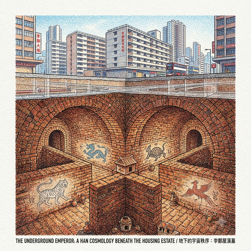
In June 1955, workers excavating foundations for the Lee Cheng Uk Resettlement Estate drove their tools into the hillside soil and broke through something that had been sealed since the second century of the common era. The chamber they uncovered — vaulted, cross-shaped, composed of intricately joined bricks — was not merely a grave. It was, according to the spatial logic of the Han Dynasty, a complete universe.
The Han tomb at Lei Cheng Uk (its formal museum name, though many still say Li Cheng Uk) is arranged in the cruciform plan that characterised elite Han burials across southern China: a front chamber opening onto a rear chamber, with two side chambers extending east and west. To the Han cosmological imagination, this geometry was not architectural convention but a precise mapping of cosmic order — the four cardinal directions each guarded by a divine animal, the Blue Dragon to the east, the White Tiger to the west, the Vermilion Bird to the south, the Dark Warrior to the north, the deceased placed at their intersection as a kind of permanent resident of the universe's most auspicious address.
The Cosmic Tomb Beneath the Concrete
More than fifty artefacts were recovered: pottery vessels, bronze items, a clay model of a building. Some bricks carry inscriptions including the characters for great good fortune. The identity of the tomb's occupant remains unknown — perhaps a minor official of the Nanhai Commandery, perhaps a merchant grown prosperous in the sea trade of the Pearl River estuary. What is certain is that someone, eighteen hundred years ago, looked at this hillside on what was then the extreme southern edge of Han civilisation, and chose it for its qi — its life force, its gathering of earth-energy — selecting a site that backed against the slope and faced south towards the water of what was then Lai Chi Kok Bay. This is one of the earliest physically documented instances of geomantic spatial thinking in the territory now called Hong Kong, predating the formal scholastic systematisation of fengshui by at least seven centuries.
The colonial government, nearly two thousand years later, chose the same hillside for a radically different kind of placement. The resettlement estate whose construction accidentally disclosed this cosmological chamber was designed to absorb tens of thousands of refugees and migrants from mainland China who had poured into the colony after 1949 — to house them, in the administrative sense, which meant to assign them grid coordinates within a rationalised, measurable, utilitarian space. The irony embedded in this sequence of events is not merely coincidental. The colonial bureaucracy dug down into a hill that had been chosen, in the Han period, as an optimal site for a different kind of human settlement — permanent, cosmologically justified, anchored in an understanding of the landscape's energetic geometry — and, in doing so, accidentally exhumed a worldview it did not possess the interpretive vocabulary to understand.
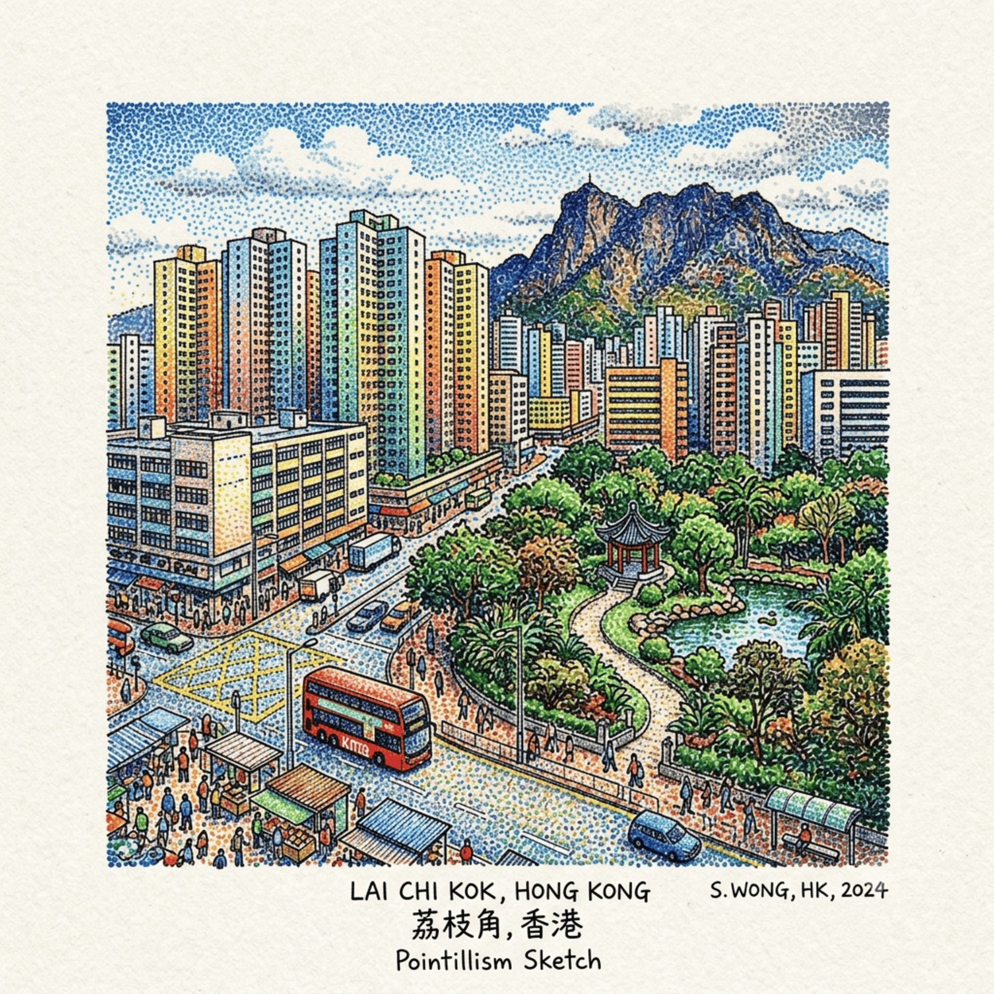
The Lei Cheng Uk Han Tomb Museum, at 41 Tonkin Street, Sham Shui Po, preserves the chamber in situ behind glass. The admission is free. The visit is rarely crowded. You descend a short ramp and find yourself in a temperature that drops perceptibly from the street outside, a cool and faintly mineral air that carries the distant quality of underground spaces everywhere, and then you are standing before four arching brick corridors extending in four directions from a central node.
Holographic Sensory Cue: The acoustic quality of this space is unlike anything in the city above. External noise — the MTR line, Cheung Sha Wan Road, the building sites that are always, somewhere in Hong Kong, underway — reduces to a frequency below hearing. What remains is the sound of your own breath, faintly multiplied by the vault above. The brick is a deep reddish-brown, textured with the handwork of a mason dead for eighteen centuries. The air temperature is perhaps four degrees lower than the street. The geometric symmetry of the four chambers, viewed from their crossing point, produces a sensation of standing at a centre — of occupying, however briefly, the spatial pivot of a cosmological system that has been waiting, sealed and intact, for someone to step back into it.
The Name That Outlasted Its Garden
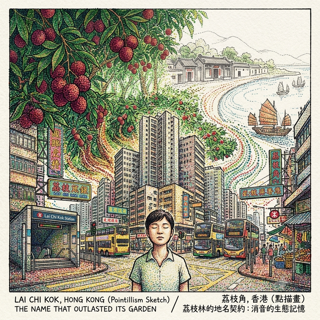
Chinese place names are not merely descriptive. They are records — compressed into phonetic form — of a landscape's original energetic character, the features that made it worth naming, the qualities that made it worth settling. Lai Chi Kok: the lychee tree (lai chi, 荔枝) belongs in the Five Elements schema to the Wood phase — growth, upward force, the vital energy of spring. A hillside dense with lychee groves, in classical geomantic assessment, would carry a strong wood qi, an auspicious gathering of the life force associated with prosperity and human flourishing. The deep red of ripened lychee fruit belongs to the Fire phase — and Wood feeds Fire, an auspicious generative cycle, the logic of accumulation.
The kok — the corner, the promontory, the place where the coastline turns — designates a point where water gathers and slows, a geographic feature that classical fengshui identifies as a natural concentrator of qi: the place where the current curves, where energy pools before dispersing outward. A Hakka or Punti village choosing to settle at Lai Chi Kok was choosing, simultaneously on practical and cosmological grounds, a site of maximum energetic advantage. The fishing harbour would shelter boats from wind. The lychee groves would generate income. The bay's curve would concentrate the invisible forces that determined whether a community would accumulate or merely subsist. In traditional Chinese village siting, these considerations were not experienced as distinct — the practical and the cosmological were folds of the same perception.
The Ghost Forest of Hong Kong
None of this survives. The lychee trees are gone. The fishing community is gone. The original clan villages — whatever their names, whatever surnames marked their ancestral halls — are so thoroughly erased that even their locations require archival reconstruction. What remains is three syllables, spoken daily by automated announcement systems and printed on maps, a linguistic fossil preserving the memory of a landscape that the city it now names has entirely replaced.
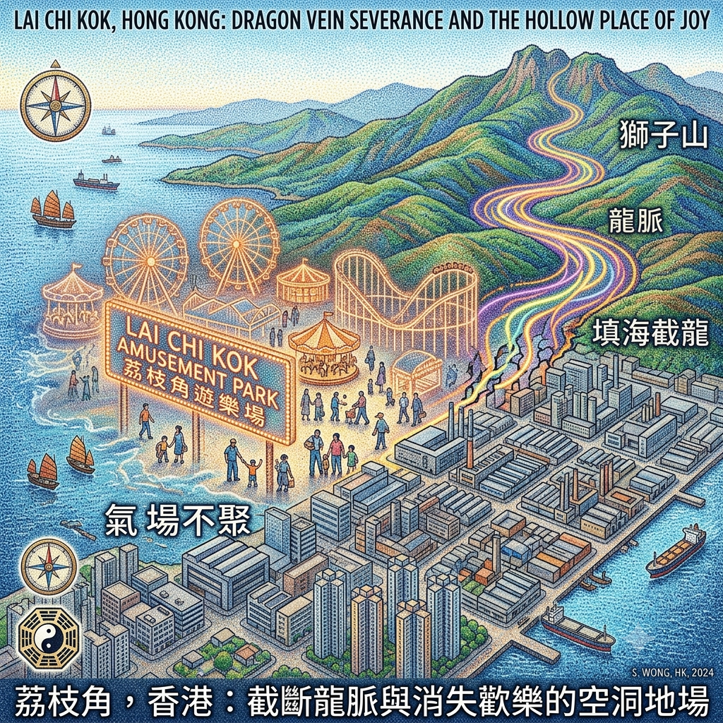
The Feng Shui of a Vanished Bay: Dragon Vein and Severance
The name Kowloon — 九龍, Gau Lung in Cantonese — encodes something important about the geomantic logic of the peninsula. Nine Dragons: the nine ridges and peaks of the Kowloon hills, each understood in the classical fengshui tradition as a segment of a longmai, a dragon vein, a channel through which the earth's living energy flows and accumulates. The western corridor of this system terminates in the hills above Lai Chi Kok, and the original Lai Chi Kok Bay was, in geomantic terms, the place where this dragon entered the water — where the vein completed its course, where the qi gathered and settled into its deepest repose.
The key principle in classical fengshui theory comes from the Book of Burial (Zangshu): qi rides the wind and scatters; it is bounded by water and halts. The curved form of Lai Chi Kok Bay — three sides held by hills, its western mouth partially closed by the island of Stonecutter's (Ang Chau, 昂船洲) — represented a near-ideal configuration for what the tradition calls cangfeng juqi: the sheltering of wind and gathering of qi, the landscape's most concentrated reserve of living energy.
The colonial reclamation programme dismantled this configuration over the course of a century. The bay was infilled, progressively, into industrial flatland. Stonecutter's Island was eventually connected to the mainland by reclamation works, losing the distinct geographic function of an island — losing its role as the mouth-closer of the bay, the shui kou sha, the sand that sealed the water gate. The dragon vein, in the fengshui reading, was severed: the terrain's capacity to gather and hold energy was disrupted, replaced by featureless reclaimed land that in geomantic terms offers nothing for energy to gather against.
The Prison Hiding in Plain Sight
Whether or not one subscribes to the metaphysical claims of classical fengshui, what this framework provides is a vocabulary for describing something real about the landscape's transformation: the conversion of a complex, organic coastal topography — with its bays, currents, hills, and islands in dynamic relationship — into an undifferentiated industrial plain. The language of dragon veins and qi-gathering is the language in which the inhabitants of this shore, for two thousand years before the colony arrived, understood their relationship to the land. To dismiss it entirely is to dismiss the interpretive framework through which this place was continuously inhabited.
Holographic Sensory Cue: Stand at the westernmost point of Lai Chi Kok Park's waterfront promenade and face southwest. Stonecutter's Island is still visible on the horizon, its military silhouette unchanged, its connection to the mainland rendered in reclaimed flatland that was, a century ago, open water. The sea breeze here comes from a direction that used to be a bay. The sounds are freight traffic and construction. Beneath those sounds, if you choose to attend to what is absent rather than what is present, is the sonic negative of a vanished coastline — the particular quality of the wind when it is shaped by water that is no longer there.
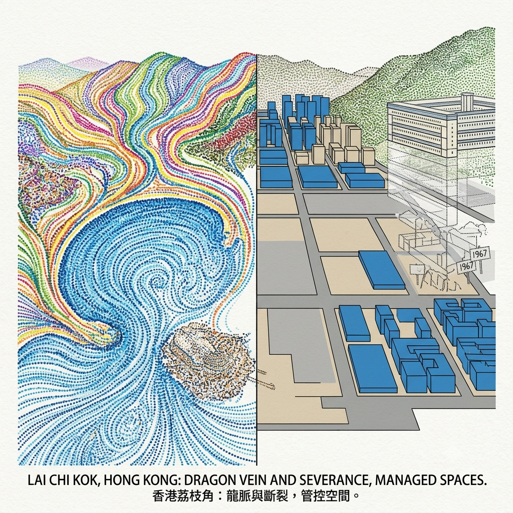
The Keeping Place: Lai Chi Kok's Geography of Confinement
Note: This section applies secular trauma geography, not the cosmological framework used elsewhere in this article. To apply fengshui or Daoist analysis to a site of systematic detention and colonial violence would be a category error and a failure of respect toward those who suffered there.
Colonial urban planning has a consistent spatial habit: it concentrates what it wishes not to see — prisons, remand facilities, psychiatric institutions, industrial waste — in the same administrative zones, the districts designated for functions that the orderly city requires but does not wish to acknowledge. Lai Chi Kok and its immediate neighbours have served this function throughout the colonial and post-colonial period.
Lai Chi Kok Reception Centre, on the hillside above Lai Chi Kok Road, occupies high ground that overlooks the district below. Its siting logic is familiar from the literature on carceral geography: elevation for surveillance, partial isolation before the district's urbanisation closed in around it, proximity to transport routes for the movement of detainees. This is the spatial vocabulary that Michel Foucault, writing about European prisons, called the panoptic geometry — the asymmetric visibility that constitutes the architecture of control.
During the Japanese occupation of Hong Kong, from December 1941 to August 1945, existing colonial detention facilities were repurposed by the military administration. The precise history of what occurred in Lai Chi Kok's institutions during this period remains incompletely documented — the archive is one of the many casualties of the occupation itself. What is documented, extensively, is the experience of the Sham Shui Po POW Camp immediately to the east, where Commonwealth soldiers endured conditions that killed many hundreds of them. The Lai Chi Kok institutions were part of the same geography of wartime confinement, though their specific history awaits fuller recovery.
Hong Kong's Indestructible Ghost Park
What is perhaps most striking about this history is its invisibility in the collective memory of the district. A few hundred metres from where the amusement park once stood — a site that has generated an enormous literature of nostalgia and longing — this institution continues its operations behind walls that the city's narrative simply does not address. The asymmetry between the intense public memory of pleasure and the public amnesia of pain is not accidental. It is one of the ways that a city tells itself the story it prefers.
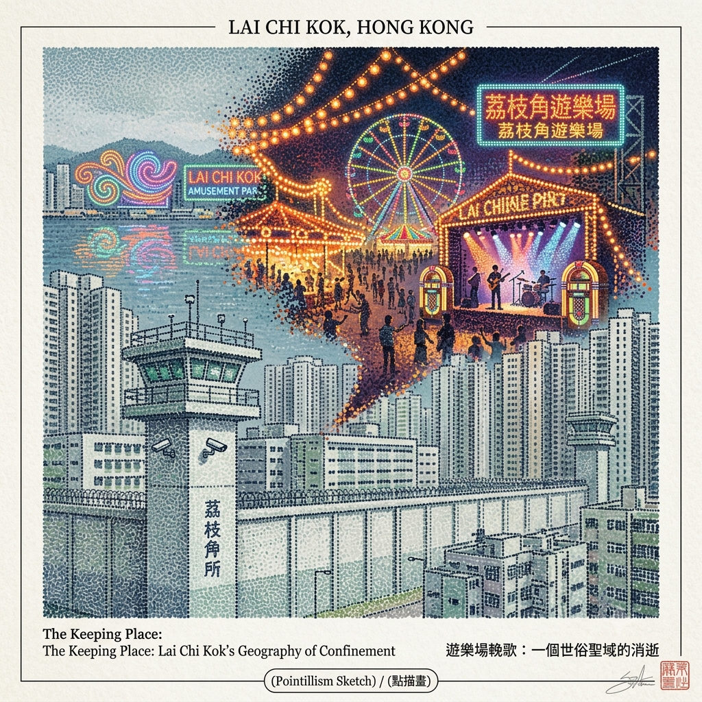
The Weight of Vanished Joy
There is a gravitational field around certain vanished places that intensifies rather than diminishes with time. The amusement park that once occupied the foreshore of what was then Lai Chi Kok Bay is one of these.
For the working population of postwar Hong Kong — the factory workers, the migrants, the families of the industrial districts of Cheung Sha Wan and Sham Shui Po — the amusement park functioned as what the sociology of urban space might call a threshold site: a place defined by the crossing of its boundary, where the logic of the working day was suspended and a different kind of time began. Religious geographers use the term liminal space for places whose significance derives from their function as thresholds between the ordinary and the extraordinary. The amusement park at Lai Chi Kok was a secular version of exactly this: a designated zone of release, open to everyone with the admission fee, lit at night when everything else in the district was either working or sleeping.
How Land Reclamation Severs the Dragon
The French historian Pierre Nora proposed the concept of lieux de mémoire — sites of memory — to describe places that carry the weight of collective recollection, that accumulate significance as physical anchors for what a community chooses to remember. The amusement park presents a troubling inversion of Nora's model. The site has been completely cleared — no fragment of the original structure survives, no plaque marks the location, the address returns nothing in the heritage record. And yet the site's presence in the memory of those who knew it seems, if anything, to have grown denser since its disappearance. Without a physical object to visit, to touch, to photograph, memory is forced to sustain itself through internal generation alone. The image grows sharper in the mind as the site grows less recoverable in the world.
Resonance Node — the void at the former park site: Walk to the former waterfront area where the amusement park once stood. There is nothing here to indicate what preceded the current buildings — no marker, no memorial, no residue. But if you can locate the specific coordinates (archival maps from the 1960s and 1970s can be found at the Public Records Office), you will be standing in what geographers of collective memory call a "hollow place" — a site charged with meaning that has been removed from the landscape's visible surface but not from the deep emotional cartography of the people who lived around it. The stillness at these locations has a quality distinct from ordinary urban quietness. It is the stillness of something that has not finished being remembered.
Lychee-Shell Encapsulation: The Hidden Frequency of This Shore
Traditional histories of Lai Chi Kok describe a simple arc of succession: agricultural settlement displaced by colonial industry, colonial industry replaced by commercial development, each era overwriting the one before it in a logic of perpetual erasure.
This framework misses what is actually happening here.
The correct description is not erasure but encapsulation. The Han tomb was not destroyed by the colonial resettlement estate — it was sealed beneath it, preserved by the weight of the decades, disclosed when the pressure of construction finally cracked the casing. The lychee orchards were not erased — they were compressed into three syllables, into a phonetic shell that continues to carry their memory daily through the city's communication systems. The amusement park was not forgotten — it was enclosed within the emotional architecture of the generation that loved it, growing more vivid as its material form grew less recoverable. The bay was not eliminated — it was buried beneath industrial flatland, its absence producing a kind of negative topography, a hollow that the landscape feels around.
Nothing here has disappeared. Everything here has been sealed.
The lychee's shell is not a barrier. It is a container. And containers, by definition, preserve what they hold.
What Lai Chi Kok teaches, at its deepest frequency, is that the city is not a process of replacement but of accumulation — a compression of layers, each one sealing the previous into a more concentrated form, until the pressure builds to the point where the shell cracks and the interior is disclosed: brilliant, intact, startlingly sweet.
If this walk through Lai Chi Kok's layers has opened something in you — a question about what your city has sealed away, what it has chosen to remember and what it has entombed in silence — consider subscribing to our newsletter. We excavate these hidden layers every month, in five languages, across the cities and coastlines where human memory has been most carefully buried.
Accessing the Physical Node
Getting there: Lai Chi Kok MTR Station (Tsuen Wan Line, blue). Exit D for Lai Chi Kok Park and the waterfront. For the Han Tomb Museum, Cheung Sha Wan MTR Station (Exit D) is the closer starting point — approximately 8 to 10 minutes' walk to 41 Tonkin Street.
Essential stops:
- Lei Cheng Uk Han Tomb Museum, 41 Tonkin Street, Sham Shui Po — Free admission. Generally open daily except Thursdays; confirm current hours before visiting. Allow at minimum 45 minutes; the experience rewards slow attention and quiet lingering at the central crossing of the four chambers.
- Lai Chi Kok Park Waterfront — The western promenade, facing Stonecutter's Island. Best visited at dusk when the light flattens against the water and the island's outline is most legible. This is where the geometry of the vanished bay is most palpable.
- Cheung Sha Wan fabric wholesale district — The surviving organic tissue of the industrial period, a street-level archive of the economic and social history of Hong Kong's manufacturing era. Worth half an hour of slow walking.
Accommodation: Multiple hotels at various price points in the Sham Shui Po and Cheung Sha Wan area, within walking distance of the district's primary nodes.
For deeper research: The Hong Kong Memory Project (hkmemory.org) holds digitised oral histories and photographic archives covering Lai Chi Kok and its surrounding districts, including materials relating to the amusement park period. The Antiquities and Monuments Office publishes documentation on the Han Tomb at antiquities.gov.hk.
💡 Lai Chi Kok History & Travel FAQ
Q1: What is there to do in Lai Chi Kok? Best cultural and hipster spots
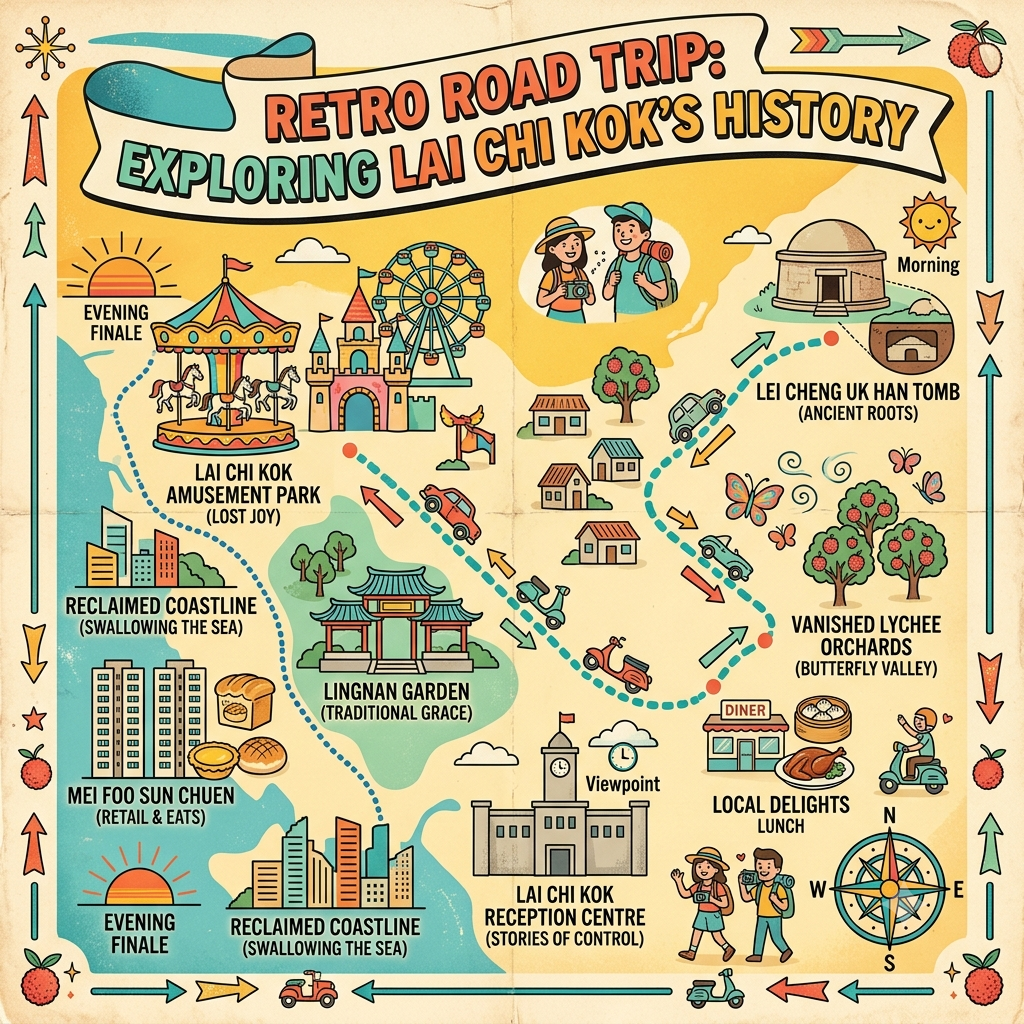
A: Lai Chi Kok has successfully transformed from a gritty industrial hub into a vibrant cultural and creative district. Start your day itinerary at D2 Place, famous for its weekend makers' markets, local indie designer boutiques, and indie cinema. Next, head over to the Jao Tsung-I Academy, a beautifully revitalized cluster of historic red-brick buildings that once served as a quarantine station and prison, now hosting art exhibitions and a tranquil hillside café. End your neighborhood walk at Mei Foo Sun Chuen to stroll through the pristine "Lingnan Garden," a traditional Chinese walled garden featuring pavilions and ponds.
Q2: Why is Mei Foo Sun Chuen significant to Hong Kong's housing history?
A: Built between 1968 and 1978 on a former Mobil oil depot, Mei Foo Sun Chuen is legendary as Hong Kong's first massive private housing estate and the birthplace of its modern middle-class lifestyle. It pioneered the "town-within-a-town" mega-structure concept, integrating its own schools, shopping arcades, and transit hubs. Most importantly, it introduced an avant-garde urban planning layout: a raised podium system that completely separated vehicular traffic on the ground from pedestrian walkways above. This ingenious design set the architectural blueprint for Hong Kong's high-density residential development for decades to come.
Q3: Where was Lai Chi Kok Amusement Park and what happened to it?
A: The iconic Lai Chi Kok Amusement Park (also known as Lai Yuen) was located along the former Lai Chi Kok Bay, where Mei Foo Sun Chuen's newer phases, Lai Yan Court, and Lai Wan Garden stand today. Opened in 1949, it was Hong Kong’s largest and most beloved vintage theme park, famous for its castle gates, Tino the Asian elephant, a ghost house, and Hong Kong’s first ice-skating rink. Facing fierce competition from Ocean Park, it ultimately closed in 1997. Today, the nearby Lai Chi Kok Park honors this nostalgic legacy with themed areas.
Reference and Further reading
First layer – Main sources of literature and institutions:
- 香港古物古蹟辦事處李鄭屋漢墓原始發掘報告(1955年)
- 香港博物館早期考古年報及文物登錄記錄
- 殖民地初期土地調查及登記檔案(香港公共記錄處);清代新安縣誌(九龍半島相關條目)
- 懲教署行政歷史記錄;香港公共記錄處殖民地行政文件;英國國家檔案館(The National Archives, Kew)香港管治相關文件
- 香港公共記錄處娛樂場所許可記錄;1950至1980年代香港中文日報(《華僑日報》、《工商日報》、《星島日報》等)遊樂場相關報道
- 香港土木工程拓展署歷史性填海工程記錄;殖民地測量及地圖檔案(不同年代海岸線比較地圖);英國皇家地理學會及大英圖書館地圖存檔
The second layer – secondary academic materials:
- 漢代南疆考古研究(廣東、廣州地區東漢磚室墓比較研究)
- 《香港考古學報》及香港歷史博物館相關出版物
- Rubie Watson、James Hayes 等人的新界及九龍宗族研究學術著作;Patrick Hase 關於香港傳統村落地理的研究
- Philip Snow, The Fall of Hong Kong: Britain, China and the Japanese Occupation (2003);Bernice Archer 等人的日據香港研究;Tony Banham 關於香港戰役及戰俘的研究著作
- 香港戰後大眾娛樂文化及工業社會史相關學術著作
- 填海工程環境及城市規劃影響的學術研究;香港海事史相關著作
Third layer – Supplementary information:
- 李鄭屋舊村民口述歷史記錄(建議向香港記憶計劃查詢)
- 香港記憶計劃(Hong Kong Memory)日據時期倖存者口述記錄資料庫;六七暴動相關口述歷史
- 香港記憶計劃(hkmemory.org)相關影像及口述記錄;香港電影資料館可能存有的相關紀錄影像
- 昂船洲前英軍人員口述記錄
Historical gap:
- There is no direct documentary evidence regarding the identity of the tomb's occupant; only speculative analyses exist.
- Interpretations of some brick inscriptions remain disputed, with no academic consensus reached.
- No systematic research has been conducted on the historical continuity between the Han tomb and the later "Li Cheng Uk" clan village.
- There is no complete record of the quantity and types of artifacts damaged during construction (further verification of original archives is recommended).
- Detailed records regarding the original clan villages in Lai Chi Kok (specific surnames and exact village locations) are extremely scarce; priority should be given to examining archives related to the "New Territories Land Survey" (1899–1904) from the early colonial period.
- No systematic research currently exists regarding the scale, business models, and timeline of the disappearance of lychee cultivation in the area.
- Further investigation is recommended regarding the ecological history of Butterfly Valley and its geographical relationship to the original Lai Chi Kok landscape.
- Reconstructing the exact usage and details of detainees at the Lai Chi Kok detention facility during the Japanese occupation is currently difficult due to the extensive loss of Japanese records; priority should be given to consulting JACAR archives.
- Complete records of political detentions during the post-war Cold War era are lacking, as some files remain under confidentiality restrictions.
- Regarding the detention details of those arrested during the 1967 Riots, it is recommended to consult relevant court records and declassified documents.
- Priority should be given to verifying primary newspaper records regarding the exact years the amusement park opened, reached its peak, and closed.
- The potential spatial connection between the amusement park and the geography of Hong Kong's early film industry awaits dedicated research.
- Further verification is recommended regarding complete records of the amusement park's management, business model, and reasons for closure.
- Original documents from the Civil Engineering and Development Department need to be consulted to determine the exact years and scale of each reclamation project phase.
- No systematic research exists on whether colonial Chinese residents formally objected to or petitioned against reclamation projects on feng shui grounds; consulting relevant Legislative Council proceedings is recommended.
- Maritime and military archives should be consulted to determine the exact timeline and engineering details of the connection that transformed Stonecutters Island into a peninsula (further verification of original archives is recommended).
 Lawrence
 Lawrence
 Lawrence
The sources for this article include primary historical records, academic papers, and public records from various levels of administrative bodies, with a commitment to historical accuracy; instances requiring further verification against primary archival materials have been noted in the text. Last updated: July 2026.