The River That Will Not Be Bridged: Five Hidden Histories of Rokugō-machi, Tokyo's Most Repeatedly Destroyed Place
A historical walking guide to Rokugō-machi, Tokyo’s river-bound delta. Discover five hidden histories spanning Minamoto samurai flag-raising rituals at Rokugō Shrine, old Tōkaidō ferry traditions, and the area's spiritual and industrial endurance.

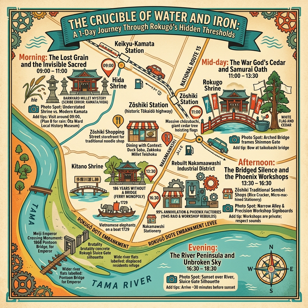
This is a historical travel story and walking guide to Rokugō-machi, a unique district in southern Tokyo enclosed on three sides by the wild Tama River. Through five hidden histories, it explores ancient Shinto shrines, historic river crossings on the Tōkaidō, and industrial ruins to show how samurai legends, natural destruction, and modern rebirth overlap on this resilient delta landscape.
 Lawrence
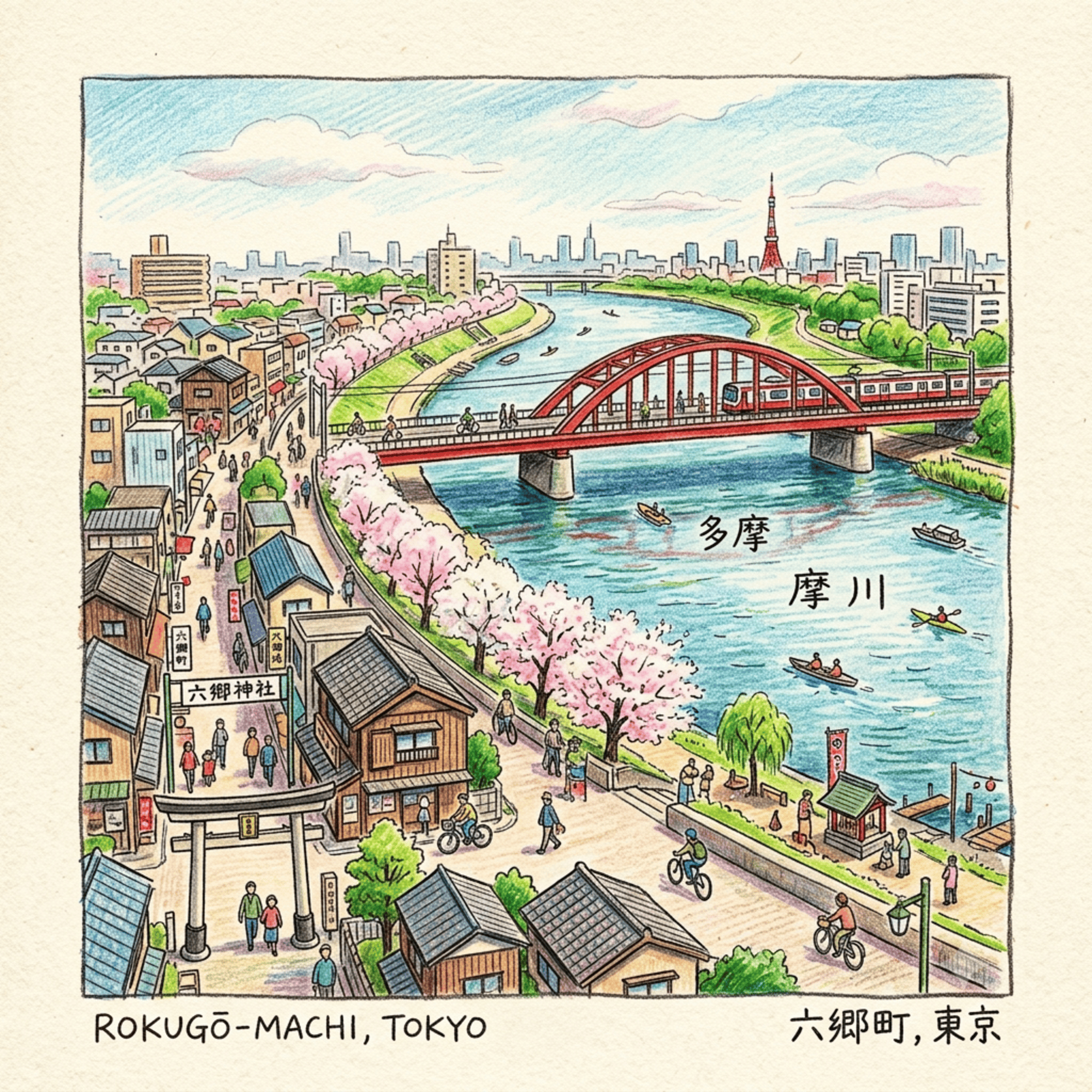
There is a district in the southern end of Tokyo described in its own administrative records — with the matter-of-fact precision of bureaucratic Japanese — as being "surrounded on three sides by the Tama River." Not one side. Not two. Three sides of water, wrapping a patch of low alluvial land in a near-complete hydraulic embrace. The effect, on any map of sufficient scale, is of a town that a river tried to swallow and then, for reasons of its own, decided to keep.
That district is Rokugō-machi — the "Six-Parish Town," as the name translates — and it sits today as the quiet, unglamorous southern fringe of Ōta Ward, hemmed in by residential streets, small factories, and the constant background roar of National Route 15. Most Tokyo guidebooks, if they mention Rokugō at all, describe it as the last crossing point on the old Tōkaidō highway before the road reached the capital. Which is accurate, and which misses almost everything important.
Because what Rokugō actually is — what a close reading of its thousand-year documentary record reveals — is something considerably stranger: a place that has been cosmologically overwritten, politically weaponized, administratively erased, and physically incinerated, and that has, after each of these events, reconstituted itself in a more resilient form than it held before. The river that imprisons it is also the engine of its perpetual renewal. The catastrophes that should have ended it are also the events that sharpened it.
This is not a piece about passing through Rokugō. This is a piece about what happens when you stop there.
How to Read a Japanese Sacred Landscape
Before any of the five histories that follow can make sense, it helps to understand the framework through which this land has always been interpreted by the people who lived on it. That framework is not the Chinese feng shui system that many Western readers associate with East Asian spiritual geography — Rokugō is a Japanese place with a Japanese cosmological logic, and conflating the two is a category error that produces precisely the kind of generic "mystical Asia" writing this site exists to outperform.
The operative system here is Shinto — not Shinto as religion in the Western institutional sense, but Shinto as a grammar of sacred space. Its central premise is deceptively simple: kami, the divine forces that animate the world, are not transcendent or remote. They inhabit specific physical things — a particular tree, a particular rock, a bend in a particular river. Those objects are called yorishiro, "dwelling places," and the job of a Shinto shrine is essentially to mark and maintain a designated yorishiro so that the kami can be consistently found, addressed, and propitiated.
What follows from this for sacred geography is profound. A river in Shinto thought is not a geographic feature — it is a divine actor with its own agency. When it floods, that is not a natural disaster; it is the river-kami asserting territorial authority. When it destroys a bridge, that is not a hydraulic event; it is a refusal. And a shrine built at a river crossing is not a roadside convenience — it is a structure placed precisely at the boundary between the world of the living and the divine realm, because in Shinto cosmology, water is the membrane between them. The Japanese Buddhist concept wataru — to cross to the other shore — carries exactly this double meaning: crossing a river and passing into the afterlife are the same word, and the same threshold.
With that frame in place, consider what the Tama River's three-sided embrace of Rokugō means: not a geographic accident, but a divine act of selection. The river enclosed this land and gave it edges. In the creation mythology of the Kojiki, Japan's oldest chronicle, the islands of the archipelago were formed precisely by the gods stirring the primordial ocean until land emerged with boundaries, identifiable and named. A piece of alluvial delta defined by three sides of water is, in this cosmological grammar, land that the divine chose to make distinguishable from everything around it.
The Tama River chose Rokugō. And then it spent a thousand years testing it.
Listen to the historical stories told in detail (For subscribers only)
1057: When a Cedar Tree Changed the Direction of Japanese History
The landscape of medieval Japan has a strange quality that is easy to miss: the political and the sacred were not separate categories. When warriors prayed, they were not performing an optional ritual supplement to military logistics — they were doing something they understood as causally necessary, as functional as sharpening a sword.
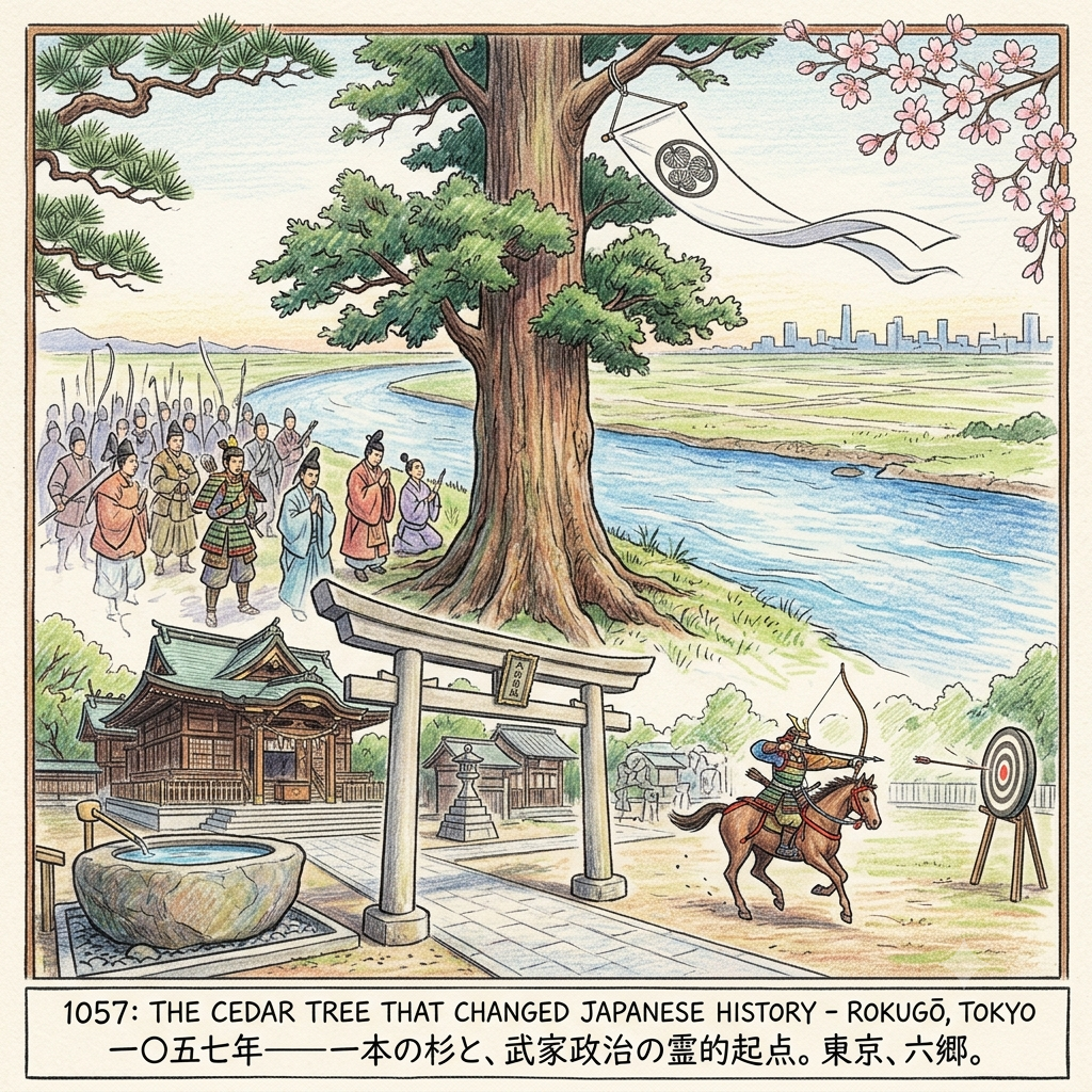
In 1057, a warrior lord named Minamoto no Yoriyoshi halted his army on the northern bank of the Tama River. He was heading north for what would become a twelve-year campaign — the Zenkunen War, or "Former Nine Years' War" — to suppress a rebellion in the remote northern province of Mutsu. Before crossing the river, he did something that would define this place for the next thousand years: he climbed to the crown of a great cedar tree that stood at the river's edge and tied the Minamoto clan's white battle flag to its highest branch.
This was not ceremony. In Shinto spatial logic, the act converted the tree into what is called a yorishiro — a physical anchor for divine presence, a point of contact between the human and the sacred. The cedar was the tallest fixed object in a delta landscape otherwise defined entirely by water and flat alluvial mud; in a cosmology where height corresponds to proximity to the divine, a flag at its crown was a prayer antenna aimed at the war deity Hachiman. Yoriyoshi's sources describe what happened next with a directness that is almost journalistic: the army's morale "blazed greatly." They crossed the river. They fought for twelve years. They won.
Returning in triumph, Yoriyoshi established a shrine at the site — an offshoot of Iwashimizu Hachiman-gū, the great shrine in Kyoto, itself derived from the ancient military shrine of Usa Hachiman in northern Kyushu. The Minamoto clan's tutelary deity had descended into this bend of the Tama River and would remain there.
The White Flag That Birthed The Samurai
One hundred and thirty-two years later, in 1189, Yoriyoshi's descendant Minamoto no Yoritomo came to the same shrine before his own northern campaign — the Ōshū Expedition, which would complete the Minamoto subjugation of all Japan. He raised the white flag at the same site, following, as the historical record puts it, "his ancestor's auspicious precedent." He won his war too. In 1191 he ordered the shrine's main hall rebuilt by his general Kajiwara Kagetoki. The following year, Yoritomo was appointed Seii-Taishogun — Supreme Commander — and founded the Kamakura Bakufu, the first of Japan's military governments and the template for the samurai political order that would persist until 1868.
The stone water basin that Yoritomo dedicated as an offering to the shrine when he returned victorious still stands in the compound today. It is unusually large for a ritual hand-washing vessel — the scale of a ceremonial offering rather than a practical convenience.
What this sequence adds up to is something the standard narrative of Japanese political history tends to obscure: the founding act of Japan's military governmental tradition was partly enacted at a river crossing in what is now a quiet residential district of southern Tokyo, by men standing in front of a tree. The Kamakura Shogunate did not originate in palaces or courtly negotiations. Its spiritual legitimacy was staked, twice, at a cedar on a flood-prone riverbank, in acts of prayer addressed to a war kami who lived in a tree.
Rokugō Shrine — still the guardian shrine for the six-village cluster that gave the district its name — holds its annual mounted archery ceremony, yabusame, every January 7. Archers in Heian costume fire at targets from horseback within the compound. The sound of the bowstring, the thud of the arrow in wood — this is the most direct sensory line that still connects the present site to its twelfth-century function. Attend it if you can.
1688: The Smartest Thing the Shogunate Did Was Nothing
In 1600, the same year he won the Battle of Sekigahara and laid the foundation for two and a half centuries of Tokugawa rule, Ieyasu had a bridge built at Rokugō. He called it the Rokugō Ōhashi — the Great Rokugō Bridge — and it was, at roughly 218 meters, one of the three largest bridges in the Edo region. It spanned the Tōkaidō highway's most critical crossing point: the first major river barrier between Edo and the rest of Japan.
The Tama River destroyed it.
Then the shogunate rebuilt it. Then the river destroyed it again. This happened six times, in 1613, 1643, 1662, 1681, and 1684, with the floods dismantling each successive bridge as methodically as a recurring inspection that keeps finding the same fault. Then, in 1688, the river took the sixth bridge, and the shogunate made a decision that would shape the next 186 years of Japanese social history: it did not build a seventh.
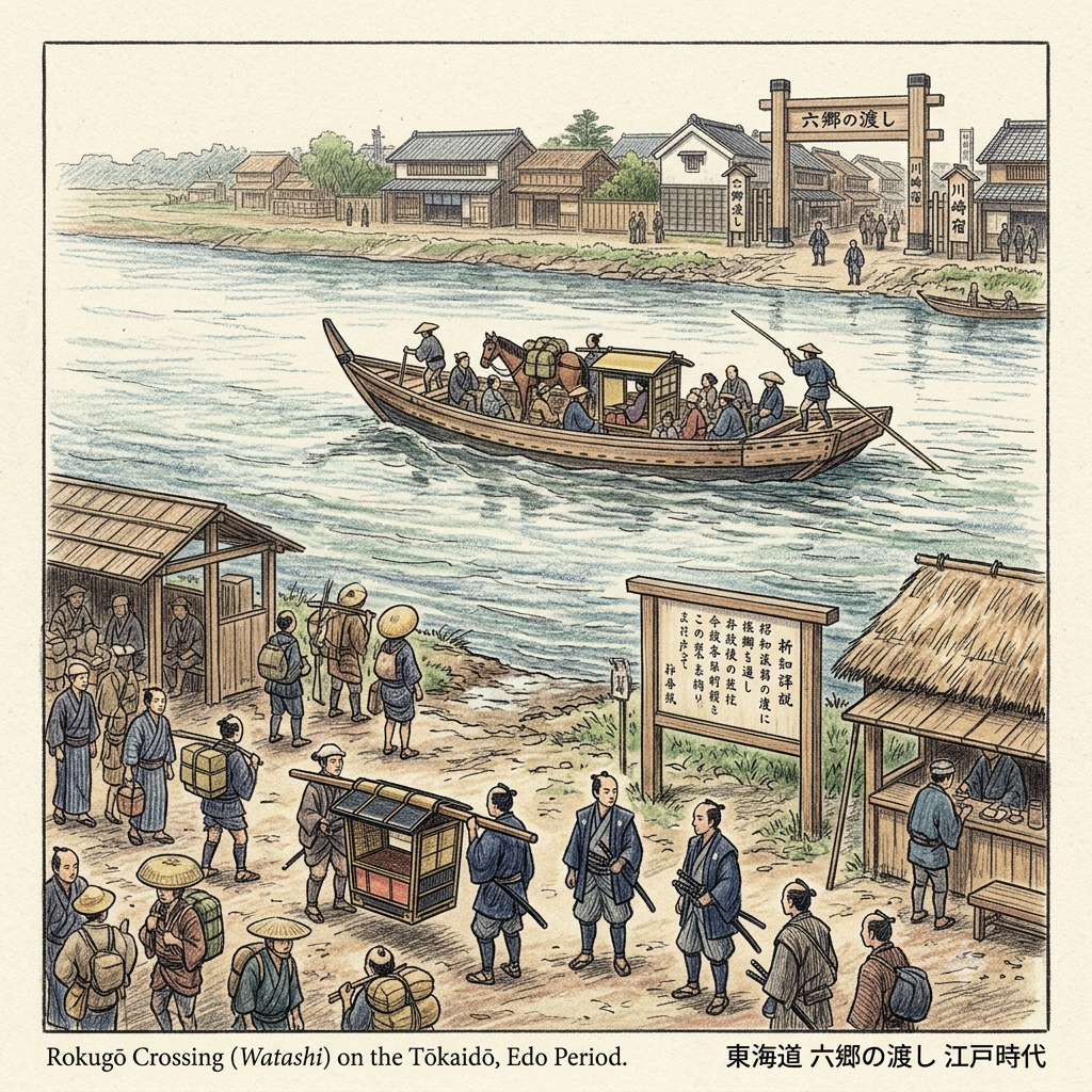
Instead, the Tōkaidō — the most heavily trafficked highway in pre-modern Japan, the road that connected the political capital of Edo to the cultural capital of Kyoto, the route used by samurai lords on their mandatory biennial residence journeys, by Buddhist pilgrims, merchants, couriers, and anyone traveling between the two halves of the country — crossed the Tama River by ferry. Specifically, by a ferry monopoly granted to the Kawasaki post town, the authorized operator of what became known as the Rokugō no Watashi: the Rokugō Crossing.
The calculation is not difficult to reverse-engineer. A bridge is infrastructure the state builds and the public uses freely. A licensed ferry crossing is infrastructure the state authorizes and the operator monetizes. More importantly for the Tokugawa political imagination: a bridge is an uncontrolled passage. A ferry is a metered one. Every person, horse, and palanquin that crossed the Tama River on the Tōkaidō now did so at a pace and in a manner determined by the ferry operator's schedule, the river's seasonal level, and the shogunate's implicit permission. No bars, no guards, no checkpoint — just water, weather, and the ferryman's call.
Japan's 186 Year Missing Bridge
The practical human cost was substantial. When the river ran high — which it did frequently, because the lower Tama earned its nickname "Abare-gawa," the Violent River, from its chronic seasonal flooding — the crossing suspended. Travelers stranded at Rokugō waited. Sometimes for days. Sometimes for weeks. The great lords' processions that were required by Tokugawa law to travel between their domains and Edo could be held here for an entire season, their thousands of retainers camped on a riverbank, burning through provisions, waiting for the ferryman's signal.
In 1729, two Vietnamese elephants — a male and female — were being transported overland from Nagasaki to Edo as a gift to the shogunate. The female died en route. The male was ferried across at Rokugō, drawing crowds from the surrounding villages to watch a creature unlike anything in their cosmological vocabulary be carried across Japan's most sacred crossing. No one at the time appears to have written down what they made of the spectacle. The fact that the story survived in local oral memory suggests they found it significant in a way they couldn't categorize.
In 1868, the Emperor Meiji — entering Edo for the first time as the restored imperial ruler after the end of the Tokugawa era — crossed at Rokugō on a temporary pontoon bridge assembled for the occasion. The relief panel of this event still stands in stone near the approach to the modern bridge. It is the kind of historical detail that feels almost too neat: the river that the Tokugawa could not bridge finally yielded to a makeshift crossing for the man who ended their dynasty.
It was a private timber merchant from Hachimanzuka village, Suzuki Sanai, who finally built the first permanent civilian bridge across this stretch of river, on January 21, 1874. The 186-year absence of a crossing ended not with an act of government but with a private individual's initiative.
The ferry site marker is now located at Kitano Shrine in Naka-Rokugō rather than at the riverbank itself — urban development absorbed the original landing — but the embankment where travelers waited still exists, still elevated above the surrounding residential grid, still facing the same expanse of water.
927 AD: The Shrine Nobody Can Find
This is the most difficult of the five stories to tell, because it concerns something that is not there anymore. Or rather: something that is there, but cannot be definitively identified.
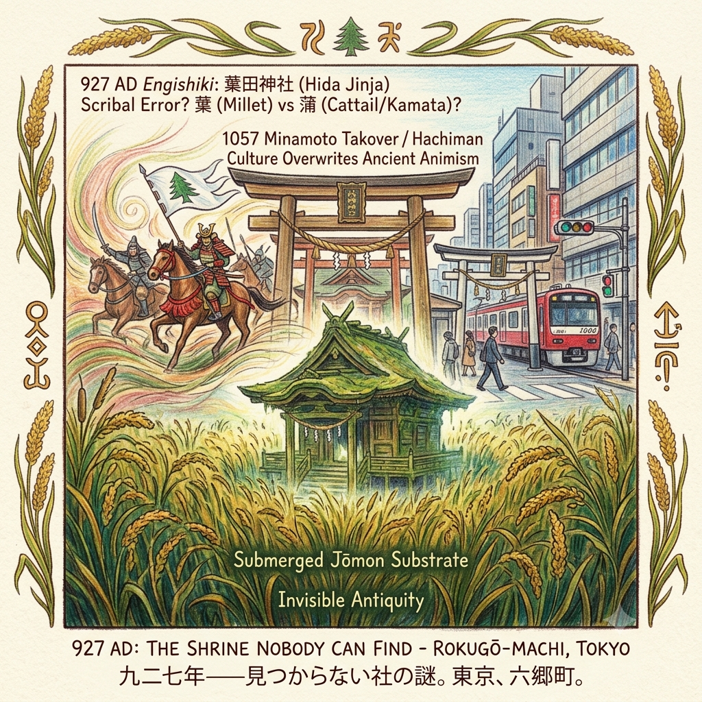
In 927 AD, the Japanese imperial court completed the Engishiki, an enormous legal and procedural compendium that included, among many other things, an official register of all shrines in Japan deemed worthy of court recognition and ritual maintenance. Among the shrines listed for Musashi Province, Ebara District — the ancient administrative unit covering what is now Ōta Ward — was one called 薭田神社: Hida Jinja, or the Shrine of the Barnyard Millet.
The character 薭, pronounced hie, refers to barnyard millet, Echinochloa esculenta, a grain that was being cultivated in the Japanese archipelago during the Jōmon period — thousands of years before wet-rice agriculture arrived and reorganized both the landscape and its spiritual priorities. A shrine dedicated to barnyard millet is a shrine that predates the samurai, the Buddhist clergy, the Tokugawa bureaucracy, and possibly wet-rice culture itself. It is a shrine of subsistence, of the food that kept people alive before the prestige grain arrived. Of the agricultural animism that was Japan's spiritual substrate before warrior culture overwrote it.
The problem — and it is a problem that has occupied local historians for centuries — is that by the medieval period, no one could remember where this shrine was. The Engishiki record survived. The shrine's location did not.
In the Edo period, at least three separate sacred sites in the Ōta Ward area simultaneously claimed to be the original Hida Jinja: a small shrine in Kamata (now officially named 薭田神社); the Rokugō Shrine compound; and a shrine that eventually ended up in present-day Minato Ward. The scholarly consensus, such as it is, holds that the Engishiki's "薭田" is probably a scribal error — that the original name was "蒲田," Kamata, meaning something closer to "Cattail Field," and that an ancient copyist misread the grass-radical character for "cattail/rush" as the similar-looking character for "barnyard millet," and that successive generations of copyists then faithfully reproduced the error for centuries, encoding the wrong plant into the shrine's eternal identity. A 9th-century court document, the Sandai Jitsuroku, refers to a goddess called Kamata-kami being elevated to official shrine status in 864 AD — strong circumstantial evidence that "Kamata" was the original reading.
If that theory is correct, then the shrine is in Kamata, misnamed. If it's wrong, the millet shrine is somewhere else, unknown. Either way, the food-kami of the Jōmon-era delta has been, at minimum, misidentified, and possibly lost entirely.
What this dispute encodes is a story larger than any single shrine location. It is the record of a cosmological takeover: the agricultural sacred geography of this delta — a web of field-spirits, harvest-prayers, and grain-kami centered on the very crops that fed the community — was gradually and then decisively overwritten when the Minamoto clan introduced warrior Hachiman culture in 1057. The sacred cedar, the white battle flag, the war god's arrival: these did not replace the older spiritual layer so much as simply grow over it, the way introduced species occupy an ecological niche until the original inhabitants are undetectable. By the time someone thought to look for the millet shrine, it had been under the warrior shrine for two centuries.
The Shrine That Never Was
The 薭田神社 claimant in Kamata — 4-18-18 Kamata, a five-minute walk from Keikyu Kamata Station — is a small, quiet urban shrine pressed between commercial buildings. There are no tourist facilities. The stone lanterns are old and smooth. The sound of the Keikyu line dominates the soundscape. Nothing about the physical site announces itself as historically significant. That invisibility is, in its way, the most accurate possible representation of what happened to the cosmological layer it may represent: enormous antiquity, completely submerged beneath the weight of everything that came afterward.
April 15, 1945: What 99 Percent Looks Like
By 1932, Rokugō-machi had been absorbed into Kamata Ward, Tokyo City, and the six old river-parishes had been subsumed into one of the most densely industrialized districts in Japan. The precision manufacturing culture that would later define Ōta Ward was already well established: hundreds of small factories producing aircraft components, navigational instruments, ball bearings, and precision metalwork for the Imperial military machine. The area had become, in the language of American strategic bombing planners, a "target-rich environment."
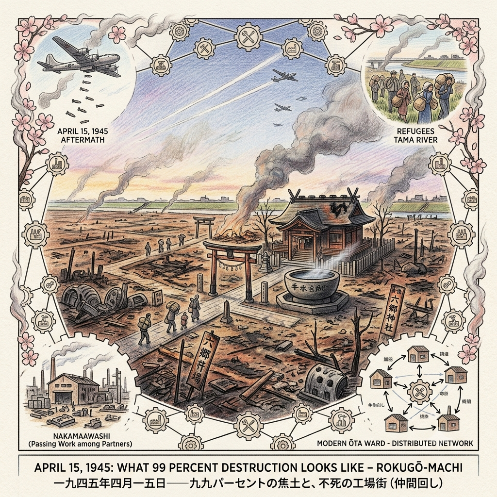
The Jōnan Air Raid — Jōnan meaning "south of the castle," a designation for the southern Tokyo industrial belt — began in the small hours of April 15, 1945. Two hundred and two B-29 Superfortress bombers arrived carrying M69 incendiary bombs, a weapon developed specifically for Japan's wooden urban architecture. The M69 scattered burning napalm in a wide pattern on impact; against densely packed wooden structures, it was catastrophically effective.
By morning, an Imperial Japanese defense command report confirmed that Kamata Ward — the administrative successor of the old Rokugō territory — had seen approximately 99 percent of its buildings destroyed. Sixty thousand or more homes burned. Around 230,000 people were made homeless. The Tama River embankment became a refugee corridor: people carried what they could and moved toward the only open space that wasn't on fire.
The figure "99 percent" deserves a moment of careful attention, because it describes something that is nearly impossible to visualize from the outside. What 99 percent destruction of a densely populated urban district looks like is not a city with most of its buildings damaged. It is a city in which you can stand at the center and see to the edges in every direction, because there is almost nothing left between you and the horizon. It is a landscape that has been returned, violently and completely, to flat open ground. Every street grid, every storefront, every factory floor, every neighborhood shrine's torii gate, every domestic garden, every textile workshop and machine shop and rice merchant and fishmonger — gone, or very nearly. The remaining one percent was, in a sense, the margin of error in the fire.
The Rokugō Shrine survived. The stone water basin that Yoritomo had offered in 1191 was still there when the fires burned out.
What happened in the decades that followed is one of the more remarkable episodes in modern urban economic history, though it rarely gets told as such because it involves no famous individuals and no single dramatic event — only an accumulation of small deliberate actions by people whose names are mostly unrecorded. The precision manufacturing workers of the former Kamata Ward rebuilt their factories. Not the same factories in the same places making the same things for the same military clients — that entire structure was gone, along with the military that had commissioned it. They rebuilt a different kind of industrial ecosystem, one organized around a practice called nakamaawashi, roughly translatable as "passing work among partners."
The Phoenix Factories Of Tokyo
Under this system, which still defines Ōta Ward today, no single factory completes a product. Each factory contributes a specialized stage: one machines a particular component, the next treats its surface, the next performs a different operation, and so on through a network of perhaps a dozen or twenty small workshops until a finished piece emerges — precision engineering distributed so finely that no single node's failure can collapse the whole. Ōta Ward today hosts roughly 3,500 factories of this type, most employing fewer than ten people. The network as a whole can produce almost anything.
There are cultural historians who read the nakamaawashi network as a structural response to the experience of collective annihilation — if the logic goes: when everything you built was destroyed because it was concentrated and visible, you rebuild in a form that is distributed and invisible, where no single point of failure can be targeted. Whether or not that reading is correct, the material result is a manufacturing ecosystem that is, by almost any metric, more sophisticated and more resilient than the militarized industrial concentration it replaced.
The B-29 crews targeted Kamata because it was a weapons-production district. They produced, indirectly, a precision-manufacturing culture of considerably greater long-term capability.
The River's Geometry
One thing that threads through all five of these histories and has not yet been stated plainly: the geographic anomaly that made them all possible.
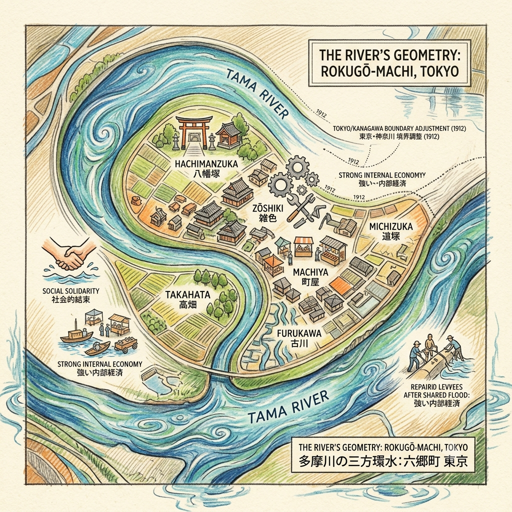
The Tama River in its lower reach makes a double bend before emptying into Tokyo Bay, and the combination of those bends positioned the old Rokugō territory in a hydraulic pocket wrapped on three sides by the same river. This is why the administrative records describe it as "surrounded on three sides." It is also why the administrative boundary between Tokyo and Kanagawa Prefecture had to be formally adjusted in 1912 — the river had moved its channel since the previous survey, and parcels that were legally in one province were physically in another.
The Village Trapped Inside A River
A community surrounded on three sides by an unpredictable river develops specific adaptations. Internal economy grows stronger because external access is intermittently cut off. Social solidarity is reinforced by periodic shared flooding. Spatial identity becomes intense because the water makes boundaries visible. The six villages that gave Rokugō its name — Hachimanzuka, Zōshiki, Machiya, Takahata, Furukawa, and Michizuka — developed as a nearly self-contained cluster precisely because the river kept them functionally isolated for substantial portions of each year.
That enforced self-containment is part of what made the nakamaawashi network possible after 1945: the social infrastructure for distributed cooperation among near-neighbors was already there, built over centuries of hydraulic adjacency. The river's geometry was not just a geographic feature. It was a social curriculum, teaching the community how to be self-sufficient before the bombs ever fell.
The Frequency This Place Runs On
Traditional Tokyo histories tend to position Rokugō as a transitional space — the last stop before Edo, the penultimate town on the great road, the place you were when you weren't yet where you were going. In this framing, Rokugō's significance is entirely borrowed from its proximity to somewhere more important.
The evidence accumulated here suggests a different interpretation entirely.
Every major force in Japanese history that passed through Rokugō left it in a worse material condition than it found it, and left it, within a generation, in a better functional condition than it had been before. The Minamoto clan made the riverbank a military staging ground, and the result was a shrine with a thousand-year lineage that still performs its mounted archery ceremony in January. The Tokugawa shogunate weaponized the river crossing as a political bottleneck, and the result was a ferry concession that produced one of the Edo period's most important hydraulic engineers. The ancient warrior culture overwrote the agricultural sacred geography so completely that the millet shrine became unfindable — and the result was a multi-site dispute that preserved the memory of an even older cosmological layer than the one that replaced it. American bombers reduced the district to 1 percent of its built environment — and the result was a precision manufacturing ecosystem of greater complexity and resilience than the industrial concentration that was targeted.
This is not the pattern of a transitional space. It is the pattern of a crucible.
In Shinto vocabulary, the recurring structure has a name: kegare to harae, pollution and purification — the cycle in which a sacred site accumulates damage, defilement, or disruption, is violently or gradually cleansed, and emerges renewed. The cycle is not metaphorical; in Shinto practice it is enacted physically, through purification ceremonies that are performed regularly at shrines to reset the balance between the human and the sacred. What Rokugō appears to do, on the scale of centuries rather than seasons, is enact this cycle at a civilizational level: the community, the sacred site, the economic infrastructure — all of them sustaining catastrophic damage, all of them reconstituting in altered and improved forms on the other side.
The Tama River is not incidental to this pattern. It is its instrument. The same hydraulic force that surrounded the community on three sides, that destroyed six bridges, that made the crossing impossible for 186 years at a stretch, that swept through the delta in flood years and reconfigured the administrative boundaries between provinces — that river is also what gave this community its geographic identity, its internal cohesion, its enforced self-sufficiency, and the social structures that allowed it to rebuild after each successive catastrophe.
The river that imprisons Rokugō is the river that keeps saving it.
If You Go
Rokugō Shrine (六郷神社) 3-10-18 Higashi-Rokugō, Ōta Ward. A ten-minute walk from either Zōshiki Station or Rokugō-dote Station on the Keikyu Line. The stone taikobashi drum bridge before the main gate is traditionally attributed to Kajiwara Kagetoki, Yoritomo's general; the oversized chōzubachi stone basin to the right of the main hall is attributed to Yoritomo's personal offering. The January 7 mounted archery ceremony (yabusame, designated Tokyo Intangible Folk Cultural Property) is the single most vivid point of contact with the site's medieval history. On ordinary days the compound is quiet to the point of austerity — the contrast with the surrounding urban noise is remarkable.
Tama River Crossing Site (多摩川渡し跡) The site marker for the Rokugō no Watashi ferry is at Kitano Shrine, 4-29 Naka-Rokugō — a short walk from the embankment. The original landing point is subsumed under the Route 15 bridge approach, but the embankment (六郷土手, Rokugō-dote) above the river retains the scale and sightlines of the historic crossing. The relief panel of Emperor Meiji's 1868 pontoon-bridge crossing stands near the foot of the Shin-Rokugō Bridge approach.
Hida Shrine (薭田神社) — Kamata Claimant 4-18-18 Kamata, Ōta Ward. Five minutes from Keikyu Kamata Station. Small, quiet, and easy to miss entirely — which is, in a historically appropriate way, the point. No tourist facilities. The compound's modesty relative to its potential antiquity is the most honest thing about it.
Rokugō Sluice Gate (六郷水門) 2-35 Minami-Rokugō. Accessible on foot from the Rokugō-dote embankment walk. The concrete flood-control gate at the point where the district's drainage canal meets the main river gives the most visceral sense of the hydraulic reality that shaped this community across millennia.
Ōta Ward Local History Museum (大田区立郷土博物館) 5-11-13 Minami-Magome. The primary institutional archive for the region, with holdings on the April 15, 1945 air raid, the postwar industrial reconstruction, and the longer local history.
💡Frequently Asked Questions (FAQ)
Q1: What is the historical significance of Rokugo-machi in Tokyo?
Rokugo-machi in Tokyo's Ota City holds rich historical significance as the gateway town of the historic Tokaido highway during the Edo period. Positioned along the Tama River, Tokugawa Ieyasu built the landmark Rokugo Bridge here to connect Edo (modern Tokyo) with Kyoto. Serving as an essential post town (post station) and river crossing, Rokugo preserved ancient shrines like Rokugo Shrine and Hohoin Temple, preserving centuries of river transport culture, samurai history, and regional heritage.
Q2: How to visit hidden historic spots near Haneda Airport?
Rokugo is one of the best off-the-beaten-path historic destinations located near Haneda Airport. Travelers can easily reach Rokugo in 15 to 20 minutes via the Keikyu Main Line from Haneda Airport to Zosiki Station or Rokugotote Station. This peaceful neighborhood features preserved Edo-period ferry crossing sites, traditional shopping streets, and historic local shrines, making it an ideal 2-to-3-hour cultural walking tour for layovers or early arrivals in Tokyo.
Q3: What are the best things to do at Rokugo-tote along the Tama River?
Rokugo-tote offers scenic riverside parks along the Tama River with panoramic views, seasonal wildflowers, and spring cherry blossoms. Popular activities include walking along the former Tokaido highway route, visiting Rokugo Shrine with its ancient stone torii gate, and photographing Keikyu train crossings over the river with Mount Fuji visible on clear days. It offers a unique mix of modern Japanese railway views and Edo-period post-town history.
Reference and Further reading
First layer – Main sources of literature and institutions:
- 六郷神社 official records (宮司文書); shrine's own historiographical compilation available at the shrine office
- 大田区郷土博物館 (Ōta Ward Local History Museum) archival holdings
- 東京都神社庁 shrine registration documents
- 御由緒掲示(境内)— shrine-history plaques, on-site
- 国土交通省 関東地方整備局 京浜河川事務所 — historical crossing documentation (公開資料)
- 大田区立郷土博物館 (Ōta Ward Local History Museum) — ferry records
- 大田区指定文化財 — designation documents for 多摩川渡し跡
- 延喜式神名帳 (Engishiki Jinmyōchō, 927 AD) — the primary document; available in full digital form through National Diet Library
- 新編武蔵風土記稿 (Shinpen Musashi Fudoki Kō) — Edo-period geographic gazetteer; contains the shrine-identity dispute discussion
- 帝都防空本部情報第170号 — wartime defense command report confirming 99% destruction of Kamata Ward
- 大田区史 (Ōta-ku Shi, the official district history) — vol. 下巻; documents the air raid and postwar reconstruction
- 東京大空襲・戦災誌 第3巻 (Documentation of Tokyo Air Raids and War Damage, vol. 3) — published records of the Jōnan raid specifically
- 国土交通省 多摩川水系誌 — comprehensive river engineering and historical documentation
- 大田区浸水実績図 (Ōta Ward historical flood record mapping) — flood history data
- 1912 administrative boundary adjustment records: Tokyo Prefecture vs. Kanagawa Prefecture official correspondence
The second layer – secondary academic materials:
- 新倉善之 大田区史跡散歩 (Gakuseisha, 1992), pp. 79–80 — covers Hida/Rokugō shrine identity question
- 陸奥話記 (Mutsu Waki) — primary Heian chronicle of the Zenkunen War; describes Yoriyoshi's movements but does not specifically mention the Rokugō site by that name
- 吾妻鏡 (Azuma Kagami) — Kamakura-period chronicle; records Yoritomo's 1189 campaign but the Rokugō shrine visit is mentioned in shrine tradition rather than the chronicle itself → VERIFICATION RECOMMENDED
- 田中丘隅 民間省要 (Minkankanyō) — primary source; treatise on flood management, written by the Kawasaki headman who ran the ferry; available in National Diet Library digital collection
- 建設省京浜工事事務所 多摩川誌 — comprehensive Tama River historical documentation
- Ōta Ward Historical Geographic Database records on flood events
- Multiple competing claims analyzed in: 新倉善之 大田区史跡散歩 (Gakuseisha, 1992)
- 三代実録 (Sandai Jitsuroku): the entry "貞観六年 (864) August 14" promotes a 武蔵国 goddess called 蒲田神 (Kamata-kami) to official shrine status — strong evidence that "蒲田" was the original reading
- 大田区郷土博物館 工場まちの探検ガイド (1994) — factory district history with survivor testimonies
- Kenneth Werrell, Blankets of Fire: US Bombers over Japan during World War II — English-language strategic bombing analysis
- 東京大空襲・戦災資料センター publications
- 建設省京浜工事事務所 多摩川誌 — most comprehensive geological and administrative history of the river system
- 有吉堤 (Ariyoshi Embankment) historical documentation — the locally-famous levee near the gas bridge area, built by community collective action; context for the grassroots flood-management tradition
Third layer – Supplementary information:
- Shrine oral tradition as recorded on境内掲示 (compound plaques) and official website (rokugo.or.jp)
- Local oral records of the elephant crossing: primarily preserved in regional gazetteers; the female elephant's death is noted inconsistently in sources — some say she died before the Rokugō crossing, others say after → 要原始文献查証
- The Suzuki Sanai civilian bridge story is documented in local history but primary sources (construction records, date confirmation) require direct archive access
- Local tradition at Kamata branch connecting Gyōki and Nichiren — no independent primary source confirmation; these are site-tradition attributions of the type common to regional shrines in Japan
- Oral survivor accounts: the 東京大空襲・戦災資料センター has collected testimony; specific Rokugō/Kamata testimonies would require on-site archival research
- Local oral tradition of the "Abare-gawa (Violent River)" — widely referenced in community documents but primary ethnographic collection of flood narratives is not centralized
Historical gap:
- The Zenkunen War chronicle does not independently confirm the Rokugō cedar episode; it exists in shrine tradition only. However, the tradition is internally consistent with Yoriyoshi's documented movements (departing eastward toward Mutsu).
- The identity of the original great cedar (白旗の杉): the tree is long gone. No documentation of when it died or was removed. Its exact location within the compound is unverified.
- Yoritomo's 1189 visit: confirmed in shrine legend but the Azuma Kagami entry for this campaign would require direct archival check. → 建議進一步查證原始檔案
- The exact hydraulic cause of the 1688 flood that destroyed the final shogunate bridge is not separately analyzed in accessible English-language scholarship. Japanese hydraulic engineering history would need to be consulted.
- Why the 8th bridge reconstruction attempt was abandoned in 1688 specifically (and not, say, after the 1684 reconstruction) requires direct consultation of shogunate administrative records (幕府日記類).
- The social history of the ferryman families (水主) from Haneda village — who held the actual oars for 186 years — is almost entirely undocumented. This is a major historiographical gap.
- The paleographic analysis of 薭 vs. 蒲 in early Engishiki manuscripts has not been definitively resolved in published scholarship accessible to this researcher. This is the load-bearing factual question for the entire Hida/Hieda identity story.
- Jōmon-period archaeological survey data for the specific parcels where these three competing shrines stand: if millet cultivation evidence could be directly dated in the soil of one site vs. the others, the question might be resolved archaeologically.→ 建議進一步查證原始檔案 / Further archival verification strongly recommended
- The specific bombing pattern over the former Rokugō-machi area (vs. Kamata center) is not disaggregated in available summaries. The ward-level 99% figure may obscure variation between the river-edge areas (closer to Rokugō) and the urban core.
- Factory-worker demographics during the war: the precision manufacturing workforce included conscripted Korean and Chinese laborers (強制連行) whose histories are almost entirely absent from official Ōta Ward documentation. This is a significant historiographical gap with ethical dimensions. → 建議進一步查証原始檔案 / Further archival research required; Korean/Zainichi community records would be the appropriate Tier 3 source
- Jōmon-period and Yayoi-period archaeological data for the Rokugō alluvial peninsula: what was the original settlement pattern, and how deep does the human occupation layer go before the agricultural communities of the historical record? This data exists in scattered archaeological reports but has not been synthesized for this area specifically.
- Climate-historical analysis of the major Tama River floods (1600, 1613, 1643, 1662, 1681, 1684, 1688): were these correlated with known climate events (Little Ice Age intensification periods)? This connection has not been made in accessible local historiography. → 建議進一步查證 / Further verification recommended
 Lawrence
 Lawrence
 Lawrence
This article draws on a full archival research dossier. Primary sources consulted include the Engishiki Jinmyōchō (927 AD), the Sandai Jitsuroku, Tanaka Kyūgu's Minkankanyō, the Ōta-ku Shi (official district history), and the Keihin River Office's Tama River historical documentation. Three areas require further primary archive verification before any claims about them should be treated as settled: the Azuma Kagami's record of Yoritomo's 1189 shrine visit; the paleographic question of 薭 versus 蒲 in the earliest Engishiki manuscripts; and the social history of the wartime Korean and Chinese conscript labor force in the Kamata Ward factory districts, a significant historiographical gap in current documentation.