Cha Kwo Ling Under Demolition: The Quarry Hill, the Moved Temple and Hong Kong’s Last Urban Squatter Village
The granite of this hill is said to stand in the walls of colonial Hong Kong. The people who lived beneath it were classed as squatters. Five stories, set down while the clearance is still under way.

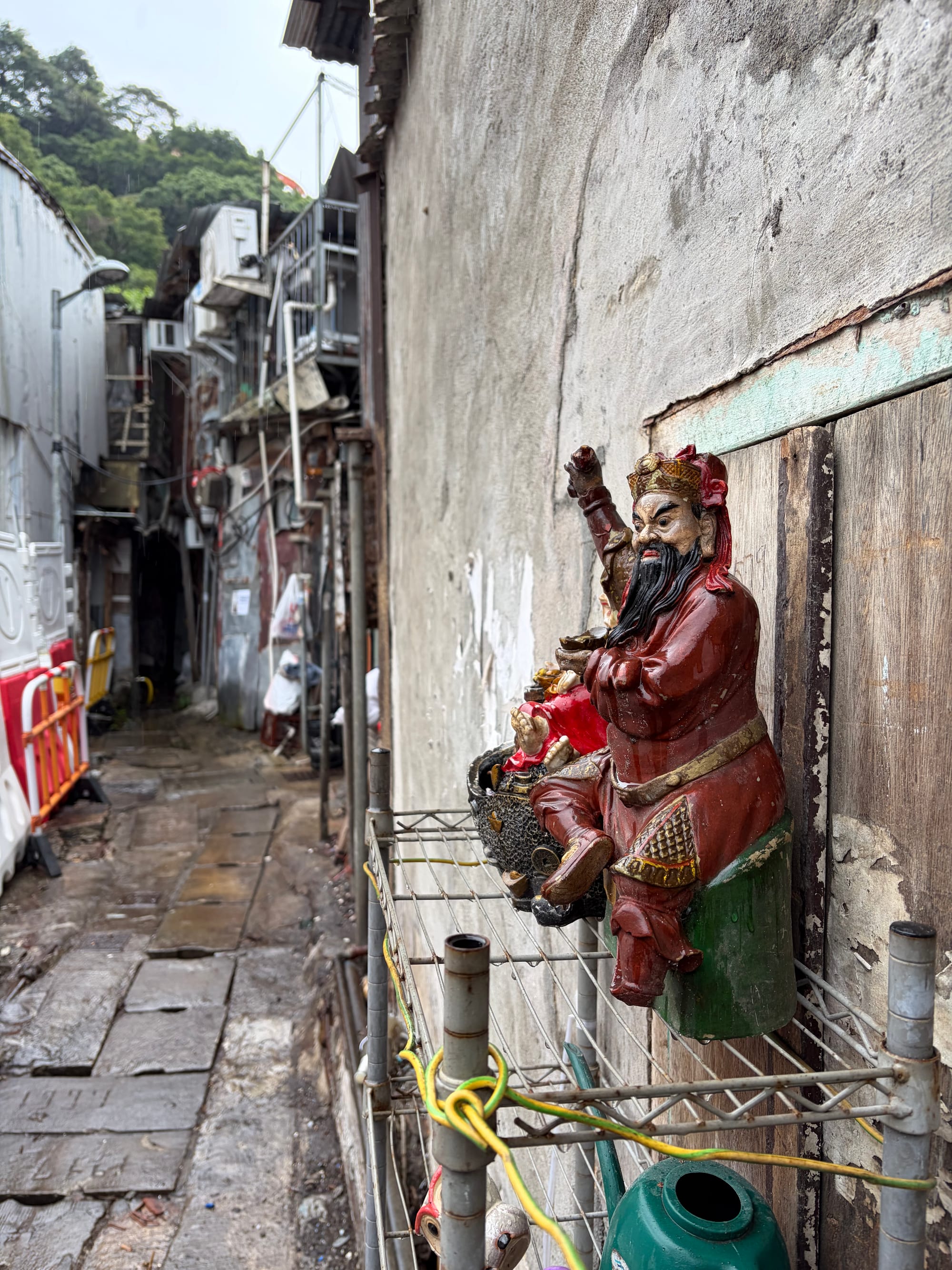
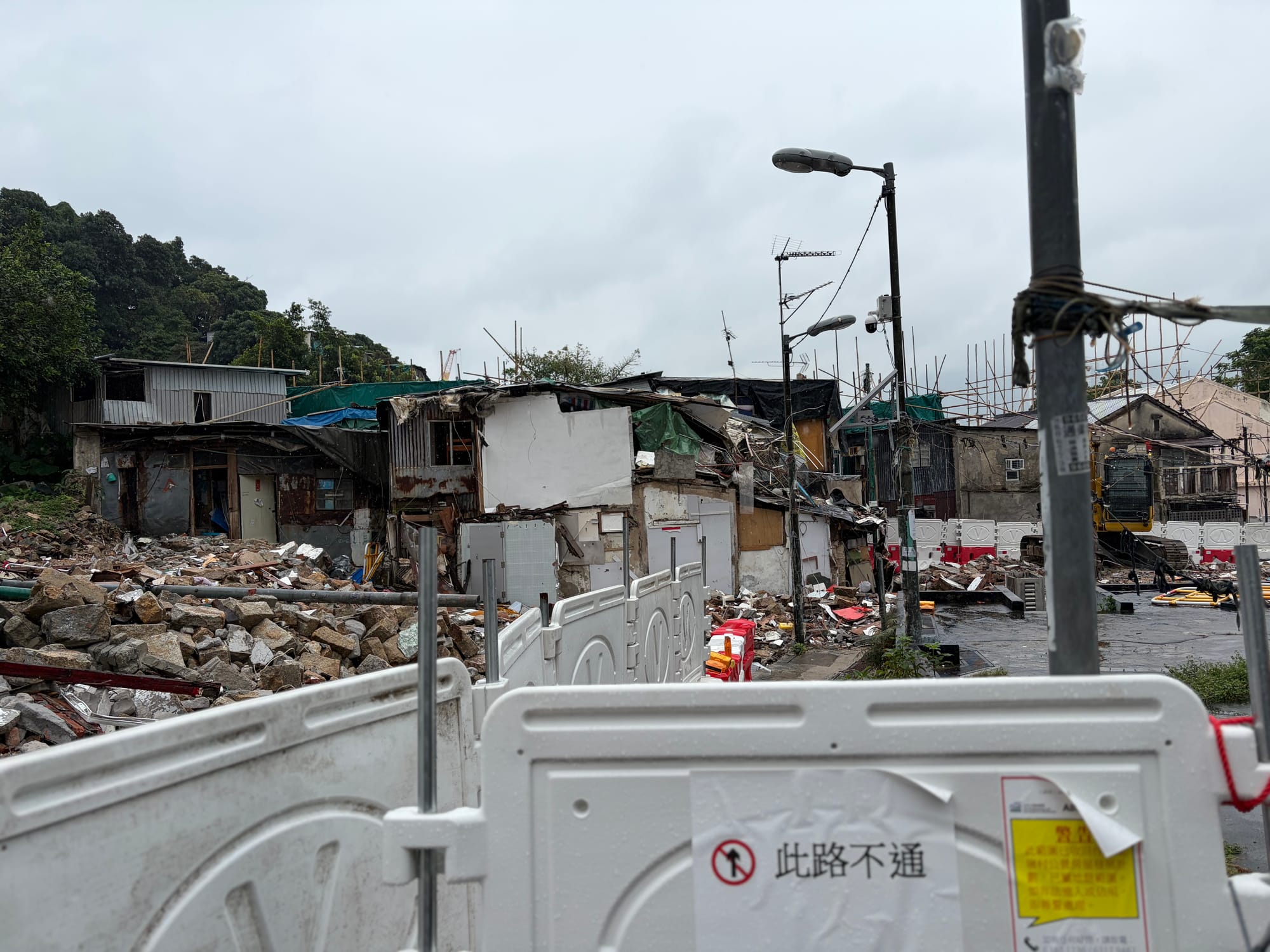
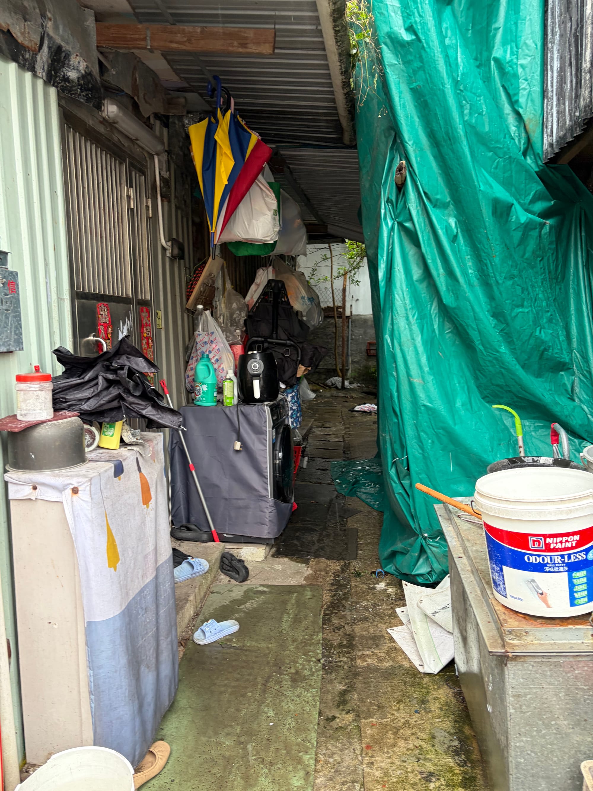
Cha Kwo Ling Village has long been famous; as a true-blue Hongkonger, I feel a bit ashamed that I had never visited until today. Although the government has already resumed the land, I could see a few households still holding their ground.
 Lawrence

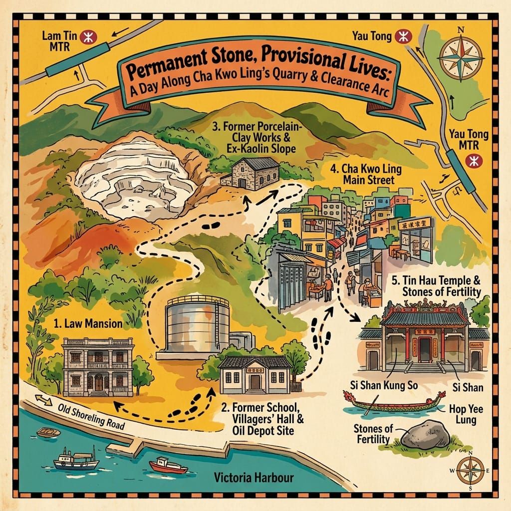
Cha Kwo Ling (茶果嶺) sits on the Kowloon waterfront between Lam Tin and Yau Tong. It was one of four quarrying hills known as Si Shan, then a kaolin mine, then a squatter village whose clearance for public housing has run in phases since 2024 and, by press reports, took effect as a land recovery on 5 October 2026. This article follows five documented episodes: a Qing-nominated headman paying Crown rent, a temple demolished for an oil depot, an admiral’s tablet that may be legend, clay shipped to Japan, and a village never granted settled status. It marks throughout what is record, what is interpretation and what is tradition. A practical section for visitors comes last.
💡 Join a community of discerning travelers. Simply enter your email to instantly unlock audio guides and one-day itineraries, and carry our exclusive historical walking maps with you on your journey.
According to one encyclopaedic account, a military map of 1922 labelled the hill Rocky Hill. The villagers below it used a softer word. Cha kwo is the leaf-lined rice cake the Hakka steamed, or so one explanation goes; another says the hill is simply cake-shaped. Surveyors wrote down what they saw. Villagers wrote down what they ate.
Between the two names lies most of what happened here: stone cut from the hill, clay dug from the back of it, and, at its foot on the Kowloon waterfront, a village that the authorities spent decades describing as temporary.
I. The Headman’s Rent
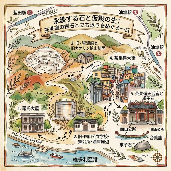
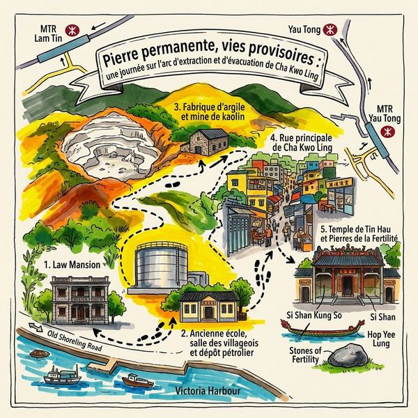
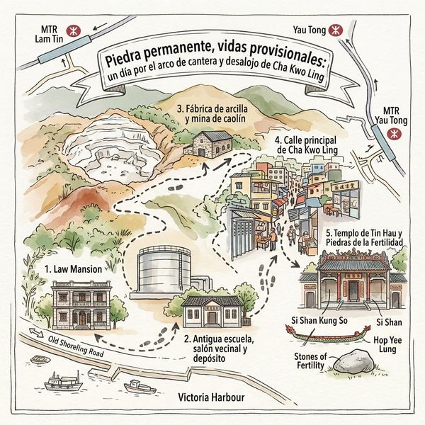
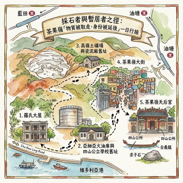
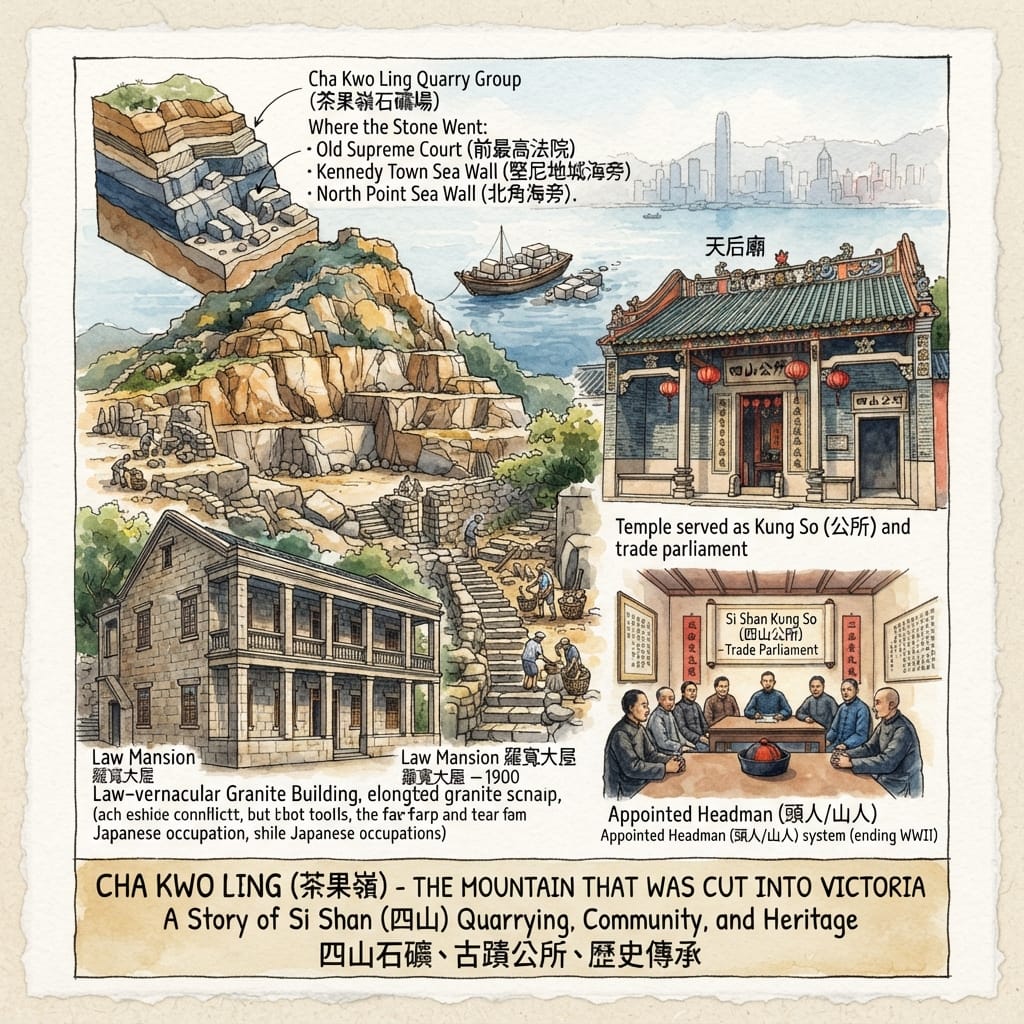
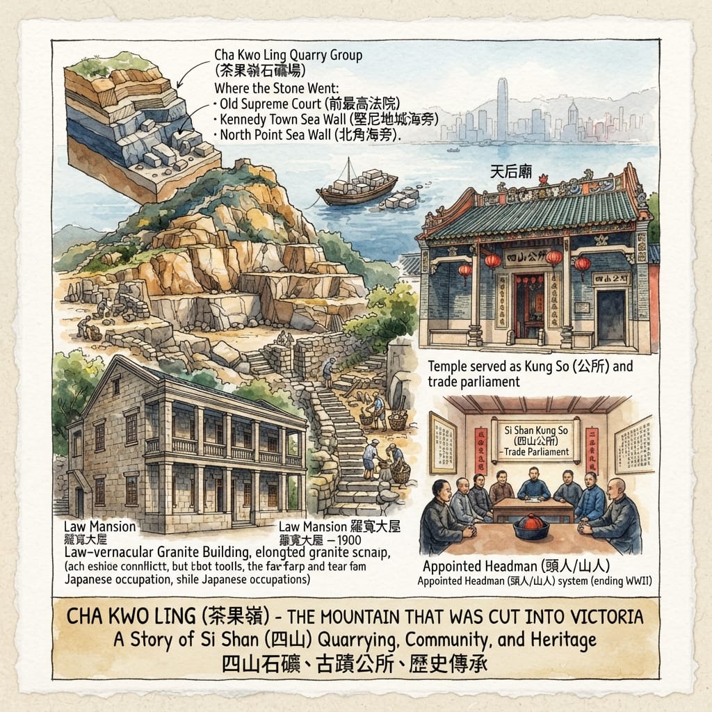
Law Mansion stands on Cha Kwo Ling Road: two storeys of long granite blocks in three bays, the plan of a Qing-dynasty house. The Antiquities Advisory Board and the 2022 heritage impact assessment date it to around 1900. A figure often repeated in print is 1855. The matter has not been settled.
A name helps. The Hong Kong Government Gazette of 24 June 1904 lists Crown rent of $450 for one group of quarries at Cha Kwo Ling, payable by a headman recorded as “Lo Fum”. The assessment identifies him as Law Fun (羅寬) and believes he had once been nominated headman by the Qing court. Whether the $450 was charged monthly or for the whole term, 1 April 1904 to 31 March 1907, is unclear: the assessment’s text and its quotation from the Gazette do not agree, and the Gazette itself needs checking.
Why would a Qing nominee pay rent to a British government? Because the hill was already organised. After Victoria was founded in 1841 the new city wanted stone for buildings, roads and sea walls, and four hills on the east Kowloon shore (Cha Kwo Ling, Ngau Tau Kok, Sai Tso Wan and Lei Yue Mun) became known as Si Shan (四山), the Four Hills. Each had a headman who administered it and collected dues. A guild hall, the Si Shan Kung So (四山公所), ran the trade. When sovereignty changed hands the arrangement did not vanish; it continued until before the Second World War. One local newspaper adds that headmen were allowed to wear official dress on the Qing court’s behalf. That detail rests on a single source and should be read as such.
The Qing Official Who Built British Hong Kong
So: one man, one hill, two sovereignties. The documents set them side by side and say nothing of how he felt about it.
Where did the stone go? Where London drew on Portland, the new colonial capital drew on hills like this one. The Board’s appraisal says only that it is “said” that the Old Supreme Court of 1912 (now the Court of Final Appeal) and the sea walls at Kennedy Town and North Point used Cha Kwo Ling granite. Longer lists circulate. We could not verify them and leave them out. Concrete replaced cut stone, and by the 1960s the quarrying had largely stopped.
The men who cut the stone came mainly from Hakka districts of eastern Guangdong. They worshipped Lu Ban (魯班), patron of builders, and on the thirteenth day of the sixth lunar month shared a communal meal called shifu fan, masters’ rice. Law Mansion’s ground floor was an ancestral hall. In the 1950s it held three small factories, later a warehouse, later rented rooms for newcomers from the Mainland. Oral history says some of its original materials were stripped during the Japanese occupation (1941–45). It is a Grade 3 historic building, designated for retention in situ.
Resonance Node: Law Mansion (Nos. 50A, 51 and 51A Cha Kwo Ling Road).
Holographic Sensory Cue: the dressed edges and joints of long granite blocks. A road now runs where the house once stood close to the shore; reclamation has pushed the sea out of sight. (Check on site.)
II. The Goddess and the Oil Depot
The ridge of the Tin Hau Temple carries ceramic dragon-fish. The roof is brown-tiled, the floor granite. The Antiquities and Monuments Office material summarised by CACHE calls it the largest surviving masonry temple in Hong Kong.
It was built in the Daoguang reign (1821–50) with contributions from Si Shan villagers; 1821, 1825 and 1845 all appear as foundation dates. A typhoon wrecked it in 1912 and the image of Tin Hau lived in a shack for roughly thirty years. In 1941 villagers raised funds and rebuilt. In 1947 the temple was demolished to make room for an oil depot of the Asiatic Petroleum Company, a Shell-group firm. The government rebuilt it on the present site, opening in 1948 with granite from the old building.
The company was not a stranger. A granite tablet of 1910 records road and bridge works at Cha Kwo Ling and lists donors, among them the Secretary for Chinese Affairs and the Asiatic Petroleum Company. Why the company gave, and how villagers took it, the records do not say.
The Sea Goddess Evicted For An Oil Tank
In 1952 Si Shan Public School opened with government help and village donations. Three classroom lintels carry three names: the Chinese Temples Committee, the Asiatic Petroleum Company, and Chung King-pui (鍾境培), Deputy Secretary for Chinese Affairs. An oil company’s name sat over a village schoolroom door beside that of the body that administered the temple. The school closed in 1993. Press reports say the Cantonese opera star Law Kar-ying (羅家英) studied there, and that by July 2026 the building had been demolished.
Tin Hau, goddess of the sea, presides inside, with Lu Ban and Guanyin in the side bays (accounts differ on which side). Her festival falls on the twenty-third day of the third lunar month. Why does a quarry village worship a sea goddess? The assessment records one plain fact: the stone left by water.
In front of the temple stand two granite boulders over two metres high, the Stones of Fertility (求子石). Tradition holds that praying at them helps the childless; that is a local belief, not a historical event. Local accounts also say the Si Shan Kung So met inside the temple, and over a side door the four characters 四山公所 are still carved in the lintel. Beside the temple sits the dragon boat Hop Yee Lung (合義龍), over twenty metres long, built in 1958 with village money; the assessment recommends moving it into storage.
Resonance Node: the temple with the Si Shan Kung So lintel, and the Stones of Fertility.
Holographic Sensory Cue: the ceramic dragon-fish on the ridge, the brown tiles, the granite floor, the carved lintel. (Check on site.)
III. The Admiral in the Side Hall
What a visitor will find in the temple’s side hall, we cannot say. It needs to be checked in person.
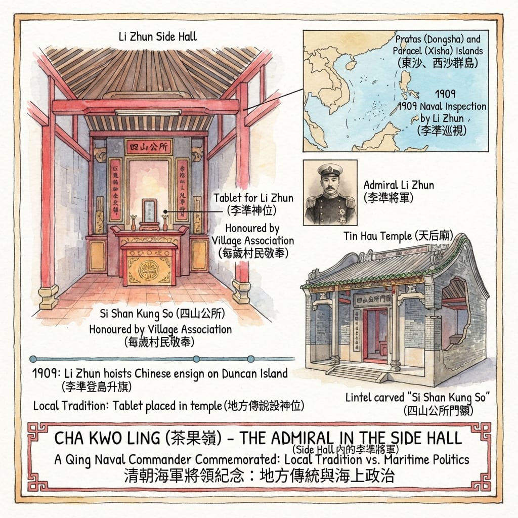
The local story concerns a Qing official, Li Zhun (李準), commander of the Guangdong navy. In 1909 he led a naval inspection to the Pratas and Paracel islands, prompted, according to researchers, by Japanese commercial activity on Pratas. A British colonial record held in the Hong Kong files notes that on 6 June 1909 the Chinese flag was raised on Duncan Island under “Admiral Li Tsun”.
Cha Kwo Ling tradition says a tablet for Li Zhun stands in the Tin Hau Temple: that he settled disputes among the four hills, paid for temple repairs and a charity school that became Si Shan Public School, and is honoured by villagers every year. The claim appears in two places. One hedges, saying he may be venerated because he donated money to repair the temple. The other is an opinion column citing an academic.
The Hidden Admiral Of Hong Kong
The heritage impact assessment and the Chinese Temples Committee mention Tin Hau, Lu Ban and Guanyin. They do not mention Li Zhun.
The 1909 voyage remains a page that gets turned to whenever the South China Sea is argued over. Chinese accounts present it as an assertion of sovereignty. Vietnamese commentary questions its legal weight. One researcher has argued that Li Zhun’s claim later blurred the Paracels and the Spratlys. This article takes no side.
A Qing naval commander in a quarry village in a British colony, beside a goddess of the sea. If the tablet exists, the temple is tied to the South China Sea. If it does not, the story is still part of what the village remembers, and a legend is evidence of memory, not of the event.
Resonance Node: the temple’s side hall. (Existence of the tablet unverified.)
IV. White Clay
The other half of the hill is kaolin, the clay that makes porcelain. When granite faded, clay took over.
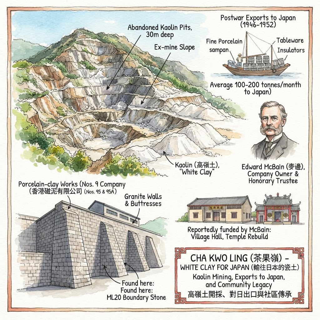
A company called Hong Kong Clays and Kaolin was formed in 1933 and worked a mine of about nineteen acres, which encyclopaedic sources attribute to the McBain family. Edward McBain served as honorary trustee of the village committee and, according to the research group Liber Research Community, helped pay for the village hall, the temple rebuilding and road repairs.
After the war the clay went to Japan. The heritage impact assessment, citing a 1952 study, says that between 1946 and 1952 an average of 100 to 200 tonnes of dried kaolin left each month, from pits over 30 metres deep. A 1956 report, as encyclopaedic sources have it, lists Japanese uses: fine porcelain, tableware and high-voltage insulators.
Japanese forces held Hong Kong from 1941 to 1945. In the first postwar years the white clay from this hill was shipped to the same country. There is no documented causal link between those facts. They sit side by side.
The Village That Rebuilt Its Enemy
When the mining ended is disputed: the assessment says the industry halted in the 1960s, while other sources say it continued, with a lease renewed from 1980 to 1990. One local account puts the peak workforce at about two thousand.
The porcelain-clay works at Nos. 95 and 95A had granite walls about six metres high, braced by heavy buttresses. Under the buttresses four boundary stones lettered “ML20” (a mining lot) were found. In the 1990s it became a waste-paper yard. The assessment recommended dismantling and storing the granite for later reuse, and a July 2026 report says the works was being demolished.
Resonance Node: the clay-works site at Nos. 95 and 95A and the quarried slope behind the village. (The works may already be gone; confirm on site.)
V. A Village Classed as Temporary
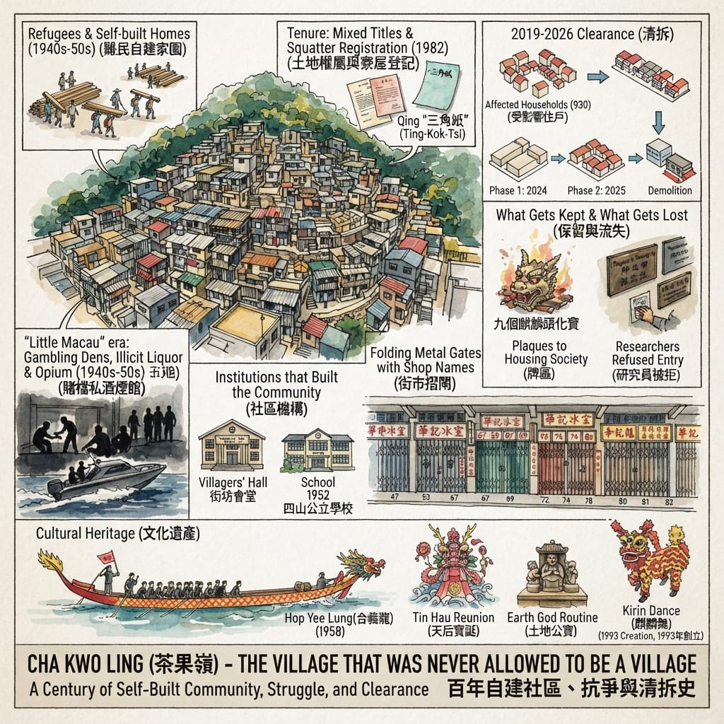
After the war, people fleeing war and revolution built timber and zinc houses up the slope. How many lived here depends on who is counting: about 6,500 in a 1955 census, then ten thousand, twenty thousand, even thirty thousand in later reports.
The village had its own order. A school in 1952, a villagers’ hall in 1956, tea houses and ice rooms from 1955 and 1962, a dragon boat in 1958. It also had a reputation: “Little Macau”. A local-history essay writes of gambling dens, illicit liquor and opium, with four distilleries and nearly forty stills; a former pupil recalls gamblers coming over from Shau Kei Wan by speedboat; another account says that in 1948 the nearest police station was at Kowloon City. These figures and claims await checking against the press and police records of the day.
One village leader says the land was a patchwork, with private lots, tax-paying land, government land and some Qing-era deeds known as saam gok ji (三角紙), and that the government’s 1982 squatter registration turned every house into a squatter structure. That is the villager’s account; its legal basis has not been independently verified. Works for the Eastern Harbour Crossing in the 1980s took down many houses, and press reports date a major fire to 21 December 1983.
The Policy Addresses of 2019 to 2021 named Cha Kwo Ling among three urban squatter areas for land resumption. A heritage assessment followed in 2022. First-phase residents left in 2024 and the second-phase deadline was 12 September 2025. By the end of August 2025, press reports citing the Lands Department said, of 930 affected households more than 85 per cent had been screened for eligibility, and 440 had moved into public housing or received ex-gratia allowances. Some long-term residents were told their huts had never been registered and would qualify only for a small allowance.
The Squatters Who Built Hong Kong
Not everyone wanted to stay. Life in squatter huts was hard: fires were frequent and facilities basic. Residents interviewed in 2025 said they accepted rehousing.
In July 2026 the leader of the village kirin dance team tried to donate kirin heads, drums and plaques to the Hong Kong Museum of History and was turned down. The Leisure and Cultural Services Department’s reply, as reported, was that the team dated only from the 1990s and its history was short. Nine kirin heads more than twenty years old, with nowhere to be kept, were burned in the customary way. The same month the villagers’ hall and school were reported demolished. The development authorities estimated that keeping the school would cost about HK$300 million and 21 months more; the assessors had never been inside the building.
One resident still returns weekly to burn incense at the earth god shrine of the family home, outside the door, and at the village shrine. The kirin team was founded in 1993.
Resonance Node: the folding shutters of the main street, twelve sets recorded at Nos. 47, 50B, 53, 67, 68, 69, 72, 74, 78, 80, 81 and 82; the assessment recommends collecting any that remain.
Holographic Sensory Cue: silver paint, shop names cut through the metal, floral geometric patterns on the shutters. (Check on site.)
The Place Today
Press reports say the government took back the land on 5 October 2026. What follows reflects mid-November 2026; which buildings still stand must be confirmed on the ground.
What is meant to remain: Law Mansion, the Tin Hau Temple and the Stones of Fertility, all kept in situ. What has gone or is going: the villagers’ hall, Si Shan Public School (reported demolished), two old ice rooms (closed), the clay works (being demolished) and an unknown number of shutters. What will come: public housing, about 4,500 flats according to the assessment, with the earliest occupation expected around 2031–32. Other reports mention a neighbouring phase on the old kaolin mine of about 2,250 flats.
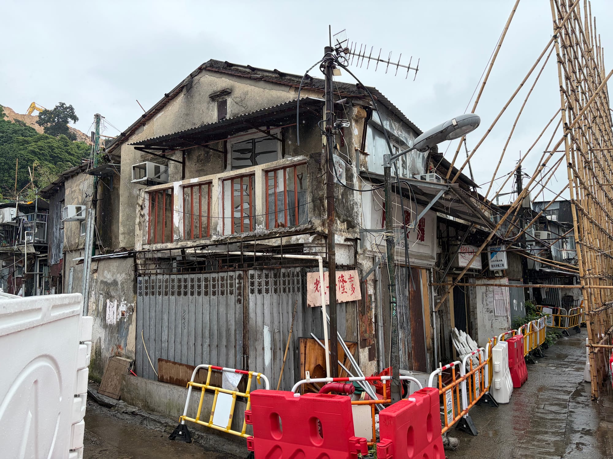
Standing in front of the temple, a visitor can see the dragon-fish on the ridge, the 四山公所 lintel, the two boulders and the dragon boat. Walk towards Law Mansion and the granite is still in the joints. The sea is no longer at the foot of the hill. Reclamation has moved it far away, and with it the plain fact the assessment noted, that this stone left by water.
Coda
The Gazette of 1904 gives the headman’s name as Lo Fum. The assessment thinks he was Law Fun. It is the only place in English where he appears, spelled by a clerk as it sounded, with the rent beside it.
Accessing the Physical Node
- Where: Cha Kwo Ling Road, east Kowloon, between Lam Tin and Yau Tong.
- Getting there: MTR Kwun Tong Line to Lam Tin or Yau Tong, then on foot. Check exits and routes on the MTR and a map app before you go.
- Access: while clearance continues, much of the village may be fenced off or closed; follow on-site instructions and do not enter work areas. Law Mansion and the Tin Hau Temple are to be retained; ask the Chinese Temples Committee or the managing bodies about opening hours and visits.
- Suggestion: keep to places open to the public along Cha Kwo Ling Road, starting at the temple, and compare what you see with this article. Conditions change often; trust what is on the ground.
💡 Q&A
Q1 | Was Cha Kwo Ling quarry headman Law Fun (Lo Fum) a Qing official paying British Crown rent, and was Law Mansion built in 1855 or around 1900? (Si Shan 四山 Quarrying Guild, 1904 Government Gazette & Law Mansion Dating)
A: No single date or title resolves both points cleanly: Law Fun (recorded as "Lo Fum" in the 24 June 1904 Hong Kong Government Gazette) appeared on a $450 Crown rent entry for Cha Kwo Ling quarries, while Law Mansion's construction remains unsettled between around 1900 and a printed figure of 1855. After Victoria was founded in 1841, Cha Kwo Ling (茶果嶺), Ngau Tau Kok, Sai Tso Wan, and Lei Yue Mun formed Si Shan (四山), with headmen and the Si Shan Kung So (四山公所) guild hall operating until before World War II. The 2022 heritage impact assessment links "Lo Fum" to Qing-nominated headman Law Fun (羅寬), though whether $450 was monthly or for the 1 April 1904–31 March 1907 term is unclear, and one newspaper claim of Qing official dress lacks corroboration. Meanwhile, official assessments favor around 1900 for Law Mansion's granite house over 1855.
Q2 | How did Cha Kwo Ling (茶果嶺) transition from a Si Shan quarry hill and kaolin clay site to a squatter village facing clearance? (Kowloon Waterfront Settlement, 1922 Map "Rocky Hill" & 2024–2026 Land Recovery)
A: Cha Kwo Ling developed along the Kowloon waterfront between Lam Tin and Yau Tong from quarrying and kaolin clay extraction into a long-standing squatter village that authorities treated as temporary before phased public housing clearance began in 2024. While a 1922 military map labelled the hill "Rocky Hill," local tradition links "cha kwo" to leaf-lined Hakka rice cakes or a cake-shaped hill, neither of which is settled as historical fact. Over time, stone was cut from the hill, kaolin clay was dug from behind it—including clay shipped to Japan—and a village grew at its foot without receiving settled status. According to the article, phased clearance for public housing has run since 2024, with press reports noting a land recovery taking effect on 5 October 2026 even as a few households remained on site.
Q3 | What do Cha Kwo Ling's moved temple, admiral's tablet legend, and surviving village structures reveal about its layered history? (Kowloon Waterfront Heritage, Temple Demolition for Oil Depot & Unverified Tradition)
A: Cha Kwo Ling's surviving and remembered landmarks reflect overlapping layers of documented displacement, local tradition, and unverified lore along the Kowloon waterfront rather than a single static past. As outlined in the article's summary, the area's documented and remembered history spans a temple demolished to make way for an oil depot, an admiral's tablet that may be legend, and a village never granted settled status despite decades of habitation. When reading accounts of an admiral's tablet or local lore alongside physical transformations such as oil-depot-driven temple demolition and public housing clearance, historians separate verified records from oral tradition and unsettled claims. Where surviving evidence is incomplete or legendary—as with the admiral's tablet noted in the article—treating it as tradition rather than proven fact preserves historical accuracy while capturing how residents remembered the changing place.
Want to follow the historical routes I’ve selected right from your phone as you walk? Click to join the exclusive Google map of historical tours titled "Historical Travel Stories"—import it to Google Maps on your phone with a single tap and let it guide you as you visit each historical site in person.


📖Reference and Further reading📖
First layer – Main sources of literature and institutions:
- AECOM for CEDD — Heritage Impact Assessment (HIA) Report (Final), Cha Kwo Ling Village public housing site formation, Oct 2022 — cites the 1904 Government Gazette, Davis (1952) and the AECOM 2009 oral-history study
- Antiquities Advisory Board — Historic Building Appraisal: Law Mansion
- Chinese Temples Committee — Tin Hau Temple, Cha Kwo Ling
- Development Bureau — LCQ2: Development plans for three squatter areas, 3 June 2020
- UK Colonial Office record CO129/464 (Hong Kong, 1920), "Japanese activities in the Paracels" — online transcription; verify against the original
The second layer – secondary academic materials:
- Kowloon Post — 「茶果嶺 與香港早期採石業」, 2017
- 香港志 (Hong Kong Chronicles) — 「消失的城中村:茶果嶺村(上)」
- Historical comparative analysis of Lei Yue Mun and Cha Kwo Ling and their Tin Hau temples (SocioStudies)
- Liber Research Community (本土研究社) — 「市區舊村最後倒數—茶果嶺村將會拆剩什麼?」, 2023
- HKU Chinese Department et al. — report on the stone walls of the Kai Tak Nullah, 2018 — context for Kai Tak stone demand
- ISEAS — commentary on Li Zhun and the origins of the Spratly claim
- Parliamentary Library of Australia — South China Sea chronology 2021–22
- CACHE — Tin Hau Temple, Cha Kwo Ling Road — AMO-based summary
- Encyclopedic entries (tertiary; verify before relying): 茶果嶺村 · 前茶果嶺高嶺土礦場 · 茶果嶺天后廟 · 終審法院大樓 · Cha Kwo Ling (English Wikipedia)
Third layer – Supplementary information:
- 集誌社 (The Collective) — 「拆村在即|老街坊想捐麒麟頭…」, 29 July 2026 — kirin heads, museum refusal, razed hall and school
- The Initium (端傳媒) — 「告別城中客家村…」, Sept 2025 — clearance process, household figures
- 集誌社 — 「茶果嶺村2|士多見證村莊變幻…」 — 1982 road plan, 1983 fire
- HK01 — 「村校校歌|茶果嶺村校花甲舊生…」 — former pupils on "Little Macau"
- 「茶果嶺大街上:賭毒猖獵「小澳門」」 (Medium local-history essay)
- HK01 — 榮華冰室結業, 4 Oct 2026
- World Journal (世界日報), 5 Oct 2026 — land recovery and ice-room closures
- Master Insight — 「茶果嶺今昔變遷」 — Lu Ban festival, Li Zhun tablet claim
- Lite News — op-ed on the Tin Hau Temple and Li Zhun
- Hong Kong Heritage — Tin Hau Temple and Stones of Fertility
- Skywalker's Heritage Archive — 茶果嶺村 — "sky tomb", kaolin workforce
- Kin Liu News — 「歷史遺恨(1)400年古村當寮屋…」 — land tenure and 1982 registration
- SCMP — photo essay, residents bid farewell, Aug 2026
- SCMP — former Sze Shan Public School should be spared demolition
- Now News — 「茶果嶺村校|逾70年歷史難逃清拆」 — school cost and time estimates
- Hong Kong Free Press, 4 Jan 2026 — clearance enters final phase — search snippet only; page not accessible to me
- Hong Kong Heritage — 茶果嶺村 (1955 census figure)
- Martin Williams — "Demolition Looms for Last Villages Below Lion Rock"
- Hanoi Times — Vietnamese view of the 1909 voyage — media position piece
 Lawrence
 Lawrence

 Lawrence