Kwun Tong: The Government's Pond and the Ground That Would Not Settle
Kwun Tong's own name means "the government's pond" — a plot of land the state has claimed, reshaped and put to work again and again since the thirteenth century. This is the story of the one thing on that coastline that ever refused to be moved.

💡 Join a community of discerning travelers. Simply enter your email to instantly unlock audio guides and one-day itineraries, and carry our exclusive historical walking maps with you on your journey.
 Lawrence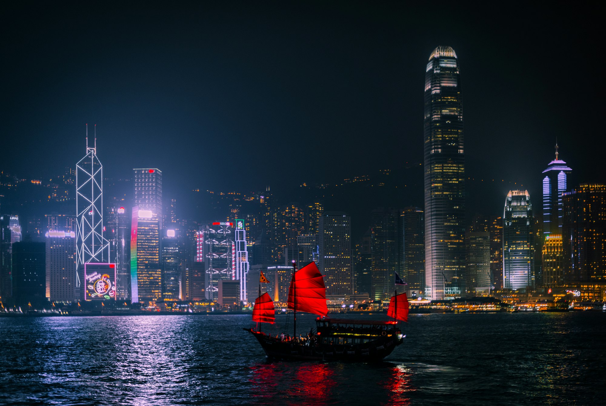
There is a district on the eastern shore of Kowloon whose Chinese name is, quite literally, a title deed. Write it one way — 官塘 — and it reads "the government's pond." Write it the way the MTR signage does today — 觀塘 — and the sound survives while the meaning quietly slips its moorings. This is not a guidebook to Kwun Tong. It is an attempt to read a stretch of reclaimed coastline the way a geomancer might read a hillside: as a record of what has been claimed here, by whom, and at what cost, across roughly seven hundred years — a saltern granted to the Song court, four Hakka quarrying villages that somehow outlasted everything built around them, a pirate's stronghold turned colonial gun battery, a hillside that gave way under a generation of refugee housing, and a manufacturing boom that rose and collapsed inside a single working lifetime. Read on, and you will understand why the district is named for a pond that no longer exists, why a mountain above Lei Yue Mun is called Devil's Peak, and why four small villages still stand, more or less untouched, inside one of the most thoroughly rebuilt districts in the whole of Hong Kong.
An Opening: Ground That Has Never Quite Settled
Some places are simply waiting to be redeveloped. Kwun Tong is not one of them — or rather, it has been "redeveloped" so many times, by so many different regimes, that redevelopment has become the closest thing it has to a settled identity. This is land that has been reclaimed from the sea more than once, built over, torn down, and rebuilt again, and yet something underneath all that fill has never quite finished settling. It is the residue of a place that was, again and again, claimed for a purpose rather than allowed simply to be inhabited: salt evaporated for imperial revenue, granite quarried by hand for export, sweat exchanged in a factory for the price of a sewing machine or a single fluorescent tube. Each generation that has arrived here has believed itself to be the first — and each has, in fact, been the latest cast member in a much older production, in which the names on the playbill change — dynasty, colonial administration, Special Administrative Region — while the underlying logic barely does. This coastline has always been a place things were done to. This is an attempt to listen to it instead.
I. The Government's Pond: Salt, Monopoly, and a Name That Outlived Its Meaning
(High-dimensional register: bureaucratic geomancy — the state's claim upon the land's own breath)
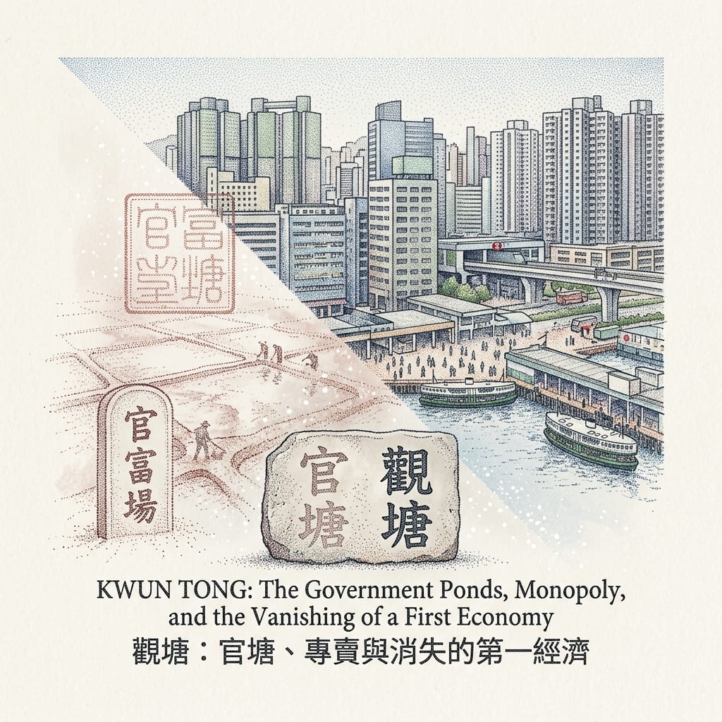
Kwun Tong's name is older than almost anything else that survives about it. Archaeological evidence places salt production on this coast back roughly seventeen centuries, long before any Cantonese-speaking clan had settled here at all. By the Southern Song dynasty, the imperial court had formalised a government saltern on this shoreline — Kwun Fu Cheung (官富場) — one of only four major official salt farms in the entire county, stretching from what is now Kowloon Bay south towards To Kwa Wan. The name Kwun Tong (官塘) is that administrative act, fossilised: "the government's pond," because the state had simply claimed the tidal flats and everything the tide produced upon them.
The Accidental Death Of An Empire S Salt
That claim was never quiet. Salt monopolies across the wider Pearl River estuary provoked genuine rebellion — in 1278, when Yuan officials tried to enforce the monopoly on nearby Lantau, local producers blockaded the shore with wooden stakes and later sailed up the Pearl River to lay siege to Guangzhou itself. Kwun Tong's own salt officials worked through that same charged atmosphere of extraction and resistance, across the Song, the Yuan and into the Ming. The Qing coastal evacuation order of 1662, issued to isolate the Ming loyalist Zheng Chenggong, emptied the shore of its residents entirely; when the ban was lifted in 1669, many of the original salt-working families never returned. Farmers took their place instead, with no particular stake in brine and evaporation pans, and the industry that had given the place its name simply died out — quietly, without ceremony, leaving only the name itself behind, a government's fingerprint on a map long after the government's actual claim had evaporated with the last of the salt.
No official's name survives from this story — and that absence is itself the point. This is institutional history, not biography; the state, not any individual, is the author.
II. The Slope That Gave Way: 18 June 1972
(High-dimensional register: secular trauma-geography, with one documented folk-religious counter-account)
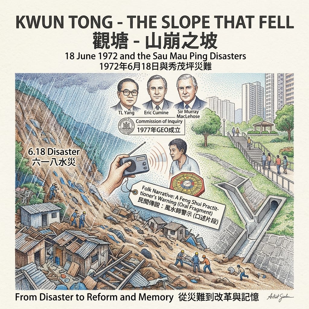
By the early 1970s, Sau Mau Ping — a hillside resettlement zone built to absorb Kwun Tong's explosive post-war population — was exactly the kind of steep, hastily engineered fill slope that Hong Kong's still-young geotechnical oversight had not yet learned to fear. After three days of exceptional rain, with a seventy-two-hour total of around 652 millimetres, a man-made slope supporting Hiu Kwong Street gave way on the afternoon of 18 June 1972. The debris swept away seventy-eight squatter huts and killed seventy-one people, a great many of them children. That same evening, on the far side of the harbour, an unrelated slide on Po Shan Road killed sixty-seven more — together, the deadliest single day of landslide disaster in Hong Kong's history, remembered locally as the "6.18 Disaster." Four years later, on 25 August 1976, barely two hundred metres from the original site, a second slope at Sau Mau Ping Estate collapsed and killed eighteen more residents. The same hillside failed twice within a single generation — and it is that repetition, more than either event alone, that gives the story its real historiographical weight: this was not an accident so much as a site that failed, more than once, under the same pressure.
Governor Sir Murray MacLehose inspected the wreckage in person; the Commission of Inquiry into the Rainstorm Disasters, chaired by T. L. Yang and Eric Cumine, produced findings that led directly to the founding of the Geotechnical Engineering Office in 1977 and, in time, to the whole of Hong Kong's modern slope safety system — a rare instance of one specific tragedy on one specific hillside in Kwun Tong reshaping engineering policy for an entire territory.
How Hong Kong Engineered Away Landslides
This is, deliberately, a secular story of memory rather than a religious one — the disaster's meaning was processed chiefly through institutional reform, not ritual. Even so, one fragment of oral testimony survives in local memory and deserves recording as exactly what it is: cultural-interpretive material, not verified fact. An account preserved on the Gwulo community history forum describes a survivor of a nearby squatter settlement, locally nicknamed "Kai Liu," who was reportedly guided or protected by a feng shui practitioner before rescuers, drawn by the sound of a radio, found her alive in the rubble. The story is worth including precisely because of what it shows — how a folk-geomantic worldview was reached for by survivors trying to make sense of something otherwise senseless — not as any claim about cause and effect.
Rather than rebuild housing or a school on the exact point of failure, the government instead reserved the ground as Sau Mau Ping Memorial Park, regrading the slope to a gentler angle and dedicating it to the dead — a wholly secular act of re-consecration, a modern equivalent of the grief-container pattern that runs through so much sacred geography, minus the sacred.
Holographic Sensory Cue: The incline underfoot in the memorial park is noticeably gentler than the untouched slopes around it — a discontinuity you feel in your legs before you consciously register why. Concrete drainage channels are cut visibly into the hillside. The park itself sits unusually quiet against the dense estate surrounding it, and the air still seems to carry the particular weight of ground that has, once, given way.
III. Devil's Peak: Pirates, Batteries, and Two Different Ways of Reading the Same Hill
(High-dimensional register: folk mythology of naming, set against colonial-secular military geometry — two frameworks, one site, two different centuries)
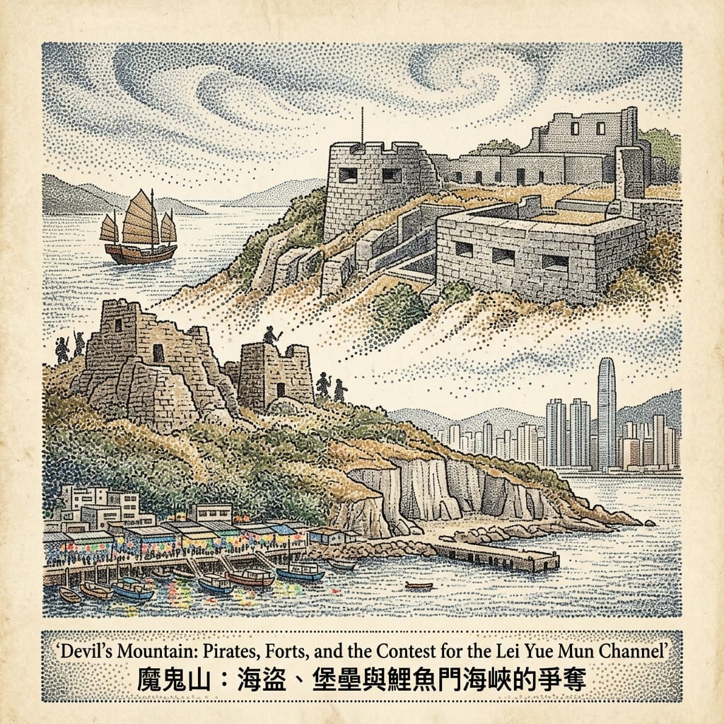
The Lei Yue Mun channel, at the southern edge of Kwun Tong District, is one of only two entrances to Victoria Harbour, and whoever held the hill above it held the gateway to the whole harbour. In the chaos of the Ming–Qing transition, the channel is said to have been the stronghold of Zheng Jian and his son Zheng Lianchang, maritime commanders whose fighters drifted, as central authority collapsed around them, into piracy — extracting tolls from merchant vessels running the narrow strait. Their base was later absorbed into the territory of Cheung Po Tsai, Hong Kong's most famous pirate, who rose from Cheung Chau to inherit control of the Lei Yue Mun approach. Centuries on, when Britain took the lease of the New Territories in 1898, colonial military engineers independently identified precisely the same 222-metre peak as the essential position from which to defend the harbour, and built the Devil's Peak Redoubt, Gough Battery and Pottinger Battery to command the very channel the pirates had once tolled.
The Mountain Claimed Twice
The hill's name — Devil's Peak, 魔鬼山 — is the folk residue of the piracy era: centuries of rumour about hidden treasure and the terror the stronghold once inspired in passing shipping, condensed into a place-name that has now outlived every pirate who earned it. That naming belongs entirely to folk narrative — vernacular, moralising, born of lived fear rather than any classical geomantic system. The British fortification a century later represents a wholly different and unrelated logic reading the same terrain: sightlines, elevation, the trigonometric command of a strait — a purely secular, strategic cosmology imported wholesale from European military science, entirely indifferent to the hill's Chinese name or its reputation for ghosts. It would be a shallow reading to claim the British "chose" Devil's Peak because of its ominous feng shui. What the record actually shows is two quite different worldviews — one narrative and supernatural, the other Cartesian and strategic — independently concluding, for their own entirely separate reasons, that this particular knuckle of rock mattered.
Resonance Node: The firing embrasures of the Devil's Peak Redoubt still command the Lei Yue Mun channel today, the sightline entirely unobstructed by anything built since. Stand in that exact firing position and you understand, without a word of signage, why pirates and colonial gunners alike were drawn to this one stretch of rock. The wind still funnels hard through the gap between the batteries, more or less exactly as it always has.
IV. The Four Hills of Kowloon: The Villages That Refused to Move
(High-dimensional register: folk religion and household-scale geomancy, at its most intact expression in Kwun Tong)
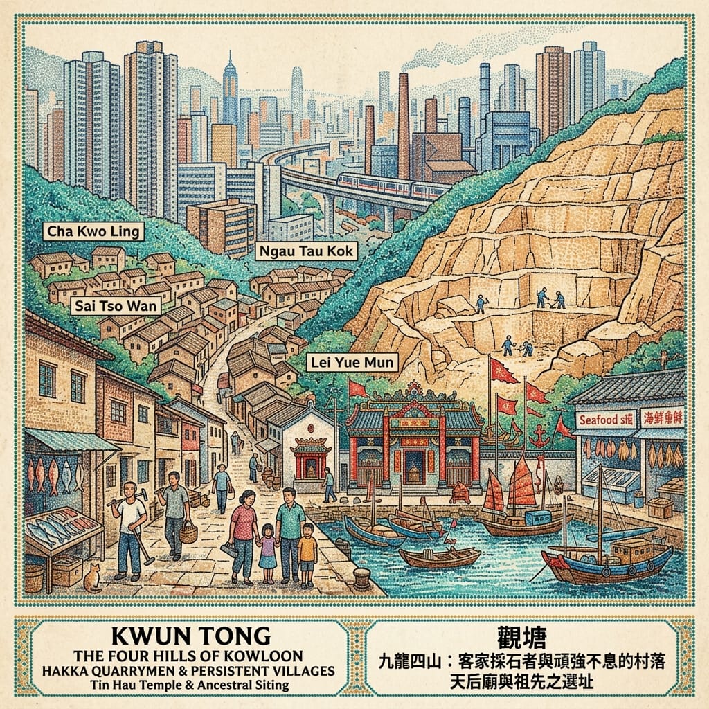
From the late eighteenth century, granite quarrying reshaped the hills of what is now Kwun Tong District. Four settlements — Cha Kwo Ling, Ngau Tau Kok, Sai Tso Wan and Lei Yue Mun — became known collectively as the Four Hills of Kowloon, worked overwhelmingly by skilled Hakka stonemasons who had come down from Guangdong. These were never transient labour camps. They were complete settlements, with houses for the quarrymen and their families and piers built specifically to ship cut granite — not only around Hong Kong, but as far afield as Japan and Europe. When Kwun Tong's mid-twentieth-century reclamation and industrialisation swept over almost everything else on this coastline — factories, resettlement blocks, and later shopping centres and railway stations — these four village clusters survived intact, recognisably themselves, embedded inside one of the most intensively redeveloped districts anywhere in Hong Kong, their narrow lanes and low house-fronts standing in direct, visible contrast to the towers rising around them.
The Villages That Outlived A Megacity
No single figure dominates this history; it belongs to collective, skilled, artisan labour and to households that stayed put across generations, rather than to any one biography — and that absence is itself worth noting. Working-class and Hakka labour history in Hong Kong is, as a rule, far less individuated in the surviving record than the lives of colonial officials.
Village siting within this quarrying culture followed a practical, domestic-scale geomancy quite different from anything applied at the level of empire: houses set against the hillside for shelter, facing the water for both livelihood and protection, with a documented Tin Hau temple at Lei Yue Mun anchoring the community's maritime folk religion at the water's edge — guarding the same fishing and shipping trade that ran alongside the quarrying itself. This is folk religion in its purest surviving form anywhere in Kwun Tong: not classical dragon-vein theory applied across an entire district, but a lived, practical geomancy applied at the scale of a stonemason's front door and a fisherman's shrine. That these four villages have survived physically intact inside a coastline otherwise rezoned, reclaimed, industrialised and redeveloped almost beyond recognition can be read — cautiously, without overreaching — as a kind of spatial argument in itself: the kinship-anchored, folk-religious logic of the village has proved more durable on this shore than either the Qing salt bureaucracy or the twentieth-century industrial planning that followed it. Both of those, in the end, have mostly gone. The villages have not.
V. From Rubbish Tip to Satellite Town: The Making and Unmaking of a District, 1953–2000
(High-dimensional register: deliberately secular — collective memory and psychogeography, in place of any manufactured mysticism)
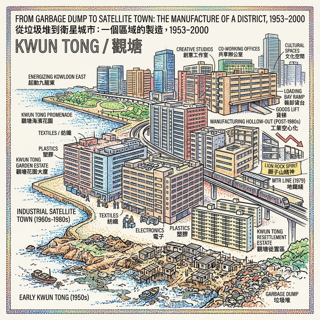
Before 1955, Kwun Tong barely registered as a place at all. Contemporary newspapers reportedly described it as little more than a vast, foul-smelling rubbish tip between Kowloon Bay and Cha Kwo Ling. Faced with a huge post-1949 refugee influx into Hong Kong and an acute shortage of manufacturing space, the colonial government designated Kwun Tong the territory's first purpose-built industrial satellite town in 1954, beginning staged land reclamation from the former oil depot — today's Laguna City — westward to Kowloon Bay, completed by 1962 and yielding roughly 140 acres of new industrial ground, some of it auctioned for as little as HK$5.60 a square foot. The growth that followed was extraordinary: from around a hundred factories and fifteen thousand workers in 1961, to some eight hundred factories and 72,300 workers by 1970, to about seven thousand factories and two hundred thousand workers by 1985 — textiles and garments dominant throughout, followed by plastics, rubber, metalware and, from the late 1960s, a rapidly growing electronics sector. Government housing rose alongside the factories to shelter the workforce — Kwun Tong Garden Estate and the Kwun Tong Resettlement Estate, both completed by 1959 — and the Kwun Tong MTR line opened in 1979, stitching the district properly into the fabric of the wider city. Then, from the 1980s, China's Reform and Opening Up policy drew manufacturing across the border to the cheaper land and labour of the Pearl River Delta, and Kwun Tong's industrial base hollowed out almost as quickly as it had been built — a complete rise and fall inside little more than three decades.
Empire Built On A Garbage Dump
No single planner or official dominates the accessible popular record of this transformation. It was bureaucratic and incremental colonial planning, not the work of any one visionary — which is, itself, worth remarking upon, given how readily Western urban-development narratives tend to foreground the individual planner as hero.
No credible religious cosmology, imported or indigenous, governs this particular story, and none is manufactured here for the sake of atmosphere. What operates instead is entirely secular: Kwun Tong's industrial rise was, for an entire generation of refugee and working-class families, the lived and unglamorous origin point of the resilience narrative Hong Kong would later mythologise, in its own secular civic vocabulary, as the "Lion Rock Spirit" — communal grit surviving cramped resettlement housing, dangerous factory floors and disaster-prone hillsides in pursuit of upward mobility. Kwun Tong is, arguably, the more literal, material site of that story than Lion Rock itself, which merely lent its name to a housing estate the legend later attached itself to elsewhere. Kwun Tong actually manufactured the goods, absorbed the refugees, and buried some of its own residents in the process. Read this way, the district functions as a collective-memory container for the whole of Hong Kong's post-war industrial and migrant identity — a working-class counterpart to the sacred geometry more usually reserved for temples and shrines, written here instead in factory floor space and resettlement block density.
Conclusion: What the Dragon Vein Does Not Reach
Kwun Tong has never been a place waiting to be discovered. It is a place that has been repeatedly claimed. From a single sheet of Song-dynasty official land-grant, to a colonial gunner's trigonometry, to a skyline once dense with factory chimneys, four entirely separate cosmologies and administrative logics have each, independently, looked out across this stretch of the Kowloon coast and arrived at the same conclusion: that this was land to be used, not a place to be settled on its own inhabitants' terms. Only one register has consistently resisted that pattern — the household-scale geomancy of the Hakka village, sited at the level of a front door and a shrine rather than an empire or a factory floor — and it is, not coincidentally, the one story out of five whose physical ground survives, essentially unbroken, into the present. That correlation, rather than any single "vibrational frequency," is Kwun Tong's genuine historiographical signature.
In an age increasingly governed by algorithm and immediacy, this kind of memory — buried in a place-name, a slope angle, a village lane that simply refused to move — may be one of the most valuable, and most easily discarded, assets we possess. It is a reminder that every stretch of ground carries a depth of time far greater than any single generation's plans for it. If that thought stays with you, there is more of this coastline, and others like it around the world, still waiting to be properly listened to — subscribe, and we will keep listening together.
Accessing the Physical Node
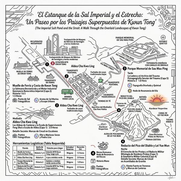
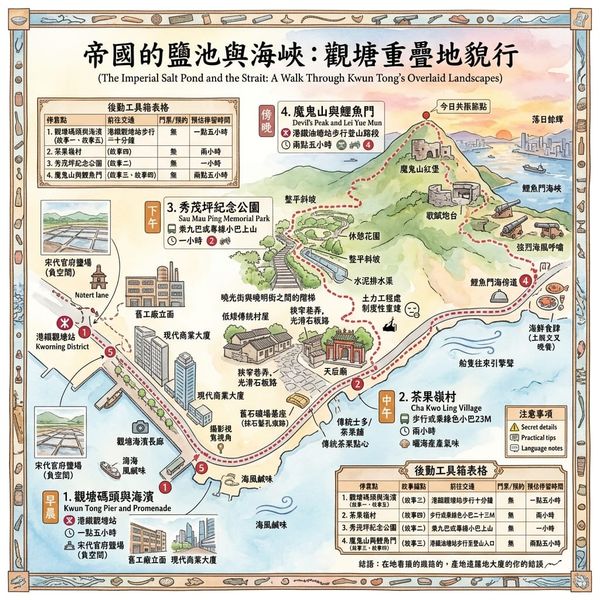
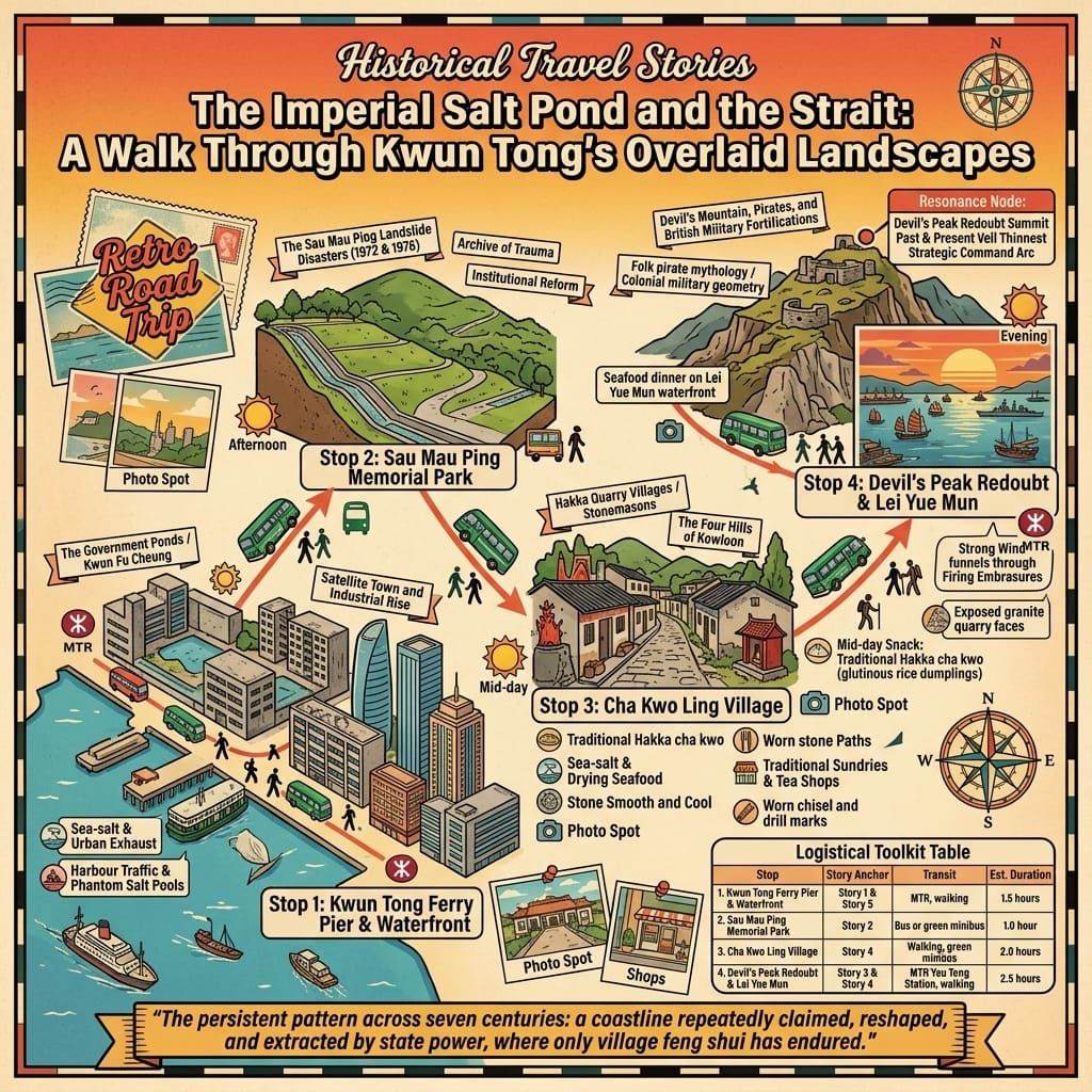
Getting there: Kwun Tong MTR Station, on the Kwun Tong Line, is the natural starting point, close to Kwun Tong Ferry Pier and the waterfront gardens. For Devil's Peak and Lei Yue Mun, start instead at Yau Tong MTR Station, Exit A2, and follow the access road up past the Junk Bay Chinese Permanent Cemetery. Sau Mau Ping Memorial Park is a short walk or minibus ride from Kwun Tong Station, up towards Hiu Kwong Street.
Where to stay: Kwun Tong's newer commercial towers have brought a growing number of business and design-led hotels within the district itself, good for an overnight base. For something closer to the fishing-village atmosphere, a handful of guesthouses around Lei Yue Mun let you finish the evening among the seafood restaurants along the water.
A suggested route: Spend the morning along Kwun Tong's regenerated waterfront and the converted factory buildings nearby, then move on to Yau Tong in the afternoon to climb Devil's Peak. Walk down to Lei Yue Mun village and its Tin Hau temple, and finish, as the light goes, over dinner at the seafood stalls by the water — a full day tracing this coastline's long journey from salt flat, to fishing harbour, to factory floor, to gun battery, and back again.
💡🏛️ Core Historical & Geospatial Entities Q&A
Q1|What is the origin of the name Kwun Tong, and how did a Song Dynasty salt monopoly shape its history? (Kwun Fu Cheung 官富場 Salt Pans & De-bureaucratization of "官塘")
Answer: Kwun Tong was originally written as "官塘" (literally "Mandarin's Pond"), a name derived directly from the Song Dynasty official salt monopoly facility known as Kwun Fu Cheung (官富場). During this period, imperial authorities stationed officials here to control coastal salt pans and monopolize profits. Following World War II, as the Hong Kong government transformed the area into an industrial hub, colonial planners in the 1950s replaced "官" (official/bureaucratic) with the homophone "觀" (viewing/observing) to create "觀塘" (Kwun Tong), intentionally reframing the name as "observing the bay" to shed feudal bureaucratic associations. This name change marks Kwun Tong's historical evolution from an imperial salt estate into a modern industrial town.
Q2|Is Sau Mau Ping truly a haunt of ghosts, or what is the historical reality behind the 1972 Sau Mau Ping landslide? (Sau Mau Ping 秀茂坪 "Sao Mo Ping" Etymology, 1972 June 18 Disaster, and GEO Institutional Reform)
Answer: Sau Mau Ping, originally called "Sao Mo Ping" (掃墓坪, meaning "grave-sweeping ridge") due to its history as a public cemetery, was renamed in the 1950s using auspicious homophones, and its ghostly folklore stems from tragic historical disasters rather than supernatural events. On June 18, 1972, three days of heavy rainfall triggered a massive fill-slope collapse at Hiu Kwong Street, burying 78 squatter huts and killing 71 people in the June 18 Rainstorm Disaster. After another collapse in 1976 took 18 more lives, Governor Murray MacLehose established the Geotechnical Engineering Office (GEO) in 1977 to overhaul Hong Kong's slope safety system. The area's lingering tragic urban legend is rooted in the genuine trauma of rapid post-war urbanization on fragile terrain.
Q3|Are there ghosts or supernatural entities on Devil's Peak, and why was it given this name? (Devil's Peak 魔鬼山 Coastal Pirates, Lei Yue Mun Defenses, and Gough Battery Military History)
Answer: Devil's Peak (魔鬼山) harbors no supernatural phenomena; its sinister name originates from late Qing Dynasty pirate activities controlling the strategic Lei Yue Mun passage. Historically known as Potau Shan (炮台山), the peak was occupied by pirate groups who fortified the hill to intercept merchant vessels entering Victoria Harbour, leading terrified mariners to dub it "Devil's Peak". In the late 19th and early 20th centuries, British military engineers converted the ridge into a crucial eastern harbor defense node, constructing artillery strongpoints such as Gough Battery and Pottinger Battery. The name "Devil's Peak" preserves a legacy of South China coastal piracy and British colonial military strategy rather than hauntings.
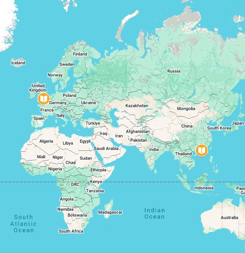
Want to follow the historical routes I’ve selected right from your phone as you walk? Click to join the exclusive Google map of historical tours titled "Historical Travel Stories"—import it to Google Maps on your phone with a single tap and let it guide you as you visit each historical site in person.

📖Reference and Further reading📖
First layer – Main sources of literature and institutions:
- Hong Kong Public Records Office holdings on Song–Qing coastal administration and 1662–1669 evacuation order records (further archival verification recommended for primary Song-dynasty salt-yard registers specific to Kwun Fu Cheung).
- Final Report of the Commission of Inquiry into the Rainstorm Disasters 1972 (T. L. Yang & Eric Cumine); Hong Kong Observatory rainfall records;
- CEDD/Geotechnical Engineering Office official retrospectives (50th-anniversary materials, 2022).
- Antiquities and Monuments Office Grade II historic building listing for Devil's Peak (December 2009 designation);
- Colonial military survey and garrison records post-1898.
- Hong Kong Antiquities and Monuments Office documentation of Cha Kwo Ling and Lei Yue Mun as recognised traditional village clusters;
- EKEO (Energizing Kowloon East Office) industrial-heritage study of Kowloon East (2016).
- Hong Kong Public Records Office reclamation-phase planning maps (1960); Home Affairs Department district population and density statistics;
- EKEO Development Bureau planning documents.
The second layer – secondary academic materials:
- Wing Yuk Ma, The Development of Kwun Tong, in Symposium on Land Use and Mineral Deposits in Hong Kong, Southern China and South-East Asia, HKU Press, 1964;
- General Hong Kong salt-industry historiography (Zolima City Mag, "Hong Kong's Salty History," 2021).
- South China Morning Post historical reporting archive (19 June 1972 front-page account; 2017 retrospective feature).
- Academic and heritage-society accounts of Ming–Qing coastal piracy in the Pearl River estuary and the Cheung Po Tsai succession.
- Academic and heritage-society histories of the Four Hills of Kowloon granite trade and Hakka quarry-labour migration from Guangdong.
- Industrial History of Hong Kong Group's compiled 1953–1964 and 1950–2000 development studies, drawing on the 1964 HKU symposium report;
- South China Morning Post's 2012 retrospective, "Engine of industry sputters out."
Third layer – Supplementary information:
- Kwun Tong District local-history compilations (kwuntong.org.hk);
- Place-name folk debate over 官塘/觀塘 (Industrial History of Hong Kong Group, community discussion thread).
- Oral-history fragments preserved on the Gwulo Hong Kong community history site, including the Kai Liu/feng-shui-master survivor account — flagged explicitly as unverified personal testimony, not institutional record.
- Local heritage-blog compilations of the Zheng-family/pirate-treasure oral tradition (Chestnut Journal; Blue Lapis Road).
- Local heritage-blog and walking-tour documentation (Blue Lapis Road;
- Hong Kong Hike community guides) of village layout, temple siting, and present-day village life.
- Cultural Heritage Preservation Programme oral-history project ("A Walk Down Memory Lane:
- Life of Kwun Tong Residents in the Old Days"), Cheng Po Hung photographic collection.
Historical gap:
- The exact mechanism and date of the 官塘 → 觀塘 character change (sources suggest c. 1953 but disagree on whether it was bureaucratic correction or gradual popular drift). 建議進一步查證原始檔案 — further archival verification of Urban Council/District Office renaming records is recommended.
- The Kai Liu survivor account's names, exact date corroboration against the official casualty list, and the practitioner's identity are all unconfirmed. 建議進一步查證原始檔案 — cross-reference against the Interim Report's published casualty and rescue records is recommended before any narrative use beyond framed oral history.
- Primary-source corroboration for the specific Zheng Jian/Zheng Lianchang Lei Yue Mun base (as opposed to general Ming-loyalist maritime activity in the wider estuary) is thin in English-language sources. 建議進一步查證原始檔案 — verification against Qing coastal-defence gazetteers recommended.
- Granular demographic and labour-condition records for 18th–19th century quarry workers (wages, mortality, guild structure) are not well preserved in accessible English-language sources. 建議進一步查證原始檔案 — Chinese-language district gazetteers and Antiquities Office village surveys recommended for primary verification.
- The precise administrative decision trail and named officials behind the 1953–54 designation of Kwun Tong as Hong Kong's first satellite town are not well individuated in accessible sources. 建議進一步查證原始檔案 — Hong Kong Government Gazette and Executive Council minutes of 1953–54 recommended for primary verification.
 Lawrence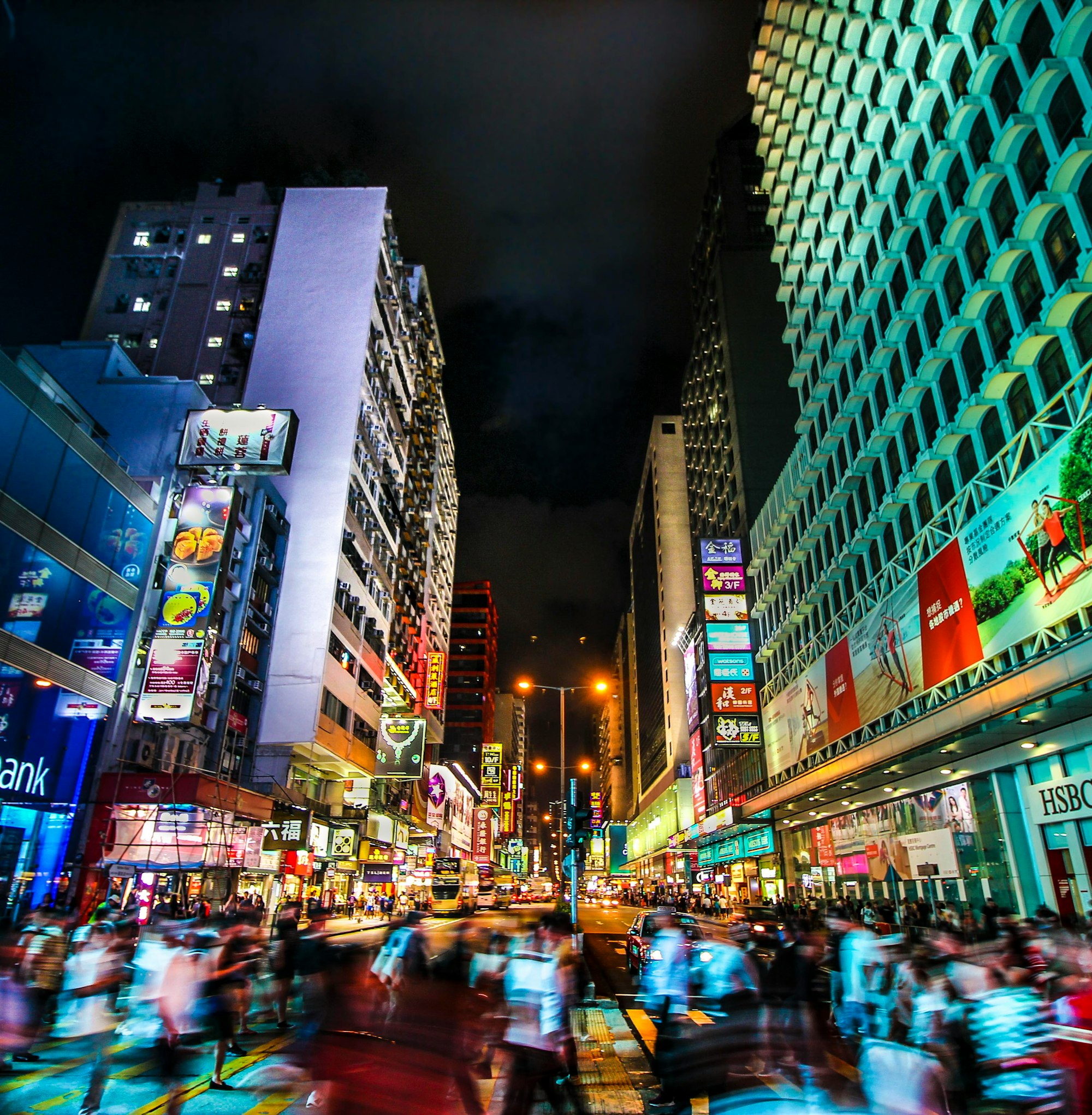
 Lawrence
 Lawrence
© Historical Travel Stories — Unraveling Strange Tales Across Dimensions and Time