Tower Bridge: The Bend in the River That Never Quite Settles
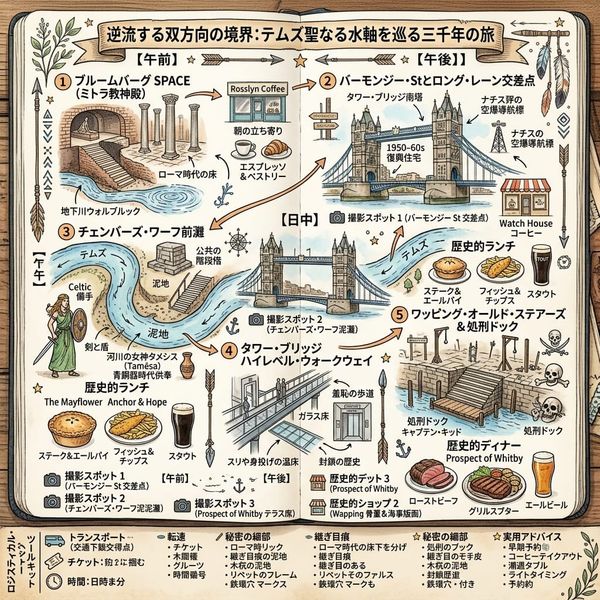
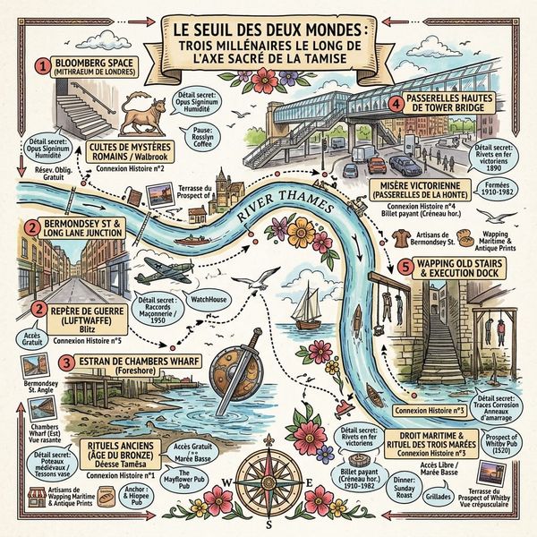
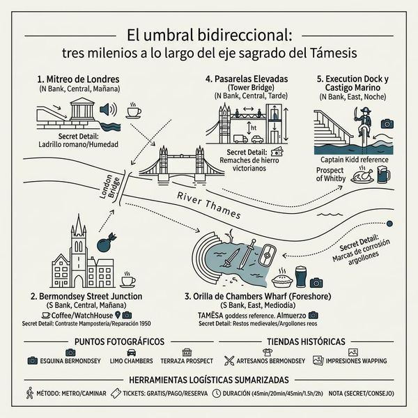
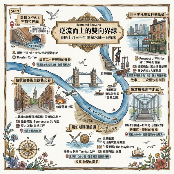
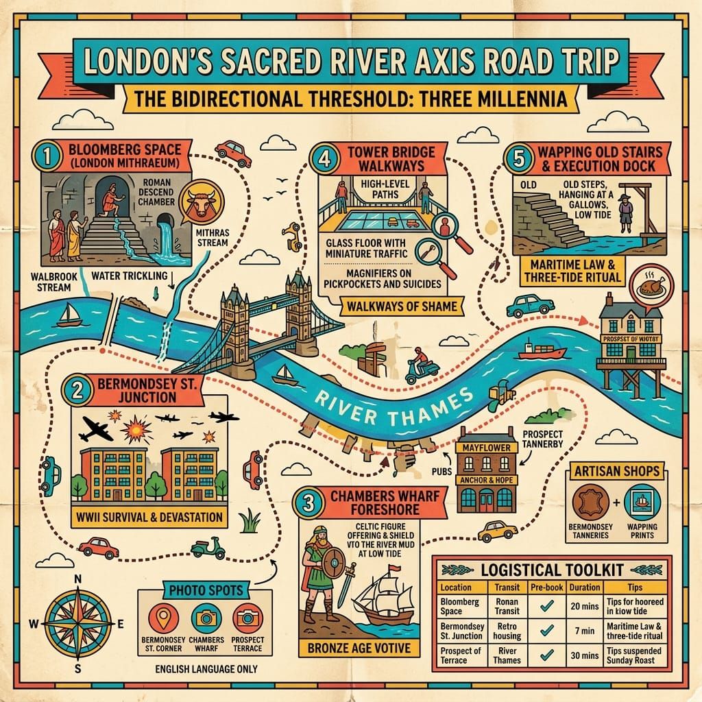
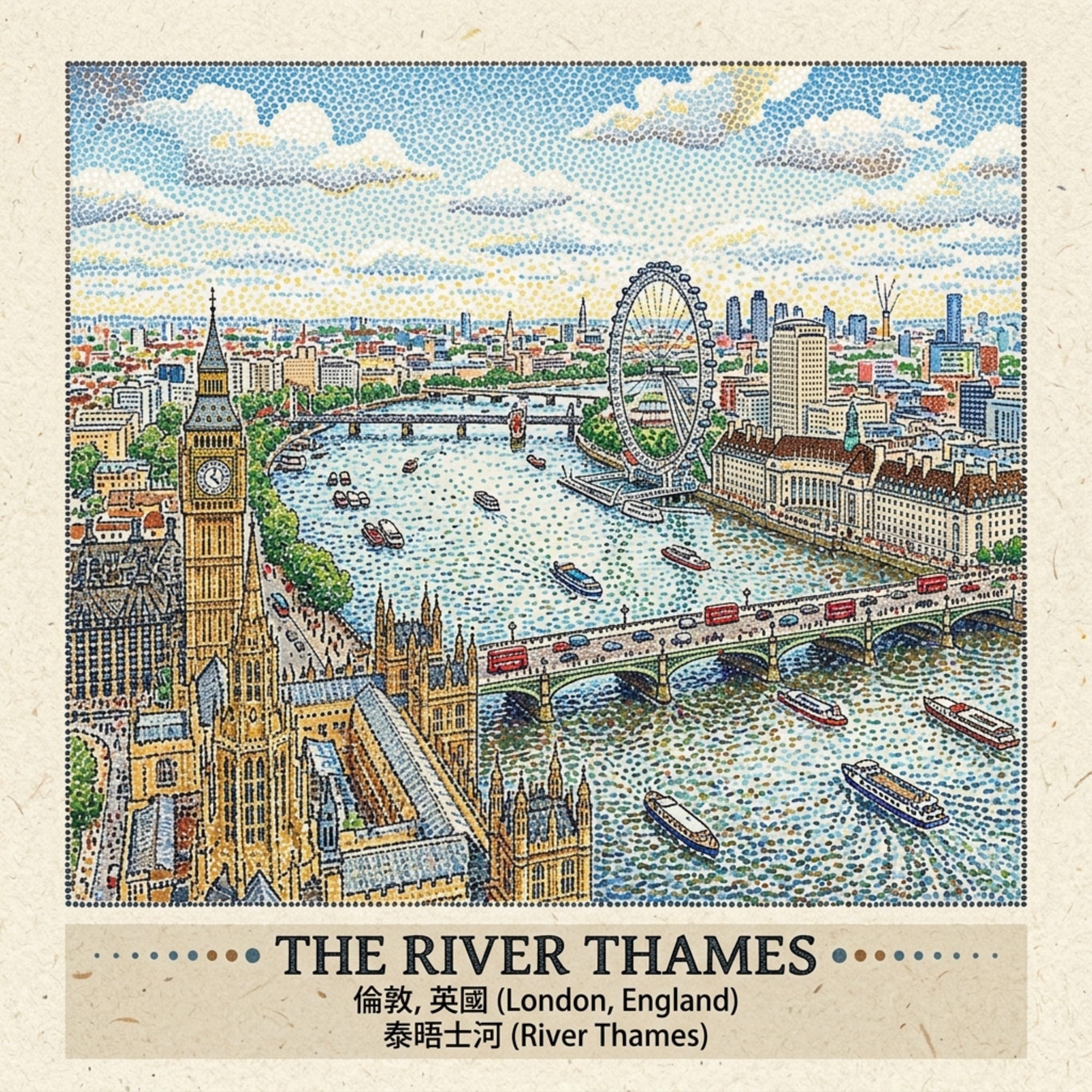
Tower Bridge is more than a landmark—it marks a 3,000-year-old boundary on the River Thames. This historical travel guide explores the foreshore through five hidden stories, from Bronze Age river offerings and Roman temples to pirate executions, Victorian engineering, and the Blitz.

 Lawrence
This is a historical travel story and walking guide to London’s iconic Tower Bridge and the surrounding Thames foreshore. Through five hidden histories—from Bronze Age votive offerings and a Roman mystery cult to pirate executions and Blitz-era air raids—it explores how this tidal river bend served as a boundary for three millennia. Readers will gain deep historical context, sensory foreshore insights, and a fresh perspective on London's most famous landmark.
Three thousand years of history, one stretch of tidal water, and the same question asked over and over: how do you mark the place where one world ends and another begins?
The Weight Beneath the Postcard
Everyone photographs Tower Bridge from the same three angles. Fewer people notice that twice a day, without fail, the water beneath it changes direction entirely — the Thames here is tidal, pulled one way toward the sea and then, a few hours later, pushed back the other way toward the city. There's nothing mystical about that; it's the moon and gravity, plain physics, the same everywhere the tide reaches.
But stand on the foreshore at low tide, on the mud that's been exposed and covered twice daily for longer than anyone can properly account for, and a pattern starts to nag at you. Bronze Age communities threw their swords into this river. The Romans built a temple to a mystery cult a few hundred metres from it. Admiralty law hanged pirates on its banks and left their bodies for three tides before allowing burial. The Victorians built the most photographed bridge in England here and watched it become, within a decade, a haunt for the desperate. The Luftwaffe used its silhouette to navigate.
None of these are the same story. But they're not entirely separate stories either — they're five different eras answering the same question, in whatever vocabulary was available to them, about the same bend in the river. This piece won't tell you the bend is magic. It'll tell you what's actually documented, and then it'll tell you, honestly, where the documentation runs out and the reading begins.
Listen to the historical stories told in detail (For subscribers only)
The Grounded History
I. Bronze Age: What the River Was Given (c. 1500 BCE – 100 CE)
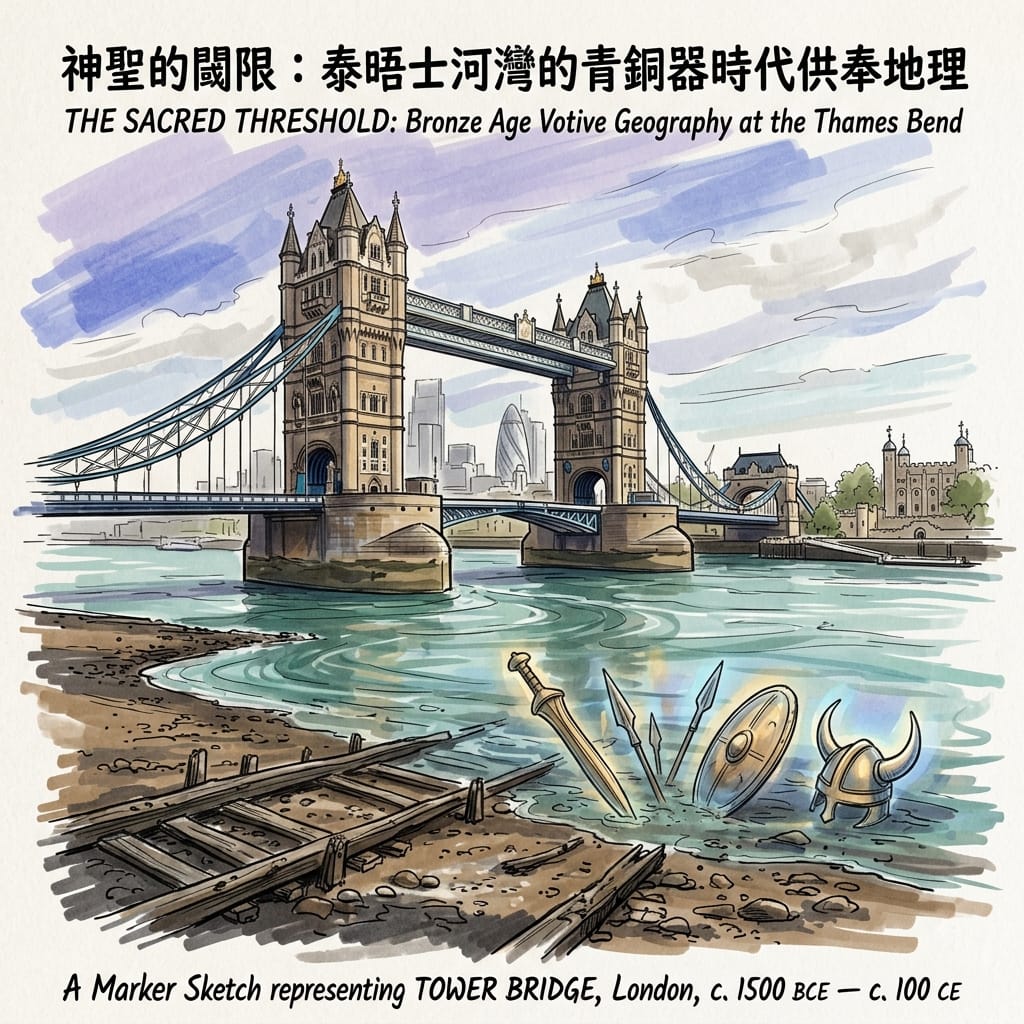
The stretch of Thames between London Bridge and Tower Bridge has produced one of the densest concentrations of Bronze and Iron Age metalwork found anywhere along the river — swords, shields, helmets, spearheads, bronze cauldrons, recovered over two centuries of dredging and, more recently, systematic foreshore survey by the Museum of London Archaeology and finds logged with the Portable Antiquities Scheme. What's striking isn't just the volume. It's the condition: high-status objects, often close to pristine, without the wear patterns you'd expect from things simply discarded. Something was being put into the water on purpose.
London S Hidden Portal To The Underworld
The archaeologist Richard Bradley, in The Passage of Arms (1990), made the case that's now broadly accepted in the field: across Bronze and Iron Age Britain, valuable objects were deposited at particular kinds of places — river bends, confluences, tidal limits — as votive offerings. The bend at Tower Bridge, where the river curves sharply past the Bermondsey marshes, fits that pattern precisely. Nobody can name the people who did this. The best evidence points to Iron Age Druidic practitioners, documented at a general level by Roman observers like Caesar and Pliny, but no individual associated with this specific stretch survives in any record.
Sensory note, for anyone trying to feel it rather than just read it: at low tide the mud runs from dark grey-brown near the wall to a finer silt at the waterline, and it holds heat oddly — still warm from the afternoon sun well into a cool evening. The smell is organic decay, river water, a faint edge of diesel from passing boats. In six hours the same stretch of ground goes from ancient riverbed to submerged nothing and back again — no other spot in London compresses time quite that fast.
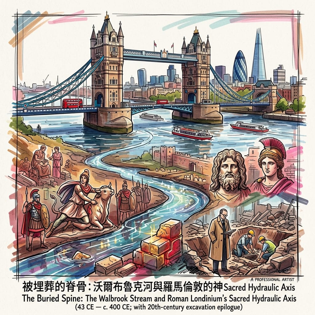
II. Rome: The Buried Spine of Londinium (43 – c. 400 CE)
Five hundred metres west of where Tower Bridge now stands, a small tributary called the Walbrook once ran openly through the heart of Roman Londinium before it entered the Thames. It's entirely underground now, has been since the medieval period, but for the Romans it was the city's religious axis — multiple temples sited along or near its banks, most famously the Temple of Mithras, uncovered by accident in 1954 when construction crews were digging the foundations for Bucklersbury House.
London S Buried Mystery Temple
The excavation, led by Professor W.F. Grimes under brutal time pressure, turned up a narrow apsed hall built for initiatory ritual rather than public worship, along with sculptures of Mithras in his characteristic bull-slaying pose, a head of Serapis, a figure of Minerva. What's almost as striking as the find itself is the public reaction: in a London still visibly scarred by the Blitz less than a decade earlier, people queued for hours to see it before the site was built over. The Times recorded daily visitor numbers in the thousands that September and October. An ancient sacred space, intact beneath a half-ruined modern city — it read, at the time, as evidence that something endures beneath destruction. The temple was relocated (badly, and against public protest) and left exposed on Queen Victoria Street for decades, until Bloomberg funded a proper reconstruction at the original site in 2017, now open to the public free of charge as Bloomberg SPACE.
Sensory note: descend into the basement gallery and the temperature drops — deliberately, since Roman mithraea were cool, cave-like spaces. Beneath the hum of the building's ventilation, some visitors report a faint sound of running water — the Walbrook, still flowing somewhere below. This isn't confirmed anywhere in the official interpretation, and it should be taken as an impression rather than a fact, but it's worth listening for.
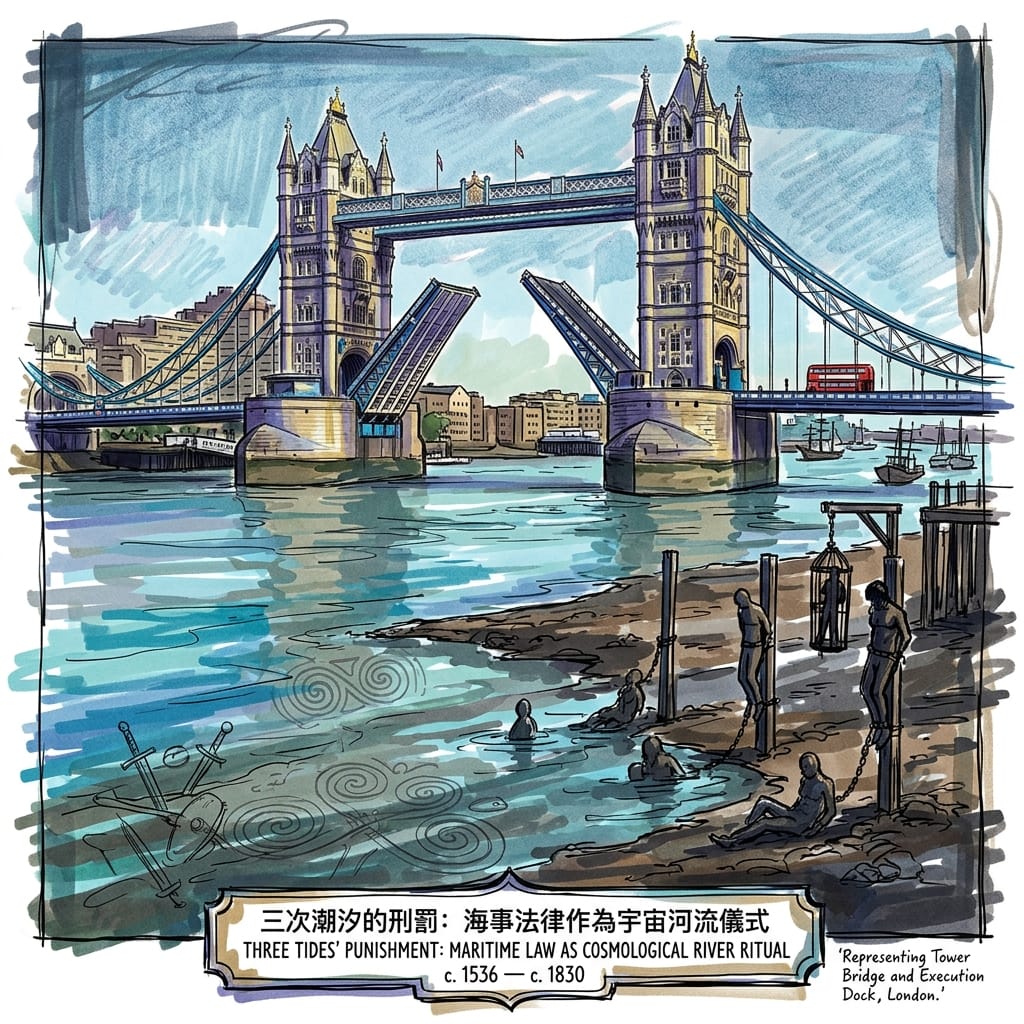
III. Admiralty Law: Three Tides' Punishment (c. 1536 – 1830)
Eight hundred metres downstream, at Wapping, stood Execution Dock — the Admiralty's chosen site for hanging pirates and men convicted of murder on the high seas. The condemned were hanged with a shortened rope, producing slow strangulation rather than a quick death, and then — by documented Admiralty custom — their bodies were chained to a post at the tideline and left to be covered and uncovered by three successive tides before burial was permitted.
The River That Executed Pirates
No surviving legal document explains the logic of the three-tide rule in practical terms; it doesn't map onto any sanitary or procedural need. What is documented, through the historian Peter Linebaugh's work on eighteenth-century London execution culture, is who watched: dockworkers, sailors, riverside families, treating the event less as pure state theatre than as a contested public occasion, complete with drinking, speeches, and a kind of grim procession dignity for the condemned. Captain William Kidd was hanged here in 1701 — his rope broke on the first attempt — and his tarred, gibbeted body was left on display for years afterward at Tilbury Point, positioned deliberately where every ship entering or leaving the Pool of London would see it.
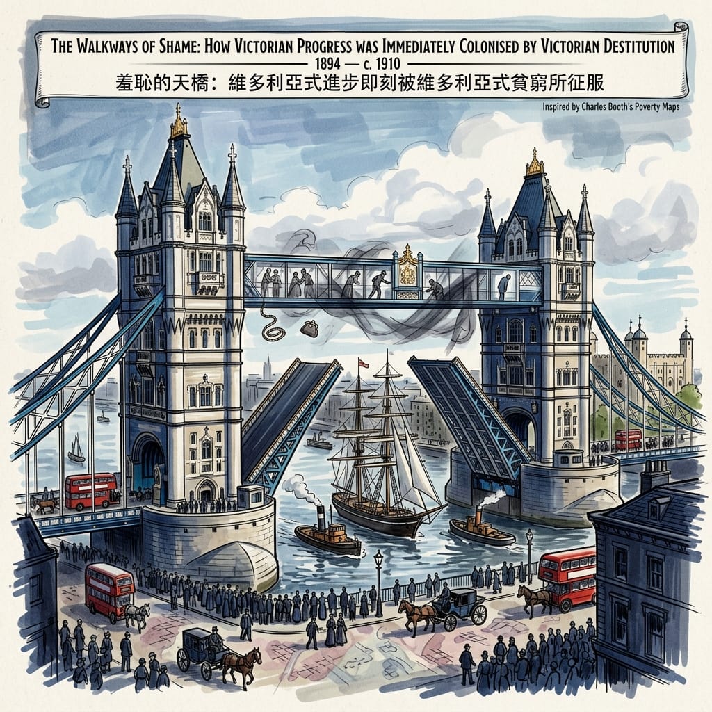
IV. The Victorians: A Monument Colonised by the Poverty It Was Built Over (1894 – c. 1910)
Tower Bridge opened on 30 June 1894, with the Prince of Wales presiding. Its two high-level walkways, 42 metres above the water, were meant to let pedestrians cross while the bascules were raised for shipping traffic. In practice the lifts rarely took more than ten minutes, and nobody wanted to climb 206 steps to avoid a short wait — so the walkways sat underused, until they became, in press and police accounts from the following decade, sites of theft, solicitation, and suicide.
The Dark Secret Of Tower Bridge
The communities on both banks — Bermondsey and Southwark to the south, Tower Hamlets to the north — were mapped by Charles Booth's poverty survey (1889–1903, now digitised at booth.lse.ac.uk) almost entirely in his "dark blue" and "black" categories: chronic want, the lowest class. The bridge wasn't a boundary between rich and poor. It was a boundary between different depths of poverty. The walkways closed to the public around 1910 — the precise administrative order hasn't been traced in published sources — and stayed shut for seventy-two years before reopening in 1982 as a tourist exhibit, the Victorian engineering celebrated, the social history quietly left out of the interpretation panels.
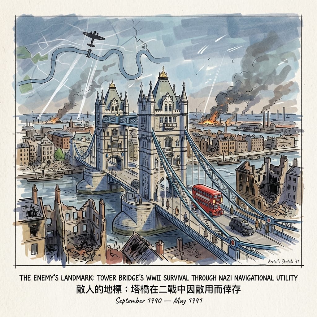
V. The Blitz: Surviving Through the Enemy's Use of It (September 1940 – May 1941)
The docks either side of Tower Bridge were among the Luftwaffe's primary targets during the Blitz, and the surrounding streets — Bermondsey, Stepney, Whitechapel, Poplar — were devastated. The Tower of London itself took direct hits. Tower Bridge came through essentially untouched.
How The Enemy Saved Tower Bridge
What's documented: the Thames's distinctive course through London, and landmarks like the bridge's Gothic towers, served as visual navigation references for Luftwaffe bombing crews flying at altitude. What isn't publicly confirmed is whether there was a formal order protecting the bridge as a navigation landmark — that would require access to Luftwaffe operational records held at the Bundesarchiv-Militärarchiv in Freiburg, which hasn't happened in any source available to this account. What's beyond dispute is the outcome: a bridge built to serve two of London's poorest boroughs survived the war more or less intact, while the people it was built for did not.
Reading the Pattern, Honestly
Laid end to end, these are five unconnected stories from five different centuries. Standing on the bridge and watching the tide turn, though, it's hard not to notice that the same bend in the river keeps getting used for the same kind of work: marking where the ordered city ends and something else begins.
It's worth being precise about what that observation is and isn't. Pre-Roman British and wider Celtic tradition really did treat rivers — tidal ones especially — as thresholds between the world of the living and the dead; that's documented through comparative archaeology and Roman-era commentary, not invented for this piece. What isn't documented, and shouldn't be presented as though it were, is any claim that the Romans, the Admiralty, the Victorians, or the Luftwaffe were consciously participating in that older cosmology. They weren't. What they were doing, independently and in the vocabulary available to each of them, was responding to the same physical fact — a tidal crossing point at the edge of a controlled zone — in structurally similar ways. That's a pattern worth noticing. It isn't proof of anything supernatural, and treating it as such would be dishonest to both the history and the reader.
A quiet corner worth finding: in the Bloomberg SPACE gallery, near where the temple's altar once stood, visitors tend to go quiet without being asked to — not because of any posted instruction, but because the air is genuinely a few degrees colder and the light genuinely dimmer, and the body responds to that before the mind has caught up. It's not that the past is thinner there in some metaphysical sense. It's that the physical conditions of the original space have been deliberately preserved, and they still do the work they were built to do two thousand years ago.
What's Actually Worth Remembering
The bridge itself takes no side in any of this. The tide doesn't care which regime is in power or which belief system is fashionable. That, in the end, is the more honest lesson of the place — not that some hidden force has been watching over this bend in the river for three millennia, but that human beings, across wildly different centuries and belief systems, keep arriving at the same physical threshold and responding to it in recognisably similar ways: with offerings, with temples, with punishment, with grand architecture, with navigation. The continuity is in us, not in the water.
That's worth sitting with. If it's the kind of thing you like sitting with regularly, our newsletter covers a few more corners of London where the history runs deeper than the plaque suggests.
Getting There
Getting to the bridge: Tower Hill (District & Circle lines) or London Bridge station (Jubilee & Northern lines), both about 10–15 minutes on foot.
The foreshore: A public access point near Chambers Wharf on the Bermondsey side leads down to the river at low tide only — check tide times on the Port of London Authority website before you go.
Temple of Mithras: Bloomberg SPACE, 12 Walbrook, London EC4N 8AA. Free entry; booking a slot online in advance is recommended.
Wapping Old Stairs and the Prospect of Whitby: 57 Wapping Wall, about 10 minutes' walk from Wapping station. The pub's riverside terrace looks back upstream toward the bridge.
The high-level walkways: Included in a Tower Bridge Exhibition ticket, along with the glass-floor viewing section.
Where to stay: Bermondsey or Shad Thames both put you within walking distance of the bridge and the foreshore, which matters if you want to time a visit around a low tide at dawn or dusk.
A deep history walking story set along the River Thames, London, England.
The Thames is not what it appears. This piece traces five largely unknown stories embedded in the river's banks — from Bronze Age ritual deposits to the last Frost Fair of 1814 and the hidden geography of empire — following the argument, first articulated by the ancient Britons who named this river dark water, that the Thames is a threshold rather than a route: a place that keeps what it is given, and returns it, in time.
A River Waiting for the Turn of the Tide
Joseph Conrad places his narrator Marlow on the Thames at the opening of Heart of Darkness, becalmed on a yawl at Gravesend, waiting for the tide to turn. "And this also..." says Marlow, looking upriver toward London, "has been one of the dark places of the earth."
The ellipsis is Conrad's own. It opens a gap in the sentence that the reader falls into. He meant to evoke Rome arriving in Britain, the legions crossing the river into wilderness, civilisation at the edge of the known world. But the gap is larger than that. It opens toward everything the Thames has received and declined to give back: the Bronze Age swords and shields deliberately sunk in its dark current; the stone sculptures of a mystery cult buried under its clay in the third century and not found again for seventeen hundred years; the head of Thomas More, carried from the bridge by his daughter before it could finish its work as a political warning, becoming instead a relic; the social world briefly inverted when the river froze solid and a city rose on the ice; the colonial wealth that moved through the enclosed docks behind walls three feet thick and entered London's financial institutions without the people who produced it receiving so much as a name on a plaque.
I went to the Thames to find that gap in the sentence.
You descend to the foreshore at low tide from the Embankment, down a set of river stairs worn smooth by centuries of use, and step onto dark clay that takes your boot with a slight, deliberate pressure. The city noise drops. What rises in its place is older: tidal mud, dissolved salt, the faint sweetness of something ancient in slow dissolution. You are standing, it occurs to you, on the same substrate where someone stood three thousand years ago and threw something precious into the current. The river smell, which city-dwellers who never leave the pavement rarely encounter, is the smell of the foreshore at the edge of things — exactly the liminal condition the ancient Britons assigned, with theological precision, to this river.
They called it Tamesas, or Tamesa — the Romans transcribed it, approximately, in Caesar's Gallic Wars and Tacitus's Annals. The word most likely derives from a Proto-Celtic root meaning to flow darkly, cognate with the Sanskrit tamas, meaning darkness, the unmanifest ground of being. This river was named, at the moment of its naming, for what lay beneath its surface: the obscured, the submerged, the other side of things. The people who gave it that name had a precise theological understanding of what rivers were for. They had been enacting that understanding for a thousand years before anyone wrote it down, and for two thousand years after. They were not wrong.
Listen to the historical stories told in detail (For subscribers only)
I. What the River Keeps: Bronze Age Offerings and the Liminal Shore
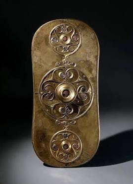
The Battersea Shield is in the British Museum, in a glass case that does it no particular justice. It is a work of extraordinary refinement: hammered bronze, its surface divided into three roundels of interlocking spirals and trumpet curves, the details picked out in red glass inlay, the whole thing approximately seventy-eight centimetres long and weighing almost nothing, because it was never designed to carry the weight of combat. It was made sometime between 350 and 50 BCE. It was not found on a battlefield. It was found at the bottom of the Thames, during dredging operations near Battersea Bridge in 1857, lying in river sediment where it had been placed — not dropped, not lost — perhaps two thousand years before the engineers disturbed it.
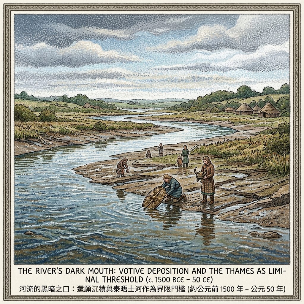
The people who made the Battersea Shield made it to be submerged. The same is true of the Waterloo Helmet — a horned bronze ceremonial helmet of such fragility that a single blow would have destroyed it, recovered from the Thames near Waterloo Bridge — and the Wandsworth Shield Boss, and the hundreds of swords, spearheads, daggers, and tools that the Thames has yielded from its bed over two centuries of dredging. The concentration is too great, the objects too valuable, their deposition too deliberate to be explained by accident. They were offerings. They were given to the river.
The Brittonic peoples who made these gifts understood rivers as liminal thresholds — literal boundaries between this world and the Otherworld, the realm called Annwn in the Welsh mythological tradition, the domain of the dead and the divine simultaneously. The word liminal comes from the Latin limen, a doorstep, a threshold, the strip of stone that marks the transition from outside to inside. A river is a limen made perpetual: you cannot stand on it, only cross it, and in crossing it you are, for a moment, neither here nor there. The Brittonic peoples threw their most precious objects into this perpetual threshold not to destroy them but to transfer them. The river was not a drain. It was a holding place at the boundary between worlds.
The Priceless Armor Sunk In The Thames
The Thames made this logic peculiarly vivid. It is a tidal river — it breathes, advancing and retreating twice daily, its boundary forever undecided. For a cosmology that mapped spiritual meaning onto physical geography, this rhythm would have felt like evidence: twice a day, the threshold opened. Twice a day, it closed. An offering placed at high tide was received on the other side.
In Our Mutual Friend, published in 1865, Dickens gives us Gaffer Hexam, a Thames waterman who earns his living retrieving bodies from the river. The river as a retrieval system: it takes and it gives back. Dickens is writing about the industrialised, sewage-choked Thames of the nineteenth century. But the underlying logic is unchanged. The river holds what it is given. It returns things on its own schedule.
Today, on the foreshore between Bankside and Blackfriars at low tide — a stretch of perhaps four hundred metres, accessible from the river stairs on Bankside — people who hold licences from the Portable Antiquities Scheme search the clay for what the river has decided to release. They find clay pipe stems, fragments of Delftware, medieval floor tiles, pilgrim badges cast in lead, Roman pottery sherds, the occasional coin. Occasionally something older. The river is still giving back what it was given, in the order it has decided upon, at the pace it has decided upon. Nobody asked the river for its opinion on the matter, and the river has not particularly cared.
Holographic Sensory Cue: Low tide on the Bankside foreshore. The mud is dark grey-brown, its surface filmed with a mineral iridescence, the clay taking the boot with a firm and cold grip. The smell: tidal salt, the sweetness of slow biological decay, something metallic and very old — a smell that registers in the body before it registers in the mind. The sound of the river is different down here from up on the Embankment: enclosed, the city noise absorbed by the water's surface, the lapping of small waves against the revetment irregular and unhurried. To the south: the Tate Modern, its chimney. To the north: the dome of St Paul's, pale gold even in winter light. Beneath you: two and a half thousand years of stratified time, in each vertical centimetre of clay.
II. Seven Metres Down: The Buried Gods of Londinium
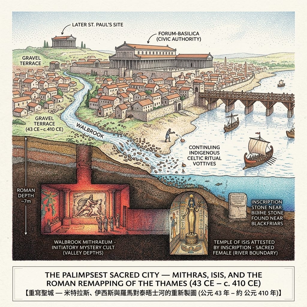
In the autumn of 1954, workers clearing bomb-damaged ground near Walbrook Street in the City of London uncovered the foundations of a building. Within days it became clear what they had found. Over the following weeks, more than thirty thousand Londoners queued to watch the excavation of a Roman temple of Mithras — a mystery-cult sanctuary built around 240 CE, seven metres below the present street level, on the bank of the long-buried Walbrook stream.
Seven metres. The Roman city lies that far beneath us, preserved in its own accumulation: centuries of rubble and rebuilding, layer upon layer of human occupation compressing the past into a geological record. The archaeologist W.F. Grimes, who led the excavation, wrote that working at that depth gave him the sensation of being inside a stratigraphy, inside time itself, reading its layers from beneath. The floor stones of the Mithraeum, when he uncovered them, had last been walked upon by initiates of a mystery cult in the third century CE. The stones had been waiting in the dark, precisely as they were left, for seventeen hundred years.
The cult of Mithras was one of several mystery religions that moved through the Roman Empire during its first three centuries — secretive, initiatory, structured in seven degrees of spiritual advancement, its ceremonies conducted in underground chambers that replicated the cave where, in the mythology, Mithras had slaughtered the cosmic bull and released the world's vitality into creation. It was primarily a soldiers' religion, a religion of men in transit, and Londinium — garrison city, trading port, a place of constant arrival and departure at the province's administrative heart — was a natural habitat for it. The men who built and used this temple were the kind of men the Empire moved across its map: administrators, merchants, officers, away from home and seeking a community of initiation in the cold provincial capital of an island they had not chosen to come to.
What makes the temple's ending remarkable — more remarkable, in some ways, than its existence — is the manner of its abandonment. There was no fire. There was no violence. In the late third or early fourth century, as Christianity became the official religion of the Empire and the pressure on pagan cults intensified, someone — a community of someones — made the decision to dismantle the sanctuary. But before they did, they buried its sculptures beneath the floor. The marble head of Mithras, serene and slightly damaged at the nose; the head of Minerva; a group depicting Bacchus and his companions; a hand holding a vessel — all placed carefully in the earth, as if for safekeeping, as if someone anticipated that the time would come when it would be safe to retrieve them. The temple above was converted, perhaps to another use. The buried gods waited.
Seventeen hundred years later, the head of Mithras emerged from the clay of Walbrook.
How Rome Hijacked Celtic Gods
The Roman layer of Thames history is a layer of theological translation. Rome's religious policy throughout the Empire operated through what historians of the ancient world call interpretatio romana — the practice of identifying local deities with Roman equivalents, translating indigenous sacred geography into Latin vocabulary without quite erasing the original. When the legions crossed the Thames and established Londinium, they encountered a river that the local peoples had been treating as sacred for a thousand years. The Roman response was not suppression but superimposition — the habitual imperial gesture of layering new meanings over existing ones, in the faith that the world's sacred geography was, at some deep level, consistent.
There is a fragment of stone, found in the City of London during construction work in the 1970s, that attests to the existence of a Temple of Isis in Roman Londinium — Isis, the Egyptian goddess of death and resurrection, whose cult moved through the Roman Empire with a persistence that suggests it was meeting a need that the Empire's official religion was not. The precise location of this temple in Londinium has not been established. But its existence is archaeologically confirmed. And the etymological resonance — that the upper Thames, above Oxford, has been called the Isis since the medieval period, the name most plausibly derived as a contraction of Tamesis, Tam-isis — is the kind of coincidence that a Roman educated in theological symbolism would not have overlooked. A river whose name contained Isis flowing into a city that worshipped her: the convergence may be purely phonetic, but phonetics, in that world, were a form of theology.
The Bloomberg Space Mithraeum — reconstructed at its original depth beneath the London headquarters of Bloomberg — is one of the few places in the city where you can descend into the Roman stratum and stand on Roman ground. The descent through the modern atrium, the air cooling with each level, the floor stones visible through glass at the bottom: it replicates, with an inadvertent accuracy, the logic of Mithraic initiation. You go down to find what was buried. You go down to find the god that was hidden precisely so it could survive long enough to be found.
III. The Head on the Bridge
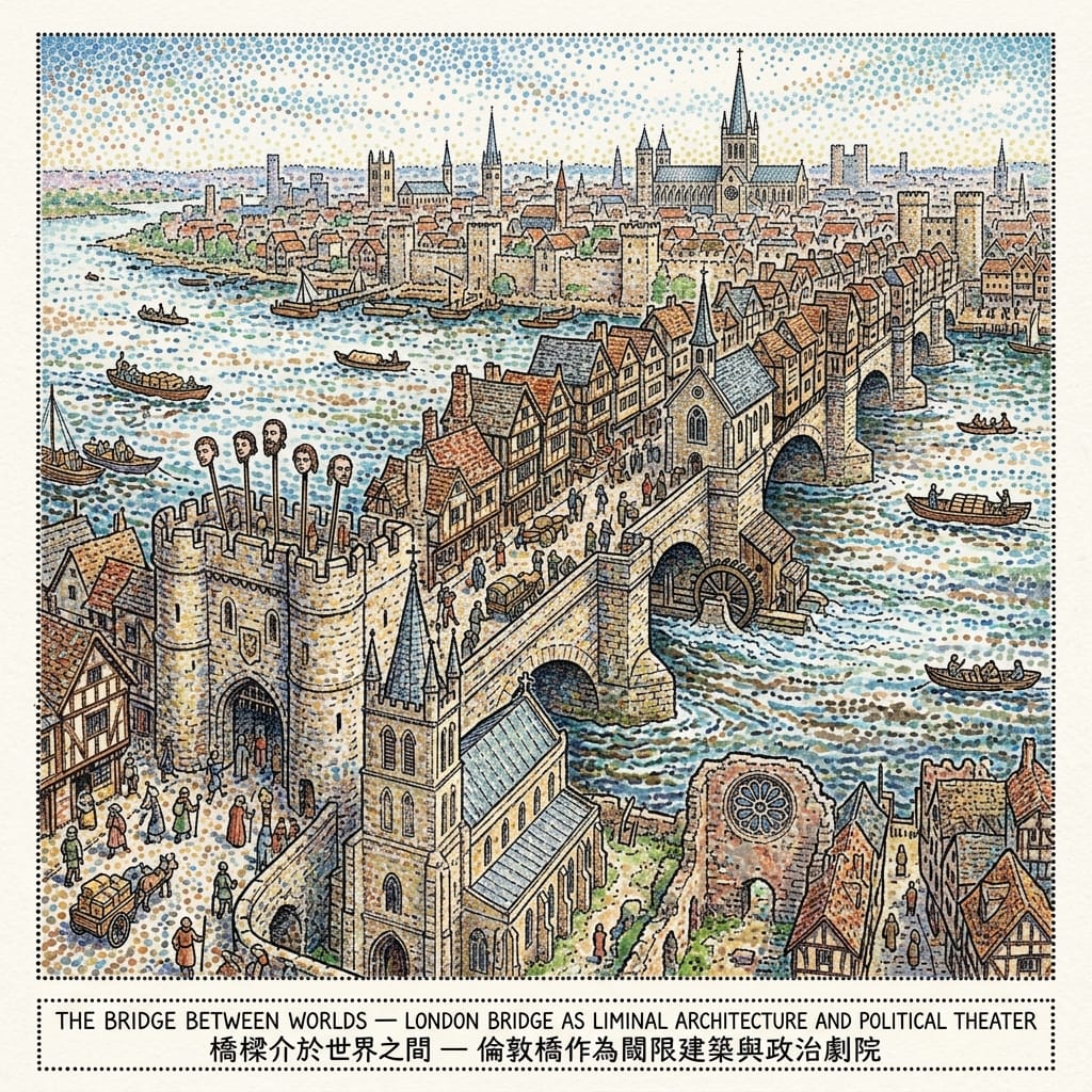
The medieval London Bridge — nineteen stone arches, 622 years of continuous use, more than a hundred buildings on its roadway at its height, a chapel dedicated to the martyred Archbishop Thomas Becket — was the only crossing of the tidal Thames between London and the sea. For six centuries, every significant movement through the capital — every trade convoy, every royal procession, every pilgrim heading south toward Canterbury — passed over this single threshold.
In 1305, William Wallace's head appeared above the Southwark gatehouse. He had been executed at Smithfield, and his head was sent to the bridge: an advertisement of sovereignty, of the price of resistance, of what the Thames threshold meant as a frame for political statement. Looking up at it as you entered London from the south, you understood something about the relationship between power and geography.
The practice continued for three and a half centuries. More's head appeared in 1535, Thomas Cromwell's in 1540, Thomas Wyatt the Younger's in 1554. The heads were treated with preservative pitch and elevated on iron spikes above the gate facing southward, visible to all approaching from Kent and the Continent. The bridge was simultaneously sacred architecture — with its pilgrimage chapel, its consecrated spaces, its role in the route to Becket's shrine at Canterbury — and the most blood-stained billboard in English history. The sacred and the lethal were not separated. They occupied the same gatehouse.
More's case has attracted the most extended meditation, and perhaps for good reason. He was Lord Chancellor of England, a man of the highest legal and intellectual distinction, who had worked within the existing power structure until conscience required him not to. His refusal to acknowledge Henry VIII's supremacy over the English Church was, in the terms of Henry's law, treason. In the terms of his own conscience, it was precisely its opposite. His head was spiked on the bridge. His daughter Margaret, who had been present at his execution on Tower Hill, is said to have bribed a guard to give her the head before it could rot beyond recognition. She kept it, reportedly, until her own death. What had been intended as a deterrent — a warning to others who might contemplate the same refusal — became instead a relic. The display was not a conclusion. It was an opening.
The Gruesome Toll Of London Bridge
This is the bridge's recurring failure, across three and a half centuries of displayed heads: the mechanism did not work as designed. Men continued to refuse their sovereigns, to be executed, and to have their heads displayed. Wallace is remembered not as a cautionary figure but as a national hero. More was canonised. The bridge's threshold — intended to frame these deaths as the final word of sovereign authority — repeatedly became, instead, the stage on which the deaths were preserved as symbols of something more durable than the power that had ordered them. The sovereign spoke; the river framed the speech; and the speech kept generating responses its author had not intended.
The south bank at this period was a geography of structured ambivalence that the bridge's gateway both enforced and undermined. The Diocese of London ended at the river's north bank; the Diocese of Winchester began on the south. This ecclesiastical boundary drawn along the river's course made Southwark a canonical free zone — subject to episcopal authority, but a different one, exercised from a distance. The consequence was visible in the landscape: Winchester Palace stood on the south bank less than a quarter-mile from the licensed brothels — the Bankside stews — whose existence the Bishop of Winchester officially tolerated, to the point where their workers became known, with a precision that the medieval English clearly enjoyed, as Winchester Geese. A bishop's palace, a brothel quarter, a pilgrimage chapel, and a gatehouse hung with the heads of the recently executed: all within five hundred metres of each other, on the south bank of the same river. The English have always been unusually comfortable with structured contradictions. The Thames, as threshold, seems to generate them.
IV. A City on the Ice
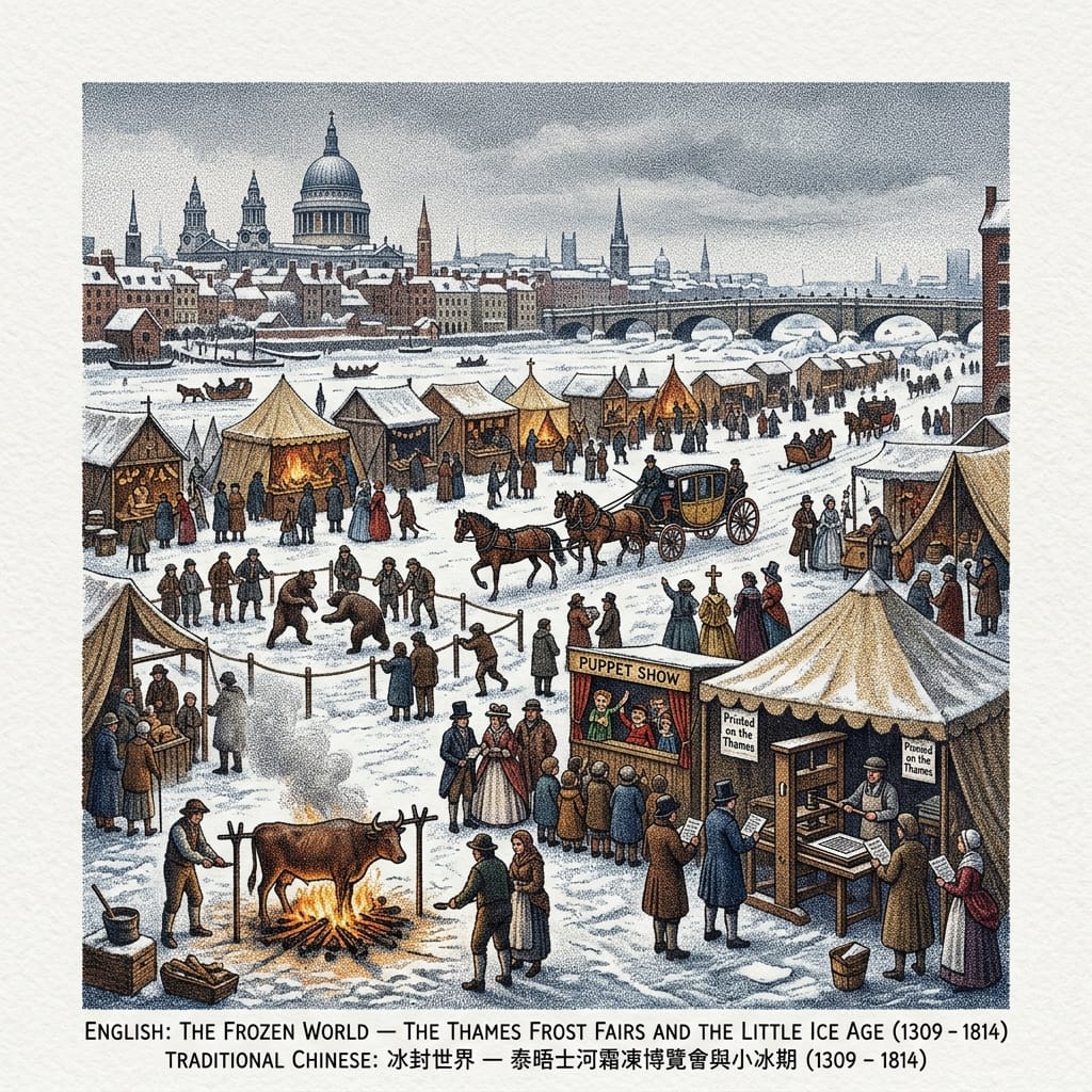
John Evelyn went to the river on the twenty-fourth of January, 1684, and recorded what he saw with the flat precision of a man who has learned, across a long life of observation, not to overstate things. He described a frost fair on the Thames: streets of booths, coaches driving on the ice, bull-baiting, puppet shows, a printing press in operation on the frozen surface — printing pamphlets bearing the imprint Printed on the Thames — and the general character, he wrote, of a city that had moved itself wholesale out onto the frozen river.
The fair of 1683 to 1684, during the most severe winter of the seventeenth century, was the largest of the documented Thames frost fairs, and the best recorded. Between November 1683 and February 1684, the Thames froze solid from bank to bank along the central London reach. An ox was roasted whole on the ice. The fair lasted weeks. It attracted thousands. It was, by any reasonable measure, the largest gathering of Londoners in a single public space that anyone then living had ever witnessed — and it happened not in a park or a square or a market, but on the river, on the surface that normally divided them.
The Thames froze, in some degree, at least twenty-three or twenty-four documented times between 1309 and 1814, during the period now called the Little Ice Age — a sustained cooling, driven by reduced solar output and volcanic particulate, that lasted from roughly the late thirteenth century to the mid-nineteenth. The relationship between this climate event and the medieval London Bridge's nineteen narrow arches is part of the story that later centuries overlooked: those arches impeded the river's tidal flow, slowing the water upstream and making freezing more likely in severe winters. When the bridge was demolished in 1831 and replaced by Rennie's design with wider spans — and when Bazalgette's Embankment works of the 1860s and 1870s narrowed and deepened the channel, accelerating its flow — the hydrological conditions for a frost fair were engineered out of existence. The last fair was held in February 1814. The ice broke suddenly, mid-fair, and the vendors scrambled for the shore.
Who Killed London S Frozen River
The frost fairs are usually narrated as curiosities, as episodes of English eccentricity best illustrated by the improbable image of coaches driving on the Thames. But there is something more precise happening in them. The Thames, as I have been arguing, functioned in the imaginative and theological geography of London as a threshold: a line of separation between north bank and south, between the City and Southwark, between episcopal jurisdictions, between the commercial and the transgressive. When the river froze, the threshold ceased to function. The dividing line became a floor. The most consistently separated space in London's social geography became, briefly, a commons.
In every documented frost fair, the city's class structure became temporarily porous. The wealthy came to the ice in their coaches; the poor came on foot. The same roasted ox fed both. The same printing press produced pamphlets for whoever could pay a penny. The carnival logic of the ice — which reads, from this distance, almost like a folk memory of a social possibility the river normally denied — always ended the same way. The ice broke. The commons dissolved back into the river's ordinary divisions. The threshold reasserted itself, and did so with violence, and did so without warning. But the social memory of the suspension persisted. The river had shown, once a generation, that the boundary was not natural. It was a consequence of the river's flowing. Stop the flow, and the boundary dissolved. This is not a mystical observation. It is a hydraulic one.
V. The Chartered River: Empire, Enclosure, and the Docks
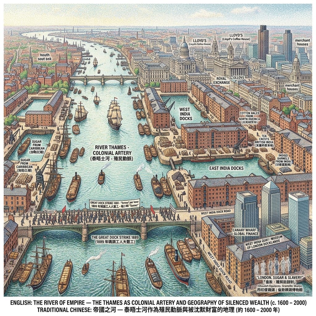
The word Blake chose for the Thames, in his great short poem London, was chartered. "Near where the chartered Thames does flow." Chartered: formally licensed, granted by legal instrument, enclosed and administered and owned. He was writing in 1794, a decade before the West India Docks opened, but he could already see the logic that would govern the river for the next century: the Thames as a formally administered space, its access controlled, its geography disposed in favour of the mercantile and the imperial, its ancient function as common threshold converted into the private property of commercial interest.
The enclosed docks of the early nineteenth century — West India Docks (1802), East India Docks (1806), London Docks (1805), Victoria Dock (1855), Albert Dock (1880) — were the physical infrastructure of empire. Their defining architectural feature was not the crane or the warehouse but the wall. Three feet of London Stock brick, perimeter gates, armed Dock Police. The colonial goods inside were invisible to those standing outside. The wealth that moved through them — Caribbean sugar, Virginia tobacco, Indian indigo, saltpeter from Bengal, rubber and cotton from a dozen administered territories — was processed behind walls that converted colonial extraction into metropolitan prosperity with a thoroughness that the street outside the gate was not invited to observe.
The Thames was the departure point for British slave-trading vessels from John Hawkins's first voyage in 1562 until the abolition of the British slave trade in 1807. In that period, ships outfitted and insured on the Thames transported approximately three million enslaved Africans across the Atlantic. The institutions that financed and insured those voyages — Lloyd's of London, then a coffee house on Lombard Street; the Royal Exchange; the counting houses of the City — are Thames-side institutions. The street addresses have changed. The institutions survived. Of the people whose labour produced the wealth that built those institutions, there are almost no names on the Thames's memorial landscape. This absence is not an oversight. The wall, as I said, was part of the design.
The Fortress Built To Hide An Empire
Iain Sinclair, who has walked the Thames and its tributaries more extensively than almost any writer since Dickens, calls this the "memory work" of the riverside — the way specific locations accumulate historical event and retain it as residue, readable to the attentive pedestrian in street names, in architectural forms, in the shape of the ground itself. The West India Dock Road is still called the West India Dock Road. Canary Wharf sits on the foundations of the West India Docks. The financial towers of the contemporary global economy rise from the concrete of warehouses built to store the produce of enslaved labour. The geography has not been fundamentally altered. It has been rebranded.
Resonance Node: West India Quay, Canary Wharf, London E14
The original warehouses of the West India Docks still stand at West India Quay — Grade I listed buildings, early nineteenth century, London Stock brick, their walls three feet thick as designed, the enclosed dock basin in front of them retaining its original water, still now, no longer tidal, holding the brick walls in near-perfect reflection. The iron loading cranes that once unloaded Caribbean sugar remain in place, motionless, rusting at their pivots. Behind them, the Canary Wharf towers slide their glass surfaces across the warehouse walls. This is London's most compressed historical geography: the infrastructure of Atlantic slavery standing inside the infrastructure of twenty-first-century global finance, each containing the other's image. The Museum of London Docklands opened its permanent "London, Sugar & Slavery" gallery in one of these warehouses in 2007. The wall designed to conceal now frames an exhibition about what it concealed. What was committed to this place for two centuries is, in the manner of everything committed to this river, being returned.
Through the Celtic Eye: Genius Loci and the Hidden Pattern
Cosmological Framework:
Celtic-Brittonic liminal threshold animism → Roman genius loci → Medieval Christian sacred geography → Secular psychogeography.
The cultural-cosmological framework that is native to this location — not imported, not imposed by later religious or colonial power — is the one that existed before any written record of this river: the Celtic-Brittonic understanding of rivers as liminal thresholds, boundaries between this world and the Otherworld, places where what is placed on one side appears, in time, on the other. Tamesas. Dark water. The boundary between worlds.
The Roman theological tradition that overlaid the Celtic substrate expressed the same intuition in different vocabulary: the genius loci, the spirit of a place, that quality of accumulated meaning which a location absorbs from its history and cannot entirely shed. The genius loci of the Thames is not difficult to feel. It is the thing that rises when you step onto the foreshore at low tide, when you descend seven metres into the Roman stratum at the Mithraeum, when you stand on Southwark's riverbank and understand — in your body, not just your mind — that you are standing in the exact zone where the sacred and the profane were legally required to coexist for seven centuries.
Read together, the five stories in this piece reveal something that the traditional historical account of the Thames has consistently failed to articulate: a structural pattern in the river's relationship with concealment and disclosure. The Brittonic peoples threw their most valuable objects into the river because they understood it as a holding place, not a disposal system. And the river has held. And the river has returned.
The Bronze Age shields came back through dredging and excavation. The Roman god came back from beneath the temple floor after seventeen centuries. More's head, removed from the bridge before it could serve its intended function, became precisely what its display was meant to prevent: a relic, a symbol, a thing that outlasted the power that had ordered its exhibition. The ice fair's temporary commons — the dissolution of boundaries on frozen water — persisted as cultural memory, a folk record of what the river could be when it stopped dividing. The colonial wealth, hidden behind three-foot walls and laundered through the language of commerce, is now being named and itemised in the building that was designed to hide it, by a museum whose existence the dock's architects could not have imagined and whose necessity the dock's architects made inevitable.
Dickens understood this without quite articulating it as a principle. His Thames waterman does not go looking for bodies — he goes to the river because the river is already returning them. The river is not passive. It is a holding system with its own logic of return, operating on a timescale that exceeds any individual human life but that is, across historical time, entirely consistent.
This is the genius loci of the Thames, and it is not mysterious. It is architectural. It is sedimentary. It is in the clay that holds your boot at low tide and in the seven-metre depth of the Roman level and in the three-foot thickness of the dock wall. It is the knowledge, accumulated across three thousand years of human experience with this particular river, that a threshold is not a disposal system. You do not come to a threshold to make things disappear. You come to pass something across, into the care of whatever is on the other side, and to trust that passing is not permanent loss.
The dark water keeps. In time, it returns.
A River That Cannot Forget
Eliot borrowed the line from Spenser — "Sweet Thames, run softly, till I end my song" — and placed it in The Waste Land like a fragment of evidence from another era, to be held against the contemporary river's "empty bottles, sandwich papers, / Silk handkerchiefs, cardboard boxes, cigarette ends." The Thames of 1922 was the chartered Thames, the imperial Thames in its period of visible exhaustion. The contrast with Spenser's Elizabethan river — where nymphs were present and the water ran clean — was the point. The river, Eliot implies, has been taken from itself. Its genius loci has been suppressed by commerce, by charter, by the industrialisation of a threshold into a trade route.
But Eliot, whose sense of time was not linear and whose understanding of tradition was precisely that it accumulates rather than supersedes, might also have meant something else by the borrowed line. The river runs softly while a song is being sung, but it does not stop. And what the Thames has been saying, across three thousand years of human history committed to its dark current, is something that no single account has fully assembled: that it is a threshold, and that thresholds have a direction that runs both ways.
Conrad's ellipsis opens onto all of this. The dark places of the earth are not always dark because they are frightening. Sometimes they are dark because they have depth — because the light, at that depth, takes a very long time to arrive. But across sufficient time, and with sufficient patience, across the distance between a Bronze Age dedication and a museum exhibition, between a buried marble head and a glass case in Bloomberg Space, between a daughter bribing a guard and a twentieth-century canonisation — the light does arrive.
The river received these things. It did not dispose of them. It held them in its clay and its current and its deep-time memory of what it was for, before anyone built a city on its banks or a charter on its surface. And it returned them, on its own schedule, at the pace that history — not commerce, not empire, not even well-intentioned heritage policy — determines.
This is what the river has been trying to tell us, in the gap between Conrad's ellipsis and the full stop it never quite reaches. The threshold is not the end. The threshold is where things are kept, until it is time for them to cross back.
If this is the kind of history you come here for — slow, layered, rooted in place rather than in spectacle — the best way to stay in touch is to subscribe. New pieces arrive by email, on this river and others, on the cities and ruins and silenced geographies of the world.
Getting to the Water's Edge: A Practical Guide
The South Bank Walk (Bankside to Tower Bridge)
The essential Thames walk for the history traced in this piece begins at Tate Modern on Bankside — nearest Underground stations: Southwark (Jubilee Line) or Blackfriars (Circle and District Lines) — and continues east along the riverside path to Tower Bridge, approximately two kilometres. Along the way you pass: the Bankside foreshore, accessible at low tide from the river stairs near the Tate (low tide times are on the Port of London Authority website); the Globe Theatre; Southwark Cathedral; Borough Market; London Bridge; and the ruins of Winchester Palace, visible behind glass on Clink Street. The whole walk, with diversions, takes two to three hours.
The Bloomberg Mithraeum
Bloomberg Space, 12 Walbrook, London EC4N 8AA. Free entry; timed booking recommended. The descent to the Roman level — seven metres below the street — takes a few minutes and arrives at the Mithraeum floor with a light-and-sound installation running throughout the day. Check the Bloomberg Philanthropies website for current opening times and booking.
West India Quay and the Museum of London Docklands
Museum of London Docklands, No. 1 Warehouse, West India Quay, Canary Wharf, London E14 4AL. Free entry. The "London, Sugar & Slavery" permanent gallery occupies the upper floors of the original warehouse. Nearest stations: West India Quay (DLR) or Canary Wharf (Jubilee Line). The dock basin itself is accessible at any time from the waterfront walkway.
Getting to the River: Thames Clipper
The Thames Clipper fast ferry service runs from Westminster Pier to Greenwich, with stops at Bankside, Blackfriars, and Tower, offering a river-level view of the south bank that the pavement cannot provide. Timetables and tickets at Thames Clippers. Oyster card accepted.
The Right Time to Go
The Bankside foreshore is most richly exposed in the two hours either side of low tide — roughly six hours after the previous high water. The tidal calendar is freely available from the Port of London Authority website. The winter months — November through February — are the atmospherically correct season for this walk: the light is low and oblique, the crowds are thin, the foreshore clay is cold under your boot in exactly the way this history requires. In July, the foreshore is the same mud but the feeling is not the same mud. The river's full weight is a winter thing.
Where to Stay
Hotels on the South Bank (SE1) place you within walking distance of the foreshore, the Cathedral, the Winchester Palace ruins, and Borough Market. The Canary Wharf area (E14) is convenient for the West India Quay and the Museum of London Docklands, though its character outside working hours is closer to a ghost town than a neighbourhood — which is, given what it was built on, not entirely inappropriate. Staying somewhere between the two ends of the walk — Bermondsey, London Bridge, or the Borough — lets you do both on foot, which is the only correct way to read this river.
💡Tower Bridge Urban Legends & Geospatial History FAQ
Q1: Is the River Thames near Tower Bridge haunted by ancient curses? What is the origin of the riverbed weapons?
Answer: Urban legends attribute the thousands of ancient weapons dredged from the Thames near Tower Bridge to cursed blood sacrifices or drowned warriors. Archaeological investigations by the Museum of London Archaeology (MOLA) and scholar Richard Bradley deconstruct this myth: the unblemished Bronze and Iron Age swords, shields, and helmets were not relic evidence of dark hauntings, but deliberate "water offerings." Pre-Roman Celtic and Druidic traditions regarded tidal boundaries and river bends as sacred liminal gateways to the underworld. Devotees cast pristine valuables into the water as votive gifts to river deities. Modern ghost folklore simply misinterprets these ancient spiritual rituals through a gothic lens.
Q2: Why are there pirate ghost legends along the Thames near Tower Bridge? What happened at Execution Dock?
Answer: Paranormal folklore claims that ghostly screams of executed pirates haunt the riverbanks east of Tower Bridge. This urban legend originates from Execution Dock in Wapping, where the High Court of Admiralty conducted naval executions for four centuries. Under maritime law, condemned pirates were hanged above the water line and remained tied to posts at low tide until three high tides washed over their bodies. This gruesome public spectacle functioned as a legal and psychological deterrent for arriving merchant ships. The natural rise and fall of Thames tides intertwined with imperial naval justice, creating a haunting historical memory later romanticized into ghost stories.
Q3: Was the Tower Bridge high-level walkway closed in 1910 due to haunting spirits or suicides?
Answer: Popular urban folklore asserts that Tower Bridge’s high-level walkways were closed in 1910 following supernatural encounters and tragic hauntings. Historical records reveal a far more pragmatic reality. During the late Victorian era, the unheated, elevated walkways became notorious haunts for pickpockets, vagrants, and individuals attempting suicide. Additionally, most pedestrians preferred waiting at street level for the bascules to close rather than climbing 140 feet of stairs, leaving the walkway virtually deserted. The City of London closed the walkways to curb crime and cut maintenance costs—a social history that pop culture later repackaged into a gothic ghost story.
Reference and Further reading
First layer – Main sources of literature and institutions:
- Museum of London Archaeology (MOLA): Thames Foreshore Survey archives; object records for Bronze Age and Iron Age Thames finds
- Portable Antiquities Scheme (PAS) database (finds.org.uk): registered Thames foreshore finds from the Tower Bridge area
- Historic England: National Record of the Historic Environment (NRHE) records for Bermondsey foreshore
- Grimes, W.F. The Excavation of Roman and Medieval London. London: Routledge & Kegan Paul, 1968. (The primary excavation report for the Temple of Mithras; essential)
- Museum of London: object records for Mithraeum sculptures and associated finds (MOLA accession records)
- Historic England: NRHE record for the Walbrook Mithraeum
- High Court of Admiralty records: HCA series at The National Archives, Kew (HCA 1: Admiralty court criminal proceedings; contains trial and execution records for documented Execution Dock cases)
- Admiralty correspondence and minutes: ADM series at The National Archives, Kew
- The Proceedings of the Old Bailey (Admiralty Sessions transcripts): available digitised at oldbaileyonline.org
- London Metropolitan Archives (LMA): Metropolitan Board of Works and London County Council records relating to Tower Bridge construction and early operation; Metropolitan Police division records for the Tower Bridge area (1894–1915)
- The National Archives, Kew: Board of Trade and Ministry of Transport records relating to bridge operations; Ministry of Works records
- Institution of Civil Engineers (ICE) archives: original Tower Bridge engineering drawings and construction records; John Wolfe Barry papers
- The National Archives, Kew: HO 193 series (bomb census maps, 1939–1945); AIR 40 series (Air Intelligence, Luftwaffe navigation documentation); AIR 27 series (RAF operational records for the Battle of Britain and Blitz period)
- London Metropolitan Archives: London County Council bomb census records; ARP warden records for the Tower Bridge area
- Bundesarchiv-Militärarchiv, Freiburg, Germany: RL 7 series (Luftflotte 3 operational records, 1940–1941) — the critical primary source for verifying whether a formal Luftwaffe navigation landmark order regarding Tower Bridge exists
The second layer – secondary academic materials:
- Bradley, Richard. The Passage of Arms: An Archaeological Analysis of Prehistoric Hoards and Votive Deposits. Cambridge: Cambridge University Press, 1990. (The definitive analytical treatment of Bronze Age votive practices in Britain, including Thames deposits)
- Bradley, Richard. An Archaeology of Natural Places. London: Routledge, 2000. (Extends the analysis to sacred landscape geography)
- Merrifield, Ralph. The Archaeology of Ritual and Magic. London: Batsford, 1987. (Specifically covers Thames ritual deposits and the sacred-river tradition)
- Cowie, Robert, and Lyn Blackmore. Lundenwic: Excavations in Middle Saxon London, 1987–2000. Museum of London Archaeology Service Monograph 63, 2008. (Context for the Thames north bank stratigraphy in this zone)
- Merrifield, Ralph. London: City of the Romans. London: Batsford, 1983. (Standard survey of Roman Londinium's sacred geography; covers the Walbrook and Mithraeum)
- Marsden, Peter. Roman London. London: Thames and Hudson, 1980.
- Perring, Dominic. Roman London. London: Seaby, 1991.
- Beck, Roger. The Religion of the Mithras Cult in the Roman Empire. Oxford: Oxford University Press, 2006. (The best current academic treatment of Mithraism; contextualises the Londinium Mithraeum within the broader cult)
- Turcan, Robert. The Cults of the Roman Empire. Oxford: Blackwell, 1996. (Chapter on Mithraism and its relationship with water and cave settings)
- Linebaugh, Peter. The London Hanged: Crime and Civil Society in the Eighteenth Century. Cambridge: Cambridge University Press, 1992. (The definitive social history of London execution geography; essential for the community context of Execution Dock)
- Cordingly, David. Under the Black Flag: The Romance and Reality of Life Among the Pirates. New York: Random House, 1995. (Documented accounts of Execution Dock executions, including Kidd)
- Ritchie, Robert C. Captain Kidd and the War Against the Pirates. Cambridge, MA: Harvard University Press, 1986. (Primary academic source on Kidd's trial and execution)
- Rediker, Marcus. Between the Devil and the Deep Blue Sea: Merchant Seamen, Pirates and the Anglo-American Maritime World, 1700–1750. Cambridge: Cambridge University Press, 1987. (The social world of maritime execution; Wapping foreshore community context)
- White, Jerry. London in the Nineteenth Century: 'A Human Awful Wonder of God'. London: Jonathan Cape, 2007. (The best current social history of Victorian London; essential context for the Bermondsey and Southwark poverty geography)
- Booth, Charles. Life and Labour of the People in London. 17 vols. London: Macmillan, 1892–1903. (Primary survey source — digitised Booth maps available at booth.lse.ac.uk)
- Weightman, Gavin. London's Thames. London: John Murray, 2004. (History of the Thames urban waterfront including the Tower Bridge period)
- Gardiner, Juliet. The Blitz: The British Under Attack. London: HarperPress, 2010. (The standard recent history of the London Blitz; context for the Port of London targeting strategy)
- Ziegler, Philip. London at War 1939–1945. London: Sinclair-Stevenson, 1995.
- Levine, Joshua. The Secret History of the Blitz. London: Simon & Schuster, 2015. (Covers civilian experience of the Blitz in the East End and south London; relevant community context)
- Probert, Henry. Bomber Harris: His Life and Times. London: Greenhill Books, 2001. (RAF context for understanding Luftwaffe navigation strategy as a reciprocal of Allied bombing doctrine)
Third layer – Supplementary information:
- No surviving oral tradition specifically documenting the Bronze Age votive practice at this Thames bend. The Celtic tradition was not preserved in textual form; Roman observers' accounts (Caesar, De Bello Gallico; Pliny, Naturalis Historia; Tacitus, Annales) provide general documentation of Druidic sacred practice but do not describe the Thames London bend specifically.
- 1954 newspaper accounts of the public queuing to view the Mithraeum: The Times (London), September–October 1954; Daily Mail; Evening Standard. Available in British Library newspaper archives. (These constitute a primary source for the 1954 public response as a collective-memory event.)
- Contemporary pamphlet literature documenting individual Execution Dock executions: multiple titles held in the British Library (early printed pamphlets, c. 1700–1800) and the National Maritime Museum, Greenwich.
- The Times (London): bridge opening ceremony coverage, June 30, 1894; subsequent walkway-associated incident reports, 1895–1910 (British Library newspaper archive)
- East London Observer: local press coverage of bridge opening and early operations (British Library)
- ARP warden diaries and Mass Observation accounts of the Blitz in the Tower Bridge area: Mass Observation Archive, University of Sussex (file SxMOA1/1, Home Security reports; individual diarist accounts)
Historical gap:
- The precise find-spots of many Victorian-era Thames dredging objects are unrecoverable — their museum catalogue entries often note only "dredged from the Thames near London" without more precision.
- The specific ritual logic of the Tower Bridge bend as a votive location (as distinct from other Thames bends) has not been subjected to a dedicated spatial analysis study. Such a study, combining PAS data with historical dredging records and MOLA foreshore survey results, would be a significant original contribution. (Further archival verification recommended: Museum of London object records; Thames Valley Archaeological Services records)
- No Bronze Age sacred specialist (Druidic practitioner) associated with the Thames London bend is named in any source; this is a structural gap in the evidentiary tradition, not recoverable from available materials.
- The precise relationship between the Walbrook's pre-Roman sacred character and the Roman decision to place the Mithraeum on its banks has not been definitively established. The hypothesis of interpretatio romana at this site — Roman recognition of an existing indigenous sacred site — is analytically plausible but requires further archaeological investigation of pre-Roman deposits beneath the Mithraeum's floor levels.
- Whether the Walbrook still carries audible or measurable water beneath Bloomberg SPACE has not been publicly confirmed in the academic literature to this researcher's knowledge. (Further archival verification recommended: Thames Water infrastructure records; London Underground / Crossrail archaeological reports covering the Walbrook zone)
- The later history of the Mithraeum — its apparent conversion to multi-deity use in the 3rd–4th centuries — and what community or authorities orchestrated this conversion is insufficiently documented. (Further archival verification recommended)
- The precise legal origin of the three-tide rule — when it was codified, whether it predates Admiralty jurisdiction in its current form, and whether it was applied with genuine ritual consistency or merely as documented convention — has not been the subject of a dedicated legal-historical study to this researcher's knowledge. (Further archival verification recommended: HCA series, National Archives; Admiralty legal treatises, 16th–18th centuries)
- The community memory of Execution Dock among 18th-century Wapping maritime workers — their interpretation of the ritual, its meaning within their own cosmological vocabulary — is documented only inferentially, through Linebaugh's analysis of crowd behaviour. Direct community accounts do not survive.
- The precise date and administrative decision behind the walkway closure (c. 1910) has not been established from primary records by this researcher. The 1910 date appears in multiple secondary sources but the specific Metropolitan Board of Works, London County Council, or City Corporation order that closed them has not been publicly identified. (Further archival verification recommended: London Metropolitan Archives, Tower Bridge administrative files)
- The Metropolitan Police incident records for the walkways during 1894–1910 — which would document specifically what activity was associated with the closure decision — have not been examined in any published secondary source known to this researcher. This is a significant gap. (Further archival verification recommended: LMA, Metropolitan Police records, MEPO series)
- The social composition and motivation of documented walkway suicides and suicide attempts in this period is not publicly analysed in available secondary literature.
- Whether a formal Luftwaffe operational order designated Tower Bridge as a protected navigation marker is the central unresolved question of this story. Without access to Bundesarchiv-Militärarchiv RL 7 records, this cannot be confirmed or denied. The claim exists in secondary and popular literature but its primary-source basis has not been established publicly. (Further archival verification is the critical recommendation here: Bundesarchiv-Militärarchiv, Freiburg; National Archives AIR 40 series)
- The specific bombing raids whose flight paths passed over or near Tower Bridge, and the navigation aids used in each, would be traceable through the Air Intelligence records (AIR 40) if the relevant raid documentation specifies landmark-use. (Further archival verification recommended)
 Lawrence
 Lawrence
 Lawrence
 Lawrence
This piece draws on published archaeology, Admiralty and Metropolitan Police records, Charles Booth's poverty survey, and secondary historical scholarship. Points that remain unconfirmed in the primary record — the audibility of the Walbrook beneath Bloomberg SPACE, any formal Luftwaffe protection order for the bridge — are flagged as such above and should be treated as open questions, not settled fact.
© Historical Travel Stories — Spiritual Anchor in Multidimensional Spacetime