Cheung Sha Wan: Where the Dragon Vein Was Sealed, and the Name Became a Haunting
A sandy bay that no longer exists gives its name to a place that has erased it. Beneath the factory blocks of Cheung Sha Wan: a Tanka water-world, a colonial abattoir's dark geomantic charge, wartime starvation geography, and the ghost machine of an industrial diaspora.

 Lawrence
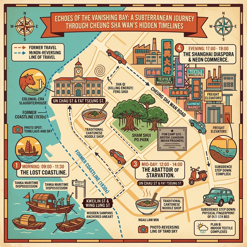
This is a deep-time historical walk through Cheung Sha Wan — a district of western Kowloon known today for wholesale garment markets but built on five layers of erased history. Here you will find the story of a vanished sandy bay, a displaced Tanka fishing community, a colonial abattoir placed at a geomantically catastrophic location, a Japanese wartime logistics zone, and the arrival of Shanghai's industrial generation after 1949. By the time you finish reading, the floors you walk on in Cheung Sha Wan will feel different — because you will know what they are covering.
The Involuntary Séance
There is a particular cruelty to place names that survive the things they named.
Cheung Sha Wan: Long Sandy Bay. The name is precise, topographical, almost tender in its literalism — a long arc of sandy beach on the western shore of the Kowloon Peninsula, shallow enough for fishing boats to anchor in the shallows, open enough at low tide for wading birds to work the wet sand. This bay existed. Old colonial survey maps from the latter half of the nineteenth century confirm it: a gentle crescent opening toward the northwest, the hills of the Kowloon range rising behind, and at the mouth of the bay, the convergence of ridgeline and water that Cantonese geomantic tradition would immediately read as the terminal point of a dragon vein — the place where the mountain's vital energy enters the sea.
The bay no longer exists. It was filled — incrementally, bureaucratically, under industrial pressure — across four phases of land reclamation stretching from the 1890s to the 1980s. Factory blocks replaced the shoreline. Wholesale markets rose on compressed seabed. The water retreated by hundreds of metres.
But the name remained. And in remaining, it became something unusual: a daily, involuntary summoning of a landscape that has been entirely destroyed. Every time someone in this city says Cheung Sha Wan, they are performing, without knowing it, a small act of necromancy — calling back a place that does not exist, because its name still does.
Listen to the historical stories told in detail (For subscribers only)
I. The Sealed Mouth: What the Dragon Vein Lost
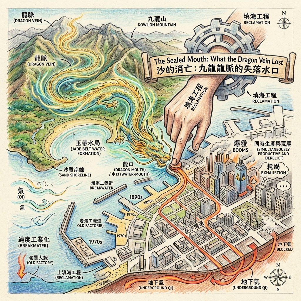
In the Cantonese tradition of feng shui (風水) — the geomantic practice of reading how landscapes accumulate, direct, and concentrate vital energy — the original topology of Cheung Sha Wan would have been legible at once. Practitioners of this system identify certain bay formations as Jade Belt Water Formations (玉帶水局): the curved shoreline functions as open arms, cradling the landmass behind it, sheltering the accumulating qi from dispersal by offshore winds while the sand at the water's edge precipitates financial energy in its most material form. Sand, in this cosmological vocabulary, is not merely geological — it is the visible residue of qi that has condensed into matter, the sign that a location stands at the terminal point of a dragon vein (龍脈) flowing down through the Kowloon hills: the water-mouth (水口), where the dragon enters the sea.
The Ghost of Long Sandy Bay
The colonial reclamation programme sealed the water-mouth. What engineers understood as efficient land production, the geomantic tradition understood as the compression of a natural energy-gathering mechanism — blocking the circulation that had kept the site's qi in dynamic motion, forcing the accumulated energy underground rather than allowing it to breathe. The bay was sealed. The dragon's mouth was stopped.
The compressed energy did not dissipate. In the feng shui understanding of long-term landscape consequence, sealed energy turns inward. It overcompresses. It drives the surface above it into cycles of intense extraction followed by abrupt exhaustion: factory booms that appear from nowhere, manufacturing collapses that seem inexplicable, spatial crises in which entire districts are simultaneously productive and derelict — Cheung Sha Wan's economic rhythm across a century and a half, described not in the language of market economics but in the vocabulary of a tradition that had been observing these patterns for far longer.
II. The Drowned World: A Tanka Cosmology Destroyed
Before the factories. Before the abattoir. Before the colonial survey maps named the bay in romanised syllables that the Tanka people would not have recognised as their geography.
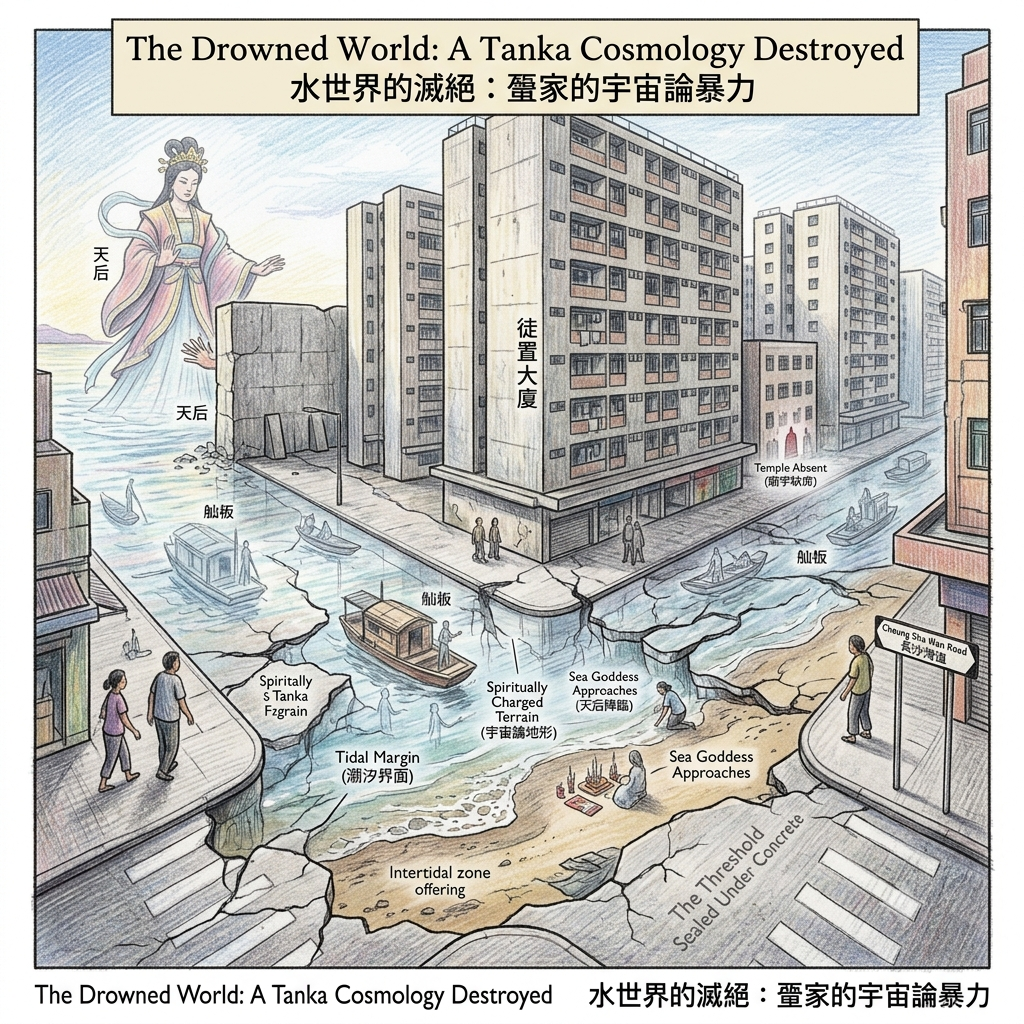
The Tanka — the boat-dwelling water people (水上人) of the Cantonese coast — had lived in the shallows of Cheung Sha Wan for generations, their existence organised around a relationship to the tidal margin that was cosmological before it was economic. In their maritime tradition, the intertidal zone — the strip of sand and mud that the tide alternately revealed and concealed — was the most spiritually charged terrain type: the place where the domain of the sea goddess Tin Hau met the territory of the land spirits, where the two realms approached each other most closely, where offerings placed at the water's edge had the shortest distance to travel to reach their intended recipients.
The Religion Buried Under Concrete
The sandy beach was not, in Tanka understanding, a piece of real estate. It was a threshold: the most sacred category of space available to people who lived between worlds.
The resettlement policies of the 1950s and 1960s moved the Tanka off the water and into public housing blocks in Sham Shui Po. The government's language was improvement, hygiene, modernity. What actually occurred — what can only be understood clearly by taking the Tanka cosmological framework seriously as a framework, rather than as superstition — was the permanent destruction of a spiritual geography. The threshold was sealed under concrete. The sea goddess's approach was blocked. A community whose entire metaphysical orientation had been organised around the tidal margin found itself stranded inland, in vertical buildings, on the wrong side of the boundary between worlds.
There is almost no Tin Hau temple in Cheung Sha Wan today. This is not an oversight. It is the material evidence of a cosmology that was interrupted faster than it could reconstruct itself in a new spatial vocabulary.
III. The Abattoir's Dark Charge
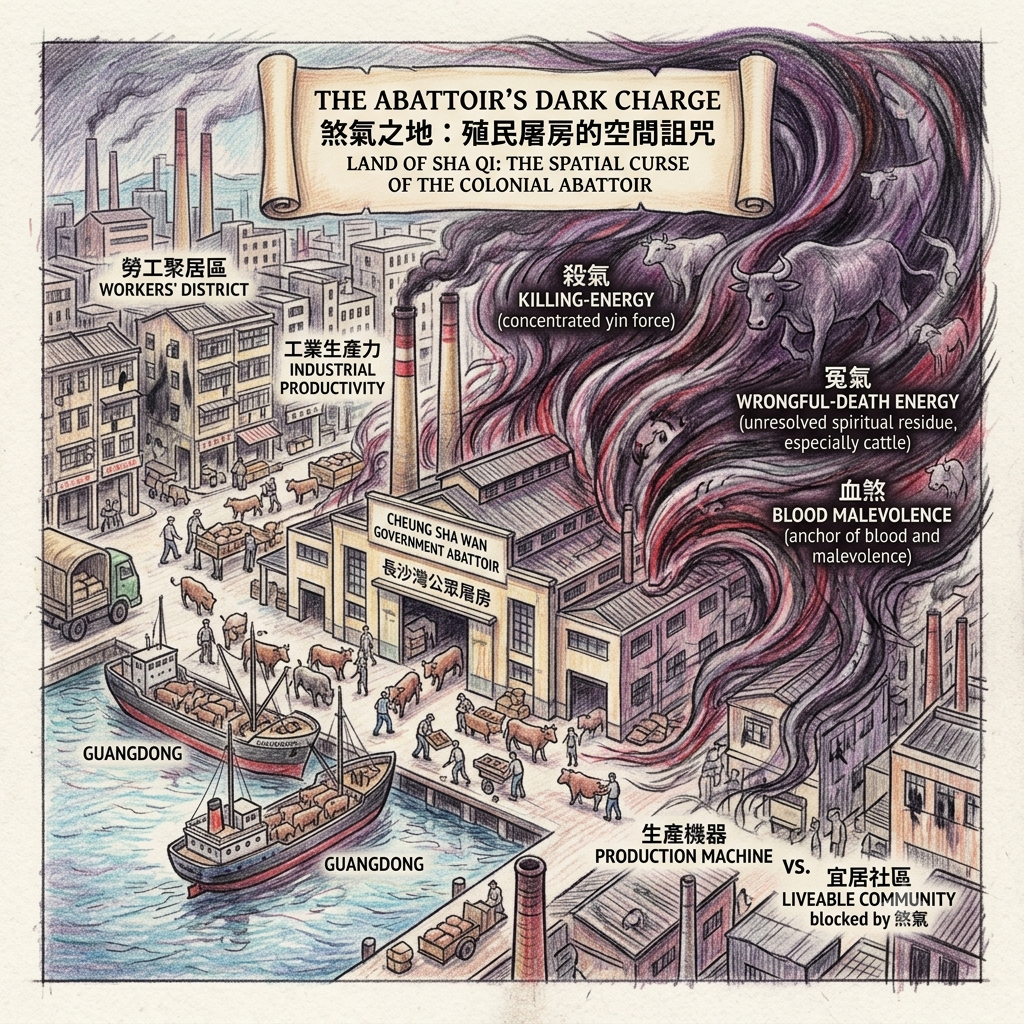
The government abattoir at Cheung Sha Wan operated at industrial scale for much of the twentieth century, processing the cattle, pigs, and poultry that fed Kowloon. Its location made complete sense within the colonial planning vocabulary: coastal access for livestock arriving by water from Guangdong, distance enough from the Central commercial district to mute the complaints, proximity to a working-class labour pool sufficient for the daily rhythms of industrial slaughter.
What the colonial administration did not know — or could not know, operating within its own epistemic framework — was that it was installing a maximum-intensity source of malevolent spatial energy (煞氣) at the centre of a location that the geomantic tradition would have identified as a natural qi-accumulator.
How Feng Shui Maps a Slaughterhouse
Feng shui is specific about what continuous large-scale killing does to a place. It generates killing-energy (殺氣): a concentrated accumulation of yin-dominant force produced by the termination of life in quantity. It generates wrongful-death energy (冤氣), particularly in the case of cattle — a category of animal that the Cantonese folk tradition regards with a specific moral sympathy derived from its contribution to agricultural labour, whose involuntary death accumulates as an unresolved spiritual residue in the surrounding space. And it generates blood malevolence (血煞), in which the physical material of slaughter acts as a concrete anchor for these forces in the immediate spatial vicinity.
The paradox that results is the defining characteristic of Cheung Sha Wan across its modern history: a place highly active in industrial production, persistently low in cultural prestige and residential desirability; a place that generates wealth without accumulating dignity. The geomantic tradition's explanation for this pattern — an accumulating site and a killing site superimposed on the same coordinates — is one that the district's conventional historiography has never articulated because it operates in a different epistemic register. But the pattern it describes is accurate.
IV. The Geography of Starvation: Black Christmas and Its Aftermath
25 December 1941. The Governor of Hong Kong surrendered. The date — Black Christmas — is one of those historical coordinates around which the air seems to change temperature once you know it, and does not change back.
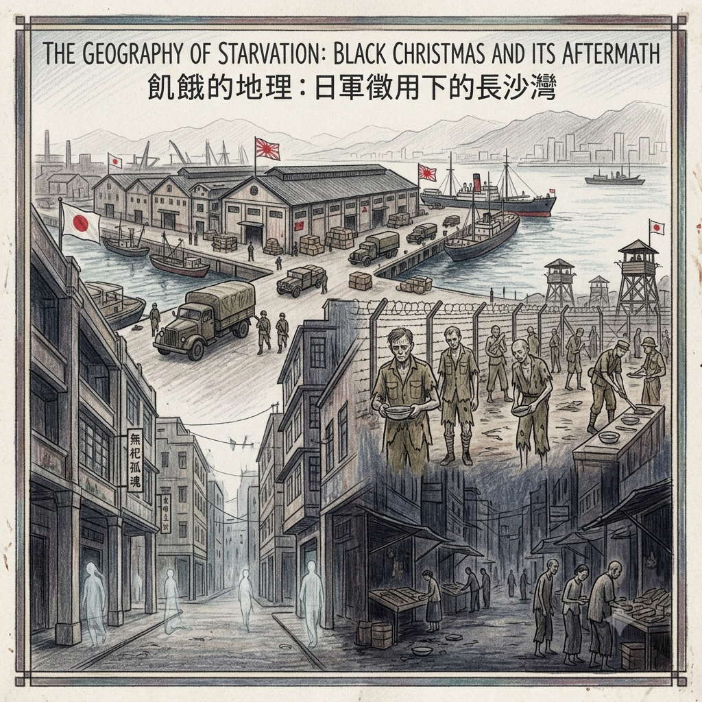
The Japanese military administration requisitioned Cheung Sha Wan's industrial facilities for logistics storage. The adjacent Sham Shui Po Camp — a prisoner-of-war compound within walking distance of the Cheung Sha Wan waterfront — became one of the most concentrated sites of wartime suffering in the territory's history. British, Canadian, and Indian military prisoners died there of diphtheria, dysentery, and beri-beri, their bodies depleted by the compounding effects of forced labour and a food rationing system in which the requisitioned abattoir's output moved through a strict military hierarchy, the civilian population positioned at the bottom.
The WWII Starvation Machine
Hong Kong's population fell from approximately 1.6 million to 600,000 during the occupation: the combined arithmetic of forced expulsion, flight, and death by starvation and disease. In the Cantonese folk cosmological system, mass death of this kind — sudden, violent, unaccompanied by proper funeral rites — generates an accumulation of unsacrificed wandering souls (無祀孤魂), a residue of unprocessed energy in the fabric of the place that persists until ritual attention addresses it.
Cheung Sha Wan carries no public memorial to this period. No monument. No named ritual ground. No annual ceremony of acknowledgement. In the geomantic reading, this absence is not neutral: it means the residue has been pressed deeper, not resolved. The silence that settles over certain corners of this district in the early morning — a silence different in quality from the ordinary quiet of an industrial street before business hours — may be one way of describing what an unaddressed landscape carries.
V. The Exile's Machine: Shanghai's Industrial Diaspora
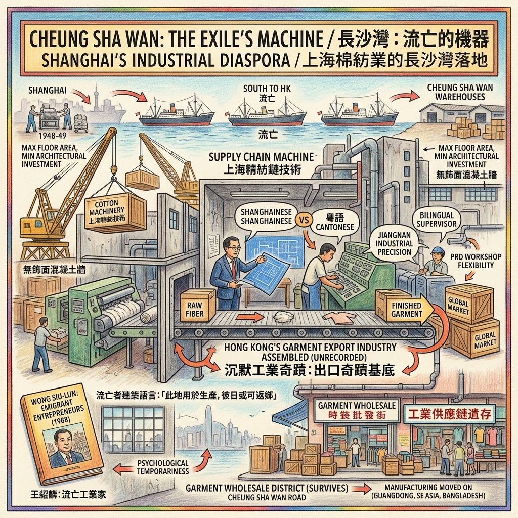
When the Shanghai industrialists left in 1948 and 1949 — some of them dismantling their machinery and shipping it south ahead of the advancing People's Liberation Army, others arriving with nothing but their knowledge and their contacts — they were carrying an entire industrial civilisation in their bodies: the accumulated expertise of operating cotton mills at scale, the knowledge of a supply chain from raw fibre to finished garment, the managerial culture of a factory system that had been sophisticated when Hong Kong was still a fishing village.
Cheung Sha Wan's cheap warehouse space received their machinery. The surrounding neighbourhood's pool of Cantonese-speaking refugees and workers received their demand for labour. What resulted was a social structure that has almost no public record and no monument: Shanghainese-speaking factory owners managing Cantonese-speaking workers, with bilingual supervisors translating not just language but two entirely different working cultures — the precision-oriented, large-scale industrial culture of Jiangnan manufacture, and the more flexible, family-workshop economy of the Pearl River Delta.
The Billionaire Refugees Who Built Hong Kong
Out of this friction, unrecorded, Hong Kong's garment export industry was assembled.
The factories they built are eloquent about their psychological condition. They are constructed fast, cheap, and pragmatic — maximum floor area, minimum architectural investment, no element that could be described as intended for permanence. No building designed for the long term looks like these structures. They were built by people who believed, in many cases for decades, that they were temporary. Wong Siu-lun's landmark study Emigrant Entrepreneurs (1988) documents how these Shanghai industrialists maintained their social networks, business associations, and cultural identity as a community in transit — producing for the global market while mentally positioned in a city they had not yet decided to stay in.
The garment wholesale district that survives on Cheung Sha Wan Road today is the ghost of that production machine: the form of an industrial supply chain persisting after the manufacturing itself has moved on — to Guangdong, to Southeast Asia, to Bangladesh — leaving behind the spatial infrastructure of distribution in a neighbourhood whose manufacturing purpose has evaporated.
The High-Dimensional Lens: Feng Shui Geomancy and the Cyclic Sealing
History Retrofitted Through the Cantonese Geomantic Framework
The tradition of feng shui is not mysticism in the pejorative sense. It is a system of observation developed across centuries, encoding patterns that practitioners understood as governing the long-term fortune of places and the communities that inhabited them. Applied to Cheung Sha Wan, it produces a reading that conventional urban history has never articulated — not because the reading is wrong, but because it operates in a different vocabulary.
The water-mouth (水口) is the point at which the dragon vein (龍脈) — the energy current running through a landscape's geological spine — enters a body of water. This point is, in the feng shui vocabulary, the most energetically sensitive location in a coastal geography: it is where accumulated energy either enters the sea and is lost, or is held in place by a sheltering bay formation, gathered and compounded rather than dissipated.
Cheung Sha Wan's original curved bay was this kind of holding formation. The reclamation that began in the 1890s and consolidated by the 1980s was, in geomantic terms, a water-mouth sealing: blocking the inlet, preventing the natural circulation that kept the site's energy in dynamic motion, forcing the compressed qi to express itself instead as cycles of intense productivity followed by rapid collapse.
This is the hidden pattern that conventional history has entirely missed: not that Cheung Sha Wan is special in being industrially productive, but that it has been industrially productive in a specific and recognisable way — through cycles of extraction that exhaust the substrate they depend on, requiring constant new interventions (new reclamation, new investment, new populations) to restart what the previous cycle has depleted. The pattern of the sealed water-mouth, running across a century and a half of urban development, describes exactly this dynamic.
Holographic Sensory Cue:
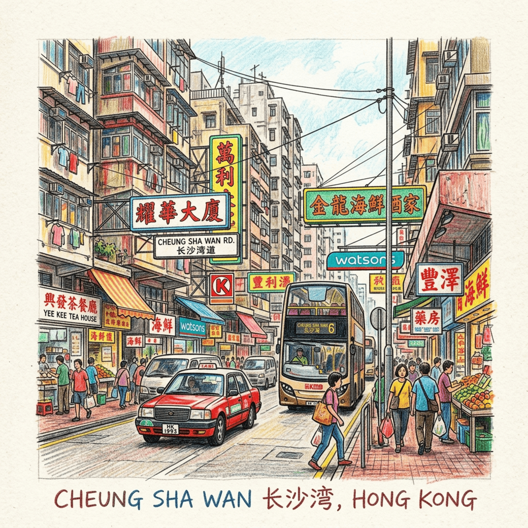
Six in the morning on Cheung Sha Wan Road. The industrial lift shudders under the weight of baled fabric — a sound like a held breath being slowly released. The smell is specific and layered: raw cotton first, then synthetic dye with its faint chemical sweetness, then the diesel of a delivery truck idling at the kerb, and underneath all of it — on the right day, with the wind coming off the harbour at exactly the right angle — a faint salinity without an obvious source, because the sea that produced it no longer exists at this address. The marble doorframes are worn smooth by decades of fabric bales passing through. The floor beneath your feet has a barely perceptible give that civil engineers would attribute to substrate compression: what is compressing is sand, the sand of the bay that the name Cheung Sha Wan still summons every morning, every time someone asks a driver to take them there, every time a child writes their home address for the first time.
Resonance Node
The ground floor of any surviving factory block on Cheung Sha Wan Road, built between 1960 and 1975.
Look for the floor level. It will be ten to thirty centimetres lower than the current street surface outside — a physical record of the settlement that happens when you build on compressed fill above a former seabed. The difference is small, but once noticed it cannot be unnoticed: you step down into these spaces, into the past as well as into the building.
The marble doorframes are polished smooth by decades of fabric bales being dragged past them. The electrical conduits run exposed along the ceilings, because these buildings were never designed to be beautiful or to last beyond their immediate economic function. The bolt-holes in the concrete floor mark where the machines were anchored — the spinning frames, the cutting tables, the industrial sewing machines operated by hands that are almost entirely absent from the historical record; workers whose names were never archived, whose contributions to the economic miracle of 1960s Hong Kong are acknowledged only in aggregate, never individually.
Stand on that floor. What you are standing on is time, compressed. Beneath you: compressed seabed. Beneath that: the sand of the bay that the name above the door still calls back, every day, without knowing it.
Conclusion: The Name as the Longest Mourning
Cities build on their own pasts without noticing. This is one of the things that makes cities possible — the capacity to produce and inhabit the present without being continuously interrupted by everything the present has displaced.
But sometimes the displacement survives in a name. Cheung Sha Wan names something that is no longer there. Every time it is spoken, the sandy bay performs a ghost's return: present in language, absent in matter, insisting on being counted even after being erased. This is not nostalgia — which looks backward with longing. It is something more structurally significant: evidence that place names carry a different kind of information than maps do, encoding not just location but the form of what was once at that location, and refusing — through the sheer conservatism of language — to update when the landscape does.
The Tanka threshold is sealed under concrete. The abattoir's accumulated killing-energy has no ritual address. The wartime dead have no monument. The Shanghai industrialists' descendants have moved on to other cities, other industries, other languages. And the bay — the long sandy bay, the dragon's water-mouth, the place where two realms approached each other across a strip of wet sand — remains exactly where it always was, beneath everything, called back by name ten thousand times a day.
That is what memory looks like in a city that does not stop to mourn.
If this kind of reading — the deep-time history beneath the visible surface of a place — is what you are looking for, subscribe to Historical Travel Stories for regular long-form historical walks through Hong Kong, Taiwan, and Japan.
Accessing the Physical Node
Getting There: Cheung Sha Wan MTR Station (Tsuen Wan Line) places you directly on Cheung Sha Wan Road. All locations described in this article are accessible on foot from the station exits.
Where to Stay: Use Sham Shui Po as your base — a neighbourhood that offers an increasing number of boutique guesthouses and the dense, ungentrified urban fabric of post-war Hong Kong's most working-class district. Its position between Cheung Sha Wan, Lai Chi Kok, and the Kowloon northern industrial corridor makes it the optimal anchor for a sustained deep-time western Kowloon itinerary.
On the Ground: Walk Cheung Sha Wan Road from the MTR station toward the waterfront, attending to factory-block architecture, street widths calibrated for freight traffic, the heavy drainage channels running along the kerbs, and the gradual transition from wholesale market to residential tower. Each shift is a layer in the stratigraphy underfoot. Carry historical survey maps of the 1900s and 1950s for direct comparison — the distance between the old coastline and where you stand is the most concrete measure of what has been buried here.
💡 Here is the English version of the visible Q&A block designed specifically for English-speaking readers.
The questions are crafted based on natural search queries an international traveler, expat, or history enthusiast would type into Google or AI assistants (using terms like "history," "origin," "things to do," and "Lei Cheng Uk Han Tomb" rather than literal translations of Cantonese idioms).
The answers are tailored to be 100–150 words each, offering rich context while remaining clear and directly indexable by search engines and AI models.
💡 Frequently Asked Questions: Cheung Sha Wan History & Attractions
Q1: What is the history of Cheung Sha Wan, and how did it get its name? A: The name "Cheung Sha Wan" literally translates to "Long Sand Bay" in Cantonese, referring to the long, curving sandy beach that shaped the coastline before major land reclamation in the 1950s. Originally a tranquil rural area inhabited by Hakka farming and fishing communities (such as Cheung Sha Wan Village and So Uk Village), the neighborhood underwent rapid urbanization in the mid-20th century. It transformed into one of Hong Kong's major light industrial hubs, famed for textile and garment manufacturing. Today, Cheung Sha Wan has evolved again into a vibrant modern district, seamlessly blending creative hubs, contemporary commercial towers, and iconic public housing estates while retaining its rich heritage.
Q2: How was the Lei Cheng Uk Han Tomb discovered, and why is it historically important? A: The Lei Cheng Uk Han Tomb was unexpectedly discovered in 1955 during slope leveling operations for the construction of a public housing estate. A subsequent archaeological excavation revealed a four-chambered brick tomb dating back to the Eastern Han Dynasty (25–220 AD). Archaeologists recovered 58 preserved artifacts, including bronze vessels, pottery models of houses, granaries, and cooking stoves. Crucially, inscriptions on the tomb bricks reading "Da Ji Fan Yu" ("Great Good Fortune for Panyu") proved that the region around deep-water Kowloon was under the formal administrative rule of the Chinese imperial court two millennia ago, offering concrete historical evidence of Hong Kong’s ancient lineage.
Q3: What are the top historic landmarks and cultural attractions to visit in Cheung Sha Wan? A: Cheung Sha Wan offers a fascinating journey through Hong Kong’s ancient and modern history across three key landmarks. First, the Lei Cheng Uk Han Tomb Museum allows visitors to view a preserved two-thousand-year-old Han Dynasty tomb up close. Second, the historic So Uk Estate showcases classic post-war public housing architecture, including preserved heritage structures like the Swallow House, reflecting the collective memory of working-class families. Finally, D2 Place—a vibrant cultural complex transformed from a former industrial building—highlights the neighborhood’s modern rebirth from a mid-century textile manufacturing base into a modern hub for creative arts, local design, and weekend markets.
Reference and Further reading
First layer – Main sources of literature and institutions:
- 香港政府工務局歷年報告(Public Works Department Annual Reports)—歷次填海行政記錄
- 英國殖民地部檔案(Colonial Office Records, CO 129 Series),英國國家檔案館(TNA, Kew)
- 香港地政總署歷史地籍圖(Lands Department Survey Office Survey Maps)—比對19世紀末至21世紀初岸線變化的最直接原始資料
- 香港屋宇建設委員會報告(Housing Authority Historical Reports)—水上人安置計劃行政記錄
- 漁農處(Marine Department / Fisheries Department)歷年報告中的疍家船隻統計
- 殖民地政府普查資料(Census Reports)—1950-1970年代,涉及水上人口分布資料
- 香港公共衛生局及食物環境衛生署歷史年報(Public Health Department / FEHD Annual Reports)
- 醫務衛生署(Medical and Health Department)早期屠房衛生督察報告
- 工務局圖則(屠房建築圖則,政府檔案處藏)
- 英國國家檔案館(TNA, Kew)殖民地部日治期間文件(CO 980, CO 129系列)
- 帝國戰爭博物館(IWM):英軍及加拿大軍戰俘日記、回憶錄
- 日本國立公文書館:軍政廳食物管制及行政命令文書(建議進一步查證可及性)
- 香港政府檔案處:戰後損失調查及佔領期間行政文件
- 香港工業總會(Federation of Hong Kong Industries)歷史檔案
- 香港貿易局(Trade Department)1950-1970年代出口統計
- 公司註冊處(Companies Registry)歷史工商登記記錄(上海系紡織廠登記資料)
The second layer – secondary academic materials:
- 夏思義(Patrick Hase):香港九龍地區歷史地理研究,收錄於《香港文化與社會》等學術文集
- 何佩然:關於香港填海史的研究著作(建議進一步查證確切書目)
- Ernest J. Eitel:Europe in China (1895)—早期殖民者對香港風水實踐的觀察,含九龍地區地形描述
- Barbara E. Ward:Floating Villages: The Boat People of Hong Kong 及相關社會人類學田野調查(1950-60年代)——已知最詳細的香港疍家學術記錄之一
- James Hayes:The Hong Kong Region, 1850-1911: Institutions and Leadership in Town and Countryside(涉及本地傳統社群結構)
- 蔡志祥:疍家及香港水上人民俗研究
- 廖迪生:香港天后信仰與沿海社群研究
- Elizabeth Sinn:香港殖民地城市規劃與工業選址研究(Power and Charity: The Early History of the Tung Wah Hospital, Hong Kong 等著作中的相關背景)
- John Carroll:A Concise History of Hong Kong(相關工業基礎設施史段落)
- Ole Bruun:An Introduction to Feng Shui(煞氣地理的分析框架)
- Philip Snow:The Fall of Hong Kong: Britain, China and the Japanese Occupation (2003)——英語學術著作中最重要的綜合研究之一
- Tony Banham:Not the Slightest Chance: The Defence of Hong Kong, 1941 及相關戰俘生存研究
- 鄺智文、蔡耀倫:《孤獨前哨——太平洋戰爭中的香港戰役》(繁體中文學術著作;建議進一步查證出版資訊)
- Gwen Dew:Prisoner of the Japs (1943)——早期平民戰俘第一手記錄(含深水埗戰俘營相關描述)
- Wong Siu-lun(王紹麟):Emigrant Entrepreneurs: Shanghai Industrialists in Hong Kong (Oxford University Press, 1988) —— 本主題最重要的直接學術參考文獻,詳細研究上海工業家在香港的社會再生產
- Linda Johnson:關於上海工業資本流亡史的研究背景
- Ezra F. Vogel:One Step Ahead in China: Guangdong Under Reform(香港-廣東工業史背景)
- 張洪:香港棉紡業的經濟史研究(建議進一步查證確切出版信息)
Third layer – Supplementary information:
- 香港口述歷史資料庫(水上人社群訪談,香港歷史博物館館藏)
- 香港大學HK Memory Project相關水上人影像及音頻材料
- 香港歷史博物館藏日治時期倖存者訪談錄音
- 香港工業家口述歷史(香港科技大學人文學部及HK Memory Project整理部分)
- 上海工業家後代回憶錄(部分在港台出版)
Historical gap:
- There is a lack of specialized academic research on the history of land reclamation in Cheung Sha Wan; relevant records are scattered across engineering and technical documents rather than historical analyses.
- Almost no written records remain regarding the local toponymy prior to reclamation (particularly the names used by the Tanka people for these waters).
- Historical documentation regarding the Cheung Sha Wan bathing beach in the 1930s is extremely scarce (suggested further verification of primary sources: historical photographs in Hong Kong museum collections; early reports on Cheung Sha Wan in newspapers such as Kung Sheung Daily News and the South China Morning Post).
- Individual narratives of the Cheung Sha Wan Tanka community are almost entirely absent from mainstream Hong Kong history; existing research focuses broadly on the "history of policies concerning boat dwellers," lacking site-specific perspectives from within the community itself.
- Written records of Tanka cosmology or spiritual geography are extremely sparse (as their knowledge tradition is oral), placing local knowledge regarding the spiritual geography of the Cheung Sha Wan waters at risk of permanent loss.
- Suggested further verification of primary sources: original Tanka documents held by the University of Hong Kong and Chinese University of Hong Kong libraries; administrative files concerning the resettlement of boat dwellers in Cheung Sha Wan held by the Government Records Service.
- There is currently no systematic academic record of the complete operational history of the Cheung Sha Wan Abattoir (including its exact establishment date, peak slaughter volume, closure date, and precise location).
- The social history of the abattoir workforce—particularly the butchers recruited from Guangdong Province during the late Qing and early Republican periods—is completely missing.
- Suggested further verification of primary sources: operational documents and maps related to the abattoir held by the Government Records Service; sections on the Cheung Sha Wan Abattoir in the annual reports of Health Inspectors.
- There is a lack of dedicated, site-specific academic study regarding the functions of Cheung Sha Wan (as a distinct location rather than part of the broader Sham Shui Po district) during the Japanese occupation.
- Records regarding the daily survival of local civilians (as opposed to prisoners of war) in Cheung Sha Wan during the Japanese occupation are extremely scarce.
- Archives of the Japanese Military Administration remain difficult for most researchers to access.
- Suggested further verification of primary sources: works by WWII historians such as Philip Snow or Tony... Data regarding the specific geographical coordinates of Cheung Sha Wan referenced in Banham’s research.
- There is a lack of granular research on the history of Shanghai-style industrial operations specifically located in Cheung Sha Wan (existing studies treat "Hong Kong" as a monolithic entity rather than examining the street or factory-building level).
- Individual narratives of factory workers—particularly female workers, who constituted the primary workforce in garment factories—are sorely lacking; this represents one of the most significant historiographical gaps in the history of Hong Kong’s industry.
- Cross-cultural studies on the industrial cultural exchange between Shanghai and Hong Kong (such as the day-to-day clashes between Shanghai management culture and Cantonese worker culture) are virtually non-existent.
- It is recommended to further verify primary archival sources, specifically: the list of Cheung Sha Wan manufacturers cited in Wang Shaolin’s research, and the industrial and commercial yearbooks (dating from the 1950s to the 1970s) held in the Hong Kong Collection at the Hong Kong Public Libraries.
 Lawrence
 Lawrence
 Lawrence
The sources for this article include primary historical records, academic papers, and public records from various levels of administrative bodies, with a commitment to historical accuracy; instances requiring further verification against primary archival materials have been noted in the text. Last updated: July 2026.