維多利亞港:一座尚未被承認的龍脈水口
維多利亞港表面上是航運要道,實則是南中國風水傳統中最重要的「水口」之一。本文以歷史為經,以龍脈與天后信仰為緯,重新丈量這片海域承載的記憶重量。

 Lawrence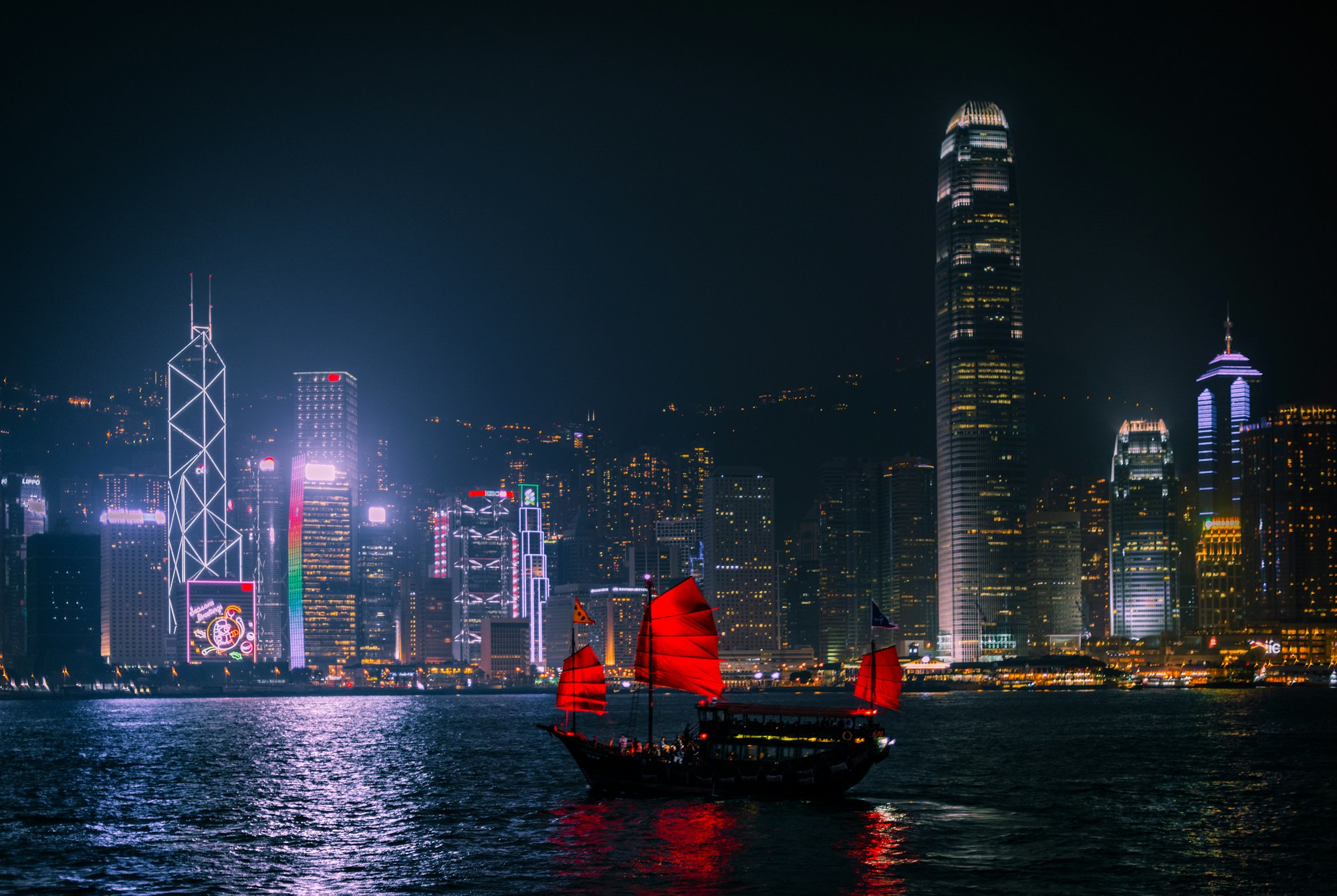
維多利亞港從來不是一道單純的地理縫隙。維多利亞港是九龍與香港島兩條山脈伸展至海邊的終點,是南中國風水傳統中所謂「水口」與「明堂」交會之處,也是宋室最後的喘息之地、疍家世代棲居的浮動家園、以及一場延續近兩個世紀、以工程與法律為語言進行的主權角力現場。本文嘗試以港島與九龍居民世代相傳的地理宇宙觀——風水、龍脈、天后信仰——重新閱讀這片海域,而非套用任何外來的神祕學框架。
引子:海面之下的重量
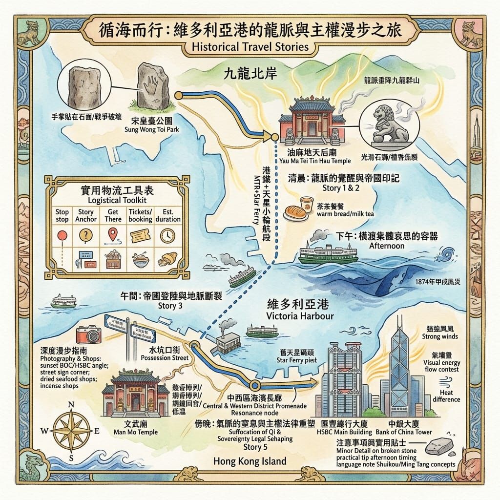
站在中環海濱,望向對岸尖沙咀的燈火,大多數人所見的是一條交通水道:渡輪、貨櫃船、遊艇往來其上,日復一日。然而在南中國風水傳統的語彙裡,這片被獅子山與太平山兩條山脈環抱的水域,是一個「明堂」——氣脈匯聚、尚未消散於大海之前的最後容器。維多利亞港曾經承載一個王朝的覆亡、一整個海上民族的信仰地圖、以及殖民與後殖民政權接連不斷的填海主張。海面看似平靜,其下卻壓著一層又一層未被言明的歷史重量。
第一章:九龍龍脈與宋室的最後呼吸
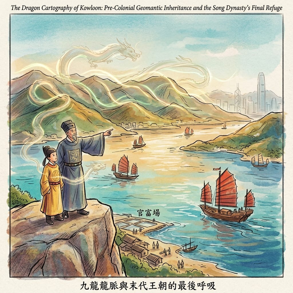
十三世紀末,南宋朝廷在蒙古鐵騎的追迫下節節南退。西元一二七七至一二七八年間,年幼的宋帝昺與殘存的朝臣、軍民輾轉抵達九龍一帶,暫居於當時稱為「官富場」的鹽田行政區。相傳幼帝曾駐蹕於俯瞰海港的巨大花崗岩巨石之上,該處其後得名「宋王臺」。翌年,宋室在崖門海戰中全軍覆沒,丞相陸秀夫背負幼帝投海殉國,數萬軍民隨之蹈海——這是中國歷史上罕見的集體殉國場面。
九龍留下的,唯有一塊刻着「宋王臺」三字的巨石,以及一則流傳甚廣的傳說:幼帝環顧九座山巒,隨行者答曰「連陛下亦是一龍,故稱九龍」。此說在史料上無法確證,卻作為一則集體地理記憶,一直流傳至今——牠所記錄的,並非傳記式的史實,而是一種將山巒讀作龍脈、由天子親自「確認」土地宇宙身分的儀式性動作。日佔時期(一九四一至一九四五年),這塊巨石被拆毀,石料被用作擴建啟德機場的填料,僅餘約一點五米高的殘塊,現存於土瓜灣宋皇臺花園。一次帝國的崩解記憶,被拆去餵養另一次帝國的機場擴張——這層歷史反諷,無需任何神祕學的加工,本身已足夠完整。
The Boy Who Named Nine Dragons
在風水傳統的解讀裡,龍脈是承載大地之氣、由祖山向南方大海延伸的脈絡;龍formation的終點,是牠「飲水」之處——即水體與陸地的交界。九龍群山的多條龍脈匯聚於維多利亞港北岸,是為「龍口」;太平山則自南岸提供對應的formation。兩相呼應,海港遂成為「明堂」——兩條龍脈懷抱之間、氣脈匯聚而未散之地。宋帝的命名之舉,在這個傳統的內部邏輯中,帶有一種「確認」的意義:天子的地理承認,將這片土地的宇宙身分,鎖定於王朝覆亡最劇烈的一刻。
全息感官提示:花崗岩表面在指尖下呈現粗礪的顆粒感,午後陽光斜照時泛出近乎赭紅的色澤;附近土瓜灣道的車流聲、大廈冷氣機的低鳴、以及地底觀塘綫列車駛過時傳來的輕微震動,構成了石頭沉默存在的當代聲景——一種截然不同時代的質感,被封存於當下之中。
第二章:疍家失落的海洋——被抹去的神聖地理
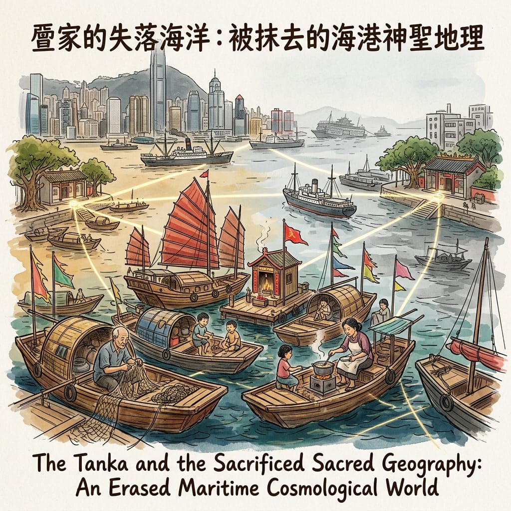
在英國殖民之前,維多利亞港的主要常住人口,並非陸上居民,而是疍家——一支世代以海為家的族群。他們的浮動社群並非臨時停泊,而是一整套永久的居住與經濟生態:多代同堂的家庭棲身於舢舨與漁船之上,浮動食肆、浮動市集、浮動天后神壇散佈其間。對疍家而言,海港不是聚落的背景,海港本身就是聚落。清代法制長期將疍民列為另冊,禁止其上岸定居、與陸上族群通婚、參與科舉。英國殖民雖然在法律上廢除了這些限制,卻以另一種排斥邏輯取而代之——將疍家定性為衛生隱患與社會問題,而非海港空間秩序的原初守護者。
二十世紀以降,疍家的浮動聚落被逐步壓縮至銅鑼灣、香港仔、油麻地等指定避風塘;自一九五零年代起,政府的徙置政策更將避風塘社群遷入陸上公共屋邨,一種延續數代的水上生活方式,自此實質終結。如今僅存香港仔一帶尚有零星的水上人家,而象徵浮動食肆傳統最華麗的珍寶王國,亦已於二零二二年拖航途中沉沒——商業式微、殖民遺產與物理消失三者交匯於同一事件,其象徵意味不言而喻。
The Erased Floating City Of Hong Kong
疍家的天后信仰,將天后理解為駐守於灣口、岬角、潮汐水道交匯處的具體地理性守護者,而非抽象的神格。環繞維多利亞港邊緣分佈的天后廟——油麻地天后廟、香港仔天后廟、以及大廟灣那座刻有南宋咸淳二年(一二六六年)題記的古廟——構成一幅前殖民時代的海港聖境地圖。饒有意味的是,本地陸上族群同時以風水的語彙,將同一批廟址解讀為「水口」能量的鎮守之地。兩套詮釋系統,收斂於同一批地點之上——這暗示的,或許是某種底層的宇宙觀共通性,亦或許只是同一批地理上「特殊」的地點,被不同族群各自映射到平行卻分立的神聖語彙之中。
共鳴節點:香港仔避風塘。平靜的水面被發電機的低鳴與柴油混雜海水的氣味打破,岸邊尚有零星的水上人家棲身其中,是這段幾近完全消失的水上文明,目前唯一仍可親身觸及的殘餘現場。
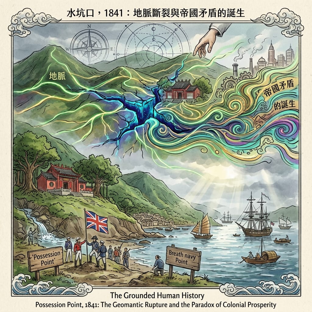
第三章:水坑口,一八四一——龍脈斷裂與帝國矛盾的誕生
一八四一年一月二十六日,英國海軍軍官砵甸乍麾下的貝爾徹船長,率領登陸隊伍在香港島西北岸一處名為「水坑口」的地點升起米字旗,正式宣告佔領。這個地名,本身指向一道淡水泉眼的出口——在古典風水語彙中,「水口」正是一個地理系統中最關鍵的門檻:內陸積聚的氣脈,經此排入大海。淡水與潮汐海水在同一點交會,構成雙重水口,是這個框架下能量最為集中、亦最為不穩定的節點。英軍選址於此,出於實際考量——岸線平緩、淡水充足、鄰近既有聚落;然而他們選中的,恰恰是港島北岸風水能量最為集中的地點之一,這是巧合,還是某種更深層的地理必然,史料未有定論。
The Flag That Cracked The Earth
登陸點西南方約二百米處山坡上,是供奉文昌帝君與武帝的文武廟——文武並祀於邊陲聚落的制高位置,在風水傳統中,正是以文武雙神鎮守爭議領土的典型佈局。曾在香港從事田野考察的殖民地觀察者歐德理,於一八七三年出版《風水》一書,記錄了本地華人對殖民地建設的一套耐人尋味的詮釋:殖民地的建設,並未消解海港原有的風水能量,反而將牠自舊有格局中釋放出來,使能量得以流經新開闢的渠道——而殖民地其後異乎尋常的商業繁榮,在這套詮釋裡,正是被釋放的能量理所當然的結果。這並非事後附會的神秘敘事,而是確有其事的社會史事實:當時的華人社群,確實以自身的宇宙觀語彙,消化了殖民地帶來的空間斷裂,既不全然抗拒,亦不全然放棄自身的詮釋框架。
第四章:甲戌風災——海港作為集體哀思的容器
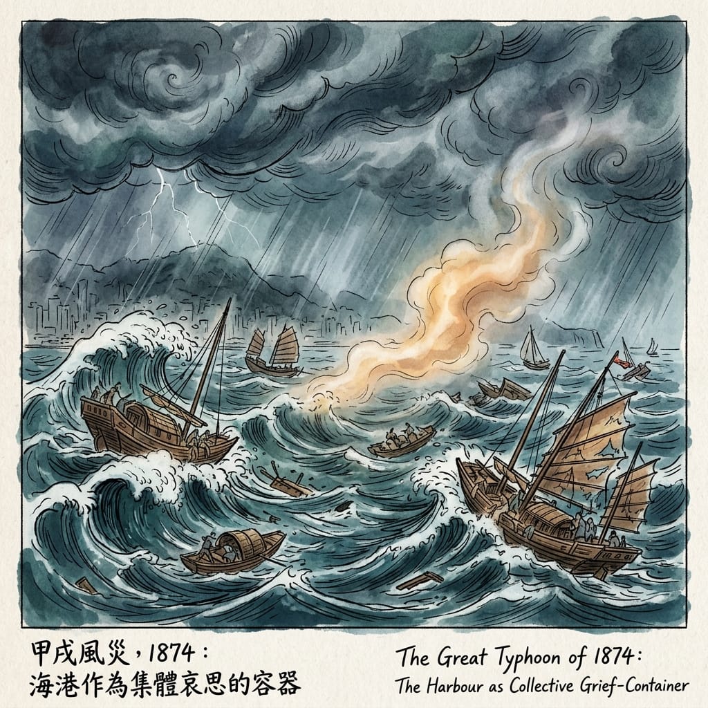
一八七四年九月二十二日凌晨,一場威力空前的颱風正面吹襲香港。當時港督堅尼地治下的殖民地已建立三十三年,海港內密集停泊着商船、皇家海軍艦艇、華南沿岸帆船,以及數量龐大的疍家舢舨。這場風災造成的死亡人數,據殖民地藍皮書估計介乎一千九百至逾二千五百人之間,絕大多數死者為疍家水上居民——他們的舢舨,是風災路徑上最為脆弱的載體。
在天后信仰的框架裡,如此嚴重的風災,是人、神、海三者之間關係承受過度壓力的訊號,而非對特定儀式過失的懲罰;適切的回應,包括加倍的廟宇奉祀與集體祭祀儀式,以修補這道斷裂的神聖契約。然而,這場風災還有一層更為根本的歷史意涵:疍家之所以死亡人數不成比例地高,並非源於宇宙失衡,而是源於殖民地空間佈局,將他們集中安置於毫無屏障的開放水域,而陸上庇護則僅供殖民地居民所用。風災以死亡的地理分佈,揭示了殖民風險分配的社會地理。此後,香港仔避風塘的正式化建設,某程度上正是這場死亡教訓的行政後果——那道防波堤所圍出的幾何形狀,是以一八七四年的死亡代價寫成的空間論證。
The Invisible Mass Grave Of Victoria Harbour
海港的水面,至今沒有任何紀念這場災難的標記。天星小輪往來中環與尖沙咀的航程中,乘客所經過的正是當年風災衝擊最劇的水域正中央——航程約八分鐘,水面與海港其他任何一段毫無二致。這種缺席本身,或許正是最需要被指出的一點:海港以無記號的方式,承載着這場大規模死亡,牠的表面與周遭的商業地理毫無分別。
全息感官提示:下層甲板的柴油廢氣氣味、中等風勢下濺起的海水鹹味、維多利亞港特有的青灰色混濁水色——懸浮沉積物、潮汐混合與亞熱帶光線折射交織而成——以及船身在跨海航跡中規律起伏的震動,構成這段航程唯一可供辨識的物理座標。
第五章:填海戰爭——龍脈的窒息與宇宙主權的爭奪
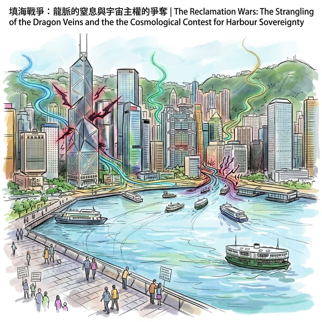
自一八五零年代港島中環海旁的首次填海工程起,維多利亞港的收窄工程,歷經英國殖民管治、日佔時期、戰後港英政府,以至九七後的特區政府,五個相繼的管治政權,從未間斷。海港最狹窄的通航點闊度,由一八四一年前後約二千二百米,收窄至二千年代初期中環至尖沙咀之間不足一千米。
一九九零年代起,一場由民間發起的護港運動——以「保護海港協會」為核心——推動了一九九七年《保護海港條例》的立法,確立了反對填海的法律推定。二零零四年,終審法院在「城市規劃委員會訴保護海港協會」一案中,確立了填海必須證明具備「凌駕性公眾需要」的法律測試,方能推翻反對填海的強烈推定——此一法律框架,在普通法世界裡幾近絕無僅有。而在整個公眾諮詢過程中,反對填海的論據,並不僅限於環境與交通考量:大量市民與風水從業者,直接向城市規劃委員會提出風水論證——填海將水轉化為土地,破壞了海港「明堂」蓄積氣脈的能力,亦削弱了五行之中「水」所象徵的財運與流通之氣。這是風水傳統與普通法城市規劃程序的正式交會,恐怕是全球獨一無二的案例。
How Land Reclamation Strangles Dragon Veins
同一時期,滙豐銀行總行大廈、中銀大廈、長江集團中心三座矗立於海港北岸的地標建築,亦各自捲入風水爭議之中——中銀大廈的三角棱柱結構,被廣泛認為向鄰近的滙豐大廈與港督府方向釋放「煞氣」,港督衛奕信據稱因此下令在港督府花園栽種柳樹,作為化解之法。這些建築物的幾何形態,彼此之間形成一場以建築語彙表達的空間角力——每一道立面的角度,亦是一種風水立場的宣示。
共鳴節點:中西區海濱長廊,天星碼頭旁。站在此處,海港收窄的程度肉眼可辨——對岸尖沙咀的建築物,已近得毋須任何輔助視力即可辨清細部。舊照片顯示,同一視角在二十世紀初所見的水面,闊度足足是今日的兩倍。
終章:水口主權場——被忽略的隱藏格局
將以上五個歷史片段並置閱讀,浮現的並非零散的巧合,而是一套延續一百八十年的格局:維多利亞港是一個「水口主權場」——一個承載宇宙能量的地理門檻,歷代管治者透過改變海港的物理形態,表達其對這片土地的主權宣示,構成一場以工程語言進行、迄今未曾間斷的宇宙角力。
傳統史學將每一次填海、每一次建築爭議,理解為商業、防務、房屋、交通需求的功能性回應——這固然準確,卻並非完整的解釋。史學家甚少追問:為何維多利亞港會一再成為主權宣示行為的specific場址,而非僅僅是功能性基建的承受者?為何海港的保護問題,會在二千年代催生出一套全球罕見的普通法先例——一套部分以風水能量語彙,在公共論述中被闡述的法律框架?二零零零年代初的護港法律行動,或許正是風水框架首度局部編入成文法律的時刻——以普通法的語彙,對這片海域的宇宙身分,作出一次遲來的重新確認。
水口的爭奪,從未真正終結。牠仍在繼續。
在這座城市不斷向前推進的每一個世代裡,海港記憶或許才是真正無法被填平的資產——牠不需要工程,不需要法律,只需要有人願意在渡輪甲板上,多站片刻,聽一聽水聲之下,那些沒有留下名字的人們,曾經如何生活、如何信仰、如何死去。若你願意讓這些記憶繼續流傳,歡迎訂閱我們的通訊,與我們一起,循海岸線一步一步,重新丈量這座城市的靈魂重量。
抵達實體節點
如何前往:宋皇臺花園可乘港鐵屯馬綫至宋皇臺站,步行數分鐘即達;油麻地天后廟位於廟街,港鐵油麻地站步行可至;香港仔避風塘可自香港仔巴士總站步行至海旁,亦可於避風塘乘搭街渡,近距離觀察現存水上人家;水坑口街位於上環,港鐵上環站步行約十分鐘;中西區海濱長廊緊鄰中環天星碼頭,港鐵中環站步行即達。
落腳之處:若欲以步行的節奏,循海港邊緣逐一探訪上述節點,建議選擇中環或上環一帶的酒店作為據點,方便日與夜分別體驗海濱長廊與渡輪航程的不同氛圍。
導覽建議:部分本地文化機構與導賞團體,提供以海港歷史與民間信仰為主題的步行導賞,能夠深入講解天后廟宇的儀式細節與宋王臺一帶的地方掌故,適合希望更深入理解這片海域的旅人。
💡維多利亞港都市傳說與地緣歷史 FAQ
Q1:維多利亞港真的有「九龍封印」風水陣嗎?為何這裡常有靈異風水傳聞?
解密答案:維多利亞港的風水傳聞源於其地形結構與歷史開闢。「九龍」得名自九龍半島九座山脈(龍脈)延伸入海的地理特徵。殖民時期興建維港兩岸工程時,港英政府的填海與建設破壞了原始山體地形,進而在民間衍生出「割斷龍脈」、「水聚天心」的風水怪談。實際上,維港地形屬天然深水港與峽灣沉降地形,水流急促且地理位處珠江口咽喉,古代海難事件與舊時漁民的海洋崇拜(如天后信仰),疊加近代都市建設帶來的地貌巨變,共同構成了維多利亞港獨特的風水與都市傳說文化基礎。
Q2:維多利亞港夜間常傳出「幽靈船」或「水鬼抓交替」傳聞,背後的歷史由來是什麼?
解密答案:維多利亞港夜間靈異傳聞的背後,實為香港作為開埠港口的慘烈海難史與二戰歷史痕跡。1941年香港保衛戰期間及日佔時期,維港海域遭受頻繁空襲與沉船事件,加之早年航道狹窄且潮差顯著,引發多宗重大海難與溺水事故。舊時水上人家(蜑家漁民)對神秘水域形成「祭水幽」與忌諱民俗。現代科學與歷史考據證實,所謂「幽靈船」與水鬼幻象,多為夜間海霧折射、強烈潮汐湧浪形成的視覺錯覺,以及民間對二戰沉船記憶與水難事故的集體 trauma 符號化演變。
Q3:維多利亞港沿岸(如中環)的「商業大樓風水大戰」是真的嗎?背後有何歷史與地緣背景?
解密答案:中環維港沿岸如中銀大廈與滙豐總行的「風水大戰」傳聞,本質上是現代建築美學、西方金融資本與嶺南風水民俗交融的產物。中銀大廈的刀片狀鋼構建築由貝聿銘設計,結構源自竹節高升概念,但在傳統民俗中被解讀為「沖煞」維港與周邊機構。港英時期的地緣政治張力與中英談判背景,使得這座建築的幾何結構被民間賦予了濃厚的政治風水寓意。這種將建築結構力學與風水幾何學相結合的解讀,反映了香港在特定歷史轉折期,大眾利用民俗心理緩解社會焦慮的地緣文化現象。
參考資料及延伸閱讀
第一層・官方/制度性原始來源
- 《宋史》 (Song History / Official Dynastic History): accounts of the southern retreat and the Yamen battle
- 《新安縣志》 (Xin'an County Gazetteer): various editions (清康熙, 清嘉慶); local accounts of the Song court's presence in the Kowloon / Guanfu area
- Hong Kong Antiquities and Monuments Office (AMO): Sung Wong Toi site documentation, boulder preservation records
- Hong Kong Public Records Office (HKPRO): early colonial survey maps documenting the boulder's location and condition
- Hong Kong AMO: Joss House Bay Tin Hau Temple inscription (1266 CE) — documentation and protection records
- Hong Kong Public Records Office: Colonial Secretariat files on typhoon shelter regulations and Tanka community resettlement programmes (1950s–1970s)
- Hong Kong Government Annual Reports: records of Aberdeen and Yau Ma Tei harbour communities
- Belcher, Captain Edward. Narrative of a Voyage Round the World, Performed in Her Majesty's Ship Sulphur, During the Years 1836–1842. London: Henry Colburn, 1843. (Belcher's own account of the Possession Point landing — primary source)
- Hong Kong Public Records Office (HKPRO), CO 129 series: Colonial Office correspondence on the establishment of the colony, 1841–1843; early petitions from Chinese community leaders
- Early Hong Kong Government Gazette: ordinances governing land use and building regulations from 1844 onward
- Hong Kong Government Blue Book, 1874–1875: official records of the typhoon's impact, vessel losses, and mortality estimates
- Hong Kong Government Annual Report, 1874: typhoon shelter development recommendations
- Hong Kong Public Records Office (HKPRO): Harbour Master correspondence relating to the 1874 typhoon; Colonial Secretariat files on typhoon shelter development
- Protection of the Harbour Ordinance (香港法例第 531 章): Legislative Council records, Hansard debates; Court of Final Appeal ruling (Town Planning Board v Society for the Protection of the Harbour Ltd., 2004 — verify citation at www.hklii.hk)
- Hong Kong Planning Department: Urban Design Guidelines; Visual Corridor Studies; Air Ventilation Assessment Guidelines
- Town Planning Board: public consultation submissions records (1990s–2000s) relating to Central and Wan Chai reclamation — a systematically underutilised primary source corpus that contains formulations of the geomantic public-interest argument
第二層・學術性二級來源
- 羅香林. 《一八四二年以前之香港及其對外交通》. 香港: 中國學社, 1959. (Foundational text on pre-colonial Hong Kong history and the Song Dynasty connection; essential)
- 蕭國健. 《香港歷史與社會》. 香港: 教育出版社, 1994.
- Carroll, John M. A Concise History of Hong Kong. Lanham: Rowman & Littlefield, 2007. (Chapter on pre-colonial history)
- Faure, David. "The Lineage as a Cultural Invention: The Case of the Pearl River Delta." Modern China 15, no. 1 (1989): 4–36.
- Anderson, E.N. The Floating World of Castle Peak Bay: Anthropological Studies of the Chinese in Hong Kong. Washington: American Anthropological Association, 1970. (Primary ethnographic source for Tanka boat-people communities in the Hong Kong region)
- Ward, Barbara E. "Varieties of the Conscious Model: The Fishermen of South China." In The Relevance of Models for Social Anthropology, edited by M. Banton, 113–137. London: Tavistock, 1965.
- 蕭鳳霞 (Helen F. Siu) and 科大衛 (David Faure), eds. Down to Earth: The Territorial Bond in South China. Stanford: Stanford University Press, 1995.
- Lang, Graeme and Lars Ragvald. The Rise of a Refugee God: Hong Kong's Wong Tai Sin. Oxford: Oxford University Press, 1993. (Contextual material on Hong Kong maritime folk religion)
- Eitel, Ernest J. Feng-Shui, or the Rudiments of Natural Science in China. London: Trübner & Co., 1873. (Critical primary-secondary document: written within the colonial period by a Hong Kong-based field observer; contains documented Chinese geomantic interpretations of colonial developments)
- Munn, Christopher. Anglo-China: Chinese People and British Rule in Hong Kong, 1841–1880. Richmond: Curzon, 2001. (The most thorough account of the social history of early colonial Hong Kong)
- 蔡榮芳. 《香港人之香港史 1841–1945》. 香港: 牛津大學出版社, 2001.
- Carroll, John M. A Concise History of Hong Kong. Lanham: Rowman & Littlefield, 2007.
- Endacott, G.B. A History of Hong Kong. Revised ed. Hong Kong: Oxford University Press, 1973. (Standard colonial administrative history; covers the 1874 typhoon)
- Eitel, Ernest J. Europe in China: The History of Hongkong from the Beginning to the Year 1882. London: Luzac & Company, 1895. (Near-contemporary account by a Hong Kong resident)
- 何佩然. 《地換山移: 香港海港及土地發展一百六十年》. 香港: 商務印書館, 2004. (Essential secondary source on the harbour and typhoon shelter development history)
- 何佩然. 《地換山移: 香港海港及土地發展一百六十年》. 香港: 商務印書館, 2004. (Definitive scholarly account of 160 years of harbour reclamation history; essential)
- Shelton, Barrie, Justyna Karakiewicz, and Thomas Kvan. The Making of Hong Kong: From Vertical to Volumetric. London: Routledge, 2011. (Analysis of Hong Kong urban form including reclamation's spatial logic)
- Bruun, Ole. An Introduction to Feng Shui. Cambridge: Cambridge University Press, 2008. (Academic treatment of feng shui as social practice; directly applicable to documented contemporary Hong Kong usage)
- Lip, Evelyn. Chinese Geomancy: A Layman's Guide to Feng Shui. Singapore: Times Books International, 1979. (Documents feng shui in Hong Kong commercial architecture; useful for the period of the HSBC/Bank of China controversies)
第三層・口傳/族群知識保存者敘述,作為文化詮釋資料而非實證事實
- Nine Dragons naming legend: recorded in multiple local oral tradition collections; referenced in 20th-century Hong Kong popular historical literature. Cannot be confirmed from extant primary Song court records. Treat as communal geomantic memory, not verified biographical fact.
- Tanka cosmological practice and Tin Hau ritual accounts: collected in Anderson (1970) and Ward (1965). Treated as cultural-interpretive data.
- Chinese community interpretations of colonial geomantic disruption: documented in Eitel (1873). Further collection of such accounts would require systematic review of late-19th-century Chinese-language newspapers, particularly 《循環日報》 (The Universal Circulating Herald, founded 1874 by Wang Tao 王韜) and 《華字日報》 (The Chinese Mail), available on microfilm at the Hong Kong Public Libraries newspaper archive. (建議進一步查證原始檔案)
- Tanka communal accounts of the 1874 typhoon: not systematically collected in available literature. Anderson (1970) contains oral accounts of typhoon disasters in Aberdeen-area communities, but specifically 1874-referenced oral traditions have not been located by this researcher. (建議進一步查證原始檔案: Aberdeen Tin Hau Temple association records; Aberdeen community oral history projects)
- Town Planning Board public submissions invoking feng shui arguments against reclamation (1990s–2000s): matters of public record; systematic collection as a primary source corpus would constitute a significant original research contribution. (建議進一步查證原始檔案)
- Feng shui practitioner assessments of the Bank of China Tower: documented in Chinese-language newspaper coverage from the late 1980s and 1990s; Hong Kong Newspaper Digitisation Project holdings at the Hong Kong Public Libraries are the appropriate access point. Relevant titles: 《明報》, 《星島日報》, 《工商日報》. (建議進一步查證原始檔案)
史學缺口:
- The precise location and extent of the Song court's encampment in the Kowloon area is incompletely documented; archaeological investigation was substantially compromised by 20th-century urban development and the Japanese airport expansion.
- The identity of the carver(s) of the 宋王臺 inscription and the date of carving (it may significantly postdate the Song period) remain contested. (建議進一步查證原始檔案)
- No extant geomantic survey (風水勘察文書) of the pre-colonial Kowloon settlement is known to this researcher. If such a document survives in Guangdong provincial archives, it would be of exceptional significance.
- The Tanka's own textual or narrative accounts of the harbour's sacred geography do not appear to have been systematically collected before the dissolution of the boat-dwelling community in the late 20th century. This constitutes a significant and likely irreversible archival gap.
- The geomantic logic behind specific Tin Hau temple siting decisions (who commissioned individual temples, what geomantic rationale was formally given) is not well documented for most harbour-edge sites. (建議進一步查證原始檔案: temple association records 廟宇紀錄 held by individual management committees)
- The social history of resettlement programmes' impact on Tin Hau temple community membership and ongoing ritual practice is incompletely studied in English-language scholarship. Chinese-language research — particularly graduate theses from Hong Kong Baptist University and the Chinese University of Hong Kong's history departments — may hold relevant material. (建議進一步查證原始檔案)
- Chinese gentry petitions specifically citing geomantic grounds for objection to early colonial development have not been definitively identified in published scholarship. If such documents exist in CO 129, they would constitute exceptional primary material for this dossier's argument. (建議進一步查證原始檔案)
- The Man Mo Temple's precise pre-colonial origins are asserted in secondary literature but the primary documentation establishing a pre-1841 antecedent remains incomplete. The temple association's own records (廟宇紀錄), if accessible, would be the appropriate source. (建議進一步查證原始檔案)
- The names and organisational structure of Tanka community leadership in 1874 are absent from available colonial records — a systematic archival silence reflecting the administrative invisibility of the boat-dwelling community.
- The specific spatial distribution of casualties within the harbour (which anchorage zones suffered the most deaths, what the relationship was between anchorage location and mortality rate) is not detailed in available colonial records. Reconstruction of this geography would require detailed cross-referencing of Harbour Master records with community accounts. (建議進一步查證原始檔案)
- Ritual responses to the 1874 disaster in Tin Hau temple association records are, to this researcher's knowledge, incompletely documented. Temple association meeting minutes and donation records from the 1874–1880 period, if they survive, would be the appropriate primary source. (建議進一步查證原始檔案)
- The degree to which feng shui consultation formally influenced (rather than post-hoc rationalised) the design decisions of the HSBC Main Building, Bank of China Tower, or Cheung Kong Center has not been definitively established in academic literature. Primary design documentation and client-architect correspondence held by the relevant architectural practices would be the appropriate sources. These documents may be partially accessible through the RIBA archives (Foster and Partners) or through the I.M. Pei partnership records.
- The relationship between the Planning Department's visual corridor guidelines and the geomantic tradition is analytically unresolved in existing scholarship. The internal development history of those guidelines — what arguments were made in their favour during the policy development process — would be significant. (建議進一步查證原始檔案)
 Lawrence
 Lawrence
© Historical Travel Stories|多維時空歷史旅遊故事系列