The Mirror Ridge: Rennie's Mill, Hong Kong's Vanished Republic, and the Three Names That Concealed It
A single brick wall in a Tseung Kwan O tower-block estate carries six carved characters: Republic of China, Year 51. It is the last visible scar of one of the twentieth century's strangest political geographies — and the place-name that conceals it is itself a lie.
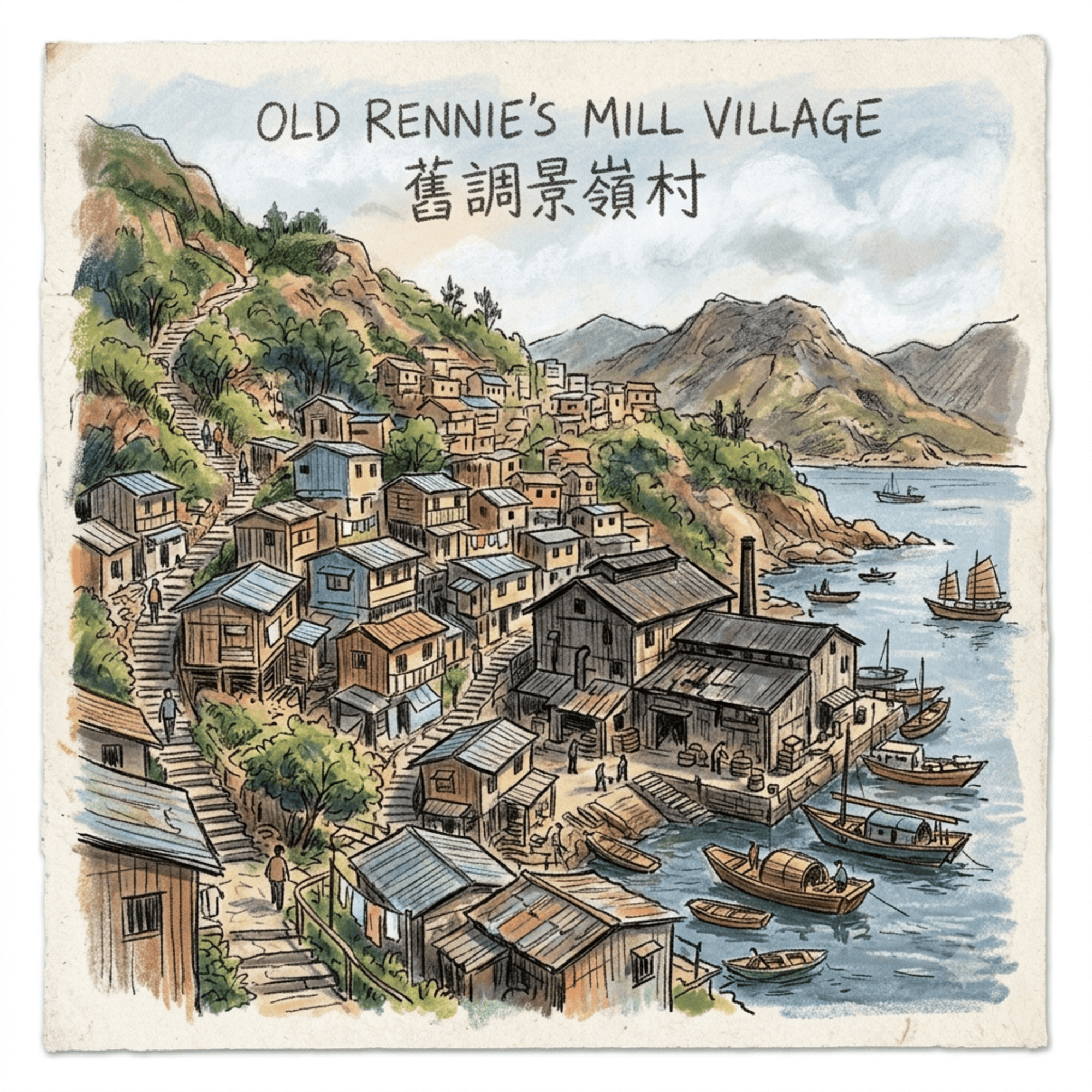
This article has the same special meaning for me – I spent my childhood here, it’s paradise, and although there are no cars in here and no high-rise buildings, it has mountains and waters, a corner of its own, and I have lived here for over 10 years.
 Lawrence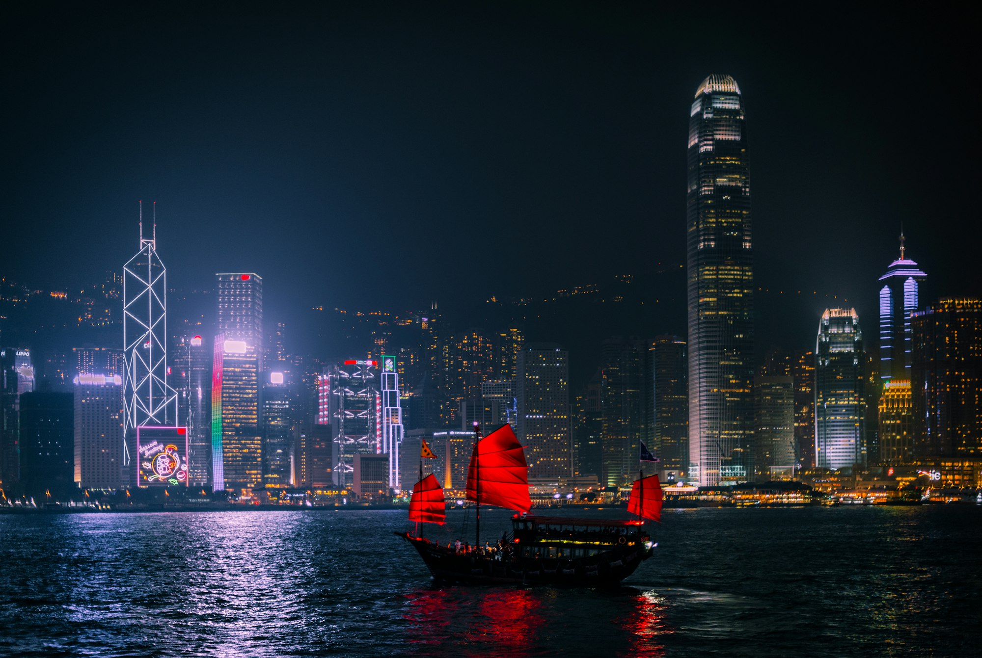
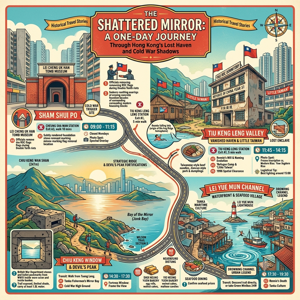
This is a work of deep-map historical travel writing about Tiu Keng Leng — known until 1997 as Rennie's Mill — in Hong Kong's Tseung Kwan O district. It traces five layers of history buried beneath a new town that went up almost overnight: a Tanka fishing community, a flour mill whose failure killed its founder, a forty-six-year Republic of China enclave within British territory, a Cold War riot ignited by a flag, and a final political clearance timed to the hour of the handover. Readers will come away with a route, a reading list, and a significantly altered sense of what a place-name can hide.
The Wall That Should Not Be There
In the new town of Tseung Kwan O, on the eastern fringe of Hong Kong's urban mass, there is a brick wall that has no business being there.
Not in the sense that it is contested or illegal — no enforcement notice is pasted to its surface, no fence marks it off from its surroundings — but in a more fundamental, temporal sense: the wall occupies a category that the city around it appears to have abolished. The buildings pressed against it on three sides belong to the twenty-first century, white-faced, high-rise, their windows catching the South China Sea light in flat, corporate planes. The wall itself belongs to something older, darker, and far more unresolved.
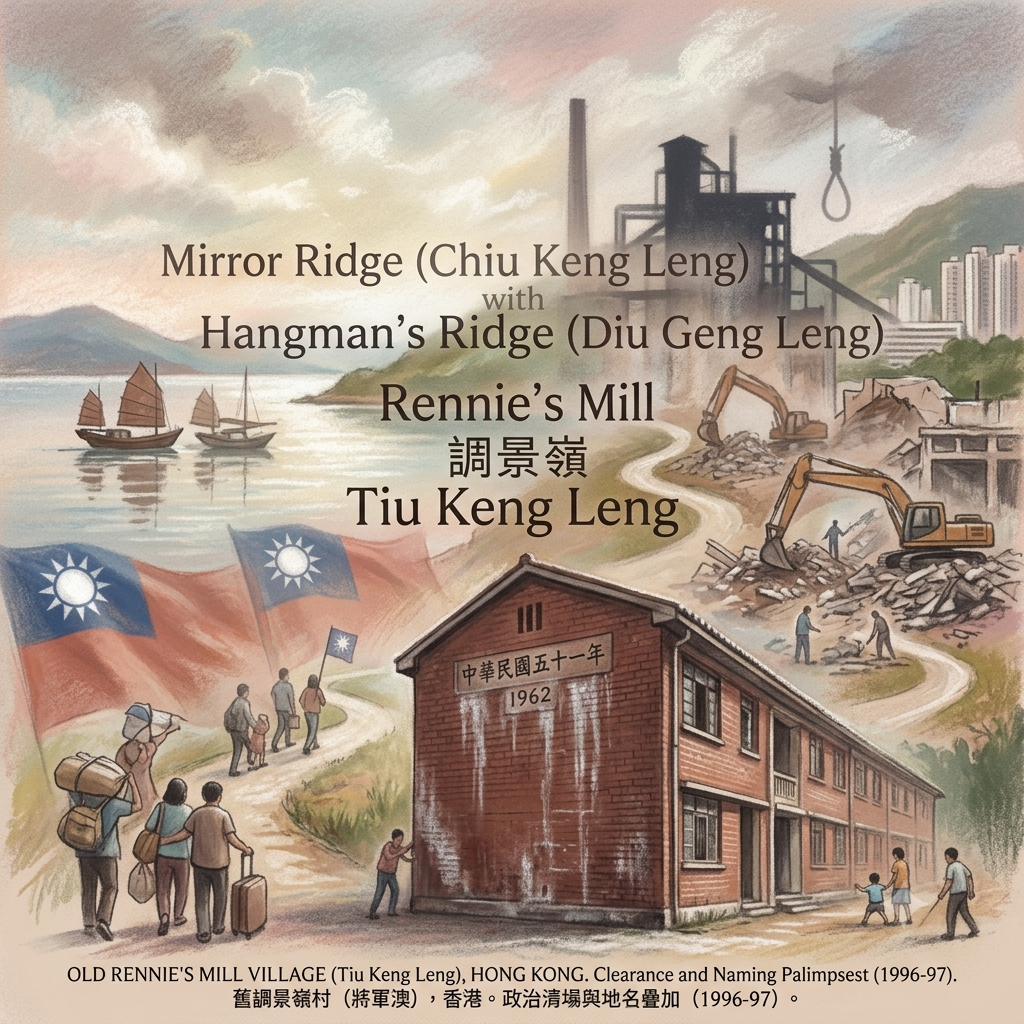
Carved into its facade, in classical Chinese characters, are six words: 中華民國五十一年. The Republic of China, Year Fifty-One. The year, by a calendar that ceased to carry official weight on this side of the Taiwan Strait more than seven decades ago, is 1962. No plaque explains the inscription. No tour group stops here. The MTR station nearby is named Tiu Keng Leng — a place-name that, if you trace its phonetic ancestry back through three distinct layers of mistranslation, death, and bureaucratic euphemism, once meant something violent and strange. That etymology, too, is unmarked.
What happened here — what the wall encodes, what the place-name conceals — is one of the twentieth century's most peculiar political geographies: a pocket of frozen time, a community sustained for nearly half a century by the belief that history had made a mistake it was about to correct. That it was quietly erased in the year before Hong Kong's handover to China is not, most historians agree, a coincidence.
Listen to the historical stories told in detail (For subscribers only)
I. The Fishermen's Name and the Cosmology of Calm Water
Before the wall, before the flour mill, before the soldiers and the flags and the broken promises, this shoreline belonged to the Tanka.
The Tanka — the name is contested, possibly derived from a Cantonese term for "egg people," perhaps a reference to the rounded hulls of their vessels — are among the oldest maritime communities of the South China Sea. For centuries, successive Chinese dynasties denied them the right to settle on land, to sit state examinations, to hold official positions in the bureaucratic hierarchy that governed terrestrial life. The sea was their entire inheritance. The naming of waters was the closest thing they had to sovereignty.
The Erased Mirror bay of Hong Kong
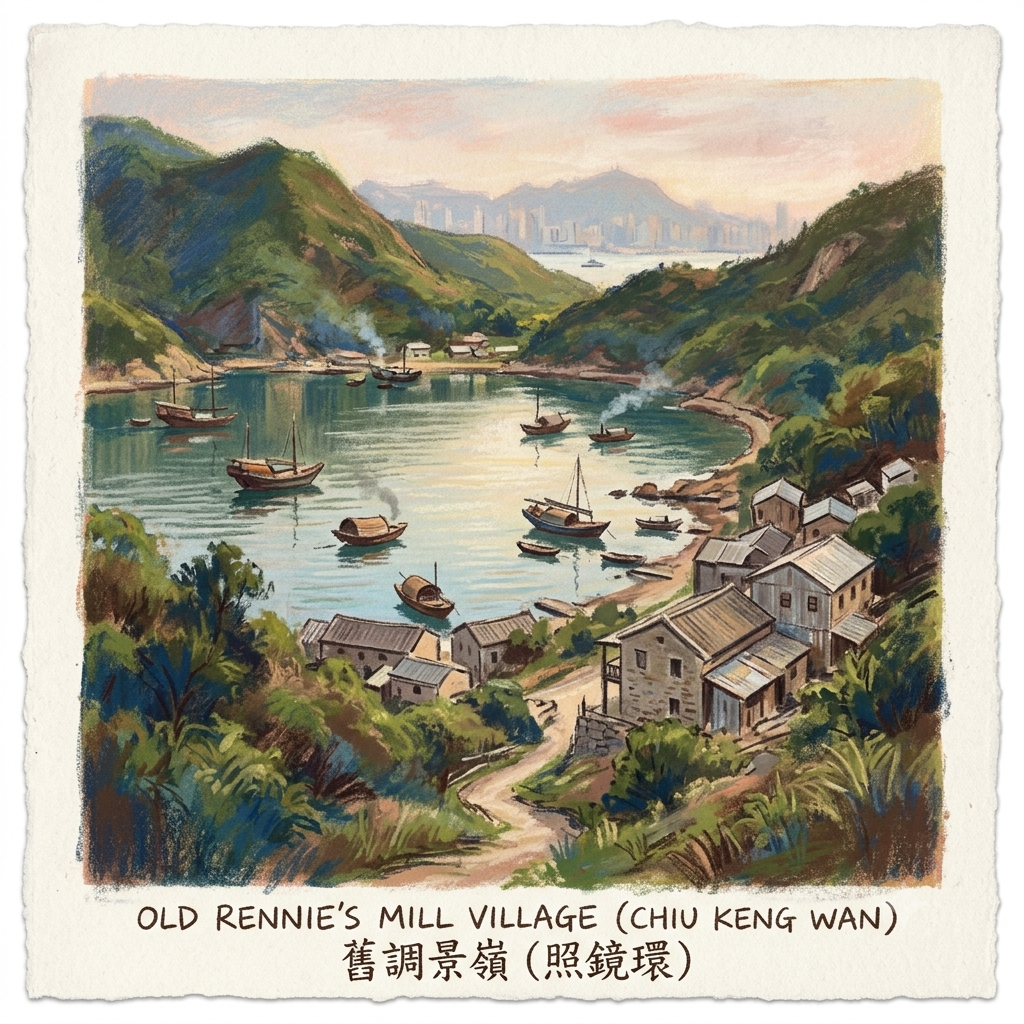
The bay at the southern foot of what is now Tiu Keng Leng, the Tanka fishermen called Chiu Keng Wan — Mirror Bay, or Mirror Ring Bay, rendered in characters that mean "the bay that reflects like a bronze mirror." The hill above it they called Chiu Keng Leng: Mirror Ridge. Both names record a single optical fact — the bay is almost perfectly circular, deeply sheltered by hills on three sides, and in calm conditions achieves that particular quality of stillness in which the water surface ceases to look like water at all and becomes instead a solid, unbroken sheet of sky.
In the Tanka cosmological framework, such waters were not merely picturesque. Still surfaces were understood as loci of spiritual convergence: the Dragon King of the sea was believed to be most legible — most audible, most petitionable — where the water lay flat and the world above could see its own face in the depths below. Mirror Bay was, in this reading, a place where the vertical axis between heaven and water was most easily traversed. The Tanka came here to fish, to conduct the rites of Tin Hau (天后 — Goddess of the Sea, protector of sailors), and to listen.
The name Chiu Keng Leng — Mirror Ridge — did not survive. The Tanka had no claim in any official registry, no voice in any administrative cartography. When the machinery of colonial land management arrived in the wake of Britain's 1898 lease of the New Territories, the fishermen's vocabulary was simply overwritten. The 1819 gazetteer of Xin'an County — the administrative unit within which this territory then fell — makes no mention of the bay at all. It was, to the mapmakers, a margin.
But the name carried something that mapmakers could not anticipate: a description of the land's deepest character. Mirror Ridge. A place where what you see is always the reflection of somewhere else — never quite itself.
II. Rennie's Death and the Palimpsest of a Place-Name
On the fourteenth of April, 1908, a Canadian entrepreneur named Alfred Herbert Rennie stepped off the deck of his private launch, the Canada, as it crossed the narrows at Lei Yue Mun, and was pulled under by the current of the strait. His body was recovered the same morning. The China Mail, Hong Kong's English-language paper of record, noted the incident in a paragraph that managed, in the manner of its era, to avoid the word suicide entirely.
Rennie had arrived in Hong Kong in 1890 as the Asia sales representative of a Portland, Oregon flour company. When Britain extended its lease to include the New Territories, he saw an opportunity that seemed, at the time, almost impossibly lucrative: he would build a mill to produce Western-style flour for the China market, sited at the sheltered bay the Tanka called Mirror Cove, a deep-water inlet accessible to ocean freighters and ringed by flat land he could fill from the sea. His investors were two of colonial Hong Kong's most eminent figures — Sir Paul Chater, the founder of Hongkong Land, and H.N. Mody, the Armenian-Indian merchant who had helped establish the Star Ferry. The mill opened in 1907, described in a contemporary commercial survey as potentially "one of the most important industrial enterprises in East Asia."
It closed eleven months later. Production costs were ruinous, the flour quality erratic, the market indifferent. Rennie's debts were beyond recovery. The launch journey on which he died was his regular morning commute between the mill and Central; he had made it dozens of times before. The Canada did not stop.
What interests me here is what happened to the place-name afterward.
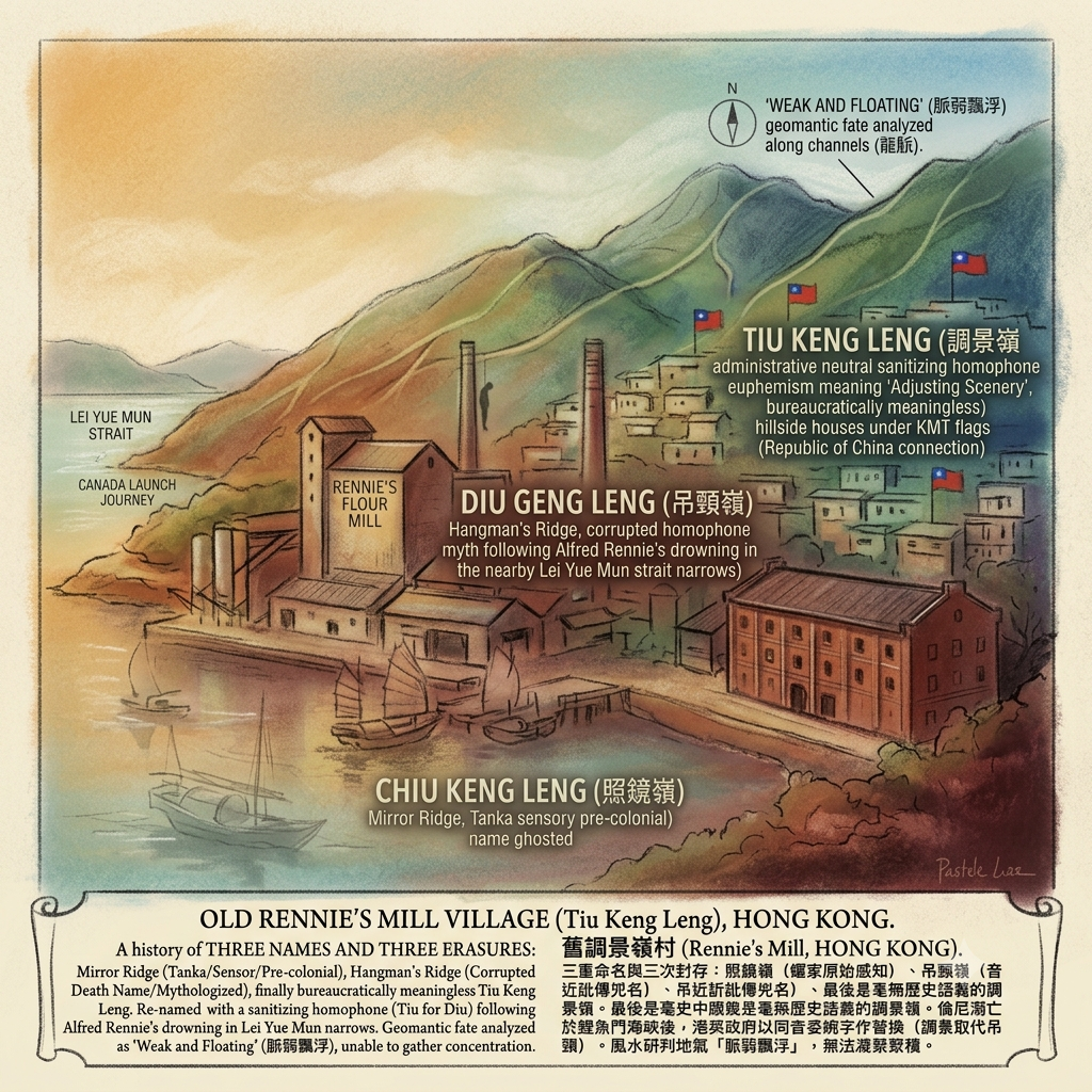
Rennie's death was misreported — or mistold — almost immediately. The rumour that circulated through Hong Kong's Cantonese-speaking communities was that the mill owner had hanged himself inside the factory. He had not; he had drowned in open water. But in Cantonese phonetics, the gap between chiu keng (照鏡, "mirror") and diu geng (吊頸, "to hang by the neck") is almost nothing — a single initial consonant separating the bay's original name from a description of the manner of a death that didn't even happen there. The two sounds collapsed into each other, and Chiu Keng Leng became Diu Geng Leng: Hangman's Ridge.
The colonial administration, uncomfortable with the omen — in Chinese geomantic tradition, a place associated with hanging carries a particular, lingering malignancy — eventually substituted a third name. They chose characters with the same Cantonese pronunciation (Tiu Keng Leng) but with the meanings of "adjusting" and "scenery": harmless, neutral, scrubbed clean. The gesture is worth pausing over. In Chinese toponymic tradition, the name of a place is not merely a label but a record — an index of everything the land has witnessed. To rename is to amputate memory at the root. The colonial administration, in choosing bureaucratic euphemism over truth, was performing a form of urban surgery whose consequences would continue to accumulate for more than a century.
Three names, three erasures:
Mirror Ridge (Tanka, sensory, pre-colonial) — overwritten by colonial cartography
Hangman's Ridge (corrupted, death-naming, mythologised) — too dangerous to keep
Tiu Keng Leng / Rennie's Mill (administrative, neutral, meaningless) — the name that outlasted all it was meant to conceal
The Deadly Pun That Cursed A City Map
The Feng Shui of Failure: Reading the Dragon's Veins
A note on interpretive register: what follows is an analysis using the Han Chinese cosmological framework of feng shui (風水) and dragon-vein theory (龍脈). This is the indigenous landscape-reading tradition of the communities that have settled this area for centuries, and it is treated here with the same analytical seriousness extended to any culturally specific framework for understanding how environment shapes human fate.
Classical Chinese feng shui holds that the earth carries qi — vital energy — along channels called long mai (龍脈), or dragon veins. These channels, traced by feng shui practitioners through the lines of mountains, ridgelines, and watercourses, determine where human settlements flourish and where they fail. The configuration of a site within this network — the direction of its "backing mountain," the quality of its water mouth, its position within the dragon-tiger binary of surrounding topography — is understood as its geomantic fate.
For the Tseung Kwan O basin, that fate is written in the ridgelines.
The main dragon vein of the district descends from Fei Ngo Shan (Kowloon Peak, 602 metres) and strikes east before grounding in Che Ku Shan (Tze Keng Shan, 431 metres), from which secondary channels distribute energy into the Tseung Kwan O valley. The two dominant landforms on either side of the bay establish what feng shui practitioners call a "clamp formation" (鉗勢): Keng Hau to the north holds the left azure dragon position — the primary, yang, generative side of any geomantic site. Rennie's Mill sits in the right white tiger position — secondary, yin, protective, fundamentally subordinate. The white tiger guards the core; it does not create it. Its role is custodial, not sovereign.
This alone would consign the site to a supporting rather than a leading geomantic role. But a further assessment — attributed to feng shui practitioners who surveyed the area — goes deeper: the dragon vein as it reaches Rennie's Mill is described as mai ruo piao fu (脈弱飄浮): "weak and floating." The energy that arrives here is attenuated, unable to gather into the concentrated pool — the jie xue, or "point of culmination" — that sustains a truly prosperous settlement. The bright hall is shallow. The qi disperses before it can be retained.
Weak and floating: it is a diagnosis that reads, in retrospect, less like geomancy and more like prophecy.
Every enterprise that put down roots at Rennie's Mill — Rennie's flour mill, the Republic of China enclave that came after it — was built, maintained with extraordinary effort, and ultimately unable to hold. Not because the people who built these things were not serious, or capable, or determined: the flour mill was backed by some of the most powerful capital in colonial Hong Kong; the refugee community that followed sustained schools, hospitals, roads, and publishing houses for nearly half a century. The failure, the floating, was structural. The qi of the place, to use the framework in which this land was always understood, did not gather. It passed through.
And underlying all of it: the oldest name, the Tanka's Chiu Keng Leng, Mirror Ridge. In the Daoist interpretive tradition that underpins feng shui, a bronze mirror is a doubled object — it reveals what is true (it was used in Daoist ritual to illuminate what the eye alone cannot see) but it also makes explicit that what you are seeing is always a reflection, never the thing itself. A settlement built on Mirror Ridge is, by definition, the image of something located elsewhere.
Holographic Sensory Cue:
Three o'clock on an October afternoon at the surviving dormitory building, Tiu Keng Leng. The sun comes in from the southwest at a low, raking angle. The brickwork is the colour of dried blood, a deep reddish-brown that sixty years of salt air has streaked with white mineral deposits — the sea's slow signature on the surface of the wall. At this hour and this angle, the carved strokes of 中華民國五十一年 throw shadows just narrow enough to give the characters depth — they appear not incised into the surface but extruded from it, as though the inscription is pushing outward from within. Running a finger along the stroke of a character, you feel the edge crumble slightly, granular, mineral, the corner of each cut rounded by decades of weather. The buildings on three sides — white plaster, aluminium window frames, washing lines — throw a flat, even light that makes no concession to the brick wall's age. Traffic noise from Tseung Kwan O Road. Somewhere behind the estate, the sound of a drill. The 1962 inscription and the 2020s tower block regard each other across about six feet of air and sixty-three years of historical rupture.
III. The Impossible State: Building a Republic Inside a Colony
In the summer of 1950, the Hong Kong government did something that it would spend the next four decades quietly pretending it had not done.
In the months following the Communist Party's establishment of the People's Republic of China in October 1949, Hong Kong absorbed a population influx of extraordinary scale. Refugees crossed the border in their hundreds of thousands — factory workers, intellectuals, merchants, civil servants, and demobilised soldiers from the defeated Nationalist army of Chiang Kai-shek's Republic of China. The colony's population went from roughly 600,000 in 1945 to more than 2.1 million by 1951. The most politically sensitive of the arrivals were the ROC soldiers: openly anti-Communist, militarily organised, and maintaining a fierce loyalty to a government that still claimed to represent all of China from its exile on Taiwan.
The British position was impossible by design. To arm or organise these soldiers was to hand Beijing a pretext for hostility toward the colony. To forcibly repatriate them was a human rights catastrophe. To disperse them into the general Hong Kong population was to introduce a heavily armed political faction into an already volatile city. The solution the administration arrived at was elegant in its cynicism: remove them from sight. Place them somewhere sufficiently remote that their existence could be managed at arm's length, acknowledged minimally, and — if necessary — denied.
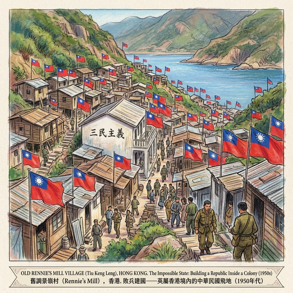
In June 1950, some six thousand Nationalist soldiers were relocated from temporary holding at Mount Davis to the site of Rennie's disused flour mill at the far end of the Tseung Kwan O inlet. Over the following months, a further ten thousand to twenty thousand civilian refugees with ROC sympathies followed. The settlement was named a "refugee camp." The Royal Hong Kong Police were instructed, effectively, to stay away. For more than a decade, the camp operated beyond normal colonial jurisdiction.
What grew in that jurisdictional gap was nothing less than a parallel state.
Taiwan's Free China Relief Association (FCRA) served as the de facto government of the enclave, funding construction of roads, water supply, electricity, and medical facilities. Schools were built and staffed according to the Republic of China curriculum; students graduating from the camp's high schools could receive FCRA-funded university places in Taiwan, free of charge, tying the community's future to the island through education as well as ideology. On every building, the ROC flag — white sun on blue sky — flew from poles and brackets. The ROC calendar — measuring years from the founding of the Republic in 1912, making 1950 the "thirty-ninth year" — was the calendar in use. Sun Yat-sen's Three Principles of the People (三民主義) were inscribed on school walls. The annual celebration of National Day on the tenth of October — the anniversary of the 1911 revolution that brought the Republic into being — was a matter of full civic ceremony: assembly, anthem, salute.
The Forgotten Republic Inside British Hong Kong
The residents of Rennie's Mill understood themselves to be in transit. This was not a home; it was a waiting room. The shared conviction that sustained the community across its four decades was the doctrine of fan gong da lu — "retaking the mainland" — the belief, official ROC policy until well into the 1970s, that the Communist interregnum was temporary, that Chiang Kai-shek's government would return to power in Beijing, and that the residents of this cramped settlement on the shore of an English colony would one day go home. They waited, in the end, for forty-six years.
It is difficult to overstate the historical strangeness of what existed here during those decades. Within a few kilometres of the border of the People's Republic of China — within a British Crown colony that maintained trade relations with both Beijing and Taipei — there existed a self-governing community of tens of thousands of people flying a flag, marking time in a calendar, and sustaining an ideological commitment that the world outside was moving steadily away from recognising. The yimin (遺民) tradition — the ancient Chinese concept of those who maintain loyalty to a fallen political order, refusing to acknowledge the legitimacy of its successor — had found its last, largest, and most materially complete expression in a waterfront settlement that the colonial administration preferred not to acknowledge.
IV. The Flag and the Fire: Double Ten, 1956
In geomantic tradition, a sacred object that has been violated does not simply represent a desecration — it is a desecration, a rupture in the fabric of the spatial order that demands a response. This is the framework within which the events of October 10th, 1956 need to be understood.
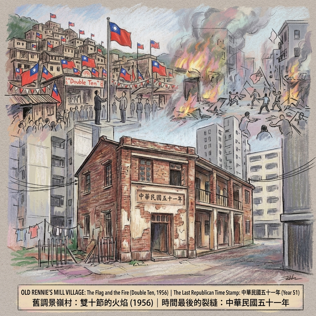
Double Ten — the tenth day of the tenth month, anniversary of the revolution of 1911 — was the holiest day in the Rennie's Mill calendar. The flag-raising ceremony that marked it was conducted with the solemnity of a religious rite: participants stood at attention, the anthem played, no one moved. The Republic of China flag, in this community, was not a political emblem in any ordinary sense. It was a sacred object — evidence, tangible and visible, that the Republic of China still existed, that the waiting was not futile, that history had not yet reached its verdict.
On the morning of October 10th, 1956, a Housing Department employee in the estate of Li Cheng Uk, in Cheung Sha Wan on the Kowloon Peninsula, carried out an instruction to remove ROC flags and Double Ten decorations from an external wall. The instruction was routine administrative tidiness. In the political atmosphere of that October, it was a lit match dropped into a powder magazine.
The Deadliest Flag In Hong Kong
The riots that followed lasted three days. Fifty-nine people died — a higher death toll than the better-known leftist riots of 1967. More than six thousand people were arrested. The wife of the Swiss vice-consul was beaten and her car set alight, generating an international diplomatic incident. Turf wars between ROC-affiliated Triad organisations and pro-Communist trade unions — two armed expressions of the Cold War's ideological fault line that ran directly through Hong Kong's working-class districts — resolved themselves in the streets of Kowloon with extreme violence.
Rennie's Mill itself was not a theatre of the riots. It was their spiritual heartland and their operational rear. The settlement's existence as an organising hub for ROC-affiliated networks throughout the colony meant that when the detonator went off at Li Cheng Uk, the infrastructure of mobilisation was already in place. What ignited was not spontaneous combustion but the discharge of pressure that had been building since 1949: the pressure of a defeated political order that refused to regard itself as defeated, contained in a colony that wanted nothing more than for the question to go away.
The British administration's response was characteristic. Rather than confront the enclave directly, it formalised it. In 1961, Rennie's Mill's status was changed from "refugee camp" to "resettlement area." The Royal Hong Kong Police were formally given jurisdiction. Infrastructure was improved. And the administration issued a letter promising residents — in writing — that they could remain indefinitely. The promise was made in full knowledge of what it was worth. It was honoured for thirty-five years.
Resonance Node
The Dormitory Wall, Tiu Keng Leng: The Last Republican Time Stamp
Of the thousands of structures that made up the Rennie's Mill settlement at its height — the schools, clinics, dormitories, community halls, the newspaper offices, the houses with their flag poles — one survives. A two-storey brick dormitory building, its facade carrying the inscription 中華民國五十一年: Republic of China, Year 51. The year is 1962. It is, so far as anyone has been able to establish, the last public building in Hong Kong to carry a date in the Republic of China calendar.
There is no interpretive panel. There is no protected status. The building sits within a residential estate, unannounced, waiting for a development cycle that will most likely remove it. To stand before it is to understand something about what erasure actually looks like: not the dramatic demolition of monuments, but the slow surrounding of the inconvenient past by the indifferent present, until the past simply ceases to be noticed, and then ceases to be.
This wall is the last legible scar of a community of tens of thousands, maintained for nearly half a century, and dismantled — physically, politically, toponymically — within the space of a single year. Visit it while it remains.
V. The Clearance: A Promise Kept for Thirty-Five Years, Then Not
The 1984 Sino-British Joint Declaration settled Hong Kong's handover date as July 1st, 1997. It settled Rennie's Mill's fate as surely as it settled anything else, though rather more quietly.
Beijing had made its position clear: a community flying the flag of the Republic of China, marking time by the ROC calendar, and operating ROC-aligned educational institutions could not exist within the territory of the People's Republic of China after the handover. The Hong Kong government's response was to designate the Rennie's Mill area for Phase Three of the Tseung Kwan O New Town development — a planning decision that provided administrative cover for what was, at its core, a political instruction.
The Village Erased From Hong Kong's Map
The letter that the Resettlement Department had written in 1961 — the letter promising indefinite residency — was now an embarrassment. When residents mounted a legal challenge, the judge, Mr Justice Raymond Sears, found himself in an awkward position. He acknowledged that the government's 1961 letter did indeed constitute a promise. He upheld the eviction anyway, on grounds of administrative necessity. The judgment was not appealed successfully.
The last residents of Rennie's Mill departed in the closing months of 1996. The majority relocated to Taiwan — the political homeland they had been waiting to return to for forty-six years turned out to be the destination after all, though not via Beijing. The buildings were demolished in the months that followed, the timetable coinciding with the handover with a precision that, as one historian drily noted, was "not widely considered coincidental."
The English-language name Rennie's Mill was replaced on official maps and MTR signage by the Cantonese romanisation Tiu Keng Leng — removing, in a single stroke, the last trace of the Canadian entrepreneur whose failure had started the chain of events that produced the settlement in the first place. The three-layer palimpsest of place-names — Mirror Ridge, Hangman's Ridge, Rennie's Mill — was compressed into a Cantonese syllable sequence that gestures acoustically toward all of them without carrying the meaning of any.
The Mirror and Its Infinite Regress
In the interpretive tradition that feng shui inherits from classical Chinese cosmology, a mirror is never simply a mirror. It is a device for making legible what is otherwise hidden; and it is simultaneously a warning that what you see in its surface is always a representation, never a presence. The things that thrive in a mirror-world — mirror-images, reflections, projections — have no weight of their own. They depend, for their existence, on the continued presence of the object they are copying.
This is what Rennie's Mill was, from the Tanka fishermen's first naming to its demolition in 1996-97: a mirror-place. It never defined itself on its own terms. It was always the image of somewhere else.
The Tanka named it for its reflective water: a bay that mirrored the sky and held the image of the divine. Rennie projected onto it the image of an industrial empire that existed only in the optimistic imagination of colonial capitalism. The ROC community that followed projected onto it the image of a China that had been politically extinguished in 1949 — a China visible only in the mirror of Taiwan, which was itself a mirror of something that no longer existed on the mainland. Three reflections, each dependent on a prior reflection, each receding further from any stable original.
In the classical cosmological reading, this is precisely what mai ruo piao fu — "weak and floating dragon vein" — produces: settlements that have the outward form of permanence but lack the geomantic groundedness that makes permanence real. The brick dormitory with its 1962 date-stamp is the perfect material expression of this floating: it is solidly built, it has lasted more than sixty years, and it means nothing to the city that has grown up around it, because the city has no memory of what it is.
What we lose when such places disappear is not primarily the buildings themselves — it is the capacity to read the landscape as a text in which the full complexity of history is encoded. Every place-name, every inscription, every structural choice made by a community under impossible political pressure contains information that cannot be recovered once the physical substrate is gone. The Tanka's Mirror Bay is inaccessible to us now; we have only the echo of Chiu Keng, and even that echo is three phonetic removes from its origin. The ROC community's four-and-a-half decades of yimin practice is preserved in documents scattered across archives in Hong Kong, Britain, and Taiwan, and in the memories of people now mostly in their eighties and nineties.
And in a brick wall, in a residential estate in Tseung Kwan O, that most people walk past without noticing.
To read history, you sometimes have to read walls.
If this kind of long-form historical cartography — finding the sedimentary layers beneath cities that only present their newest faces — is what you come here for, the email list is where we send one piece a month, drawn from the same depth of field. No algorithms. Just the sites that make you stop, and the histories that earned the stopping.
Accessing the Physical Node
Getting there: Take the MTR Tseung Kwan O Line to Tiu Keng Leng Station (approximately 27 minutes from Kowloon Tong, 35 minutes from Central via interchange at Quarry Bay). The station is built directly above the former settlement area — the concourse level sits on ground that once held the community's central buildings.
The surviving dormitory (中華民國五十一年): No signage marks this building, and its precise location is not on any heritage trail. The most reliable navigation is through photographs and location data posted by Hong Kong's urban exploration community; a brief search of urbex forums for "Tiu Keng Leng ROC building" or "民國五十一年" will yield workable coordinates. The inscription is on the building's front facade. There is no guarantee this building will exist when you arrive — it has no protected status. If it matters to you, go soon, and document what you find.
Mirror Ridge (照鏡環山): The hill that carries the original Tanka name — 247 metres, reached by footpath from the Tiu Keng Leng area — offers the best surviving view of the Tseung Kwan O basin in something approaching its original form. On clear mornings, the reclaimed land below shows the ghost of the circular bay the Tanka named. The hill itself is lightly maintained and little visited. Bring water; the paths are uneven.
Lei Yue Mun: The strait where Rennie drowned is approximately 3 kilometres from the mill site, reached most directly from Yau Tong MTR station. The shoreline is now a seafood restaurant district; Devil's Peak Fort (魔鬼山炮台) above it is a preserved Second World War fortification with a commanding view of the passage between Kowloon and Hong Kong Island. The fort's name — "Devil's Peak" — appears on British Admiralty charts from the mid-nineteenth century, predating Rennie by decades. The concatenation of ominous English toponyms in this stretch of water (Devil's Peak, Rennie's Mill) was not, as far as anyone has established, a factor in any of the deaths that occurred nearby.
Staying overnight: The Tseung Kwan O district has a standard range of new-town business hotels. For those who prefer a more historically layered base, the area around Yau Tong and Kwun Tong to the west offers older building stock and better access to the broader arc of Hong Kong's mid-twentieth-century industrial and refugee history. The journey from either area to Tiu Keng Leng is under thirty minutes by MTR.
Guided walks: No regular tours specifically address Rennie's Mill's history. Walk in Hong Kong (walkhongkong.com) offers custom heritage routes and can accommodate requests. The Industrial History of Hong Kong Group (industrialhistoryhk.org) maintains the most detailed English-language archive of the mill period specifically. For the ROC enclave history in English, the most accessible single source remains the Taiwan Panorama article "Doomed Village" (1989), freely available in the publication's online archive — an early, sympathetic portrait of the community written while it still existed.
"The place-name is the first draft of history. Every subsequent draft tries to make you forget what the first one said."— lawrencetravelstories.com
💡 Frequently Asked Questions (FAQ)
Q: What is the history of Rennie’s Mill (Tiu Keng Leng) in Hong Kong and how did it get its name?
A: Rennie’s Mill, now known as Tiu Keng Leng, originally takes its name from Alfred Rennie, a Canadian businessman who established a flour mill there in 1905. Following his tragic suicide by drowning in 1908, a local rumor incorrectly spread that he had hanged himself. This led to the Cantonese moniker "Hanging Ridge" (Diu King Leng). In the 1950s, the Hong Kong government officially renamed it Tiu Keng Leng ("Adjusted Ridge") to remove the somber association, turning a tragic commercial failure into one of Hong Kong’s most storied geographic name evolutions.
Q: Why was Rennie’s Mill called "Little Taiwan" during the Cold War era?
A: Following the Chinese Civil War in 1949, thousands of Kuomintang (KMT) soldiers and refugees fled mainland China to Hong Kong and were resettled in the isolated hillsides of Rennie’s Mill. The enclave developed a self-sustaining community flying the Republic of China flag, earning the nickname "Little Taiwan." Positioned within British Hong Kong, it functioned as an extraordinary political enclave and refugee sanctuary, reflecting the complex geopolitical dynamics and human displacement during the height of the Asian Cold War.
Q: What happened to Rennie’s Mill and can you still visit historical ruins today?
A: In 1996, ahead of the 1997 handover of Hong Kong to China, the Hong Kong government fully cleared and redeveloped Rennie’s Mill into the modern urban township of Tseung Kwan O. While the wooden cottages and political flags were demolished, visitors today can still explore surviving traces of its past. Notable historic landmarks include the former Rennie’s Mill Police Station—now revitalized as the Tseung Kwan O Heritage Post—and scattered concrete foundation remnants along local hiking trails, preserving the memory of this lost community.
Reference and Further reading
First layer – Main sources of literature and institutions:
- 英國殖民地政府土地記錄(Public Records Office, Hong Kong)、1819年《新安縣志》(確認此地不在記載之內)、英國新界租借後(1898年後)之地政測繪記錄
- 《中國郵報》(China Mail),1908年4月14日,〈倫尼先生之死〉;香港政府公報(Hong Kong Government Gazette),1903-1908年相關土地記錄;香港工業歷史研究組(Industrial History of Hong Kong Group)存檔
- 香港政府檔案(調景嶺難民營設立相關行政文書,1950年);中國自由總會(FCRA)檔案(台灣,部分已解密);胡俊慧(Chun-Huei Hu)主編,《調景嶺營的誕生與消失》(台北縣:國立歷史博物館,1997年)
- 1956年香港暴動政府調查報告(英國解密文件,TNA/PRO);ROC方面的外交檔案(台灣國史館);《工商日報》、《香港時報》(右派)及《大公報》(左派)1956年10月相關報道
- 調景嶺居民高等法院訴訟判決書(1996年,雷蒙・西爾斯法官);香港政府刊憲記錄(調景嶺徙置區清拆公告);香港立法局會議記錄(1990年代相關辯論)
The second layer – secondary academic materials:
- 藍安偉(Kenneth Lan On-wai),《Rennie's Mill: The Origin and Evolution of a Special Enclave in Hong Kong》,博士論文,香港大學,2006年(此論文為迄今最完整的調景嶺學術研究);蕭鳳霞(Helen Siu)等關於新界社群研究之著作
- 《20世紀香港印象》(20th Century Impressions of Hong Kong),1908年(Graham Brash 1990年再版);Gerald Friesen教授(加拿大馬尼托巴大學歷史系)現正進行的Rennie生平研究;Christopher Munn(香港大學榮譽副教授)對Rennie早期生涯的研究
- 藍安偉,《Rennie's Mill》,博士論文,香港大學,2006年;Mark Chi-Kwan,"The 'Problem of People': British Colonials, Cold War Powers, and the Chinese Refugees in Hong Kong, 1949–62," Modern Asian Studies 41:6 (2007);林孝庭(Hsiao-Ting Lin),《冷戰中的兩岸:解密文件》(香港:三聯書店,2015年)
- Kent Wan, "The KMT versus the CCP: Dueling Chinese Nationalisms and the Politics of Colonial Rule During Hong Kong's 1956 Riots," Journal of Southeast Asian Studies (2025);Mark Chi-Kwan, Hong Kong and the Cold War: Anglo-American Relations, 1949–1957 (Oxford: Clarendon Press, 2004);Christine Loh, Underground Front: The Chinese Communist Party in Hong Kong (Hong Kong: HKU Press, 2010)
- 藍安偉,《Rennie's Mill》,博士論文(2006);Edward Kai,《荒原上的遺民——調景嶺的滄桑歲月與愛的軌跡》(香港,2013年);林孝庭,《冷戰中的兩岸:解密文件》(2015年);《Zolima CityMag》,"Hong Kong's Industrial History, Part VIII: The Ill Fate of Rennie's Mill, AKA Little Taiwan"(2026年更新版)
Third layer – Supplementary information:
- 蜑家命名傳統屬口傳文化,無文字紀錄;香港地方志中心相關地名考證
- 坊間流傳之「吊頸」訛傳記錄(多見於20世紀初香港民間口述,無統一版本)
- 龍應台,《大江大海一九四九》(台北:天下雜誌,2009年)——提供大量遺民社群的第一人稱記憶素材;《台灣光華雜誌》,1989年12月,〈天涯倦鳥〉(Doomed Village),是英語世界最早的深度報道之一
- 1956年暴動倖存者口述記錄(多保存於個人回憶錄或本地歷史口述計畫中,未見系統性整理)
- 前調景嶺居民訪談(胡俊慧主編,1997年);調景嶺社區老照片檔案(多由最後一批居民攜往台灣,或收藏於香港大學圖書館)
Historical gap:
- There is virtually no record of the specific ways the Tanka people utilized these waters; their community organizational structure prior to official colonial surveying remains unknown.
- The exact date of origin for the name "Zhaojinghuan" (照鏡環) cannot be verified, nor is the process by which it evolved from Tanka vernacular into a written place name clear.
- No systematic archaeological surveys have been conducted to determine whether traces of earlier settlements—whether Han Chinese or other ethnic groups—existed in the Tiu Keng Leng area prior to the Qing Dynasty.
- "Recommendation for further archival research": Do early records by British surveyors contain place-name descriptions provided by Tanka interviewees?
- Alfred Herbert Rennie’s memoir, Twenty Years in Hong Kong (tentative title), is known to exist in references, yet scholars have so far been unable to locate a physical copy; if such a document were found, it could significantly alter the understanding of his state of mind regarding his failure. "Recommendation to further verify original records": The Archives of Ontario (Canada) may hold surviving documents related to the Rennie family.
- The usage status of the mill site remains unclear for the period between the cessation of production and its conversion into a quarantine station (1908–1925).
- The exact timeframe of the name change from "Zhao Jing Ling" (Mirror-Gazing Ridge) to "Diao Jing Ling" (Hanging-Neck Ridge) cannot currently be confirmed.
- Records of the FCRA’s comprehensive organizational activities in Tiu Keng Leng are currently held in Taiwan; academic research in Chinese-language scholarship remains insufficient.
- Diplomatic cables between the Hong Kong government and Beijing regarding the Tiu Keng Leng issue should be accessible within the declassified British archives (TNA/PRO); a comprehensive picture of the relevant Cold War negotiations awaits further in-depth study.
- There is currently no complete academic study on the Tiu Keng Leng community's comprehensive education system (curriculum, teaching materials, and sources of teaching staff).
- Existing academic research inadequately describes the specific roles played by Tiu Keng Leng residents during the 1956 riots (e.g., active organizers, moral supporters, or completely unaware bystanders).
- Records of the Hong Kong government's intelligence surveillance of Tiu Keng Leng (which certainly exist but have not yet been the subject of systematic declassification-based research).
- A lack of oral history records regarding the long-term psychological impact of the 1956 events on Tiu Keng Leng residents.
- A lack of systematic follow-up research on the total number of people relocated to Taiwan during the 1996 clearance operation and their subsequent living conditions.
- There are no relevant government records regarding the statutory heritage conservation status of the "Republic of China Year 51 (1962) Dormitory"; it is recommended to further verify the archives of the Antiquities Advisory Board.
- The process of community reconstruction after residents settled in Taiwan awaits in-depth documentation by researchers specializing in the history of migration to Taiwan.
 Lawrence
 Lawrence
 Lawrence
The sources for this article include primary historical records, academic papers, and public records from various levels of administrative bodies, with a commitment to historical accuracy; instances requiring further verification against primary archival materials have been noted in the text. Last updated: July 2026.